
UnRestricted Mesoscale Analysis (URMA)
URMA
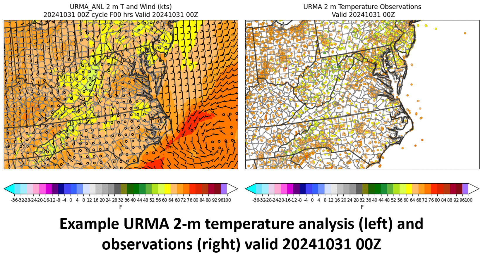 URMA Temperature Analysis and Observations 20241031
The UnRestricted Mesoscale Analysis (URMA) product is a high-spatial and temporal resolution analysis/assimilation system for sensible weather elements. Its main component is the NCEP/EMC Gridpoint Statistical Interpolation (GSI) system applied in two-dimensional variational mode to assimilate conventional and satellite-derived observations. URMA serves as a companion system to the Real-Time Mesoscale Analysis (RTMA). URMA runs 6 hours past analysis time in order to capture late-arriving observations and is used for verification and calibration of the National Blend of Models (NBM). URMA analyses are available on four output grids: CONUS, Alaska, Hawaii, and Puerto Rico. Output files are grib2 datasets. Currently, the CONUS and Hawaii analyses are at 2.5 km resolution, Puerto Rico is at 1.25 km resolution, and Alaska is at 3.0 km resolution. Each grid has its own hourly analysis file, and each variable is a message within the grib2 file. Variables include: Elevation, Station Pressure, 2-m Temperature, 2-m Dew Point, 10-m Wind Speed, Wind Direction, Wind Gust, 2-m Specific Humidity, Visibility, Cloud Cover, Cloud Ceiling Height, Minimum temperature (20Z analysis only, all grids), Maximum temperature (08Z analysis only, all grids), and Significant Wave Height.
Dataset Citation
- Cite as: NOAA National Centers for Environmental Prediction. (2026). UnRestricted Mesoscale Analysis (URMA). [indicate subset used]. NOAA National Centers for Environmental Information. https://doi.org/TBD. Accessed [date].
Dataset Identifiers
- DSI 2058_01
- NCEI Metadata ID: gov.noaa.ncdc:C01581
- doi:10.7289/TBD
ISO 19115-2 Metadata
gov.noaa.ncdc:C01581
| Download Data |
|
| Distribution Formats |
|
| Ordering Instructions | Contact NCEI for other distribution options and instructions. |
| Distributor |
NOAA National Centers for Environmental Information ncei.info@noaa.gov |
| Dataset Point of Contact | Customer Engagement Branch NOAA National Centers for Environmental Information 1-828-271-4800 ncei.orders@noaa.gov |
| Time Period | 2014-01-28 to Present (time interval: 1-hour) |
| Spatial Bounding Box Coordinates |
West: -161.6
East: -59.0
South: 16.8
North: 75.4
West: -138.4
East: -59.0
South: 19.2
North: 57.1
West: -161.6
East: -153.8
South: 18.0
North: 23.1
West: -68.2
East: -63.9
South: 16.8
North: 19.8
West: -150.2
East: -93.6
South: 40.5
North: 75.4
|
| Spatial Coverage Map |
| General Documentation |
|
| Associated Resources |
|
| Publication Dates |
|
| Edition | Version 1 |
| Data Presentation Form | Digital model - multi-dimensional digital representation of a feature, process, etc. |
| Dataset Progress Status | Ongoing - data is continually being updated |
| Data Update Frequency | Daily |
| Purpose | These data are available to the public for a wide variety of uses including scientific research and analysis. |
| Dataset Citation |
|
| Cited Authors | |
| Principal Investigators | |
| Publishers |
| Theme keywords |
Global Change Master Directory (GCMD) Science Keywords
|
| Data Center keywords |
Global Change Master Directory (GCMD) Data Center Keywords
|
| Place keywords |
Global Change Master Directory (GCMD) Location Keywords
|
| Data Resolution keywords |
Global Change Master Directory (GCMD) Horizontal Data Resolution Keywords
|
| Use Constraints |
|
| Data License |
|
| Access Constraints |
|
| Fees |
|
| Lineage information for: dataset | |
|---|---|
| Lineage Statement | This dataset was produced by the National Centers for Environmental Prediction (NCEP) and is archived by the NOAA National Centers for Environmental Information (NCEI). |
| Lineage information for: repository | |
|---|---|
| Processing Steps |
|
Last Modified: 2026-08-09T14:33:13
For questions about the information on this page, please email: ncei.info@noaa.gov
For questions about the information on this page, please email: ncei.info@noaa.gov