GHRSST Level 2P Western Atlantic Regional Skin Sea Surface Temperature from the Geostationary Operational Environmental Satellites (GOES) Imager on the GOES-13 satellite (GDS versions 1 and 2)
 Preview graphic
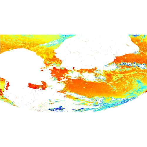
The Geostationary Operational Environmental Satellites (GOES) operated by the United States National Oceanic and Atmospheric Administration (NOAA) support weather forecasting, severe storm tracking, meteorology and oceanography research. Generally there are several GOES satellites in geosynchronous orbit at any one time viewing different earth locations including the GOES-13 launched 24 May 2006. The radiometer aboard the satellite, The GOES N-P Imager, is a five channel (one visible, four infrared) imaging radiometer designed to sense radiant and solar reflected energy from sampled areas of the earth. The multi-element spectral channels simultaneously sweep east-west and west-east along a north-to-south path by means of a two-axis mirror scan system returning telemetry in 10-bit precision. For this Group for High Resolution Sea Surface Temperature (GHRSST) dataset, skin sea surface temperature (SST) measurements are calculated from the far IR channels of GOES-13 at full resolution on a half hourly basis. In native satellite projection, vertically adjacent pixels are averaged and read out at every pixel. L2P datasets including Single Sensor Error Statistics (SSES) are then derived following the GHRSST Data Processing Specification (GDS) version 2.0. The full disk image is subsetted into granules representing distinct northern and southern regions.
- Cite as: Maturi, Eileen; Sapper, John F.; Harris, Andy; Mittaz, Jonathan; Koner, Prabhat (2011). GHRSST Level 2P Western Atlantic Regional Skin Sea Surface Temperature from the Geostationary Operational Environmental Satellites (GOES) Imager on the GOES-13 satellite (GDS versions 1 and 2). [indicate subset used]. NOAA National Centers for Environmental Information. Dataset. https://doi.org/10.7289/v52805n2. Accessed [date].
gov.noaa.nodc:GHRSST-GOES13-OSPO-L2P
| Search Data |
-
Granule Search (search)
Search for data granules belonging to this collection (a granule is the smallest aggregation of data that can be independently described and retrieved).
|
| Download Data |
-
THREDDS (download)
These data are available through a variety of services via a THREDDS (Thematic Real-time Environmental Distributed Data Services) Data Server (TDS). Depending on the dataset, the TDS can provide WMS, WCS, DAP, HTTP, and other data access and metadata services as well. For more information on the TDS, see http://www.unidata.ucar.edu/software/thredds/current/tds/.
-
HTTPS (download)
Navigate directly to the URL for data access and direct download.
-
FTP (download)
These data are available through the File Transfer Protocol (FTP). FTP is no longer supported by most internet browsers. You may copy and paste the FTP link to the data into an FTP client (e.g., FileZilla or WinSCP).
|
| Distribution Formats |
- netCDF (Version: netCDF-3)
- File Specification: GDS-1.0r1.6, CF-1.0
- File Compression: gzip
- netCDF (Version: netCDF-4 classic model)
- File Specification: GDS-2.0, CF-1.4
|
| Ordering Instructions |
Contact NCEI for other distribution options and instructions. |
| Distributor |
NOAA National Centers for Environmental Information
+1-301-713-3277
NCEI.Info@noaa.gov
|
| Dataset Point of Contact |
NOAA National Centers for Environmental Information
ncei.info@noaa.gov
|
| Time Period |
2010-06-21 to 2018-01-08 |
| Spatial Bounding Box Coordinates |
West: -151.839
East: 2.357
South: -52.439
North: 66.24
|
| Spatial Coverage Map |
|
| General Documentation |
|
| Associated Resources |
- Ionin, Raisa; Lemieux, Paul; Luquire, Katy. Data Stewardship Maturity Report for GHRSST Level 2P Western Atlantic Regional Skin Sea Surface Temperature from the Geostationary Operational Environmental Satellites (GOES) Imager on the GOES-13 satellite (GDS versions 1 and 2). NOAA Technical Information Series NESDIS DSMR; 00090. 2021. https://doi.org/10.25923/j3ne-yz22
- GHRSST User Guide version 9.1
- The Recommended GHRSST Data Specification (GDS) GDS 2.0 revision 5
- GOES Sea Surface Products: SST Monitoring
- GOES Sea Surface Temperature Products: Background
- The GOES-13 Science Test: Imager and Sounder Radiance and Product Validations
- Hybrid cloud and error masking to improve the quality of deterministic satellite sea surface temperature retrieval and data coverage
- NOAA/NESDIS USA, 5200 Auth Rd, Camp Springs, MD, 20746 (2014). GHRSST Level 2P Western Atlantic Regional Skin Sea Surface Temperature from the Geostationary Operational Environmental Satellites (GOES) Imager on the GOES-13 satellite (GDS version 2). https://doi.org/10.5067/ghg13-2po02
|
| Publication Dates |
- publication: 2011-09-07
- revision: 2022-09-03
|
| Data Presentation Form |
Digital table - digital representation of facts or figures systematically displayed, especially in columns
|
| Dataset Progress Status |
Complete - production of the data has been completed
Historical archive - data has been stored in an offline storage facility |
| Data Update Frequency |
As needed |
| Supplemental Information |
This collection includes data from the following product(s): GHRSST Level 2P Western Atlantic Regional Skin Sea Surface Temperature from the Geostationary Operational Environmental Satellites (GOES) Imager on the GOES-13 satellite (GDS version 2) (GOES13-OSPO-L2P-v1.0); GHRSST Level 2P Western Atlantic Regional Skin Sea Surface Temperature from the Geostationary Operational Environmental Satellites (GOES) Imager on the GOES-13 satellite (OSDPD-L2P-GOES13). |
| Purpose |
This dataset is available to the public for a wide variety of uses including scientific research and analysis. |
| Use Limitations |
- Distribution liability: NOAA and NCEI make no warranty, expressed or implied, regarding these data, nor does the fact of distribution constitute such a warranty. NOAA and NCEI cannot assume liability for any damages caused by any errors or omissions in these data. If appropriate, NCEI can only certify that the data it distributes are an authentic copy of the records that were accepted for inclusion in the NCEI archives.
|
| Dataset Citation |
- Cite as: Maturi, Eileen; Sapper, John F.; Harris, Andy; Mittaz, Jonathan; Koner, Prabhat (2011). GHRSST Level 2P Western Atlantic Regional Skin Sea Surface Temperature from the Geostationary Operational Environmental Satellites (GOES) Imager on the GOES-13 satellite (GDS versions 1 and 2). [indicate subset used]. NOAA National Centers for Environmental Information. Dataset. https://doi.org/10.7289/v52805n2. Accessed [date].
|
| Cited Authors |
|
| Originators |
|
| Contributors |
|
| Resource Providers |
|
| Publishers |
|
| Theme keywords |
NODC DATA TYPES THESAURUS
NODC OBSERVATION TYPES THESAURUS
WMO_CategoryCode
Global Change Master Directory (GCMD) Science Keywords
|
| Data Center keywords |
NODC COLLECTING INSTITUTION NAMES THESAURUS
NODC SUBMITTING INSTITUTION NAMES THESAURUS
Global Change Master Directory (GCMD) Data Center Keywords
|
| Platform keywords |
NODC PLATFORM NAMES THESAURUS
Global Change Master Directory (GCMD) Platform Keywords
|
| Instrument keywords |
NODC INSTRUMENT TYPES THESAURUS
Global Change Master Directory (GCMD) Instrument Keywords
|
| Place keywords |
NODC SEA AREA NAMES THESAURUS
Global Change Master Directory (GCMD) Location Keywords
|
| Project keywords |
NODC PROJECT NAMES THESAURUS
Global Change Master Directory (GCMD) Project Keywords
|
| Keywords |
NCEI ACCESSION NUMBER
|
| Use Constraints |
- Cite as: Maturi, Eileen; Sapper, John F.; Harris, Andy; Mittaz, Jonathan; Koner, Prabhat (2011). GHRSST Level 2P Western Atlantic Regional Skin Sea Surface Temperature from the Geostationary Operational Environmental Satellites (GOES) Imager on the GOES-13 satellite (GDS versions 1 and 2). [indicate subset used]. NOAA National Centers for Environmental Information. Dataset. https://doi.org/10.7289/v52805n2. Accessed [date].
|
| Access Constraints |
- Use liability: NOAA and NCEI cannot provide any warranty as to the accuracy, reliability, or completeness of furnished data. Users assume responsibility to determine the usability of these data. The user is responsible for the results of any application of this data for other than its intended purpose.
|
| Fees |
- In most cases, electronic downloads of the data are free. However, fees may apply for custom orders, data certifications, copies of analog materials, and data distribution on physical media.
|
| Lineage information for: repository |
|---|
| Processing Steps |
- 2015-04-22T00:00:00 - NOAA created the National Centers for Environmental Information (NCEI) by merging NOAA's National Climatic Data Center (NCDC), National Geophysical Data Center (NGDC), and National Oceanographic Data Center (NODC), including the National Coastal Data Development Center (NCDDC), per the Consolidated and Further Continuing Appropriations Act, 2015, Public Law 113-235. NCEI launched publicly on April 22, 2015.
|
| Acquisition Information (collection) |
|---|
| Instrument |
|
| Platform |
|
Last Modified: 2023-10-20T12:28:00Z
For questions about the information on this page, please email:
ncei.info@noaa.gov