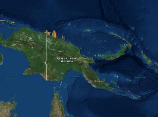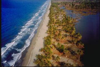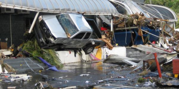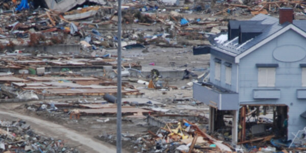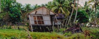
On July 17, 1998, a 7.0 magnitude (Mw) earthquake struck the island of Papua New Guinea at 5:49 p.m. local time. But the terror for the villagers on the islands was far from over after the ground stopped shaking. Three catastrophic tsunami waves followed—devastating and razing the entire villages of Sissano, Warapu, Arop, and Malomo on the north coast of Papua New Guinea, killing at least 1,600 people, injuring 1,000, and displacing more than 10,000 people.
Terror and Panic in Papua New Guinea
Soon after the first earthquake, there were several strong and moderate aftershocks that struck in rapid succession, with aftershocks lasting throughout the night.
According to Hugh Davies in his book about the 1998 event, Aitape Story, families in the coastal villages were gathered for their evening meals when the initial earthquake hit. It was also the beginning of a week of school vacation, so students had returned from their boarding schools to be with their families. The main earthquake caused some damage to structures and cracks developed in the ground but nothing appeared life-threatening.
Soon after, however, the villagers heard a loud boom and went to the beach to investigate the unusual noise, observing that the sea was “boiling” or "bubbling". They could see a large wave developing in the distance. The villagers ran away from the approaching waves, and a few escaped by climbing trees or pushing their boats into the lagoon, but almost all were caught. People in the waves were vigorously tumbled and turned in water that was inundated with debris.
Those who were lucky were able to cling to floating debris, but the less fortunate were swept out to sea or killed by piles of logs and debris. In the end, three tsunami waves had come in quick succession, killing and injuring virtually all in their path. Entire villages were erased.
A Unique Occurrence
The tsunami in Papua New Guinea had confirmed run-up heights of 15 meters (49 feet) at the village of Arop and 10–15 meters (33-49 feet) on a 25-kilometer (15-mile) stretch of coastline from the village of Sissano to Teles.
While most tsunamis are triggered by earthquakes, the tsunami that devastated Papua New Guinea was quite different. Since it arrived ten minutes later than predicted from earthquake sources, scientists determined that a submarine landslide generated by the earthquake actually triggered the tsunami.
This unusual occurrence generated interest in tsunami hazards in many parts of the world not previously considered at high risk of earthquake-generated landslide tsunamis. This event also brought to light the need for every country to identify the scope of their tsunami probability hazard and develop a tsunami preparedness plan.
From Great Disaster Comes Great Resilience
In the 1990s, the people of Papua New Guinea were largely unaware of their tsunami hazard risk. There had been no major tsunami causing significant loss of life in Papua New Guinea for more than 60 years.
After the 1998 tsunami, a video documentary was produced to help the villagers of Papua New Guinea understand why and how the tsunami disaster happened. The video showed how residents survived the earthquake and tsunami and provided suggestions on what to do in similar circumstances.
The video was shown a year later in 1999 to the residents of Vanuatu, an island not far from Papua New Guinea. The timing of the film showing was quite fortuitous as three weeks later, on November 26, 1999, a 7.5 Mw earthquake occurred, followed by a tsunami measured at 6.6 meters (21 feet). Since the villagers had just seen the video, only five people perished from the tsunami out of a possible 300.
NOAA’s Tsunami Warning Centers work in collaboration with international partners, including the International Tsunami Information Center, in a cooperative effort to minimize the impacts of tsunamis.
An effective tsunami warning system relies on the free and open exchange and long-term management of global data and science products to mitigate, model, and forecast tsunamis. NCEI is the global data and information service for tsunamis. Global historical tsunami data, including more information about the Papua New Guinea Tsunami of 1998, are available via interactive maps and a variety of web services.
For more information on how you can prepare for a tsunami, visit the National Tsunami Hazard Mitigation Program. Visit NCEI’s Natural Hazards website for more earthquake and tsunami data, images, and educational materials.
References
Davies, H. L. (2017). Aitape Story: The Great New Guinea Tsunami of 1998. Braddon, Australian Capital Territory: Halstead Press.
Kong, L., P. Dunbar, and N. Arcos (2015). Pacific Tsunami Warning System: A Half-Century of Protecting the Pacific 1965-2015. Honolulu: International Tsunami Information Center.

