Where the water meets the land, coastlines are formed. Humans gravitate toward the coast with almost 40 percent of the United States total population living in coastal counties. With a large and growing population, it is critical for all coastal communities to prepare to minimize the impacts of coastal flooding events including tsunamis, sea level rise, storm surge, and hurricanes. Coastal digital elevation models (DEMs) are essential data products to help researchers and decision makers understand and predict environmental changes that affect coastal regions.
What is a DEM?
A coastal DEM depicts Earth’s land surface and seafloor in an integrated digital map of a coastal region.
NOAA develops and uses coastal digital elevation models to support a variety of mission requirements. These include coastal flood forecasts and warnings due to tsunamis, hurricanes, and storm surge, as well as research into fish habitats, sea level changes, and off-shore energy. Accurate coastal DEMs are needed because the shape and depth of the ocean floor affects the speed and height of waves, and the coastal land surface height primarily determines the inland extent of flooding.
An Integrated Framework
NCEI is an international leader in coastal DEM development. NCEI creates global, regional, and local coastal DEMs that enable modeling of ocean, coastal and surface processes, and improve event forecasting and warning systems.
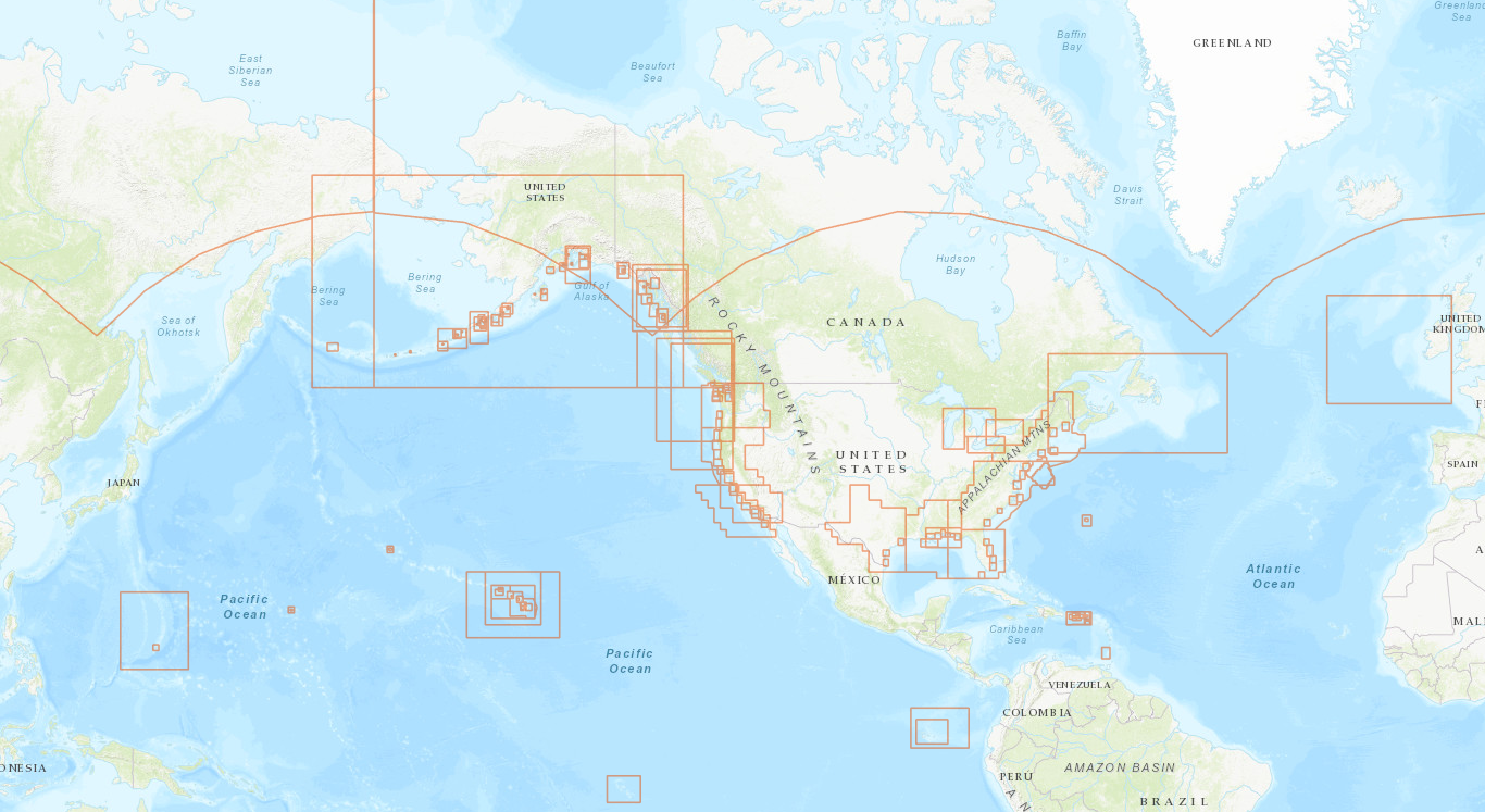
NCEI develops high-resolution DEMs by drawing on its vast archive of ocean floor depth data (bathymetry data), collected by NOAA for navigation and ocean resource management, and integrating the bathymetric data with land surface height data (topographic data) from other federal agencies, academia, and nonprofit organizations. These DEMs can be accessed through the NOAA NCEI Bathymetry Viewer and the NOAA Office for Coastal Management’s Digital Coast: Data Access Viewer. NCEI has developed over 200 DEMs including high-resolution, community-specific regional models and global models.
In the wake of Hurricane Sandy, NCEI and the U.S. Geological Survey collaboratively developed a framework to generate an accurate, consistent, and seamless national depiction of merged bathymetry and topography in the U.S. coastal zone. NCEI generates continuously updated digital elevation models (CUDEMs) that are tiled to enable targeted, rapid updates as new data become available. This framework supports a sustainable, seamless depiction of elevation from the near-shore to the Exclusive Economic Zone. CUDEMs support many different uses, such as tsunami modeling, hazard mitigation, spatial planning, habitat research, and coastal change studies.
Earth Visualization
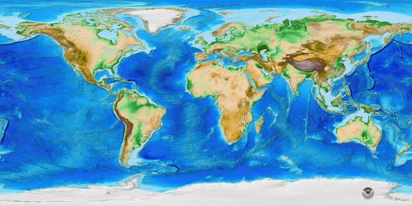
Beyond the coastline, Earth TOPOgraphy (ETOPO) 2022 Global Relief Model is a global DEM, integrating topography, bathymetry, and shoreline data to model the contours and features of the entire planet, both above and below sea level. With this Earth model, the characteristics of our world—both land and ocean floor—become more than two dimensional.
ETOPO 2022 provides accurate topographic and bathymetric data to predict water movement across ocean surfaces and over landscapes. Although it is designed to support tsunami forecasting, inundation, and warnings, the model can also be used for ocean circulation modeling and Earth visualization.
By providing a global, seamless bathymetry/topography mosaic that includes NCEI's ETOPO 2022 and the Continuously Updated DEMs (CUDEMs) for U.S. coastal regions, NCEI supports NOAA's mission to understand and predict changes in Earth's environment, and conserve and manage coastal and marine resources to meet our Nation's economic, social, and environmental needs.