The depth, shape, and composition of the seafloor are foundational data elements that are needed to explore, sustainably develop, conserve, and manage our coastal and offshore ocean resources. Mapping America’s waters is vital to human and marine health, coastal resilience, safe navigation, national security, and understanding how the ocean influences climate. Yet, despite centuries of coastal and ocean mapping, there remains a major gap in detailed nautical charts, bathymetric maps, and products over large parts of the ocean and coastal regions, including the U.S. Exclusive Economic Zone (EEZ).
Despite its critical importance, 53% of U.S. ocean, coastal, and Great Lakes waters are unmapped. This percentage was determined by the federal Interagency Working Group on Ocean Coastal Mapping in 2020 when it released a progress report showing the vast gaps yet to be mapped in U.S. waters. The gap analysis was a direct response to the National Strategy for Mapping, Exploring, and Characterizing the United States Exclusive Economic Zone (NOMEC), developed by a NOAA-led federal task force calling for fully mapped U.S. deep waters by the year 2030 and nearshore waters by 2040. Additional international efforts, including the Nippon Foundation–GEBCO Seabed 2030 Project, aim to resolve mapping deficiencies on the global scale.
Economic Prosperity Linked to the EEZ
The EEZ extends 200 nautical miles from U.S. shores and provides the Nation with sovereign rights for fishing, drilling, and other economic activities. It is larger than the land area of all 50 states combined, making it the second-largest EEZ in the world.

In 2016, NOAA estimated that the U.S. ocean economy produced more than $300 billion in goods and services and that there were approximately 154,000 ocean-dependent businesses, which employed more than 3 million people and paid $129 billion in wages.
Given the size of the current U. S. EEZ and coastline, the energy, critical minerals, living resources, and ecosystems it encompasses may be worth many billions if not trillions of dollars. The goal of the NOMEC strategy is to provide the foundational knowledge needed to address many complex ocean-related challenges and inform decision-making that will ultimately strengthen the Nation and its communities.
Data Availability is Key
The role of NCEI in the implementation of NOMEC is to archive and make data collected by federal and non-federal partners discoverable and publicly accessible. To achieve the goals of NOMEC, over 20 petabytes of new bathymetric data will need to be collected, in addition to the secondary datasets also expected to be collected, including backscatter, water column sonar, side-scan sonar, magnetometer, and subbottom profiler data.
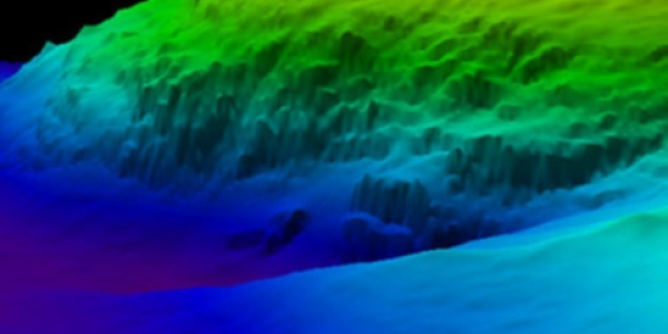
Multibeam and lidar surveys are the two primary sources of bathymetry needed to fill these gaps. In support of the integrated ocean and coastal mapping goal to “map once, use many times,” all of the data collected in this effort are publicly available via NCEI’s Bathymetric Data Viewer and NOAA Office of Coastal Management’s Digital Coast to benefit numerous user communities.
A Call to Action
The NOMEC Strategy is a call to action for Federal agencies and non-Federal partners to build a national enterprise to map, explore, and characterize the U. S. EEZ. Meeting this challenge requires coordinated action and collaborative efforts that join scientific inquiry, entrepreneurial enterprise, philanthropic endeavor, and public and private investment. It also requires a broadly defined but common direction to help guide our actions and ocean stewardship.
In doing so, we will dramatically increase our knowledge of ocean and coastal resources, and enhance our economic competitiveness, strengthen our national security, protect our environment and preserve continued prosperity.
 encompasses the U.S. Eastern Seaboard, Gulf of Mexico, Puerto Rico/U.S. Virgin Islands, and Hawaii.")