

While thousands of people have summited Mount Everest, the highest point on Earth, fewer than a handful have managed to explore our planet’s deepest point, a location known as the Challenger Deep in the Pacific Ocean’s Mariana Trench.
A Trench of Epic Proportions
Located in the western Pacific Ocean, east of the Philippines, the Mariana Trench is a crescent-shaped scar in Earth’s crust that measures more than 1,500 miles (2,550 kilometers) long and 43 miles (69 kilometers) wide on average. If you cut Mount Everest off at sea level and put it on the ocean bottom in the Challenger Deep, there would still be over a mile of water over the top of it.
The Mariana Trench was formed through a process called subduction. Earth’s crust is made up of comparably thin plates that “float” on the molten rock of the planet’s mantle. While floating on the mantle, the edges of these plates slowly bump into each other and sometimes even collide head-on.
When two plates crash into each other, an oceanic plate plunges downward into the mantle, while the other plate rides up over the top. This movement creates a trench where the descending oceanic plate drags down the edge of the overriding plate. This movement also creates the largest known earthquakes, which often generate tsunamis.

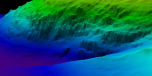
This image illustrates two plates crashing into each other. The Pacific Plate plunges downward into the mantle.
Today, the majority of the Mariana Trench is a U.S. protected zone as part of the Marianas Trench Marine National Monument, established in 2009.
Science Goes Deep
Part of the reason that the Challenger Deep is largely unexplored is due to hydrostatic pressure. When you enter any body of water and begin diving down from the surface, the deeper you dive the more water covers you. The more gallons of water between you and the surface, the greater the pressure on your body.
When you dive into a swimming pool and go all the way to the bottom of the deep end, you can often feel the hydrostatic pressure against your eardrums—a feeling of having them squeezed or pushed in. Magnify that feeling by thousands and you can imagine how incredible the pressure would be in the Challenger Deep with almost 7 miles of water overhead.
As challenging as it is to explore the Mariana Trench and the Challenger Deep in particular, several intrepid explorers have succeeded in this task.
The first recordings of the depth of the trench were made by the British Royal Navy Challenger expedition in 1875, using a weighted rope, which recorded a depth of 4,475 fathoms (8,184 meters; 26,850 feet).The Mariana Trench was also surveyed in 1951 by the British Survey vessel, Challenger II, which is the namesake for the Challenger Deep. In 1984, the Japanese sent a survey vessel to the Trench to collect data using a multibeam echo sounder. The sound waves sent from the echo sounder bounce off the bottom of the ocean and are plotted on a graph to make a map of the ocean bottom. This system allowed scientists to collect important environmental data without endangering a human diver. A 2010 multibeam sonar survey of the Mariana Trench by the University of New Hampshire found new seafloor features, and obtained the most precise measurement of Challenger Deep— 10,994 meters (6.8 miles), plus or minus 40 meters (.02 miles).
Most famously, in 2012, director James Cameron made a historic, solo dive down to the bottom of the Challenger Deep in a specially-designed manned submersible named DEEPSEA CHALLENGER. This expedition collected data and specimens previously unknown, leading to a wealth of scientific knowledge about one of the least known parts of our Earth.
Discover the Mariana Trench From Your Couch
You don’t have to take a trip in the DEEPSEA CHALLENGER to get a glimpse of the Mariana Trench for yourself. Experts at NCEI have created visual dive animations that allow you to travel through portions of the Mariana Trench.
Along with a visual journey to the Mariana Trench, you can view a wealth of data related to the area, including multibeam bathymetry data and digital elevation models (DEMs) that illuminate seafloor features, such as seamounts and fault scarps. DEMs are a 3D representation of terrain, merging both land and seafloor. An endeavor to map the entirety of the world’s ocean floor, Seabed 2030, will reveal even more seafloor features and deepen our understanding of the processes shaping the seabed.
With continued research into the deepest points of our ocean, the mysteries held in the Mariana Trench are slowly being revealed.
 encompasses the U.S. Eastern Seaboard, Gulf of Mexico, Puerto Rico/U.S. Virgin Islands, and Hawaii.")
