To communicate the hazards of hurricanes, researchers see value in a new forecasting metric

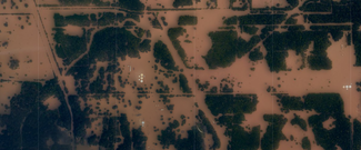
Besides deadly winds and battering waves, hurricanes can exhibit another devastating trait: intense rainfall. A group of researchers has developed a regional hurricane forecasting tool specifically for extreme precipitation in recognition of its increasing threat to life and property.
In the March 2020 Bulletin of the American Meteorological Society (BAMS), the researchers describe their new way to categorize hurricane rainfall hazards, an alternative but complementary metric to the widely used Saffir–Simpson wind scale.
The Wind Alternative: Extreme Rain Multiplier
The traditional Saffir–Simpson hazard scale concerns maximum sustained wind speeds—designating a storm a Category 1 to 5, with 1 being low (74–95 mph) and 5, catastrophic (157 mph or higher). The scale only addresses wind speed. The need for an alternative to Saffir-Simpson has become more important, because wind speed has not been a reliable predictor of tropical cyclone rainfall amounts.
Hurricanes examined in the study, Harvey in 2017 and Florence in 2018, both weakened post-landfall but caused severe flooding. In the case of Harvey in the Gulf of Mexico, the result was the highest tropical cyclone-related rainfall total ever recorded in the United States: Nederland, Texas received 1,500 mm (60 inches) of rain. Florence broke the North Carolina record for tropical cyclone rainfall.
Jim Kossin, a co-creator of the new metric, previously found a pattern emerging in hurricanes: a stalling effect. Regardless of wind speed, hurricanes that move slowly or stall over land can cause devastating impacts.
Because no official numeric scale of risk applies to rain in hurricane weather warnings, studies have found that descriptions have fallen short of providing the public accurate information. Calling an event a “500-year” or “1,000-year” flood has lacked relevance in the mind of the public, according to research. The new study developed a more intuitive alternative metric—the extreme rain multiplier (ERM).
ERM expresses tropical cyclone rainfall for a region by comparing the potential for rain to events more typically experienced in an area. In the study, the researchers used a region’s most severe 2-year rainfall event as a baseline. At any given time, a 2-year “heavy” rainstorm might occur 50 percent of the time, causing negative impacts. Because current conditions are compared to the recent past, greater understanding of the risk is likely.
Applying the New Metric
Authors from several universities, including Kossin of NCEI and based at the University of Madison-Wisconsin, applied the ERM to several hurricanes to check its validity, with significant results. A retrospective analysis of ERM values for tropical cyclones from 1948 to 2017 demonstrated the utility of the metric as a hazard quantification and communication tool.
The ERM correctly identified damaging historical tropical cyclones that would have been ranked potentially severe for rainfall but were classified as “weak” using wind-based metrics. Along with Hurricane Harvey, two other hurricanes were described: Hurricane Georges in Mississippi and Hurricane Floyd in North Carolina. All three generated high ERMs.
Hurricane Georges made landfall near Biloxi, Mississippi, on September 28, 1998, as a Category 2 storm. Within 24 hours, the system weakened to a tropical depression and became nearly stationary. Georges generated 561 mm (22 inches) of rain in two days. Hurricane Floyd first came ashore in North Carolina as a Category 2 storm on September 19, 1999, and left 415 mm (16 inches) of rainfall in one day near Bald Head Island, North Carolina.
The examples spanned the eastern and southern United States, showing that ERM applied across regions and added credence to the metric’s validity.


