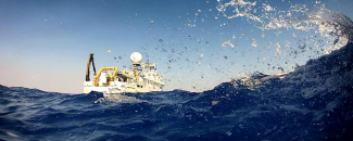
We are proud to support NOAA Ocean Exploration in its efforts to explore the world’s ocean using the NOAA ship Okeanos Explorer. Our combined data management efforts deliver rapid data access and data visualization, facilitate efficient and effective long-term data preservation, and inspire further exploration and research. These ocean exploration data collections align with FAIR (Findable, Accessible, Interoperable, Reusable) principals through careful stewardship and are available to the public through our NOAA Ocean Exploration Data Management website.
Okeanos Explorer’s remotely operated vehicle (ROV), Deep Discoverer, collects biological, geological, and water samples during dives to help scientists understand more about the physical, chemical, and biological environment of the deep ocean. NCEI scientists work with NOAA Ocean Exploration to assist in the collection of critical baseline information about unknown and poorly understood areas of the ocean. Our staff often work as Sample Data Managers to preserve physical data samples and enter information into the Sampling Operations Database Application—a database which NCEI developed and maintains that ties the environmental variables to the physical samples. This “data about the data” follows the physical samples throughout the data's life cycle ending at the long-term repository, such as biological samples being curated at the Smithsonian National Museum of Natural History.
In addition to supporting the Okeanos Explorer, NCEI also provides data management for NOAA Ocean Exploration’s funded opportunities. The projects are funded via annual competitive opportunity and enable other agencies, academia, and nonprofits to contribute to the NOAA Ocean Exploration mission by enhancing ocean exploration and scientific knowledge of unexplored or poorly known areas of the ocean.
Live Operations Map
NCEI partners with NOAA Ocean Exploration to provide the Okeanos Explorer-Live Operations Map. This map viewer provides near-real-time information about the Okeanos Explorer’s current location and meteorological readings. The map also displays the compiled ship track for the current cruise and daily multibeam bathymetric products. This map is hosted through Esri's ArcGIS Online, using cloud technologies.
We also partner to maintain the Ocean Exploration Data Atlas. The Data Atlas is an interactive map that displays the locations of NOAA-sponsored expeditions from 2001 to present. The atlas provides scientists and the public with improved data visualization as well as direct links providing access to scientific data and products, related publications and documentation, biological and geological specimen information, and even educational resources.
Data Access Pages
The Ocean Exploration Data Management Team at NCEI recognizes that not all end users are familiar with accessing data via map viewers. To provide a more approachable experience for accessing data collected by NOAA Ship Okeanos Explorer, NCEI developed and maintains the data access landing pages. The NOAA Ocean Explorations funded opportunities data access page can be found here.
Video Portal
The NOAA Ocean Exploration Video Portal makes searching thousands of hours of high-definition video easy. Since 2010, the Okeanos Explorer has collected hundreds of terabytes—thousands of hours—of underwater video. Viewers have been thrilled to follow along with the voyages of the Okeanos Explorer to catch glimpses of curious marine animals, historic shipwrecks, and amazing geological formations. To address the high demand for these underwater videos, NCEI created the self-service portal for finding, previewing, and downloading these video data.
Benthic Animal Guide
The video data collected during expeditions can be used for many purposes. A good example is the Benthic Deepwater Animal Identification Guide which was created by NCEI with the guidance of Dr. Christopher Kelley of the University of Hawaii. This guide is a collection of high-resolution images of marine animals created from video recorded during the Okeanos Explorer’s 2015-2017 missions in the Pacific Ocean. The guide is organized by major taxa, or scientific units of animals, and is a reference for scientists and anyone else interested in these fascinating deep-sea dwellers.
Understanding the Ocean
These data collections contribute greatly to scientific understanding of the world’s ocean. Working with NOAA Ocean Exploration, NCEI carefully stewards the vital sonar, oceanographic, imagery, video, and collected specimen information that contributes to the scientific understanding of the world’s ocean. We ensure the data are available to the public and align with FAIR (Findable, Accessible, Interoperable, Reusable) principals. These joint efforts enable rapid and easy data access, facilitate efficient and effective long-term data preservation, and inspire further ocean exploration and research.


