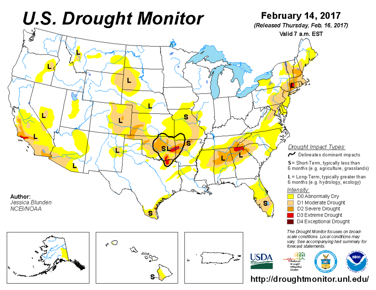
According to the February 14, 2017, U.S. Drought Monitor, moderate to extreme drought covers 13.5% of the contiguous United States, a decrease from last week’s 14.3%. Areas of extreme drought remained unchanged. No areas were in exceptional drought, the worst category.
Drought contracted as Pacific weather systems continued to hammer the West Coast this U.S. Drought Monitor week, bringing several more inches of precipitation to the coastal states, while a couple strong low pressure systems brought above-normal rain and snow to the eastern Great Lakes and Northeast. Passing fronts and low pressure systems left above-normal precipitation across parts of the Southeast and Northern Plains, but most of the Plains and Mid-Atlantic states were drier than normal, with drought or abnormal dryness expanding in some areas. Warmer-than-normal temperatures dominated most of the country, except for parts of the Northwest and New England, which averaged cooler than normal for the week.

The full U.S. Drought Monitor weekly update is available from Drought.gov.
In addition to Drought.gov, you can find further information on the current drought as well as on this week’s Drought Monitor update at the National Drought Mitigation Center.
The most recent U.S. Drought Outlook is available from NOAA’s Climate Prediction Center and the U.S. Department of Agriculture’s World Agriculture Outlook Board provides information about the drought’s influence on crops and livestock.
For additional drought information, follow #DroughtMonitor on Facebook and Twitter.


