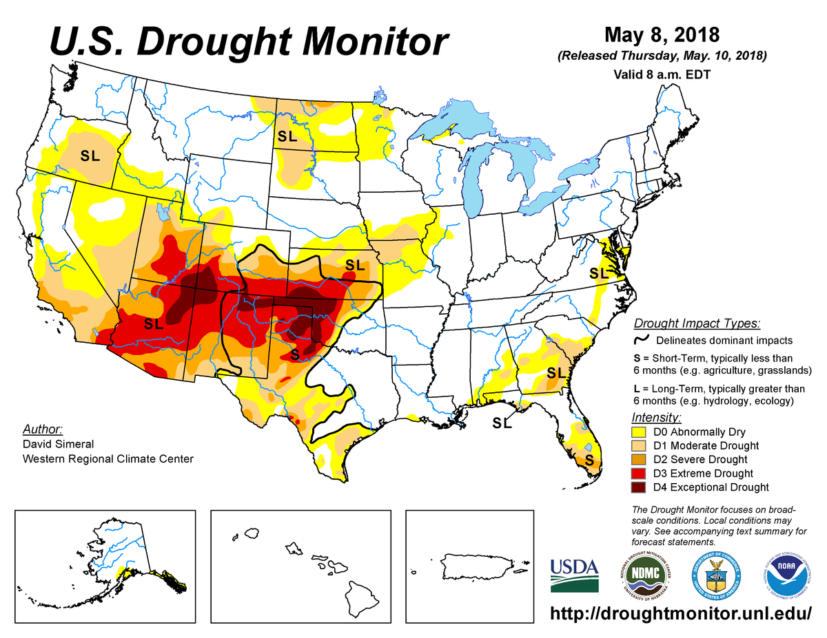
According to the May 8, 2018, U.S. Drought Monitor, moderate to exceptional drought covers 27.7% of the contiguous United States, a slight decrease from last week’s 28.6%. Extreme and exceptional drought—the worst categories—expanded to cover 9.3% of the Lower 48, up from 8.9% last week.
A broad-scale ridge in the upper atmosphere brought warmer-than-normal temperatures to most of the contiguous United States during this U.S. Drought Monitor week. Large, slow-moving upper-level weather systems, and their associated surface cold fronts, slogged through the ridge, bringing areas of rain to parts of the country. The ridge generally inhibited precipitation, so only parts of the West, southern and central Plains, Great Lakes, middle Appalachia, and southern Florida saw locally widespread above-normal precipitation. As a result, drought and abnormal dryness contracted in parts of the southern to central Plains, but expanded in parts of the Southwest, northern Plains, Mid-Mississippi Valley, and Southeast.
Abnormal dryness and drought are currently affecting over 91 million people across the United States—about 29.3% of the country’s population.

The full U.S. Drought Monitor weekly update is available from Drought.gov.
In addition to Drought.gov, you can find further information on the current drought as well as on this week’s Drought Monitor update at the National Drought Mitigation Center.
The most recent U.S. Drought Outlook is available from NOAA’s Climate Prediction Center and the U.S. Department of Agriculture provides information about the drought’s influence on crops and livestock.
For additional drought information, follow #DroughtMonitor on Facebook and Twitter.


