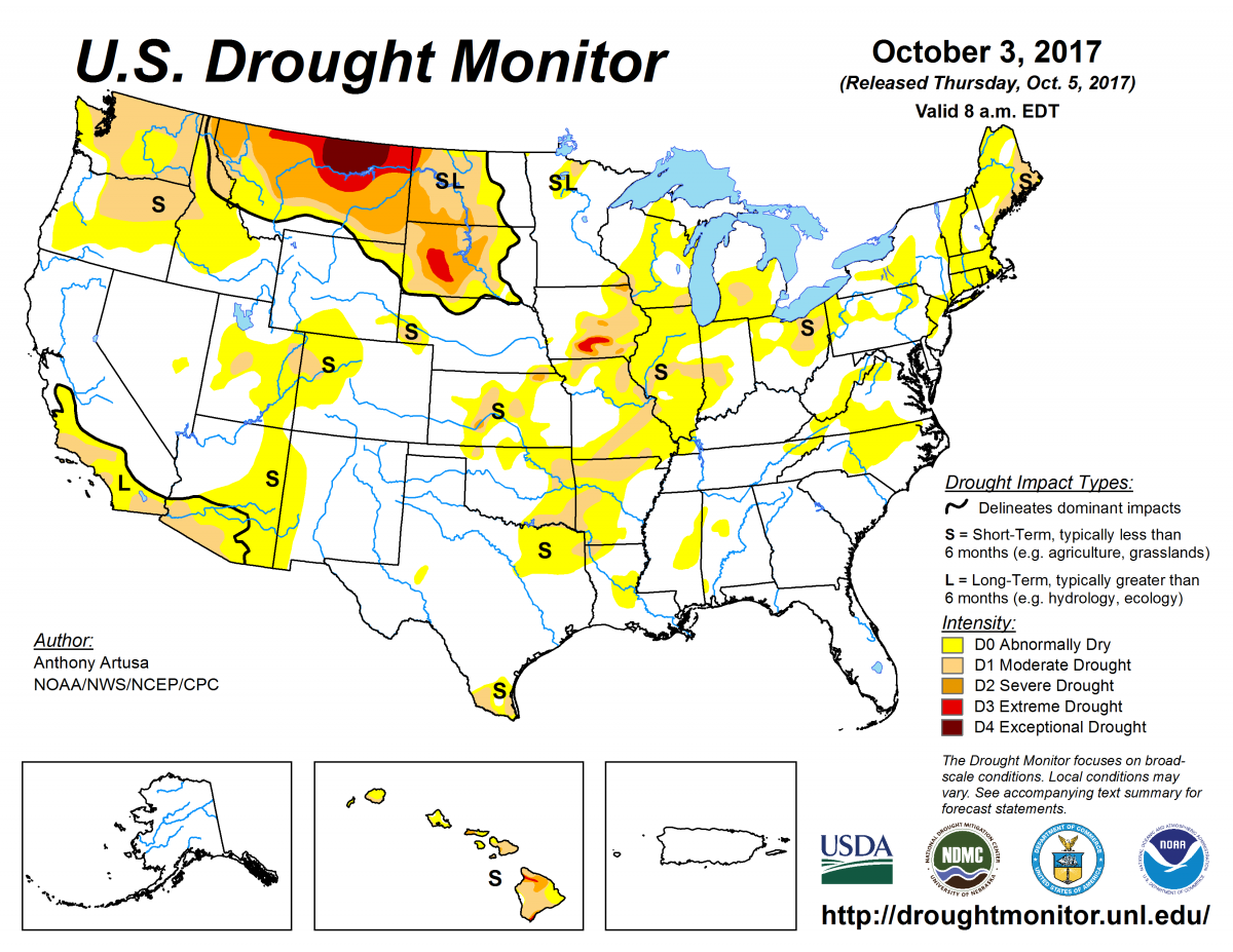
According to the October 3, 2017, U.S. Drought Monitor, moderate to exceptional drought covers 14.4% of the contiguous United States, an increase from last week’s 13.8%. However, the worst drought categories (extreme to exceptional drought) decreased from 2.4% last week to 1.4%.
The main atmospheric circulation pattern continued to be an upper-level trough over the western contiguous United States and an upper-level ridge over the East. However, weather systems migrated through this pattern, dragging mostly dry Canadian cold fronts along with them. And by the end of the week, a third front stalled out over the Great Plains.
The fronts left above-normal precipitation in their wake from the Rockies to Upper Midwest and improved drought conditions. Temperatures averaged below normal beneath the trough in the West and above normal from the Plains to East Coast beneath the upper-level ridge. The ridge also kept the weather dry from the Mississippi River to the East Coast, with drought and abnormal dryness expanding in places.
Abnormal dryness and drought are currently affecting nearly 127 million people across the United States—about 40.7% of the country’s population.

The full U.S. Drought Monitor weekly update is available from Drought.gov.
In addition to Drought.gov, you can find further information on the current drought as well as on this week’s Drought Monitor update at the National Drought Mitigation Center.
The most recent U.S. Drought Outlook is available from NOAA’s Climate Prediction Center and the U.S. Department of Agriculture provides information about the drought’s influence on crops and livestock.
For additional drought information, follow #DroughtMonitor on Facebook and Twitter.


