Fire activity spread northward across the U.S. during July, as numerous large fires developed across the Pacific Northwest, Northern Rockies, and Columbia Plateau regions. As reported by the National Interagency Fire Center, over 4.6 million acres had burned across the U.S. by the end of July. The area burned had surpassed 5 million acres as of mid–August, with activity increasing significantly along the Bitterroot Mountains of Idaho and Montana during the first half of August.
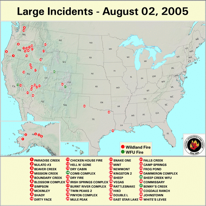
The majority of the large fire activity during the first half of the season occurred in the Southwest and Great Basin regions, where numerous fires continued to burn in July and early August. The locations and extent of wildfire activity in the western U.S. through the month of July can be seen on the active and burned area map from the 31 July 2005 MODIS fire detections. Significant fire activity was also observed across interior parts of Alaska and the western Yukon during July.

Drier than normal conditions across the western U.S. this summer have contributed to extremely low dead fuel moisture levels across the West and High Plains. Fine fuels remained extremely dry across the Great Basin, but dry fuels have also developed across northern California and the interior Pacific Northwest. 10–hr fuel moistures in early August were below 5% across most of these areas.
| As of July 31, 2005 | Nationwide Number of Fires | Nationwide Number of Acres Burned |
|---|---|---|
| 2005 | 38,371 | 4,673,837 |
| 2004 | 47,650 | 5,495,416 |
| 2003 | 36,301 | 1,822,974 |
| 10–year Average | N/A | 2,700,734 |
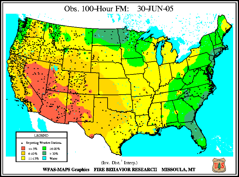
Medium to larger fuels dried out east of the Cascade Mountain range across the Columbia Plateau during July (i.e., the July 31st 100–hr and July 31st 1000–hr fuel moistures), with 100–hr fuels below 5% over most of eastern Washington and Oregon by the end of the month. The observed fuel moistures at the end of July were a significant change from those measured at the end of June for this region (i.e., see the June 30th 100–hr fuel moistures).
The Keetch–Byram Drought Index (KBDI), a widely used index for fire risk, had the largest potential for wildland fire activity in the contiguous U.S. at the end of July across parts of northern California and coastal Oregon, along with a large area of the southern Plains and Gulf Coast region. For further information on drought conditions go to the July drought summary page for the U.S.
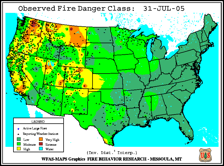
Also note that the potential for large fire development was evident in the fire danger classification at the end of July, which remained very high to extreme across parts of eastern Washington and Montana.