
Océano Profundo 2018: Exploring Deep-Sea Habitats off Puerto Rico and the U.S. Virgin Islands
Vessel: NOAA Ship Okeanos Explorer; Expedition Dates: October 30, 2018 to November 20, 2018
Ports: San Juan, PR to San Juan, PR
Project Principals: Daniel Wagner, NOAA/OAR/OER (Expedition Coordinator); Derek Sowers, NOAA/OAR/OER (Mapping Lead)
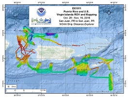
Operations will include the use of the ship's deep-water mapping systems (Kongsberg EM302 multibeam sonar, EK60 split-beam fisheries sonars, Knudsen 3260 chirp sub-bottom profiler sonar, and Teledyne Acoustic Doppler Current Profiler), XBTs in support of multibeam sonar mapping operations, CTD casts, OER's two-body ROV system (Deep Discoverer and Seirios), and the ship's high-bandwidth satellite connection for continuous ship-to-shore communications. Operations will focus on exploring deep waters (>250 m) in the U.S. exclusive economic zone (EEZ) of the Caribbean Sea, as well as in territorial waters surrounding surrounding Puerto Rico and the U.S. Virgin Islands.
Expedition Data and Resources
| Ship Navigation Data (ASCII) | Download | Use zip utility to open file |
| Ship SCS/Sensor Data (ASCII) | Download | Use zip utility to open file |
| Ship SCS/Sensor Data (NetCDF) | Open | NetCDF file format: Special software needed to read |
| Shipboard CTDs | Download | Use zip utility to open file |
| Mapping Products | Download | Use zip utility to open file |
Submersible Data and Resources
| Dive Track KMLs | Download | Use zip utility to open file |
| Event Logs | Open | Click to open link |
| Cruise Video Collection Self-Service Portal | Open | Click to open link |
| Collected Specimens | Open | Click to open link |
| Submersible Navigation/Sensor Data (ASCII) | Download | Use zip utility to open file |
Collected Specimen Repositories
| Smithsonian Institution's National Museum of Natural History Research and Collections (Biological Samples) | Open | Click to visit repository website |
| Ocean Genome Legacy Center (OGL) at Northeastern University | Open | Click to visit repository website |
| Oregon State University's Marine Geology Repository | Open | Click to visit repository website |
Educational Resources
| Expedition Education Module | Open | Click to open Education Module |
| Lesson Plans (K-12) | Open | Click to open Lesson Plans |
| Education Materials Collection | Open | Click to open Education Materials |
Links to Archived Data and Resources
| Multibeam Archive Collection | Get Data | Click to Access Archive |
| Water Column Sonar Archive Collection | Get Data | Click to Access Archive |
| Trackline Data (Single-beam and Sub-bottom) | Get Data | Click to Access Archive |
| Physical, Chemical, and Biological Archive Collection | Get Data | Click to Access Archive |
| Expedition Metadata | Open | Click to view Metadata in xml format |
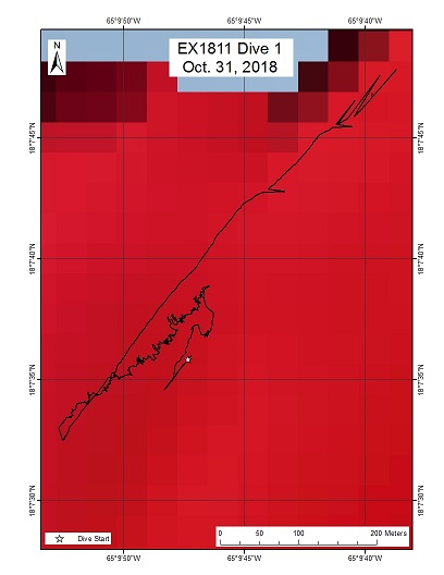
East of Vieques Island
Area
East of Vieques Island; U.S. Caribbean Sea
Overview
| Date: | October 31, 2018 |
| Max Depth: | 283 Meters |
| Bottom Time: | 2 Hours 11 Minutes 43 Seconds |
Purpose
The purpose of the dive was exploratory with an emphasis on identifying occurrences of deepwater fish species, as well as their habitat preferences along the dive track. The dive survey was designed to traverse a variety of slopes, ultimately ending on a local topographic high. The targeted depth range lied within the known depth range for commercially important snapper species in the area. The dive also targeted deep-sea coral and sponge communities.
Download & View Files
| Dive Summary Report (PDF - 1.36 MB) | View/Download | Requires Adobe Acrobat Reader to view the Dive Summary Report |
| Dive Track (KML - 64.1 KB) | View/Download | Requires Google Earth or equivalent client to view the Dive Track |
| ROV Ancillary Data (Zip - 2.4 MB) | Download | Link takes you to a public FTP server |
| ROV CTD/Sensor Data (Zip - 2.45 MB) | Download | Link takes you to a public FTP server |
| Camera Platform Sensor Data (Zip - 2.22 MB) | Download | Link takes you to a public FTP server |
| Low-Resolution Video Clips (Zip - 4.23 GB) | Download | Link takes you to a public FTP server |
| Underwater Still Images (Zip - 39.7 MB) | Download | Link takes you to a public FTP server |
| Dive Video Collection Self-Service Portal | Open | Link takes you to an online video discovery and access tool |
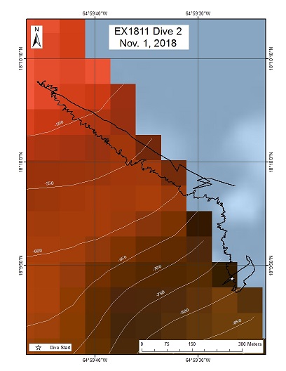
East of Vieques Island 2
Area
East of Vieques Island 2; U.S. Caribbean Sea
Overview
| Date: | November 01, 2018 |
| Max Depth: | 780 Meters |
| Bottom Time: | 6 Hours 55 Minutes 4 Seconds |
Purpose
The purpose of the dive was exploratory with an emphasis on identifying occurrences of deepwater fish species, as well as their habitat preferences. The dive survey was designed to traverse a variety of slopes and ultimately ending on a local topographic high. The targeted depth range lied within the known depth range for commercially-important snapper and grouper species. The dive also sought to survey and characterize deep-sea coral and sponge communities.
Download & View Files
| Dive Summary Report (PDF - 2.9 MB) | View/Download | Requires Adobe Acrobat Reader to view the Dive Summary Report |
| Dive Track (KML - 67.1 KB) | View/Download | Requires Google Earth or equivalent client to view the Dive Track |
| ROV Ancillary Data (Zip - 5.8 MB) | Download | Link takes you to a public FTP server |
| ROV CTD/Sensor Data (Zip - 6.23 MB) | Download | Link takes you to a public FTP server |
| Camera Platform Sensor Data (Zip - 6.04 MB) | Download | Link takes you to a public FTP server |
| Low-Resolution Video Clips (Zip - 11.7 GB) | Download | Link takes you to a public FTP server |
| Underwater Still Images (Zip - 159 MB) | Download | Link takes you to a public FTP server |
| Dive Video Collection Self-Service Portal | Open | Link takes you to an online video discovery and access tool |
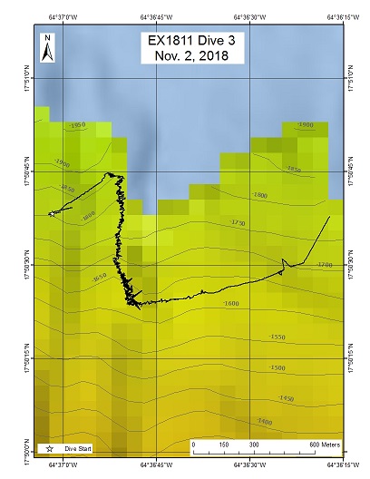
Buck Island Reef National Monument
Area
Buck Island Reef National Monument; U.S. Caribbean Sea
Overview
| Date: | November 02, 2018 |
| Max Depth: | 1812 Meters |
| Bottom Time: | 5 Hours 52 Minutes 6 Seconds |
Purpose
The purpose of the dive was exploratory with an emphasis on surveying and characterizing deep-sea coral and sponge communities. The dive also sought to document deepwater demersal fish species, as well as their habitat preferences along the dive track. The dive track was designed to start just outside the Monument boundary and traversed southward into the Monument up a steep slope.
Download & View Files
| Dive Summary Report (PDF - 1.36 MB) | View/Download | Requires Adobe Acrobat Reader to view the Dive Summary Report |
| Dive Track (KML - 67.7 KB) | View/Download | Requires Google Earth or equivalent client to view the Dive Track |
| ROV Ancillary Data (Zip - 4.44 MB) | Download | Link takes you to a public FTP server |
| ROV CTD/Sensor Data (Zip - 6.04 MB) | Download | Link takes you to a public FTP server |
| Camera Platform Sensor Data (Zip - 6.01 MB) | Download | Link takes you to a public FTP server |
| Low-Resolution Video Clips (Zip - 11.8 GB) | Download | Link takes you to a public FTP server |
| Underwater Still Images (Zip - 143 MB) | Download | Link takes you to a public FTP server |
| Dive Video Collection Self-Service Portal | Open | Link takes you to an online video discovery and access tool |
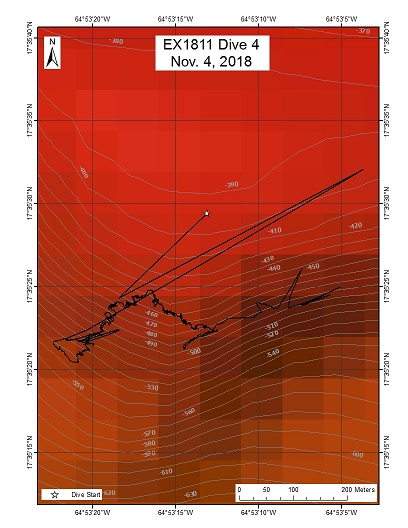
St. Croix Amphitheater
Area
St. Croix Amphitheater; U.S. Caribbean Sea
Overview
| Date: | November 04, 2018 |
| Max Depth: | 564 Meters |
| Bottom Time: | 4 Hours 51 Minutes 54 Seconds |
Purpose
The purpose of the dive was exploratory with an emphasis on surveying and characterizing deep-sea corals, specifically Lophelia pertusa, as well as deepwater sponges and demersal fish species.
Download & View Files
| Dive Summary Report (PDF - 1.59 MB) | View/Download | Requires Adobe Acrobat Reader to view the Dive Summary Report |
| Dive Track (KML - 66.6 KB) | View/Download | Requires Google Earth or equivalent client to view the Dive Track |
| ROV Ancillary Data (Zip - 3.68 MB) | Download | Link takes you to a public FTP server |
| ROV CTD/Sensor Data (Zip - 4.58 MB) | Download | Link takes you to a public FTP server |
| Camera Platform Sensor Data (Zip - 4.44 MB) | Download | Link takes you to a public FTP server |
| Low-Resolution Video Clips (Zip - 8.5 GB) | Download | Link takes you to a public FTP server |
| Underwater Still Images (Zip - 97.3 MB) | Download | Link takes you to a public FTP server |
| Dive Video Collection Self-Service Portal | Open | Link takes you to an online video discovery and access tool |
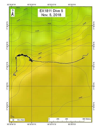
Virgin Islands Trough South Wall
Area
Virgin Islands Trough South Wall; U.S. Caribbean Sea
Overview
| Date: | November 05, 2018 |
| Max Depth: | 2153 Meters |
| Bottom Time: | 5 Hours 43 Minutes 54 Seconds |
Purpose
The purpose of the dive was to characterize the deep-sea coral and sponge communities in a relatively unexplored ridge feature west of St. Croix. The dive also sought to identify occurrences of deepwater demersal fish species, as well as their habitat preferences along the dive track. The dive track was designed to begin near the top of the south wall of the Virgin Islands Trough and then traversed southward up a steep nose feature in the wall from a depth of 1737 to 2138 m. Slopes expected along this dive track averaged between 30-40 degrees incline. This depth range was selected to better understand deepwater community transitions between steep topography and ridge crests.
Download & View Files
| Dive Summary Report (PDF - 1.8 MB) | View/Download | Requires Adobe Acrobat Reader to view the Dive Summary Report |
| Dive Track (KML - 67.5 KB) | View/Download | Requires Google Earth or equivalent client to view the Dive Track |
| ROV Ancillary Data (Zip - 5.03 MB) | Download | Link takes you to a public FTP server |
| ROV CTD/Sensor Data (Zip - 5.9 MB) | Download | Link takes you to a public FTP server |
| Camera Platform Sensor Data (Zip - 6.17 MB) | Download | Link takes you to a public FTP server |
| Low-Resolution Video Clips (Zip - 12.2 GB) | Download | Link takes you to a public FTP server |
| Underwater Still Images (Zip - 149 MB) | Download | Link takes you to a public FTP server |
| Dive Video Collection Self-Service Portal | Open | Link takes you to an online video discovery and access tool |
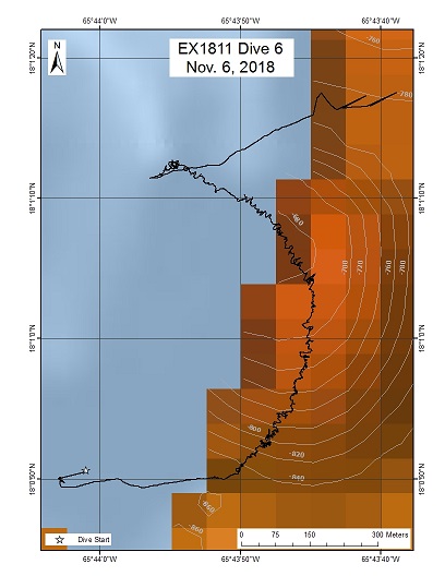
Punta Yeguas
Area
Punta Yeguas; U.S. Caribbean Sea
Overview
| Date: | November 06, 2018 |
| Max Depth: | 877 Meters |
| Bottom Time: | 7 Hours 10 Minutes 8 Seconds |
Purpose
The purpose of the dive was exploratory with an emphasis on identifying occurrences of deepwater fish species, corals and sponges, as well as their habitat preferences along the dive track. This dive took place in the Ines Maria Mendoza Nature Reserve, also known as Punta Yeguas. The dive track was designed to traverse a 200 m tall mound, starting at a steep slope towards the northeast.
Download & View Files
| Dive Summary Report (PDF - 2.01 MB) | View/Download | Requires Adobe Acrobat Reader to view the Dive Summary Report |
| Dive Track (KML - 66.7 KB) | View/Download | Requires Google Earth or equivalent client to view the Dive Track |
| ROV Ancillary Data (Zip - 4.98 MB) | Download | Link takes you to a public FTP server |
| ROV CTD/Sensor Data (Zip - 6.58 MB) | Download | Link takes you to a public FTP server |
| Camera Platform Sensor Data (Zip - 6.37 MB) | Download | Link takes you to a public FTP server |
| Low-Resolution Video Clips (Zip - 12 GB) | Download | Link takes you to a public FTP server |
| Underwater Still Images (Zip - 212 MB) | Download | Link takes you to a public FTP server |
| Dive Video Collection Self-Service Portal | Open | Link takes you to an online video discovery and access tool |
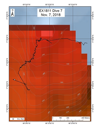
Isla Caja de Muertos
Area
Isla Caja de Muertos; U.S. Caribbean Sea
Overview
| Date: | November 07, 2018 |
| Max Depth: | 535 Meters |
| Bottom Time: | 4 Hours 35 Minutes 0 Seconds |
Purpose
The purpose of this dive was to survey deep-sea coral and sponge communities, as well as deepwater demersal fish species along the dive track. The dive started on a steep slope (40 degrees), while traversing northeast along gentle slope area and then moved up a mound. This site was located to the south of the Caja de Muertos Island, south of Ponce, Puerto Rico.
Download & View Files
| Dive Summary Report (PDF - 1.67 MB) | View/Download | Requires Adobe Acrobat Reader to view the Dive Summary Report |
| Dive Track (KML - 67 KB) | View/Download | Requires Google Earth or equivalent client to view the Dive Track |
| ROV Ancillary Data (Zip - 3.83 MB) | Download | Link takes you to a public FTP server |
| ROV CTD/Sensor Data (Zip - 4.93 MB) | Download | Link takes you to a public FTP server |
| Camera Platform Sensor Data (Zip - 4.73 MB) | Download | Link takes you to a public FTP server |
| Low-Resolution Video Clips (Zip - 8.9 GB) | Download | Link takes you to a public FTP server |
| Underwater Still Images (Zip - 108 MB) | Download | Link takes you to a public FTP server |
| Dive Video Collection Self-Service Portal | Open | Link takes you to an online video discovery and access tool |
La Parguera Ridges
Area
La Parguera Ridges; U.S. Caribbean Sea
Overview
| Date: | November 08, 2018 |
| Max Depth: | 1101 Meters |
| Bottom Time: | 6 Hours 57 Minutes 3 Seconds |
Purpose
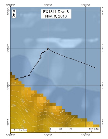
The purpose of the dive was to characterize deep-sea coral and sponge communities in an unexplored ridge feature off La Parguera. The dive also sought to identify occurrences of deepwater demersal fish species, as well as their habitat preferences along the dive track. The dive track began near the bottom of a steep slope (average 30 degree incline) and continued eastward toward a more moderate ridge.
Download & View Files
| Dive Summary Report (PDF - 1.56 MB) | View/Download | Requires Adobe Acrobat Reader to view the Dive Summary Report |
| Dive Track (KML - 67.9 KB) | View/Download | Requires Google Earth or equivalent client to view the Dive Track |
| ROV Ancillary Data (Zip - 4.56 MB) | Download | Link takes you to a public FTP server |
| ROV CTD/Sensor Data (Zip - 6.34 MB) | Download | Link takes you to a public FTP server |
| Camera Platform Sensor Data (Zip - 6.26 MB) | Download | Link takes you to a public FTP server |
| Low-Resolution Video Clips (Zip - 12.2 GB) | Download | Link takes you to a public FTP server |
| Underwater Still Images (Zip - 144 MB) | Download | Link takes you to a public FTP server |
| Dive Video Collection Self-Service Portal | Open | Link takes you to an online video discovery and access tool |
Jaguey Spur
Area
Jaguey Spur; U.S. Caribbean Sea
Overview
| Date: | November 09, 2018 |
| Max Depth: | 2789 Meters |
| Bottom Time: | 4 Hours 47 Minutes 46 Seconds |
Purpose
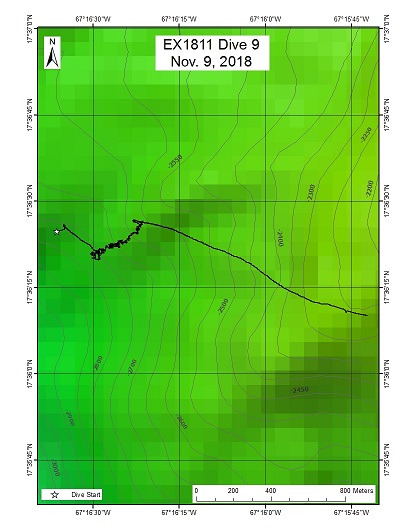
The purpose of this dive was to characterize deep-sea coral and sponge communities in an unexplored ridge feature and slope off the southwest coast of Puerto Rico. The dive also sought to identify occurrences of deepwater demersal fish species, as well as their habitat preferences along the seafloor. The dive track was designed to explore a steeply sloped ridge between depths of 2,786 to 2,502 m.
Download & View Files
| Dive Summary Report (PDF - 1.78 MB) | View/Download | Requires Adobe Acrobat Reader to view the Dive Summary Report |
| Dive Track (KML - 67.7 KB) | View/Download | Requires Google Earth or equivalent client to view the Dive Track |
| ROV Ancillary Data (Zip - 4.82 MB) | Download | Link takes you to a public FTP server |
| ROV CTD/Sensor Data (Zip - 5.84 MB) | Download | Link takes you to a public FTP server |
| Camera Platform Sensor Data (Zip - 5.79 MB) | Download | Link takes you to a public FTP server |
| Low-Resolution Video Clips (Zip - 11.5 GB) | Download | Link takes you to a public FTP server |
| Underwater Still Images (Zip - 120 MB) | Download | Link takes you to a public FTP server |
| Dive Video Collection Self-Service Portal | Open | Link takes you to an online video discovery and access tool |
Mona Canyon West Wall
Area
Mona Canyon West Wall; U.S. Caribbean Sea
Overview
| Date: | November 10, 2018 |
| Max Depth: | 2766 Meters |
| Bottom Time: | 3 Hours 36 Minutes 43 Seconds |
Purpose
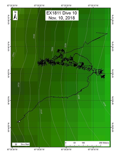
This dive was an extended (10 h) dive consisting of two parts. The first part explored the geology of a landslide scarp at Mona Canyon at 2,500-2,800 m depths, which is believed to have caused the major tsunami of 1918. This part of the dive sought to add additional observations on the geology of Mona Canyon to those made during previous dives in the canyon off the E/V Nautilus in 2013 and NOAA Ship Okeanos Explorer in 2015. The second part included a series of midwater transects at depths between 2,000 m and 300 m in order to explore the pelagic fauna of the area.
Download & View Files
| Dive Summary Report (PDF - 1.66 MB) | View/Download | Requires Adobe Acrobat Reader to view the Dive Summary Report |
| Dive Track (KML - 67.8 KB) | View/Download | Requires Google Earth or equivalent client to view the Dive Track |
| ROV Ancillary Data (Zip - 5.4 MB) | Download | Link takes you to a public FTP server |
| ROV CTD/Sensor Data (Zip - 7.5 MB) | Download | Link takes you to a public FTP server |
| Camera Platform Sensor Data (Zip - 7.49 MB) | Download | Link takes you to a public FTP server |
| Low-Resolution Video Clips (Zip - 14.1 GB) | Download | Link takes you to a public FTP server |
| Underwater Still Images (Zip - 106 MB) | Download | Link takes you to a public FTP server |
| Dive Video Collection Self-Service Portal | Open | Link takes you to an online video discovery and access tool |
Vega Baja Landslide
Area
Vega Baja Landslide; U.S. Caribbean Sea
Overview
| Date: | November 11, 2018 |
| Max Depth: | 3342 Meters |
| Bottom Time: | 4 Hours 35 Minutes 51 Seconds |
Purpose
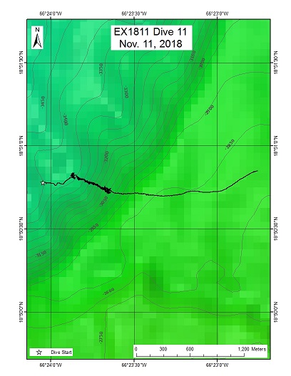
The purpose of this dive was to explore a landslide scarp north of Vega Baja, Puerto Rico. The site was originally proposed by partners at USGS due to its potential as a geohazard. The dive sought to make observations on the geology of exposed rocks and collect samples to determine the age of any recent geological activity in the area. Further, the dive sought to characterize the seafloor fauna of the area, focusing on deep-sea corals, sponges and demersal fishes.
Download & View Files
| Dive Summary Report (PDF - 1.72 MB) | View/Download | Requires Adobe Acrobat Reader to view the Dive Summary Report |
| Dive Track (KML - 67.9 KB) | View/Download | Requires Google Earth or equivalent client to view the Dive Track |
| ROV Ancillary Data (Zip - 4.86 MB) | Download | Link takes you to a public FTP server |
| ROV CTD/Sensor Data (Zip - 6.63 MB) | Download | Link takes you to a public FTP server |
| Camera Platform Sensor Data (Zip - 6.29 MB) | Download | Link takes you to a public FTP server |
| Low-Resolution Video Clips (Zip - 11.9 GB) | Download | Link takes you to a public FTP server |
| Underwater Still Images (Zip - 128 MB) | Download | Link takes you to a public FTP server |
| Dive Video Collection Self-Service Portal | Open | Link takes you to an online video discovery and access tool |
Mona Canyon East Wall
Area
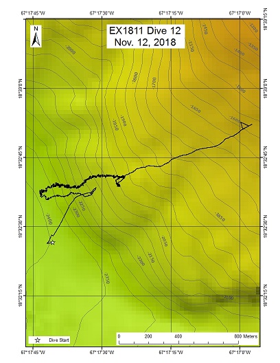
Mona Canyon East Wall; U.S. Caribbean Sea
Overview
| Date: | November 12, 2018 |
| Max Depth: | 2415 Meters |
| Bottom Time: | 6 Hours 2 Minutes 50 Seconds |
Purpose
The purpose of the dive was to characterize deep-sea coral and sponge communities in an unexplored steep ridge feature located on the eastern side of the Mona Canyon, off the northwestern shore of Puerto Rico. The dive also sought to identify the occurrences of deepwater demersal fish species, as well as their habitat preferences along the dive track.
Download & View Files
| Dive Summary Report (PDF - 1.84 MB) | View/Download | Requires Adobe Acrobat Reader to view the Dive Summary Report |
| Dive Track (KML - 68.2 KB) | View/Download | Requires Google Earth or equivalent client to view the Dive Track |
| ROV Ancillary Data (Zip - 5.17 MB) | Download | Link takes you to a public FTP server |
| ROV CTD/Sensor Data (Zip - 7.19 MB) | Download | Link takes you to a public FTP server |
| Camera Platform Sensor Data (Zip - 7.01 MB) | Download | Link takes you to a public FTP server |
| Low-Resolution Video Clips (Zip - 12.3 GB) | Download | Link takes you to a public FTP server |
| Underwater Still Images (Zip - 162 MB) | Download | Link takes you to a public FTP server |
| Dive Video Collection Self-Service Portal | Open | Link takes you to an online video discovery and access tool |
Mona Island Escarpment
Area
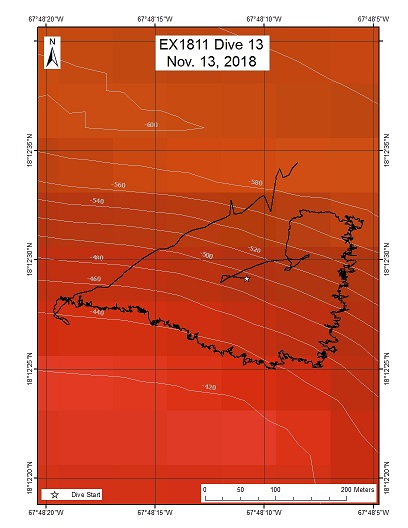
Mona Island Escarpment; U.S. Caribbean Sea
Overview
| Date: | November 13, 2018 |
| Max Depth: | 566 Meters |
| Bottom Time: | 6 Hours 55 Minutes 8 Seconds |
Purpose
This dive targeted potential habitats of commercially valuable deepwater fishes, including snappers and groupers. The depth profile and topography both fell in the habitat preferences of the commercially important deepwater fishes as reported by the local fishing community in the region. The dive also sought to characterize the habitats of deep-sea corals, sponges and other demersal fish communities.
Download & View Files
| Dive Summary Report (PDF - 1.7 MB) | View/Download | Requires Adobe Acrobat Reader to view the Dive Summary Report |
| Dive Track (KML - 67.3 KB) | View/Download | Requires Google Earth or equivalent client to view the Dive Track |
| ROV Ancillary Data (Zip - 4.63 MB) | Download | Link takes you to a public FTP server |
| ROV CTD/Sensor Data (Zip - 6.32 MB) | Download | Link takes you to a public FTP server |
| Camera Platform Sensor Data (Zip - 6.36 MB) | Download | Link takes you to a public FTP server |
| Low-Resolution Video Clips (Zip - 11.6 GB) | Download | Link takes you to a public FTP server |
| Underwater Still Images (Zip - 190 MB) | Download | Link takes you to a public FTP server |
| Dive Video Collection Self-Service Portal | Open | Link takes you to an online video discovery and access tool |
North of Bajo de Sico
Area
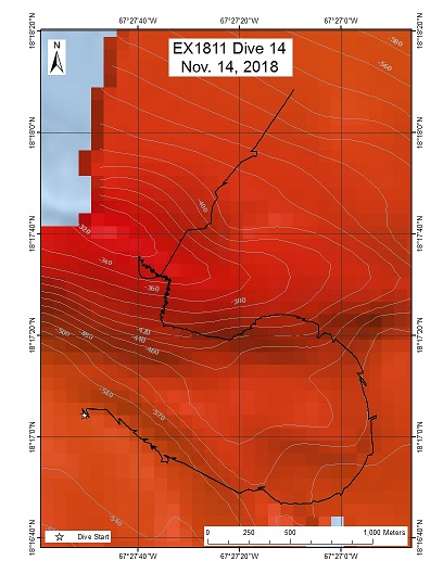
North of Bajo de Sico; U.S. Caribbean Sea
Overview
| Date: | November 14, 2018 |
| Max Depth: | 566 Meters |
| Bottom Time: | 3 Hours 1 Minutes 57 Seconds |
Purpose
This dive explored a submarine bank north of Bajo de Sico in the Mona Passage. The purpose of this dive was to make observations of potential habitats and occurences of deepwater fish species, including snappers and groupers. The depth profile and topography fell in the habitat preferences of commercially important fishes as reported by the local fishing community. This dive further sought to characterize the habitats of deep-sea corals, sponges, mobile invertebrates, and other demersal fish communities.
Download & View Files
| Dive Summary Report (PDF - 1.44 MB) | View/Download | Requires Adobe Acrobat Reader to view the Dive Summary Report |
| Dive Track (KML - 67.5 KB) | View/Download | Requires Google Earth or equivalent client to view the Dive Track |
| ROV Ancillary Data (Zip - 3.65 MB) | Download | Link takes you to a public FTP server |
| ROV CTD/Sensor Data (Zip - 4.31 MB) | Download | Link takes you to a public FTP server |
| Camera Platform Sensor Data (Zip - 4.46 MB) | Download | Link takes you to a public FTP server |
| Low-Resolution Video Clips (Zip - 8.5 GB) | Download | Link takes you to a public FTP server |
| Underwater Still Images (Zip - 94.1 MB) | Download | Link takes you to a public FTP server |
| Dive Video Collection Self-Service Portal | Open | Link takes you to an online video discovery and access tool |
Pichincho Wall East
Area
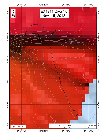
Pichincho Wall East; U.S. Caribbean Sea
Overview
| Date: | November 15, 2018 |
| Max Depth: | 366 Meters |
| Bottom Time: | 5 Hours 33 Minutes 10 Seconds |
Purpose
This dive targeted potential habitats of deep-sea fish species, including snappers and groupers. The depth profile and topography, fell in the habitat preferences of commercially important deepwater fishes as reported by the local fishing community. The dive also sought to characterize the habitats of deep-sea corals, sponges, mobile invertebrates and other demersal fish communities.
Download & View Files
| Dive Summary Report (PDF - 1.65 MB) | View/Download | Requires Adobe Acrobat Reader to view the Dive Summary Report |
| Dive Track (KML - 66.7 KB) | View/Download | Requires Google Earth or equivalent client to view the Dive Track |
| ROV Ancillary Data (Zip - 4.63 MB) | Download | Link takes you to a public FTP server |
| ROV CTD/Sensor Data (Zip - 6.47 MB) | Download | Link takes you to a public FTP server |
| Camera Platform Sensor Data (Zip - 6.38 MB) | Download | Link takes you to a public FTP server |
| Low-Resolution Video Clips (Zip - 11.7 GB) | Download | Link takes you to a public FTP server |
| Underwater Still Images (Zip - 187 MB) | Download | Link takes you to a public FTP server |
| Dive Video Collection Self-Service Portal | Open | Link takes you to an online video discovery and access tool |
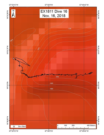
Pichincho Fish Tail
Area
Pichincho Fish Tail; U.S. Caribbean Sea
Overview
| Date: | November 16, 2018 |
| Max Depth: | 521 Meters |
| Bottom Time: | 6 Hours 59 Minutes 58 Seconds |
Purpose
This dive targeted potential habitats of deepwater fish species, including snappers and groupers. The depth profile and topography, fell within the habitat preferences of commercially important deepwater fishes as reported by the local fishing community in the region. The dive also sought to characterize the habitats of deep-sea corals, sponges, mobile invertebrates and other demersal fish communities along the seafloor.
Download & View Files
| Dive Summary Report (PDF - 1.94 MB) | View/Download | Requires Adobe Acrobat Reader to view the Dive Summary Report |
| Dive Track (KML - 67.3 KB) | View/Download | Requires Google Earth or equivalent client to view the Dive Track |
| ROV Ancillary Data (Zip - 4.85 MB) | Download | Link takes you to a public FTP server |
| ROV CTD/Sensor Data (Zip - 6.4 MB) | Download | Link takes you to a public FTP server |
| Camera Platform Sensor Data (Zip - 6.58 MB) | Download | Link takes you to a public FTP server |
| Low-Resolution Video Clips (Zip - 11.7 GB) | Download | Link takes you to a public FTP server |
| Underwater Still Images (Zip - 129 MB) | Download | Link takes you to a public FTP server |
| Dive Video Collection Self-Service Portal | Open | Link takes you to an online video discovery and access tool |
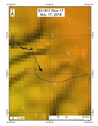
Mona South Ridge
Area
Mona South Ridge; U.S. Caribbean Sea
Overview
| Date: | November 17, 2018 |
| Max Depth: | 1212 Meters |
| Bottom Time: | 4 Hours 8 Minutes 37 Seconds |
Purpose
This was a two-part dive, with the first part targeting seafloor habitats at 1,000-1,200 m depths south of Mona Island, and the second part including midwater transects at 300-900 m depths. The purpose of the first portion of the dive was exploratory with objectives to characterize seafloor communities, both hard and soft bottom. Hardbottom faunal communities, including coral and sponges, were expected on steeper-sloped terrain and on top of the ridge feature.
Download & View Files
| Dive Summary Report (PDF - 1.67 MB) | View/Download | Requires Adobe Acrobat Reader to view the Dive Summary Report |
| Dive Track (KML - 67.8 KB) | View/Download | Requires Google Earth or equivalent client to view the Dive Track |
| ROV Ancillary Data (Zip - 5.44 MB) | Download | Link takes you to a public FTP server |
| ROV CTD/Sensor Data (Zip - 7.67 MB) | Download | Link takes you to a public FTP server |
| Camera Platform Sensor Data (Zip - 7.69 MB) | Download | Link takes you to a public FTP server |
| Low-Resolution Video Clips (Zip - 14.6 GB) | Download | Link takes you to a public FTP server |
| Underwater Still Images (Zip - 133 MB) | Download | Link takes you to a public FTP server |
| Dive Video Collection Self-Service Portal | Open | Link takes you to an online video discovery and access tool |
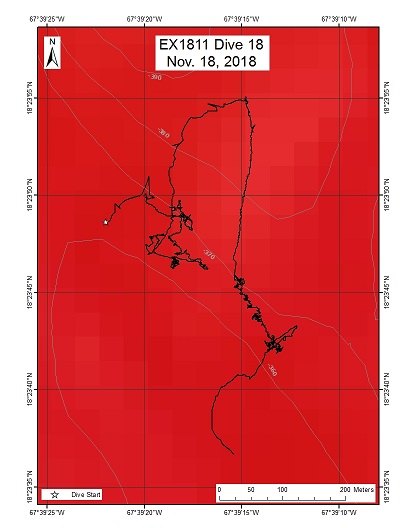
Desecheo Ridge
Area
Desecheo Ridge; U.S. Caribbean Sea
Overview
| Date: | November 18, 2018 |
| Max Depth: | 367 Meters |
| Bottom Time: | 3 Hours 45 Minutes 39 Seconds |
Purpose
This dive targeted potential habitats of deep-sea fish, including snappers and groupers. The depth profile and topography fell in the habitat preferences of commercially important deep-sea fishes as reported by the local fishing community. The dive also sought to characterize the habitats of deep-sea corals, sponges, and other demersal fish communities. Further, the dive targeted a range of different slope types to evaluate the influence of topography on deep-sea fish and benthic communities.
Download & View Files
| Dive Summary Report (PDF - 1.7 MB) | View/Download | Requires Adobe Acrobat Reader to view the Dive Summary Report |
| Dive Track (KML - 67 KB) | View/Download | Requires Google Earth or equivalent client to view the Dive Track |
| ROV Ancillary Data (Zip - 3.49 MB) | Download | Link takes you to a public FTP server |
| ROV CTD/Sensor Data (Zip - 3.91 MB) | Download | Link takes you to a public FTP server |
| Camera Platform Sensor Data (Zip - 3.94 MB) | Download | Link takes you to a public FTP server |
| Low-Resolution Video Clips (Zip - 7.4 GB) | Download | Link takes you to a public FTP server |
| Underwater Still Images (Zip - 121 MB) | Download | Link takes you to a public FTP server |
| Dive Video Collection Self-Service Portal | Open | Link takes you to an online video discovery and access tool |
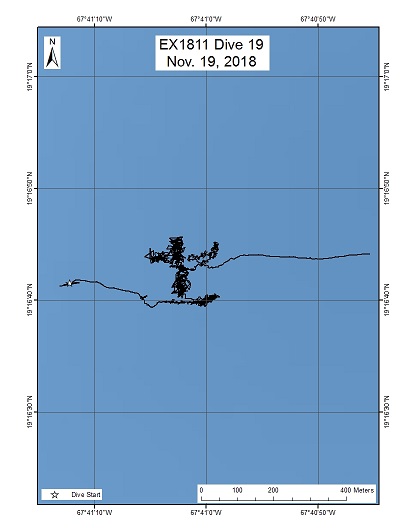
Mona Seamount
Area
Mona Seamount; U.S. Caribbean Sea
Overview
| Date: | November 19, 2018 |
| Max Depth: | 4998 Meters |
| Bottom Time: | 2 Hours 32 Minutes 22 Seconds |
Purpose
The purpose of the dive was exploratory with objectives to characterize seafloor faunal communities, both on hard and soft bottom habitats. Hardbottom faunal communities, including deep-sea coral and sponges, were anticipated on steep sloped terrain. The dive also sought to to identify deep-sea fishes, as well as the geology of Mona Seamount.
Download & View Files
| Dive Summary Report (PDF - 1.85 MB) | View/Download | Requires Adobe Acrobat Reader to view the Dive Summary Report |
| Dive Track (KML - 68.3 KB) | View/Download | Requires Google Earth or equivalent client to view the Dive Track |
| ROV Ancillary Data (Zip - 4.9 MB) | Download | Link takes you to a public FTP server |
| ROV CTD/Sensor Data (Zip - 6.69 MB) | Download | Link takes you to a public FTP server |
| Camera Platform Sensor Data (Zip - 6.37 MB) | Download | Link takes you to a public FTP server |
| Low-Resolution Video Clips (Zip - 11.9 GB) | Download | Link takes you to a public FTP server |
| Underwater Still Images (Zip - 93.6 MB) | Download | Link takes you to a public FTP server |
| Dive Video Collection Self-Service Portal | Open | Link takes you to an online video discovery and access tool |

