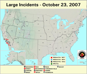
Long–term drought conditions and strong Santa Ana winds brought devastating wildfires to Southern California in October. Numerous large fires burned over 900,000 acres during the month across the region.
By the end of the month, incident managment teams had contained the largest of the wildfires in Southern California, although in early November two large fires continued to burn across Orange and San Diego counties.
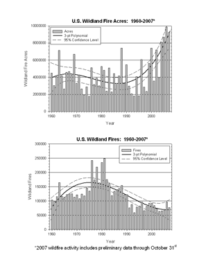
According to the National Interagency Fire Center (NIFC), as of November 5th over 77,600 wildland fires had been reported across the U.S., with more than 9.2 million acres burned so far in 2007.
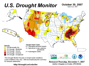
Unusually dry conditions and severe–to–extreme drought across most of the Intermountain West have resulted in a large region of extreme fire potential according to the U.S. Forest Service (USFS) experimental fire potential index.
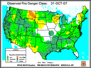
At the end of October, the highest fire danger remained across parts of Southern California, eastern Montana, and Wisconsin.
The extreme fire activity in southern California generated numerous smoke plumes that generally moved westward over the ocean. However, after the Santa Ana winds subsided and the flow turned onshore the smoke and poor air quality spread across portions of the Great Basin. Wildfires and smoke also impacted parts of Baja California in Mexico.
Dead fuel moisture levels have remained extremely dry across the western U.S. during October. The 10–hour fuel moisture levels on October 31st were exceptionally dry throughout most of the southwestern U.S., and were also unusually dry across the southern Appalachians due to widespread drought.
| Totals as of November 5th | Nationwide Number of Fires | Nationwide Number of Acres Burned |
|---|---|---|
| 11/5/2007 | 77,691 | 9,270,348 |
| 11/5/2006 | 89,036 | 9,468,959 |
| 11/5/2005 | 57,933 | 8,318,527 |
| 11/5/2004 | 63,412 | 8,057,053 |
| 11/5/2003 | 57,372 | 3,806,134 |
| 11/5/2002 | 70,140 | 6,734,211 |
| 11/5/2001 | 73,842 | 3,255,259 |
| 11/5/2000 | 87,809 | 7,048,206 |
| 5–yr average (2003 – 2007) |
72,089 | 7,784,204 |
| 10–yr average (1997 – 2006) |
74,140 | 6,337,096 |
Medium to larger fuels (i.e., the October 31st 100–hr and October 31st 1000–hr fuel moistures) were also very dry, with exceptionally dry fuel conditions across parts of the Southwest (Arizona, New Mexico and Nevada).
The Keetch–Byram Drought Index (KBDI), a widely used drought index for fire risk, had the largest potential for wildland fire activity in the contiguous U.S. across a large portion of California, as well as over most of Nevada and southwest Arizona.
At the end of October, wildfires also impacted the South Kohala region of the Big Island of Hawaii. The fires were located near Puako, where homes were threatened and residents were under mandatory evacuation orders.
 NOAA's National Centers for Environmental Information


