
Okeanos Explorer (EX1504L2): Campaign to Address Pacific monument Science, Technology, and Ocean NEeds (CAPSTONE) NWHI Exploration Leg II (ROV/Mapping)
Vessel: NOAA Ship Okeanos Explorer; Expedition Dates: July 31 - August 22, 2015
Project Principals: Kelley Elliott, NOAA/OAR/OER (Expedition Coordinator); Elizabeth Lobecker, NOAA/OAR/OER (Mapping Lead)
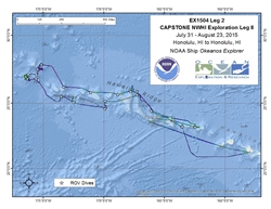
The ship will conduct 24 hour operations consisting of daytime ROV dives and evening/nighttime mapping operations including during transit. During this cruise we will conduct 8 hour ROV dives on most days with occasional 10 or 12 hour dives on particularly interesting or deep dive sites. ROV operations will focus in depths between 250 and 6,000 meters and will include high-resolution visual surveys and limited sample collection. Mapping operations will be conducted in 250 m of water and deeper, and include transit and overnight multibeam, water column backscatter, and sub-bottom data collection. Opportunistic CTD rosette operations may be requested to collect more information about the environmental parameters at ROV dives sites, or opportunistically at selected sites where collecting the data is considered important to understanding the physical or chemical properties of the overlying water column. ROV and mapping operations will not be conducted in state waters. CTD rosette operations may be requested in state waters.
Expedition Data and Resources
| Ship Navigation Data (ASCII) | Download | Use zip utility to open file |
| Ship SCS/Sensor Data (ASCII) | Download | Use zip utility to open file |
| Ship SCS/Sensor Data (NetCDF) | Open | NetCDF file format: Special software needed to read |
| Shipboard CTDs | Download | Use zip utility to open file |
| Mapping Products | Download | Use zip utility to open file |
| GIS Products | Download | Use zip utility to open file |
Submersible Data and Resources
| Dive Track KMLs | Download | Use zip utility to open file |
| Event Logs | Open | Click to open link |
| Collected Specimens | Open | Click to open link |
| Cruise Video Collection Self-Service Portal | Open | Click to open link |
| Submersible Navigation/Sensor Data (ASCII) | Download | Use zip utility to open file |
Collected Specimen Repositories
| Smithsonian Institution's National Museum of Natural History Research and Collections (Biological Samples) | Open | Click to visit repository website |
| Ocean Genome Legacy Center (OGL) at Northeastern University | Open | Click to visit repository website |
| Bernice Pauahi Bishop Museum's Marine Invertebrate Collection | Open | Click to visit repository website |
| Oregon State University's Marine Geology Repository | Open | Click to visit repository website |
Educational Resources
| Expedition Education Module | Open | Click to open Education Module |
| Lesson Plans (K-12) | Open | Click to open Lesson Plans |
| Education Materials Collection | Open | Click to open Education Materials |
Links to Archived Data and Resources
| Multibeam Archive Collection | Get Data | Click to Access Archive |
| Water Column Sonar Archive Collection | Get Data | Click to Access Archive |
| Trackline Data (Single-beam and Sub-bottom) | Get Data | Click to Access Archive |
| Physical, Chemical, and Biological Archive Collection | Get Data | Click to Access Archive |
| Collection of Documents | Get Data | Click to Access Archive |
| Expedition Metadata | Open | Click to view Metadata in xml format |
East Necker Seamount (Keoea Seamount)
Area
East Necker Seamount (Keoea Seamount); North Pacific Ocean; Northwestern Hawaiian Islands
Overview
| Date: | August 02, 2015 |
| Max Depth: | 2222 Meters |
| Bottom Time: | 5 Hours 14 Minutes 0 Seconds |
Purpose
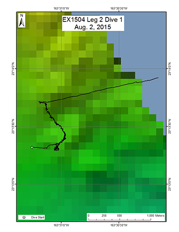
This dive, located on the southeast rift zone of Keoea seamount east of Necker Island (Mokumanamana), was carried out to determine the lower depth range of a coral and sponge community found in 2003 during a HURL Pisces submersible dive. This was the first of several dives that will be conducted for the purpose of identifying the lower depth limit of known communities of corals and sponges in the region, thereby providing information valuable to NOAA's Deep Sea Coral Research and Technology Program (DSCRTP). The primary objective was to explore the rift zone below the deepest depth reached by the submersible (1720m). The target start point of the dive was on a flat terrace located at a depth of 2221m, which transitions into a steep slope at approximately 2200m. The ROV plan was to survey up the steep slope to a final target depth between 1700-1800m, documenting in particular the abundance of corals and sponges present for comparison to previous finding by the HURL submersible in shallower water.
Download & View Files
| Dive Summary Report (PDF - 320 KB) | View/Download | Requires Adobe Acrobat Reader to view the Dive Summary Report |
| Dive Trailer (MOV - 43.1 MB) | Download | Link takes you to a public FTP server |
| ROV Ancillary Data (Zip - 1.67 MB) | Download | Link takes you to a public FTP server |
| ROV CTD/Sensor Data (Zip - 5.22 MB) | Download | Link takes you to a public FTP server |
| Camera Platform Sensor Data (Zip - 4.8 MB) | Download | Link takes you to a public FTP server |
| Low-Resolution Video Clips (Zip - 4.1 GB) | Download | Link takes you to a public FTP server |
| Underwater Still Images (Zip - 383 MB) | Download | Link takes you to a public FTP server |
| Dive Video Collection Self-Service Portal | Open | Link takes you to an online video discovery and access tool |
North French Frigate Shoals Seamount (Kanehunamoku Seamount)
Area
North French Frigate Shoals Seamount (Kanehunamoku Seamount); North Pacific Ocean; Northwestern Hawaiian Islands
Overview
| Date: | August 03, 2015 |
| Max Depth: | 2484.9 Meters |
| Bottom Time: | 5 Hours 12 Minutes 46 Seconds |
Purpose
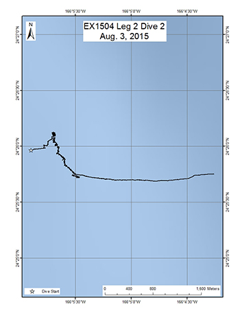
This dive was located on Kanehunamoku seamount located north of French Frigate Shoals. Its primary objective was to determine the lower depth range of a known dense coral and sponge community found in 2007. This was the second of several dives on this leg that will be conducted for the purpose of identifying the lower depth limit of important communities of corals and sponges in the region, thereby providing information valuable to NOAA's Deep Sea Coral and Technology Program (DSCTP). The target start point of the dive was on a small relatively flat area located at a depth of 2500m, which transitioned into a steep slope at approximately 2480m. The plan of the dive was to survey up the steep slope to a final target depth of approximately 2270m, documenting in particular the abundance of corals and sponges.
Download & View Files
| Dive Summary Report (PDF - 368 KB) | View/Download | Requires Adobe Acrobat Reader to view the Dive Summary Report |
| Dive Trailer (MOV - 78.4 MB) | Download | Link takes you to a public FTP server |
| ROV Ancillary Data (Zip - 1.89 MB) | Download | Link takes you to a public FTP server |
| ROV CTD/Sensor Data (Zip - 5.33 MB) | Download | Link takes you to a public FTP server |
| Camera Platform Sensor Data (Zip - 4.75 MB) | Download | Link takes you to a public FTP server |
| Low-Resolution Video Clips (Zip - 4.6 GB) | Download | Link takes you to a public FTP server |
| Underwater Still Images (Zip - 404 MB) | Download | Link takes you to a public FTP server |
| Dive Video Collection Self-Service Portal | Open | Link takes you to an online video discovery and access tool |
St. Rogatien Rift Zone Ridge
Area
St. Rogatien Rift Zone Ridge; North Pacific Ocean; Northwestern Hawaiian Islands
Overview
| Date: | August 04, 2015 |
| Max Depth: | 2155.6 Meters |
| Bottom Time: | 5 Hours 46 Minutes 19 Seconds |
Purpose
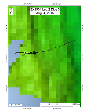
This dive was located on the east side of a large rift zone ridge north of St. Rogatien Bank. The objectives of the dive were to survey a completely unexplored area, testing the hypothesis that high density communities of corals and sponges can be found on ridge topography. No previous dives have ever been conducted on this site. Discovery of high density communities would provide valuable new information to NOAA's Deep Sea Coral and Technology Program (DSCTP). The target start point of the dive was a relatively flat terrace located at a depth of 2168m, which transitioned into a steep slope at approximately 2100m. The plan was to survey up the steep slope to a final target depth of approximately 1900m, documenting in particular the abundance of corals and sponges.
Download & View Files
| Dive Summary Report (PDF - 312 KB) | View/Download | Requires Adobe Acrobat Reader to view the Dive Summary Report |
| Dive Trailer (MOV - 51 MB) | Download | Link takes you to a public FTP server |
| ROV Ancillary Data (Zip - 2.28 MB) | Download | Link takes you to a public FTP server |
| ROV CTD/Sensor Data (Zip - 5.24 MB) | Download | Link takes you to a public FTP server |
| Camera Platform Sensor Data (Zip - 4.77 MB) | Download | Link takes you to a public FTP server |
| Low-Resolution Video Clips (Zip - 4.08 GB) | Download | Link takes you to a public FTP server |
| Underwater Still Images (Zip - 400 MB) | Download | Link takes you to a public FTP server |
| Dive Video Collection Self-Service Portal | Open | Link takes you to an online video discovery and access tool |
Maro Crater
Area
Maro Crater; North Pacific Ocean; Northwestern Hawaiian Islands
Overview
| Date: | August 05, 2015 |
| Max Depth: | 3036.4 Meters |
| Bottom Time: | 6 Hours 14 Minutes 59 Seconds |
Purpose
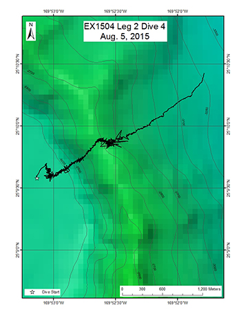
This dive was located on eastern ridge of a crater that is located East of Maro Reef. Its objectives were to explore for high density communities of deep-sea coral and sponges along the ridge of the crater, as well as gain insights into how this peculiar feature might have formed geologically. The target start point of the dive was a flat surface inside the crater located at a depth of 3035m. The plan was to move the inside base of the crater wall, and then survey up the slope to the crest of the crater rim. If time permitted, the plan was to drop down along the outside rim a short distance and survey back up to the crest on the outside of the rim. The final target depth was approximately at 2774m.
Download & View Files
| Dive Summary Report (PDF - 360 KB) | View/Download | Requires Adobe Acrobat Reader to view the Dive Summary Report |
| Dive Trailer (MOV - 57.7 MB) | Download | Link takes you to a public FTP server |
| ROV Ancillary Data (Zip - 2.32 MB) | Download | Link takes you to a public FTP server |
| ROV CTD/Sensor Data (Zip - 5.95 MB) | Download | Link takes you to a public FTP server |
| Camera Platform Sensor Data (Zip - 5.4 MB) | Download | Link takes you to a public FTP server |
| Low-Resolution Video Clips (Zip - 5.37 GB) | Download | Link takes you to a public FTP server |
| Underwater Still Images (Zip - 460 MB) | Download | Link takes you to a public FTP server |
| Dive Video Collection Self-Service Portal | Open | Link takes you to an online video discovery and access tool |
Southeast Maro Ridge
Area
Southeast Maro Ridge; North Pacific Ocean; Northwestern Hawaiian Islands
Overview
| Date: | August 06, 2015 |
| Max Depth: | 4831.2 Meters |
| Bottom Time: | 2 Hours 56 Minutes 47 Seconds |
Purpose
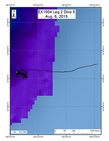
This dive was located on a ridge that is Southeast of Maro Reef. This dive was the deepest conducted during this cruise and its objective was to explore biological communities at depths that have never previously been explored inside the Monument. The target start point of the dive was on the abyssal seafloor located at a depth of 4830m, which transitioned into a steep slope at approximately 4800m. The plan was to survey up a steep slope to a final target depth of approximately 4450m, documenting in particular the abundance of corals and sponges.
Download & View Files
| Dive Summary Report (PDF - 240 KB) | View/Download | Requires Adobe Acrobat Reader to view the Dive Summary Report |
| Dive Trailer (MOV - 44.2 MB) | Download | Link takes you to a public FTP server |
| ROV Ancillary Data (Zip - 1.77 MB) | Download | Link takes you to a public FTP server |
| ROV CTD/Sensor Data (Zip - 5.3 MB) | Download | Link takes you to a public FTP server |
| Camera Platform Sensor Data (Zip - 4.85 MB) | Download | Link takes you to a public FTP server |
| Low-Resolution Video Clips (Zip - 2.41 GB) | Download | Link takes you to a public FTP server |
| Underwater Still Images (Zip - 144 MB) | Download | Link takes you to a public FTP server |
| Dive Video Collection Self-Service Portal | Open | Link takes you to an online video discovery and access tool |
West Northampton Seamount Ridge
Area
West Northampton Seamount Ridge; North Pacific Ocean; Northwestern Hawaiian Islands
Overview
| Date: | August 07, 2015 |
| Max Depth: | 1997 Meters |
| Bottom Time: | 5 Hours 34 Minutes 13 Seconds |
Purpose
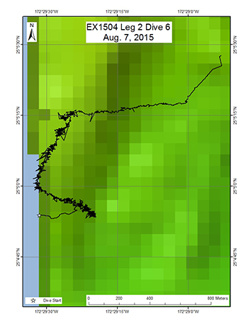
This dive was located on a ridge extending south from West Northampton Seamount. The objective of the dive was to survey a completely unexplored area of the seamount, testing the hypothesis that high density communities of corals and sponges can be found on ridge topography. The target start point of the dive was located along the east slope of the ridge at 1988m. The plan was to move west up the slope until the ROV reached the ridge crest at 1844m. At this point, the ROV would turn towards the north surveying up the ridge crest until a final target depth of approximately 1748m.
Download & View Files
| Dive Summary Report (PDF - 320 KB) | View/Download | Requires Adobe Acrobat Reader to view the Dive Summary Report |
| Dive Trailer (MOV - 67.5 MB) | Download | Link takes you to a public FTP server |
| ROV Ancillary Data (Zip - 1.95 MB) | Download | Link takes you to a public FTP server |
| ROV CTD/Sensor Data (Zip - 4.89 MB) | Download | Link takes you to a public FTP server |
| Camera Platform Sensor Data (Zip - 4.6 MB) | Download | Link takes you to a public FTP server |
| Low-Resolution Video Clips (Zip - 4.26 GB) | Download | Link takes you to a public FTP server |
| Underwater Still Images (Zip - 290 MB) | Download | Link takes you to a public FTP server |
| Dive Video Collection Self-Service Portal | Open | Link takes you to an online video discovery and access tool |
Pioneer Bank Ridge
Area
Pioneer Bank Ridge; North Pacific Ocean; Northwestern Hawaiian Islands
Overview
| Date: | August 08, 2015 |
| Max Depth: | 2118.4 Meters |
| Bottom Time: | 4 Hours 1 Minutes 13 Seconds |
Purpose
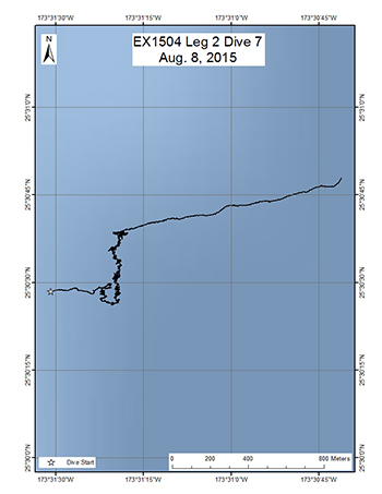
This dive was located on a sharp ridge extending to the south of Pioneer Bank. The objective of the dive was to survey the area below previous Pisces submersible dives on the ridge, in order to determine the lower depth limit of known communities of corals and sponges. The target start point of the dive was a relatively flat spot along the crest of the ridge at 2114m, which transitioned into a steep slope at 2100m. The plan was to move up the ridge from the south towards the north until a final target depth of 2000, documenting in particular the density of corals and sponges.
Download & View Files
| Dive Summary Report (PDF - 400 KB) | View/Download | Requires Adobe Acrobat Reader to view the Dive Summary Report |
| Dive Trailer (MOV - 34.9 MB) | Download | Link takes you to a public FTP server |
| ROV Ancillary Data (Zip - 2.09 MB) | Download | Link takes you to a public FTP server |
| ROV CTD/Sensor Data (Zip - 4.15 MB) | Download | Link takes you to a public FTP server |
| Camera Platform Sensor Data (Zip - 3.82 MB) | Download | Link takes you to a public FTP server |
| Low-Resolution Video Clips (Zip - 3.57 GB) | Download | Link takes you to a public FTP server |
| Underwater Still Images (Zip - 312 MB) | Download | Link takes you to a public FTP server |
| Dive Video Collection Self-Service Portal | Open | Link takes you to an online video discovery and access tool |
Bank 9 South
Area
Bank 9 South; North Pacific Ocean; Northwestern Hawaiian Islands
Overview
| Date: | August 09, 2015 |
| Max Depth: | 1381.6 Meters |
| Bottom Time: | 6 Hours 51 Minutes 2 Seconds |
Purpose
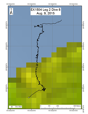
This dive was located on the south side of Bank 9, which is believed to be a Cretaceous guyot or flat-topped seamount. Previous high-resolution mapping data of Bank 9 suggests that it is a composite feature that includes both a Cretaceous guyot to the south as well as a younger Hawaiian guyot to the north. The objectives of the dive were to explore for high-density communities of deep-sea corals and sponges on the southern older part, starting just below the break in slope of the main terrace, then move up to the terrace top, transect over to the base of what appears to be a volcanic cone, and finally up the slope of the cone. We hoped to encounter a coral and sponge community either on the terrace edge or the cone, and that the dive would provide insights into how this peculiar composite seamount might have formed. We also planned to survey for the presence of fossil rudist bivalves, which if found would conclusively indicate a Cretaceous age for this part of Bank 9. The target start point of the dive was on the terrace flank at a depth of 1396 m, while the endpoint of the dive was at the summit of the cone at 1127m.
Download & View Files
| Dive Summary Report (PDF - 552 KB) | View/Download | Requires Adobe Acrobat Reader to view the Dive Summary Report |
| Dive Trailer (MOV - 50.5 MB) | Download | Link takes you to a public FTP server |
| ROV Ancillary Data (Zip - 2.29 MB) | Download | Link takes you to a public FTP server |
| ROV CTD/Sensor Data (Zip - 5.15 MB) | Download | Link takes you to a public FTP server |
| Camera Platform Sensor Data (Zip - 4.83 MB) | Download | Link takes you to a public FTP server |
| Low-Resolution Video Clips (Zip - 4.96 GB) | Download | Link takes you to a public FTP server |
| Underwater Still Images (Zip - 397 MB) | Download | Link takes you to a public FTP server |
| Dive Video Collection Self-Service Portal | Open | Link takes you to an online video discovery and access tool |
East Salmon Bank
Area
East Salmon Bank; North Pacific Ocean; Northwestern Hawaiian Islands
Overview
| Date: | August 10, 2015 |
| Max Depth: | 2284.6 Meters |
| Bottom Time: | 5 Hours 48 Minutes 36 Seconds |
Purpose
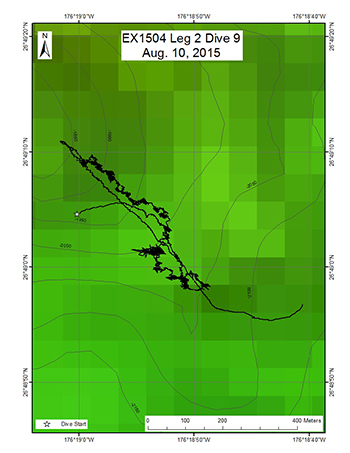
This dive site was located on a sharp ridge that extended west from East Salmon Bank, and its objective was to survey for the presence of high densities of corals and sponges and examine the impact of ridge orientation on the presence of high density communities. The discovery of a high density community would provide information valuable to NOAA's Deep Sea Coral and Technology Program (DSCTP). The target start point was a small relatively flat area located at a depth of 2300m, which transitioned into a steep slope towards the east at approximately 2250m. At this depth, the ROV would move northeastward to a final target depth of approximately 2046m, documenting in particular the abundance of corals and sponges.
Download & View Files
| Dive Summary Report (PDF - 296 KB) | View/Download | Requires Adobe Acrobat Reader to view the Dive Summary Report |
| Dive Trailer (MOV - 52.2 MB) | Download | Link takes you to a public FTP server |
| ROV Ancillary Data (Zip - 19.6 MB) | Download | Link takes you to a public FTP server |
| ROV CTD/Sensor Data (Zip - 19.6 MB) | Download | Link takes you to a public FTP server |
| Camera Platform Sensor Data (Zip - 4.71 MB) | Download | Link takes you to a public FTP server |
| Low-Resolution Video Clips (Zip - 5.26 GB) | Download | Link takes you to a public FTP server |
| Underwater Still Images (Zip - 249 MB) | Download | Link takes you to a public FTP server |
| Dive Video Collection Self-Service Portal | Open | Link takes you to an online video discovery and access tool |
Salmon Bank Southeast Ridge
Area
Salmon Bank Southeast Ridge; North Pacific Ocean; Northwestern Hawaiian Islands
Overview
| Date: | August 11, 2015 |
| Max Depth: | 2052.5 Meters |
| Bottom Time: | 5 Hours 38 Minutes 24 Seconds |
Purpose
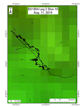
This dive was located on a ridge that extends to the southeast of Salmon Bank. The objectives were to survey a completely unexplored area for corals and sponges, testing the hypothesis that high density communities can be found on ridge topography. No previous dives have ever been conducted on this site. Discovery of high density communities would provide valuable information to NOAA's Deep Sea Coral and Technology Program (DSCTP) and to PMNM. The target start point of the dive was on a slope of the ridge at a depth of 2123m. The ROV would then survey up the slope of the ridge to a small summit at a final target depth of 1806m, surveying in particular for the presence of deep-sea corals and sponges.
Download & View Files
| Dive Summary Report (PDF - 392 KB) | View/Download | Requires Adobe Acrobat Reader to view the Dive Summary Report |
| Dive Trailer (MOV - 54.8 MB) | Download | Link takes you to a public FTP server |
| ROV Ancillary Data (Zip - 2.17 MB) | Download | Link takes you to a public FTP server |
| ROV CTD/Sensor Data (Zip - 5.14 MB) | Download | Link takes you to a public FTP server |
| Camera Platform Sensor Data (Zip - 4.72 MB) | Download | Link takes you to a public FTP server |
| Low-Resolution Video Clips (Zip - 4.15 GB) | Download | Link takes you to a public FTP server |
| Underwater Still Images (Zip - 398 MB) | Download | Link takes you to a public FTP server |
| Dive Video Collection Self-Service Portal | Open | Link takes you to an online video discovery and access tool |
Bank 9 North
Area
Bank 9 North; North Pacific Ocean; Northwestern Hawaiian Islands
Overview
| Date: | August 12, 2015 |
| Max Depth: | 2158.3 Meters |
| Bottom Time: | 5 Hours 39 Minutes 22 Seconds |
Purpose
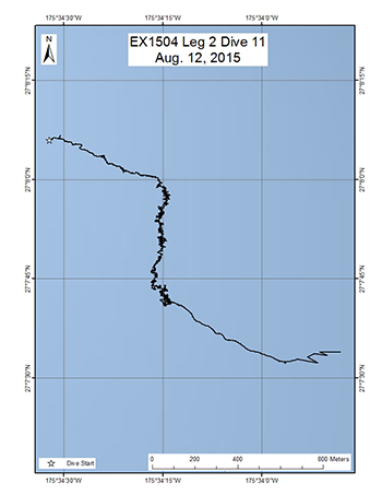
This dive was located on a modest ridge that extends north from the northern half of Bank 9. The objectives of the dive were to explore for high density communities of deep-sea corals and sponges along the ridge. The target start point of the dive was the top of the ridge at 2201m. The plan was to survey over to the east side of the ridge top to the break in slope, then turn south and survey along the edge to a final target depth of approximately 2091m, documenting in particular the abundance of corals and sponges.
Download & View Files
| Dive Summary Report (PDF - 272 KB) | View/Download | Requires Adobe Acrobat Reader to view the Dive Summary Report |
| Dive Trailer (MOV - 45.1 MB) | Download | Link takes you to a public FTP server |
| ROV Ancillary Data (Zip - 2.03 MB) | Download | Link takes you to a public FTP server |
| ROV CTD/Sensor Data (Zip - 5.09 MB) | Download | Link takes you to a public FTP server |
| Camera Platform Sensor Data (Zip - 4.62 MB) | Download | Link takes you to a public FTP server |
| Low-Resolution Video Clips (Zip - 6.38 GB) | Download | Link takes you to a public FTP server |
| Underwater Still Images (Zip - 420 MB) | Download | Link takes you to a public FTP server |
| Dive Video Collection Self-Service Portal | Open | Link takes you to an online video discovery and access tool |
Southeast Pearl & Hermes Ridge
Area
Southeast Pearl & Hermes Ridge; North Pacific Ocean; Northwestern Hawaiian Islands
Overview
| Date: | August 13, 2015 |
| Max Depth: | 2800.1 Meters |
| Bottom Time: | 5 Hours 46 Minutes 43 Seconds |
Purpose
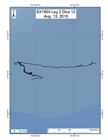
This dive was located along the western edge of a rift zone ridge extending southeast from Pearl & Hermes Atoll. The objectives of the dive were to explore for high density communities of deep-sea corals and sponges along the edge of the ridge crest, where there might be a local area of topographically induced upwelling. Additionally, as this dive explored a deeper depth than many of the previous dives of the expedition, it sought to obtain information on the lower depth range of these communities. The target start point of the dive was a relatively flat surface just above the break in slope at a depth of 2806m. The plan was to survey up the ridge along the western edge toward a final depth of 2751m. In addition to the surveying the seafloor, this dive would also include the first mid-water transects of the expedition, which would be carried out during the ROV's ascent towards the surface. The objective of the mid-water transects was to explore depths between 800-1200 m in order to examine the potential prey field for deep-diving toothed whales, as well as documenting other nekton and gelatinous megaplankton. The mid-water transects were planned to begin after the ROV came up from the seafloor and ascended to 1200m. A total of five mid-water transects were planned, each conducted for 10 minutes at 100m depth increments between 1200 and 800m (10-minute transect at 1200m, 1100m, 1000m, 900m, and 800m). During each transect, the ROV would be below and in sight of Seirios, moving at ~0.5 knots or less. If any large object were to be encountered during the transect, the ROV would stop to image it.
Download & View Files
| Dive Summary Report (PDF - 400 KB) | View/Download | Requires Adobe Acrobat Reader to view the Dive Summary Report |
| Dive Trailer (MOV - 56.7 MB) | Download | Link takes you to a public FTP server |
| ROV Ancillary Data (Zip - 2.38 MB) | Download | Link takes you to a public FTP server |
| ROV CTD/Sensor Data (Zip - 6.46 MB) | Download | Link takes you to a public FTP server |
| Camera Platform Sensor Data (Zip - 5.82 MB) | Download | Link takes you to a public FTP server |
| Low-Resolution Video Clips (Zip - 6.76 GB) | Download | Link takes you to a public FTP server |
| Underwater Still Images (Zip - 426 MB) | Download | Link takes you to a public FTP server |
| Dive Video Collection Self-Service Portal | Open | Link takes you to an online video discovery and access tool |
Unnamed Seamount east of Pearl & Hermes
Area
Unnamed Seamount east of Pearl & Hermes; North Pacific Ocean; Northwestern Hawaiian Islands
Overview
| Date: | August 14, 2015 |
| Max Depth: | 2306 Meters |
| Bottom Time: | 3 Hours 50 Minutes 52 Seconds |
Purpose
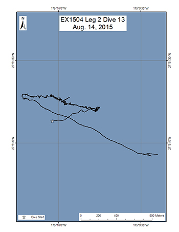
This dive was on a ridge that extends to the southeast of an unnamed seamount east of Pearl and Hermes Atoll. The objectives of the dive were to explore the ridge for high density communities of deep-sea corals and sponges. The target start point of the dive was on the crest of the ridge at a depth of 2300m. The plan was to then head up the ridge crest until reaching a depth of 2120m, documenting in particular the abundance of corals and sponges.
Download & View Files
| Dive Summary Report (PDF - 384 KB) | View/Download | Requires Adobe Acrobat Reader to view the Dive Summary Report |
| Dive Trailer (MOV - 62.7 MB) | Download | Link takes you to a public FTP server |
| ROV Ancillary Data (Zip - 1.93 MB) | Download | Link takes you to a public FTP server |
| ROV CTD/Sensor Data (Zip - 4.34 MB) | Download | Link takes you to a public FTP server |
| Camera Platform Sensor Data (Zip - 3.97 MB) | Download | Link takes you to a public FTP server |
| Low-Resolution Video Clips (Zip - 5.17 GB) | Download | Link takes you to a public FTP server |
| Underwater Still Images (Zip - 264 MB) | Download | Link takes you to a public FTP server |
| Dive Video Collection Self-Service Portal | Open | Link takes you to an online video discovery and access tool |
North Pioneer Ridge
Area
North Pioneer Ridge; North Pacific Ocean; Northwestern Hawaiian Islands
Overview
| Date: | August 15, 2015 |
| Max Depth: | 1645 Meters |
| Bottom Time: | 6 Hours 3 Minutes 59 Seconds |
Purpose
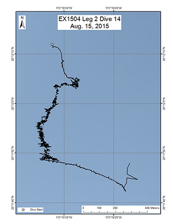
This site was located on a ridge that extends northward from Pioneer Bank. The dive was conducted for the purpose of determining whether ridge topography is suitable for high density communities of corals and sponges, thereby providing valuable information to NOAA's Deep Sea Coral and Technology Program (DSCTP). The target start point of the dive was on the eastern side of the ridge at a depth of 1666m. The ROV would survey up the side of the ridge until it reached the crest at 1620m, then turn southward and survey the ridge crest until reaching a depth of 1552m. This depth of this dive was closer to the oxygen minimum zone so we were also interested in detecting any effects of a lower oxygen environment on the communities.
Download & View Files
| Dive Summary Report (PDF - 312 KB) | View/Download | Requires Adobe Acrobat Reader to view the Dive Summary Report |
| Dive Trailer (MOV - 69.6 MB) | Download | Link takes you to a public FTP server |
| ROV Ancillary Data (Zip - 1.89 MB) | Download | Link takes you to a public FTP server |
| ROV CTD/Sensor Data (Zip - 5.09 MB) | Download | Link takes you to a public FTP server |
| Camera Platform Sensor Data (Zip - 4.72 MB) | Download | Link takes you to a public FTP server |
| Low-Resolution Video Clips (Zip - 4.19 GB) | Download | Link takes you to a public FTP server |
| Underwater Still Images (Zip - 406 MB) | Download | Link takes you to a public FTP server |
| Dive Video Collection Self-Service Portal | Open | Link takes you to an online video discovery and access tool |
North Maro Ridge
Area
North Maro Ridge; North Pacific Ocean; Northwestern Hawaiian Islands
Overview
| Date: | August 16, 2015 |
| Max Depth: | 1752.4 Meters |
| Bottom Time: | 6 Hours 19 Minutes 14 Seconds |
Purpose
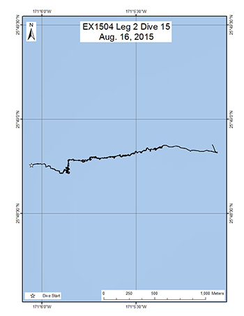
This dive was on a ridge located north of Maro Reef. The objectives of the dive were to survey a completely unexplored area for corals and sponges, testing the hypothesis that high density communities can be found on ridge topography and that the orientation of the ridge is important. No previous dives have ever been conducted on this site. Discovery of high density communities will provide valuable information to NOAA's Deep Sea Coral and Technology Program (DSCTP). The target start point of the dive was approximately 100m below the southern break in slope at a depth of 1743m. The plan was to survey up the steep side of the ridge to the ridge crest at 1714m. The ROV would then turn east and follow the ridge crest up to a final depth of 1570m.
Download & View Files
| Dive Summary Report (PDF - 336 KB) | View/Download | Requires Adobe Acrobat Reader to view the Dive Summary Report |
| Dive Trailer (MOV - 72.8 MB) | Download | Link takes you to a public FTP server |
| ROV Ancillary Data (Zip - 1.96 MB) | Download | Link takes you to a public FTP server |
| ROV CTD/Sensor Data (Zip - 5.04 MB) | Download | Link takes you to a public FTP server |
| Camera Platform Sensor Data (Zip - 4.75 MB) | Download | Link takes you to a public FTP server |
| Low-Resolution Video Clips (Zip - 4.53 GB) | Download | Link takes you to a public FTP server |
| Underwater Still Images (Zip - 367 MB) | Download | Link takes you to a public FTP server |
| Dive Video Collection Self-Service Portal | Open | Link takes you to an online video discovery and access tool |
Gardner Terrace
Area
Gardner Terrace; North Pacific Ocean; Northwestern Hawaiian Islands
Overview
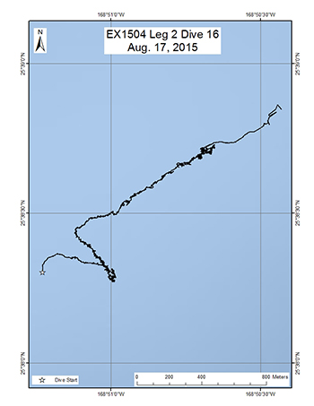
| Date: | August 17, 2015 |
| Max Depth: | 1563.6 Meters |
| Bottom Time: | 6 Hours 33 Minutes 13 Seconds |
Purpose
This dive site was located on what is believed to be an old reef terrace edge north of Gardner Pinnacles. The objective of this dive was to survey the terrace edge, which is now a 200m high narrow ridge, for corals and sponges, testing the hypothesis that high density communities can be found on ridge topography. One other previous Pisces submersible dive was conducted on this ridge in 2011, approximately 3 km to the east. Discovery of high density communities at this dive site will provide information about the extent and size of the community further along the ridge that will provide valuable information to NOAA's Deep Sea Coral and Technology Program (DSCTP). The target start point of the dive was a flat surface located at a depth of 1561m, which transitioned into a steep slope at approximately 1550m. The plan was to survey up the steep slope of the ridge until reaching the ridge crest at 1476m. Then the ROV would move east along the ridge crest to a final target depth of 1478m, documenting in particular the abundance of corals and sponges.
Download & View Files
| Dive Summary Report (PDF - 240 KB) | View/Download | Requires Adobe Acrobat Reader to view the Dive Summary Report |
| Dive Trailer (MOV - 46.4 MB) | Download | Link takes you to a public FTP server |
| ROV Ancillary Data (Zip - 2.07 MB) | Download | Link takes you to a public FTP server |
| ROV CTD/Sensor Data (Zip - 4.2 MB) | Download | Link takes you to a public FTP server |
| Camera Platform Sensor Data (Zip - 4.69 MB) | Download | Link takes you to a public FTP server |
| Low-Resolution Video Clips (Zip - 4.24 GB) | Download | Link takes you to a public FTP server |
| Underwater Still Images (Zip - 399 MB) | Download | Link takes you to a public FTP server |
| Dive Video Collection Self-Service Portal | Open | Link takes you to an online video discovery and access tool |
East North Gardner
Area
East North Gardner; North Pacific Ocean; Northwestern Hawaiian Islands
Overview
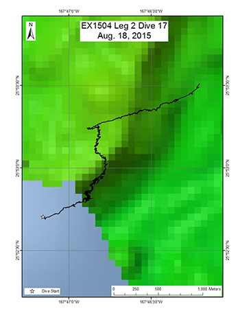
| Date: | August 18, 2015 |
| Max Depth: | 2085.9 Meters |
| Bottom Time: | 6 Hours 28 Minutes 41 Seconds |
Purpose
This dive site was located just outside the boundaries of the Monument on a ridge that extends north of Gardner Pinnacles. Its objectives were to survey a completely unexplored area for corals and sponges, testing the hypothesis that high density communities can be found on ridge topography. No previous dives have ever been conducted at this site. Discovery of high density communities will provide valuable information to NOAA's Deep Sea Coral and Technology Program (DSCTP). The target start point was on the east slope of the ridge below the crest at 2108m. The plan was to survey up the slope of the ridge until reaching the ridge crest at 2053m. Then the ROV would move northeastward along the crest of the ridge to a final target depth of 1991m, documenting in particular the abundance of corals and sponges. In addition to the surveying the seafloor, this dive would also include the second mid-water transects of the expedition, which would be carried out during the ROV's ascent towards the surface. The objective of the mid-water transects was to explore depths between 800-1200 m in order to examine the potential prey field for deep-diving toothed whales, as well as documenting other nekton and gelatinous megaplankton. The mid-water transects were planned to begin after the ROV came up from the seafloor and ascended to 1200m. Five mid-water transects were planned, each conducted for 10 minutes at 100m depth increments between 1200 and 800m (10-minute transect at 1200m, 1100m, 1000m, 900m, and 800m). Additionally, a fifth 10 minute transect was planned for a depth to be determined to contain the thickest backscattering layer, as revealed by the EK60 sonar prior to the surveys. During each transect, the ROV would be below and in sight of Seirios, moving at ~0.5 knots or less. The ship would move stern-first using dynamic positioning. If the ROV encountered any large object during transects, the ROV would stop and image it.
Download & View Files
| Dive Summary Report (PDF - 384 KB) | View/Download | Requires Adobe Acrobat Reader to view the Dive Summary Report |
| Dive Trailer (MOV - 65.4 MB) | Download | Link takes you to a public FTP server |
| ROV Ancillary Data (Zip - 2.4 MB) | Download | Link takes you to a public FTP server |
| ROV CTD/Sensor Data (Zip - 6.34 MB) | Download | Link takes you to a public FTP server |
| Camera Platform Sensor Data (Zip - 6.01 MB) | Download | Link takes you to a public FTP server |
| Low-Resolution Video Clips (Zip - 5.3 GB) | Download | Link takes you to a public FTP server |
| Underwater Still Images (Zip - 402 MB) | Download | Link takes you to a public FTP server |
| Dive Video Collection Self-Service Portal | Open | Link takes you to an online video discovery and access tool |
West Nihoa
Area
West Nihoa; North Pacific Ocean; Northwestern Hawaiian Islands
Overview
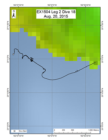
| Date: | August 20, 2015 |
| Max Depth: | 1598.6 Meters |
| Bottom Time: | 4 Hours 23 Minutes 51 Seconds |
Purpose
This dive site was located in the channel between WestpacBank and Nihoa Island, which creates a constriction point for current flow. The objective of the dive was to survey a completely unexplored area for corals and sponges, testing the hypothesis that high density communities can be found in areas were the surrounding topography accelerates current flow. No previous dives have ever been conducted at this site. Discovery of high density communities will provide valuable information to NOAA's Deep Sea Coral and Technology Program (DSCTP). The target start point was a flat surface east of Westpac Bank at 1612m. The plan was to then head southwest moving up a pinnacle inside the channel to a final target depth of 1384m.
Download & View Files
| Dive Summary Report (PDF - 352 KB) | View/Download | Requires Adobe Acrobat Reader to view the Dive Summary Report |
| Dive Trailer (MOV - 49.7 MB) | Download | Link takes you to a public FTP server |
| ROV Ancillary Data (Zip - 1.82 MB) | Download | Link takes you to a public FTP server |
| ROV CTD/Sensor Data (Zip - 4.51 MB) | Download | Link takes you to a public FTP server |
| Camera Platform Sensor Data (Zip - 4.13 MB) | Download | Link takes you to a public FTP server |
| Low-Resolution Video Clips (Zip - 2.14 GB) | Download | Link takes you to a public FTP server |
| Underwater Still Images (Zip - 196 MB) | Download | Link takes you to a public FTP server |
| Dive Video Collection Self-Service Portal | Open | Link takes you to an online video discovery and access tool |

