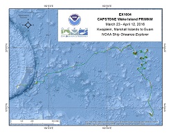
Okeanos Explorer (EX1604): CAPSTONE Wake Island PRIMNM (Preliminary Mapping)
Vessel: NOAA Ship Okeanos Explorer; Expedition Dates: March 23 - April 13, 2016
Project Principals: Derek Sowers, NOAA/OAR/OER (Expedition Coordinator and Mapping Lead)

Multibeam and singlebeam mapping operations will be conducted 24 hours a day throughout the cruise. Sub-bottom profile mapping will be conducted 24 hours a day at the discretion of the CO. XBT and/or UnderwayCTD (UCTD) sound velocity casts in support of multibeam sonar mapping operations will be conducted at an interval defined by prevailing oceanographic conditions, but not to exceed 6 hours. All data will be fully processed according to standard onboard procedures and will be archived with the NOAA National Centers for Environmental Information.
Expedition Data and Resources
| Expedition Summary Report (PDF - 3.56 MB) | Open | Click to open link |
| Mapping Summary Report (PDF - 3.56 MB) | Open | Click to open link |
| Mapping Products | Download | Use zip utility to open file |
| Shipboard CTDs | Download | Use zip utility to open file |
| Ship Navigation Data (ASCII) | Download | Use zip utility to open file |
| Ship SCS/Sensor Data (ASCII) | Download | Use zip utility to open file |
| Ship SCS/Sensor Data (NetCDF) | Open | NetCDF file format: Special software needed to read |
Educational Resources
| Education Materials Collection | Open | Click to open Education Materials |
Publication Resources
| NOAA Central Library OER Bibliography | Open | Click to open OER Bibliography |
Links to Archived Data and Resources
| Multibeam Archive Collection | Get Data | Click to Access Archive |
| Water Column Sonar Archive Collection | Get Data | Click to Access Archive |
| Trackline Data (Single-beam and Sub-bottom) | Get Data | Click to Access Archive |
| Physical, Chemical, and Biological Archive Collection | Get Data | Click to Access Archive |
| Collection of Documents | Get Data | Click to Access Archive |
| Expedition Metadata | Open | Click to view Metadata in xml format |

