
Okeanos Explorer (EX1705): CAPSTONE American Samoa, Kingman/Palmyra, Jarvis (ROV & Mapping)
Vessel: NOAA Ship Okeanos Explorer; Expedition Dates: April 27 - May 19, 2017
Project Principals: Kasey Cantwell, NOAA/OAR/OER (Expedition Coordinator); Michael White, NOAA/OAR/OER (Mapping Lead)
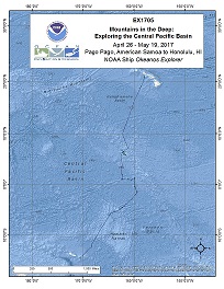
Operations will include the use of the ship's deep water mapping systems (Kongsberg EM302 multibeam sonar, EK60 split-beam fisheries sonars, Knudsen 3260 chirp sub-bottom profiler sonar, and Teledyne Acoustic Doppler Current Profilers), XBT and Underway CTD casts in support of multibeam sonar mapping operations, OER's 6000 m two-body ROV Deep Discoverer and Seirios, and the ship's high-bandwidth satellite connection for continuous real-time ship-to-shore communications.
Expedition Data and Resources
| Ship Navigation Data (ASCII) | Download | Use zip utility to open file |
| Ship SCS/Sensor Data (ASCII) | Download | Use zip utility to open file |
| Ship SCS/Sensor Data (NetCDF) | Open | NetCDF file format: Special software needed to read |
| Shipboard CTDs | Download | Use zip utility to open file |
| Mapping Products | Download | Use zip utility to open file |
| GIS Products | Download | Use zip utility to open file |
Submersible Data and Resources
| Dive Track KMLs | Download | Use zip utility to open file |
| Event Logs | Open | Click to open link |
| Cruise Video Collection Self-Service Portal | Open | Click to open link |
| Collected Specimens | Open | Click to open link |
| Submersible Navigation/Sensor Data (ASCII) | Download | Use zip utility to open file |
Collected Specimen Repositories
| Smithsonian Institution's National Museum of Natural History Research and Collections (Biological Samples) | Open | Click to visit repository website |
| Ocean Genome Legacy Center (OGL) at Northeastern University | Open | Click to visit repository website |
| Bernice Pauahi Bishop Museum's Marine Invertebrate Collection | Open | Click to visit repository website |
| Oregon State University's Marine Geology Repository | Open | Click to visit repository website |
Educational Resources
| Expedition Education Module | Open | Click to open Education Module |
| Lesson Plans (K-12) | Open | Click to open Lesson Plans |
| Education Materials Collection | Open | Click to open Education Materials |
Links to Archived Data and Resources
| Multibeam Archive Collection | Get Data | Click to Access Archive |
| Water Column Sonar Archive Collection | Get Data | Click to Access Archive |
| Trackline Data (Single-beam and Sub-bottom) | Get Data | Click to Access Archive |
| Physical, Chemical, and Biological Archive Collection | Get Data | Click to Access Archive |
| Collection of Documents | Get Data | Click to Access Archive |
| Expedition Metadata | Open | Click to view Metadata in xml format |
Aunu'u Unit
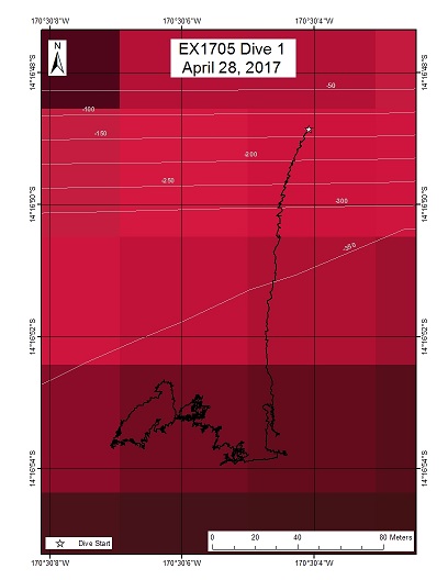
Area
Aunu'u Unit; National Marine Sanctuary of American Samoa
Overview
| Date: | April 27, 2017 |
| Max Depth: | 291.2 Meters |
| Bottom Time: | 0 Hours 19 Minutes 43 Seconds |
Purpose
The purpose of this dive was to collect the first deep water information in the Aunu'u Unit of the National Marine Sanctuary of American Samoa. A total of 5.8 square miles of reef and offshore waters around Aunu'u have been included in the sanctuary, with 3.9 square miles designated a research zone and allows surface fishing for pelagics only, and 1.9 square miles multiple use zone that allows traditional and nondestructive fishing practices. The research and multiple use zones will allow for comparisons over time of an area that prohibits the take of reef fish and bottom dwelling species and benefits to an adjacent area of higher human uses that meets the needs of day-to-day living in sustainable ways. Information on bottom fish off Aunu'u will be used to inform the next sanctuary Condition Report that will be produced in 2017/18 and the process update of the sanctuary management plan that will begin in 2017/18. Additionally, this area is of importance and interest to local governments and fishermen.
Download & View Files
| Dive Summary Report (PDF - 925 KB) | View/Download | Requires Adobe Acrobat Reader to view the Dive Summary Report |
| Dive Track (KML - 69.9 KB) | View/Download | Requires Google Earth or equivalent client to view the Dive Track |
| ROV Ancillary Data (Zip - 969 KB) | Download | Link takes you to a public FTP server |
| ROV CTD/Sensor Data (Zip - 1.71 KB) | Download | Link takes you to a public FTP server |
| Camera Platform Sensor Data (Zip - 1.76 KB) | Download | Link takes you to a public FTP server |
| Low-Resolution Video Clips (Zip - 3.12 GB) | Download | Link takes you to a public FTP server |
| Underwater Still Images (Zip - 29.7 MB) | Download | Link takes you to a public FTP server |
| Dive Video Collection Self-Service Portal | Open | Link takes you to an online video discovery and access tool |
Te Tukunga o Fakahotu (Te Tuku)
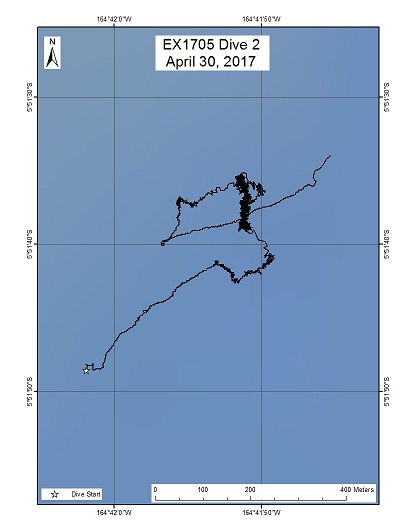
Area
Te Tukunga o Fakahotu (Te Tuku); Northern Manihiki Plateau
Overview
| Date: | April 30, 2017 |
| Max Depth: | 2495.1 Meters |
| Bottom Time: | 1 Hours 52 Minutes 13 Seconds |
Purpose
This dive will investigate the distribution and abundance of benthic megaepifauna (both invertebrate and fish), map substrate composition in order to evaluate the relationship between faunal communities and substrate type, collect rock and crust samples to determine their geological and geochemical properties.
Download & View Files
| Dive Summary Report (PDF - 1.09 MB) | View/Download | Requires Adobe Acrobat Reader to view the Dive Summary Report |
| Dive Track (KML - 72 KB) | View/Download | Requires Google Earth or equivalent client to view the Dive Track |
| ROV Ancillary Data (Zip - 1.29 MB) | Download | Link takes you to a public FTP server |
| ROV CTD/Sensor Data (Zip - 4.19 MB) | Download | Link takes you to a public FTP server |
| Camera Platform Sensor Data (Zip - 3.76 MB) | Download | Link takes you to a public FTP server |
| Low-Resolution Video Clips (Zip - 7.18 GB) | Download | Link takes you to a public FTP server |
| Underwater Still Images (Zip - 76 MB) | Download | Link takes you to a public FTP server |
| Dive Video Collection Self-Service Portal | Open | Link takes you to an online video discovery and access tool |
Te Kawhiti a Maui Potiki (Te Kawhiti)
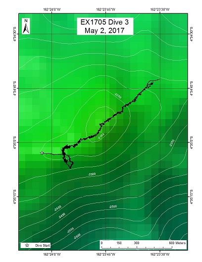
Area
Te Kawhiti a Maui Potiki (Te Kawhiti); Northern Manihiki Plateau
Overview
| Date: | May 02, 2017 |
| Max Depth: | 2219.7 Meters |
| Bottom Time: | 5 Hours 20 Minutes 40 Seconds |
Purpose
This dive will investigate the distribution and abundance of benthic and water column fauna, map substrate composition in order to evaluate the relationship between faunal communities and substrate type, collect rock and crust samples to determine their geological and geochemical properties.
Download & View Files
| Dive Summary Report (PDF - 1.17 MB) | View/Download | Requires Adobe Acrobat Reader to view the Dive Summary Report |
| Dive Track (KML - 143 KB) | View/Download | Requires Google Earth or equivalent client to view the Dive Track |
| ROV Ancillary Data (Zip - 1.64 MB) | Download | Link takes you to a public FTP server |
| ROV CTD/Sensor Data (Zip - 7.81 MB) | Download | Link takes you to a public FTP server |
| Camera Platform Sensor Data (Zip - 7.01 MB) | Download | Link takes you to a public FTP server |
| Low-Resolution Video Clips (Zip - 14.7 GB) | Download | Link takes you to a public FTP server |
| Underwater Still Images (Zip - 240 MB) | Download | Link takes you to a public FTP server |
| Dive Video Collection Self-Service Portal | Open | Link takes you to an online video discovery and access tool |
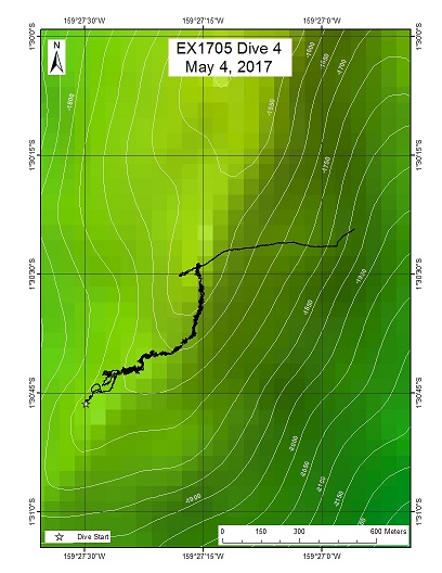
Kahalewai seamount (proposed name)
Area
Kahalewai seamount (proposed name); Jarvis Unit of the Pacific Remote Islands Marine National Monument
Overview
| Date: | May 04, 2017 |
| Max Depth: | 1700 Meters |
| Bottom Time: | 6 Hours 0 Minutes 37 Seconds |
Purpose
This dive investigated the distribution and abundance of benthic and water column fauna, mapped substrate composition in order to evaluate the relationship between faunal communities and substrate type, collected rock and crust samples to determine their geological and geochemical properties.
Download & View Files
| Dive Summary Report (PDF - 1.4 MB) | View/Download | Requires Adobe Acrobat Reader to view the Dive Summary Report |
| Dive Track (KML - 146 KB) | View/Download | Requires Google Earth or equivalent client to view the Dive Track |
| ROV Ancillary Data (Zip - 1.79 MB) | Download | Link takes you to a public FTP server |
| ROV CTD/Sensor Data (Zip - 6.45 MB) | Download | Link takes you to a public FTP server |
| Camera Platform Sensor Data (Zip - 5.76 MB) | Download | Link takes you to a public FTP server |
| Low-Resolution Video Clips (Zip - 11.8 GB) | Download | Link takes you to a public FTP server |
| Underwater Still Images (Zip - 135 MB) | Download | Link takes you to a public FTP server |
| Dive Video Collection Self-Service Portal | Open | Link takes you to an online video discovery and access tool |
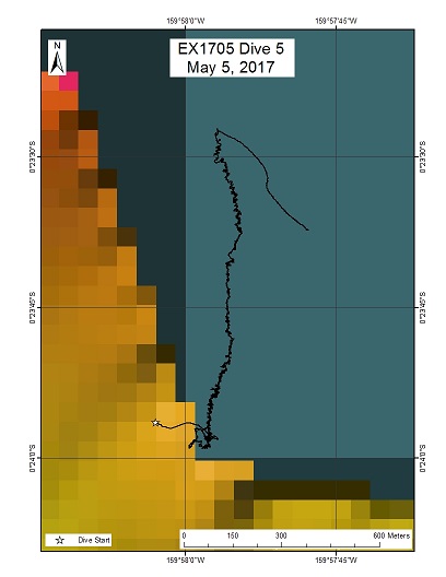
Jarvis Island
Area
Jarvis Island; Jarvis Island Unit of the Pacific Remote Islands Marine National Monument
Overview
| Date: | May 05, 2017 |
| Max Depth: | 819.3 Meters |
| Bottom Time: | 7 Hours 6 Minutes 58 Seconds |
Purpose
This dive will investigate the distribution and abundance of benthic fauna on the submerged flanks of Jarvis Island, map substrate composition in order to evaluate the relationship between faunal communities and substrate type, collect rock and crust samples to determine their geological and geochemical properties.
Download & View Files
| Dive Summary Report (PDF - 1.10 MB) | View/Download | Requires Adobe Acrobat Reader to view the Dive Summary Report |
| Dive Track (KML - 216 KB) | View/Download | Requires Google Earth or equivalent client to view the Dive Track |
| ROV Ancillary Data (Zip - 1.54 MB) | Download | Link takes you to a public FTP server |
| ROV CTD/Sensor Data (Zip - 6.38 MB) | Download | Link takes you to a public FTP server |
| Camera Platform Sensor Data (Zip - 5.22 MB) | Download | Link takes you to a public FTP server |
| Low-Resolution Video Clips (Zip - 12 GB) | Download | Link takes you to a public FTP server |
| Underwater Still Images (Zip - 236 MB) | Download | Link takes you to a public FTP server |
| Dive Video Collection Self-Service Portal | Open | Link takes you to an online video discovery and access tool |
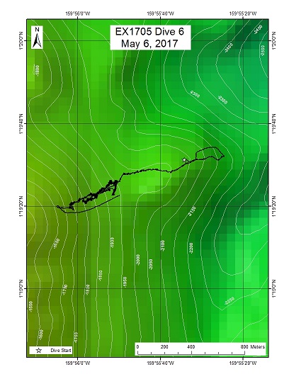
Keli'ihananui seamount (proposed name)
Area
Keli'ihananui seamount (proposed name); Jarvis Island Unit of PRIMNM
Overview
| Date: | May 06, 2017 |
| Max Depth: | 1934.1 Meters |
| Bottom Time: | 2 Hours 54 Minutes 28 Seconds |
Purpose
This dive will investigate the distribution and abundance of benthic and water column fauna, map substrate composition in order to evaluate the relationship between faunal communities and substrate type, collect rock and crust samples to determine their geological and geochemical properties.
Download & View Files
| Dive Summary Report (PDF - 1.01 MB) | View/Download | Requires Adobe Acrobat Reader to view the Dive Summary Report |
| Dive Track (KML - 134 KB) | View/Download | Requires Google Earth or equivalent client to view the Dive Track |
| ROV Ancillary Data (Zip - 1.42 MB) | Download | Link takes you to a public FTP server |
| ROV CTD/Sensor Data (Zip - 6.49 MB) | Download | Link takes you to a public FTP server |
| Camera Platform Sensor Data (Zip - 5.89 MB) | Download | Link takes you to a public FTP server |
| Low-Resolution Video Clips (Zip - 12.2 GB) | Download | Link takes you to a public FTP server |
| Underwater Still Images (Zip - 147 MB) | Download | Link takes you to a public FTP server |
| Dive Video Collection Self-Service Portal | Open | Link takes you to an online video discovery and access tool |
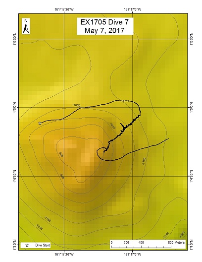
"Whaley" seamount (proposed name)
Area
"Whaley" seamount (proposed name); Jarvis Island Unit of PRIMNM
Overview
| Date: | May 07, 2017 |
| Max Depth: | 1103.1 Meters |
| Bottom Time: | 6 Hours 28 Minutes 23 Seconds |
Purpose
This dive will investigate the distribution and abundance of benthic fauna, map substrate composition in order to evaluate the relationship between faunal communities and substrate type, collect rock and crust samples to determine their geological and geochemical properties.
Download & View Files
| Dive Summary Report (PDF - 1.16 MB) | View/Download | Requires Adobe Acrobat Reader to view the Dive Summary Report |
| Dive Track (KML - 182 KB) | View/Download | Requires Google Earth or equivalent client to view the Dive Track |
| ROV Ancillary Data (Zip - 1.58 MB) | Download | Link takes you to a public FTP server |
| ROV CTD/Sensor Data (Zip - 6.36 MB) | Download | Link takes you to a public FTP server |
| Camera Platform Sensor Data (Zip - 5.76 MB) | Download | Link takes you to a public FTP server |
| Low-Resolution Video Clips (Zip - 12.1 GB) | Download | Link takes you to a public FTP server |
| Underwater Still Images (Zip - 157 MB) | Download | Link takes you to a public FTP server |
| Dive Video Collection Self-Service Portal | Open | Link takes you to an online video discovery and access tool |
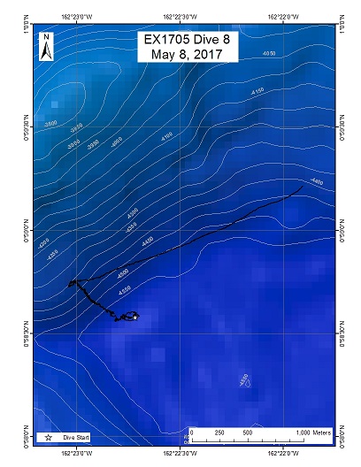
Western Clipperton Fracture Zone
Area
Western Clipperton Fracture Zone; Jarvis Island Unit of PRIMNM
Overview
| Date: | May 08, 2017 |
| Max Depth: | 4573.4 Meters |
| Bottom Time: | 4 Hours 43 Minutes 52 Seconds |
Purpose
This dive will investigate the distribution and abundance of benthic fauna, map substrate composition in order to evaluate the relationship between faunal communities and substrate type, collect rock and crust samples to determine their geological and geochemical properties.
Download & View Files
| Dive Summary Report (PDF - 1.12 MB) | View/Download | Requires Adobe Acrobat Reader to view the Dive Summary Report |
| Dive Track (KML - 51.3 KB) | View/Download | Requires Google Earth or equivalent client to view the Dive Track |
| ROV Ancillary Data (Zip - 1.54 MB) | Download | Link takes you to a public FTP server |
| ROV CTD/Sensor Data (Zip - 8.18 MB) | Download | Link takes you to a public FTP server |
| Camera Platform Sensor Data (Zip - 7.03 MB) | Download | Link takes you to a public FTP server |
| Low-Resolution Video Clips (Zip - 14.4 GB) | Download | Link takes you to a public FTP server |
| Underwater Still Images (Zip - 154 MB) | Download | Link takes you to a public FTP server |
| Dive Video Collection Self-Service Portal | Open | Link takes you to an online video discovery and access tool |
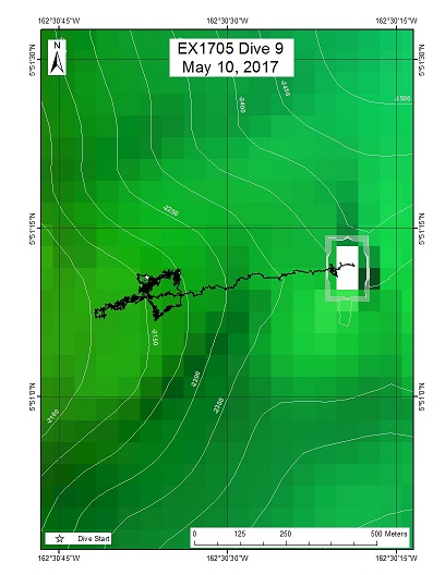
West Palmyra Seamount
Area
West Palmyra Seamount; Kingman Reef and Palmyra Atoll Unit of PRIMNM
Overview
| Date: | May 10, 2017 |
| Max Depth: | 2171.8 Meters |
| Bottom Time: | 1 Hours 48 Minutes 28 Seconds |
Purpose
This dive will investigate the distribution and abundance of benthic fauna, map substrate composition in order to evaluate the relationship between faunal communities and substrate type, collect rock and crust samples to determine their geological and geochemical properties.
Download & View Files
| Dive Summary Report (PDF - 1.03 MB) | View/Download | Requires Adobe Acrobat Reader to view the Dive Summary Report |
| Dive Track (KML - 53.8 KB) | View/Download | Requires Google Earth or equivalent client to view the Dive Track |
| ROV Ancillary Data (Zip - 1.21 MB) | Download | Link takes you to a public FTP server |
| ROV CTD/Sensor Data (Zip - 3.54 MB) | Download | Link takes you to a public FTP server |
| Camera Platform Sensor Data (Zip - 3.35 MB) | Download | Link takes you to a public FTP server |
| Low-Resolution Video Clips (Zip - 6.44 GB) | Download | Link takes you to a public FTP server |
| Underwater Still Images (Zip - 107 MB) | Download | Link takes you to a public FTP server |
| Dive Video Collection Self-Service Portal | Open | Link takes you to an online video discovery and access tool |
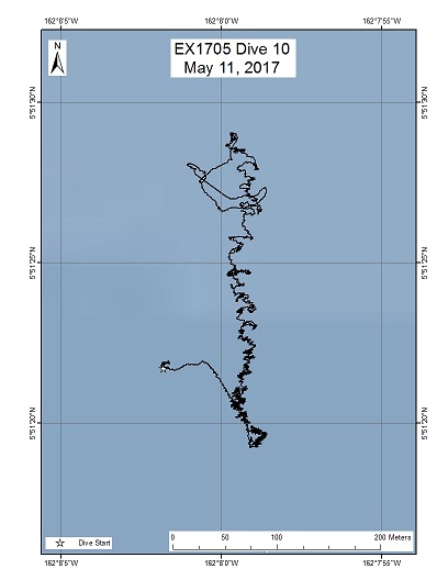
Palmyra Atoll
Area
Palmyra Atoll; Kingman Reef and Palmyra Atoll Unit of PRIMNM
Overview
| Date: | May 11, 2017 |
| Max Depth: | 491.7 Meters |
| Bottom Time: | 4 Hours 1 Minutes 44 Seconds |
Purpose
This dive will investigate the distribution and abundance of benthic fauna, map substrate composition in order to evaluate the relationship between faunal communities and substrate type, collect rock and crust samples to determine their geological and geochemical properties.
Download & View Files
| Dive Summary Report (PDF - 1.22 MB) | View/Download | Requires Adobe Acrobat Reader to view the Dive Summary Report |
| Dive Track (KML - 110 KB) | View/Download | Requires Google Earth or equivalent client to view the Dive Track |
| ROV Ancillary Data (Zip - 1.43 MB) | Download | Link takes you to a public FTP server |
| ROV CTD/Sensor Data (Zip - 3.99 MB) | Download | Link takes you to a public FTP server |
| Camera Platform Sensor Data (Zip - 3.5 MB) | Download | Link takes you to a public FTP server |
| Low-Resolution Video Clips (Zip - 7.55 GB) | Download | Link takes you to a public FTP server |
| Underwater Still Images (Zip - 100 MB) | Download | Link takes you to a public FTP server |
| Dive Video Collection Self-Service Portal | Open | Link takes you to an online video discovery and access tool |
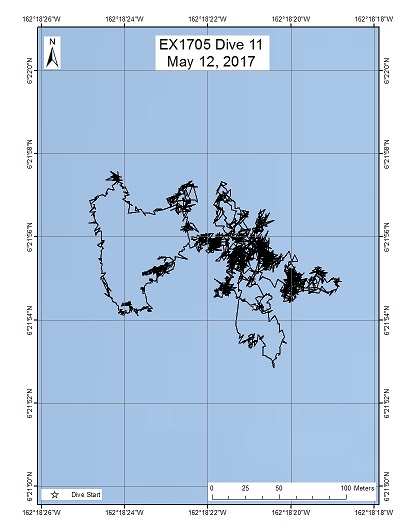
Kingman Reef Cone
Area
Kingman Reef Cone; Kingman Reef and Palmyra Atoll Unit of the Pacific Remote Island Marine National Monument
Overview
| Date: | May 12, 2017 |
| Max Depth: | 1029.1 Meters |
| Bottom Time: | 3 Hours 8 Minutes 44 Seconds |
Purpose
This dive will investigate the distribution and abundance of benthic fauna, map substrate composition in order to evaluate the relationship between faunal communities and substrate type, collect rock and crust samples to determine their geological and geochemical properties.
Download & View Files
| Dive Summary Report (PDF - .99 MB) | View/Download | Requires Adobe Acrobat Reader to view the Dive Summary Report |
| Dive Track (KML - 100 KB) | View/Download | Requires Google Earth or equivalent client to view the Dive Track |
| ROV Ancillary Data (Zip - 1.19 MB) | Download | Link takes you to a public FTP server |
| ROV CTD/Sensor Data (Zip - 3.74 MB) | Download | Link takes you to a public FTP server |
| Camera Platform Sensor Data (Zip - 3.53 MB) | Download | Link takes you to a public FTP server |
| Low-Resolution Video Clips (Zip - 6.98 GB) | Download | Link takes you to a public FTP server |
| Underwater Still Images (Zip - 118 MB) | Download | Link takes you to a public FTP server |
| Dive Video Collection Self-Service Portal | Open | Link takes you to an online video discovery and access tool |
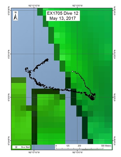
Kingman Reef Deep
Area
Kingman Reef Deep; Kingman Reef and Palmyra Atoll Unit of the Pacific Remote Island Marine National Monument
Overview
| Date: | May 13, 2017 |
| Max Depth: | 2254.6 Meters |
| Bottom Time: | 6 Hours 12 Minutes 16 Seconds |
Purpose
This dive will investigate the distribution and abundance of benthic and mid-water fauna, map substrate composition in order to evaluate the relationship between faunal communities and substrate type, collect rock and crust samples to determine their geological and geochemical properties.
Download & View Files
| Dive Summary Report (PDF - 1.14 MB) | View/Download | Requires Adobe Acrobat Reader to view the Dive Summary Report |
| Dive Track (KML - 111 KB) | View/Download | Requires Google Earth or equivalent client to view the Dive Track |
| ROV Ancillary Data (Zip - 1.6 MB) | Download | Link takes you to a public FTP server |
| ROV CTD/Sensor Data (Zip - 7.69 MB) | Download | Link takes you to a public FTP server |
| Camera Platform Sensor Data (Zip - 6.9 MB) | Download | Link takes you to a public FTP server |
| Low-Resolution Video Clips (Zip - 13.9 GB) | Download | Link takes you to a public FTP server |
| Underwater Still Images (Zip - 349 MB) | Download | Link takes you to a public FTP server |
| Dive Video Collection Self-Service Portal | Open | Link takes you to an online video discovery and access tool |

