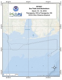
Okeanos Explorer (EX1801): Gulf of Mexico Sea Trials and Shakedown (Mapping)
Vessel: NOAA Ship Okeanos Explorer; Expedition Dates: March 17, 2018 to March 19, 2018
Ports: Pascagoula, MS to Pascagoula, MS
Project Principals: Elizabeth Lobecker, NOAA/OAR/OER (Expedition Coordinator and Mapping Lead)

Operations will include the use of the ship's deep water mapping systems (Kongsberg EM302 multibeam sonar, EK60 split-beam fisheries sonars, Knudsen 3260 chirp sub-bottom profiler sonar, and Teledyne Acoustic Doppler Current Profiler), XBT and CTD casts in support of multibeam sonar mapping operations, and the ship's high-bandwidth satellite connection for continuous real-time ship-to-shore communications.
Expedition Data and Resources
| Ship Navigation Data (ASCII) | Download | Use zip utility to open file |
| Ship SCS/Sensor Data (ASCII) | Download | Use zip utility to open file |
| Ship SCS/Sensor Data (NetCDF) | Open | NetCDF file format: Special software needed to read |
Educational Resources
| Education Materials Collection | Open | Click to open Education Materials |
Publication Resources
| NOAA Central Library OER Bibliography | Open | Click to open OER Bibliography |

