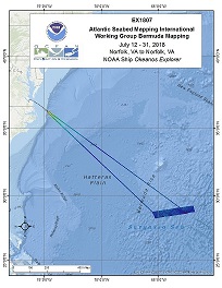
Okeanos Explorer (EX1807): Galway: ASMIWG Bermuda Mapping (Mapping)
Vessel: NOAA Ship Okeanos Explorer; Expedition Dates: July 12, 2018 to July 31, 2018
Ports: Norfolk, VA to Norfolk, VA
Project Principals: Michael White, NOAA/OAR/OER (Expedition Coordinator and Mapping Lead)

EX-18-07, from July 12 to August 4, will be the first dedicated government non-transect survey in support of the Atlantic Ocean Research Alliance/Atlantic Seabed Mapping International Working Group (AORA/ASMIWG). AORA/ASMIWG was established by the Trilateral Galway Statement Implementation Committee to identify steps required to implement a seabed mapping strategy to support the objectives of the Galway Statement. As the first U.S. lead mapping effort in support of Galway Statement on Atlantic Ocean Cooperation, EX-18-07 will include onboard and remote participation from Canadian and European Union students and scientists.
Expedition Data and Resources
| Mapping Summary Report (PDF - 2.81 MB) | Open | Click to open link |
| Mapping Products | Download | Use zip utility to open file |
| Shipboard CTDs | Download | Use zip utility to open file |
| Ship Navigation Data (ASCII) | Download | Use zip utility to open file |
| Ship SCS/Sensor Data (ASCII) | Download | Use zip utility to open file |
| Ship SCS/Sensor Data (NetCDF) | Open | NetCDF file format: Special software needed to read |
Educational Resources
| Education Materials Collection | Open | Click to open Education Materials |
Publication Resources
| NOAA Central Library OER Bibliography | Open | Click to open OER Bibliography |
Links to Archived Data and Resources
| Multibeam Archive Collection | Get Data | Click to Access Archive |
| Water Column Sonar Archive Collection | Get Data | Click to Access Archive |
| Trackline Data (Single-beam and Sub-bottom) | Get Data | Click to Access Archive |
| Physical, Chemical, and Biological Archive Collection | Get Data | Click to Access Archive |
| Expedition Metadata | Open | Click to view Metadata in xml format |

