Efforts continue to track and understand harmful algal blooms

Harmful algal blooms (HAB) are the proliferation of any number of plankton or algae species that occurs when coastal conditions are conducive to rapid growth that is associated with a harmful impact. Scientists continue to study why HABs occur, but water temperature, wind, nutrient pollution, extreme weather events, and other factors can contribute to their development.
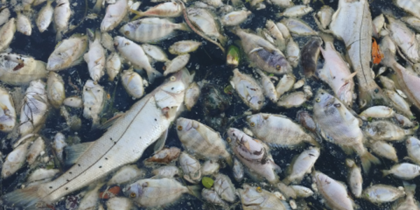
The impact of a HAB event can adversely affect the environment, the health of humans and marine life, and the economy. HABs can contaminate water and seafood, deter fishing and tourism, kill marine life, and make humans sick. Though rare, some human deaths have been attributed to HABs. Every U.S. coastal and Great Lakes state experiences HABs. Depending on the type of HAB organism, blooms can be several colors or colorless.
The Red Culprit: Karenia brevis
The harmful Karenia brevis algae are common in the Gulf of Mexico, occurring nearly every year along the Gulf Coast of Florida and with increasing frequency along the coast of Texas. Commonly called red tides, the blooms get their name from the cloudy red or rust-colored swaths caused by Karenia brevis growing in overabundance.
HABs in the Gulf of Mexico arise more often between August and October and end between December and February, but events have lasted longer, some for more than a year. The intensity and the extent of the area impacted by a bloom can also vary significantly, although HABs typically impact a small section of water for a short period. However, recent blooms have broken previous patterns.
NCEI receives HAB data from partner state agencies and maintains the Harmful Algal BloomS Observing System (HABSOS). The HABSOS website disseminates information and maps of the Gulf of Mexico to give environmental managers, scientists, and the public a data-driven resource for HAB events. NOAA National Ocean Service also provides official forecasts for Gulf of Mexico coastal communities as they respond to red tide events. NOAA issues conditions reports and bulletins for southwest and eastern Florida, northwest Florida to Louisiana, and Texas.
Forecasts rely on satellite imagery, field observations, models, public health reports, and buoy data to provide the data required. Many stakeholders—including partner agencies and numerous other organizations—contribute to monitoring the Gulf of Mexico. They participate in the national HAB Operational Forecast System (OFS), an ongoing project that depends on many contributors’ dedication, energy, and feedback. Several NOAA organizations support the effort, including the National Weather Service, the National Data Buoy Center, and CoastWatch.
NCEI archives collected data as part of HABSOS with data as far back as 1953. Historical data can be used to determine geographical areas affected, movement of red tide from offshore to inshore, and movement alongshore. In some cases, red tide data are combined with other observations, such as salinity, temperature, winds, currents, hurricane paths, and even mortalities and morbidities of aquatic organisms, to look for patterns.
The Florida Fish and Wildlife Conservation Commission provides data to HABSOS and maintains one of the longest records of blooms in its HAB Monitoring Database. In Florida, blooms form more frequently offshore of the southwest coast of Florida between Tampa Bay and Naples. Occasionally, a harmful algal bloom that forms offshore the west coast of Florida can be transported to the east coast by ocean currents.
Responding to User Community
Based on feedback from scientists and resource managers, NCEI added additional data functionality to HABSOS. In addition to Karenia Brevis, HABSOS now contains data on two other HAB species: Cyanobacteria and Sargassum.
Cyanobacteria data is provided to HABSOS by the U.S. Army Corps of Engineers. Also known as blue-green algae, Cyanobacteria is a type of photosynthetic bacteria that can discolor the water bright green or blue- green and form scum. Cyanobacteria are often the cause of algal blooms in freshwater and, occasionally, in estuarine areas, such as the large bloom in the Gulf of Mexico in 2019 along the coasts of Mississippi and Louisiana. Cyanobacteria blooms produce multiple toxins, including liver, nerve, and skin toxins, which can affect human and animal health.
Sargassum is a genus of large brown seaweed (a type of algae) that may form floating island-like masses and never attaches to the seafloor. It is an important marine habitat that provides food, refuge, and breeding grounds for an array of animals such as fishes, sea turtles, marine birds, and more. Since 2011, however, an unprecedented amount of this floating algae has begun to disrupt shipping, tourism, fishing, and coastal ecosystems. This is particularly true in the Caribbean and Gulf of Mexico regions. The decomposition of large quantities of Sargassum along coastlines consumes oxygen, potentially creating large oxygen-depleted zones resulting in fish kills. The decomposing sargassum can also be harmful to people as it creates hydrogen sulfide gas, which causes a range of health impacts in humans. The Sargassum data displayed on the HABSOS map is from the University of South Florida.
Having three HAB species available in HABSOS allows scientists and resource managers to visualize the data in an interactive map along with oceanographic and meteorological features.


