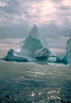
NOAA/WDS Paleoclimatology - Northeast Atlantic Foramifinferal Abundance, d15N and Sea Water Temperature Data during the last 10ka
 Paleoclimatology - Paleoceanography
This archived Paleoclimatology Study is available from the NOAA National Centers for Environmental Information (NCEI), under the World Data Service (WDS) for Paleoclimatology. The associated NCEI study type is Paleoceanography. The data include parameters of paleoceanography with a geographic location of North Atlantic Ocean. The time period coverage is from 10575 to -63 in calendar years before present (BP). See metadata information for parameter and study location details. Please cite this study when using the data.
- Cite as: Spooner, P.T.; Thornalley, D.J.R.; Oppo, D.W.; Fox, A.D.; Radionovskaya, S.; Green, K.; Rose, N.L.; Monica, T.; Thrower, L.; Mallett, R.; Cooper, E.; Roberts, J.M. (2020-02-14): NOAA/WDS Paleoclimatology - Northeast Atlantic Foramifinferal Abundance, d15N and Sea Water Temperature Data during the last 10ka. [indicate subset used]. NOAA National Centers for Environmental Information. https://doi.org/10.25921/drxq-xe93. Accessed [date].
- Please refer to Credit tab for full citation information.
- doi:10.25921/drxq-xe93
- noaa-ocean-29030
- NCEI DSI 1200_02
- NCEI DSI 1200_01
noaa-ocean-29030
| Search Data |
|
| Download Data |
|
| Distribution Formats |
|
| Ordering Instructions | Contact NCEI for other distribution options and instructions. |
| Distributor | NOAA National Centers for Environmental Information
ncei.info@noaa.gov |
| Dataset Point of Contact | NOAA National Centers for Environmental Information
ncei.info@noaa.gov |
| Dataset Point of Contact | Data Center Contact
NOAA World Data Service for Paleoclimatology 828-271-4800 paleo@noaa.gov |
| Coverage Description | Date Range: -8625 CE to 2013 CE; Date Range: 10575 cal yr BP to -63 cal yr BP; |
| Time Period | -8625 to 2013 |
| Spatial Bounding Box Coordinates |
N: 62.6125
S: 61.3465
E: 21.7326
W: -19.536
|
| Spatial Coverage Map | |
| General Documentation |
|
| Associated Resources |
|
| Publication Dates |
|
| Data Presentation Form | Digital table - digital representation of facts or figures systematically displayed, especially in columns
|
| Dataset Progress Status | Complete - production of the data has been completed |
| Data Update Frequency | Data update frequency not available |
| Supplemental Information |
STUDY NOTES: Provided Keywords: foraminifera, industrial-era
ABSTRACT SUPPLIED BY ORIGINATOR: In the North Atlantic, the subpolar gyre (SPG) connects tropical and high latitude waters, playing a leading role in deep-water formation, propagation of Atlantic water into the Arctic, and as habitat for many ecosystems. Detailed instrumental records spanning the last few decades document significant decadal variability in SPG circulation, with associated hydrographic and ecological changes. Emerging longer-term records provide circumstantial evidence that the North Atlantic also experienced centennial trends during the 20th century. Here, we use marine sediment records to show that there has been a long-term change in SPG circulation during the industrial era, most of which occurred during the 20th century. Moreover, we show that the shift and modern SPG configuration are unprecedented in the last 10,000 years. Modern SPG dynamics have resulted in an expansion of subtropical ecosystems into new habitats and likely also altered the northward transport of heat to high latitudes. |
| Purpose | Records of past climate and ocean circulation derived from marine sediments. Parameter keywords describe what was measured in this dataset. Additional summary information can be found in the abstracts of papers listed in the dataset citations. |
| Dataset Citation |
|
| Cited Authors |
|
| Originators |
|
| Publishers |
|
| Theme keywords | Global Change Master Directory (GCMD) Science Keywords
|
| Data Center keywords | Global Change Master Directory (GCMD) Data Center Keywords
|
| Place keywords |
|
| Use Constraints |
|
| Access Constraints |
|
| Fees |
|
Last Modified: 2024-04-10
For questions about the information on this page, please email: ncei.info@noaa.gov