Adaptive Ecosystem Climatology Beta 6 Satellite Climatology
AEC Beta 6
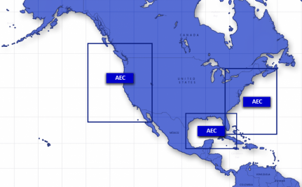 Coverage Areas for the Adaptive Ecosystem Climatology.
The Adaptive Ecosystem Climatology (AEC) is produced by the Naval Research Laboratory (NRL). It consists of two datasets covering multiple regions of the ocean. One is a climatology derived from satellite data, the other is a climatology derived from a computer model of parts of the ocean that simulates physical and biological phenomena. The satellite climatology has data for chlorophyll concentration and sea surface temperature. The model climatology has fields for sea surface height, temperature, current, and concentrations of various types of plankton on the surface and underwater. Spatial resolution ranges from 1km to 4km depending on the product. These data are in NetCDF version 3 format with metadata attributes included.
- Cite as: Naval Research Laboratory (2017): Adaptive Ecosystem Climatology Beta 6 Satellite Climatology. [indicate subset used]. NOAA National Centers of Environmental Information. [access date].
- gov.noaa.ncdc:C01599
- NCEI DSI 2030_02
C01599
| Download Data |
|
| Distribution Formats |
|
| Ordering Instructions | Contact NCEI for other distribution options and instructions. |
| Distributor | NOAA National Centers for Environmental Information
ncei.info@noaa.gov |
| Dataset Point of Contact | Customer Engagement Branch
NOAA National Centers for Environmental Information 1-828-271-4800 ncei.orders@noaa.gov |
| Time Period | 1980-01-01 to 2012-12-31 (time interval: 24-hour) |
| Spatial Bounding Box Coordinates |
N: 46.0000
S: 22.9276
E: -62.9870
W: -82.0000
N: 53.0000
S: 29.4970
E: -114.5000
W: -135.0000
|
| Spatial Coverage Map | |
| General Documentation |
|
| Associated Resources |
|
| Publication Dates |
|
| Edition | beta6 |
| Data Presentation Form | Digital image
|
| Dataset Progress Status | Complete - production of the data has been completed |
| Data Update Frequency | As needed |
| Purpose | These data could be used in climate and ocean modeling research. |
| Dataset Citation |
|
| Cited Authors |
|
| Originators |
|
| Publishers |
|
| Theme keywords | Global Change Master Directory (GCMD) Science Keywords
|
| Data Center keywords | Global Change Master Directory (GCMD) Data Center Keywords
|
| Platform keywords | Global Change Master Directory (GCMD) Platform Keywords
|
| Instrument keywords | Global Change Master Directory (GCMD) Instrument Keywords
|
| Place keywords | Global Change Master Directory (GCMD) Location Keywords
|
| Project keywords | Global Change Master Directory (GCMD) Project Keywords
|
| Data Resolution keywords | Global Change Master Directory (GCMD) Horizontal Data Resolution Keywords
|
| Stratum keywords | Global Change Master Directory (GCMD) Location Keywords
|
| Use Constraints |
|
| Access Constraints |
|
| Fees |
|
| Lineage Statement | The model-based climatology is derived from a 33-year simulation (1980-2012) of a 4-km resolution coupled biophysical ocean model that used the Navy Coastal Ocean Model (NCOM) hydrodynamics and the Carbon Silicate Nitrogen Ecosystem (COSINE) marine biochemistry. The model assimilates altimetry data and satellite sea surface temperature from the AVHRR. It is forced by boundary conditions prescribed by the 1/8° Global NCOM and by atmospheric fluxes prescribed by NASA's Modern Era Retrospective-Analysis for Research and Applications (MERRA). The satellite daily climatology provides chlorophyll concentration and sea surface temperature derived from the Moderate Resolution Imaging Spectroradiometer (MODIS) level-1 data processed at 1-km resolution and spanning the period 2003-2013. |
| Processing Steps |
|
| Processing Steps |
|
Last Modified: 2023-06-23
For questions about the information on this page, please email: ncei.info@noaa.gov