U.S. COOP Summary of the Month

browse graphic
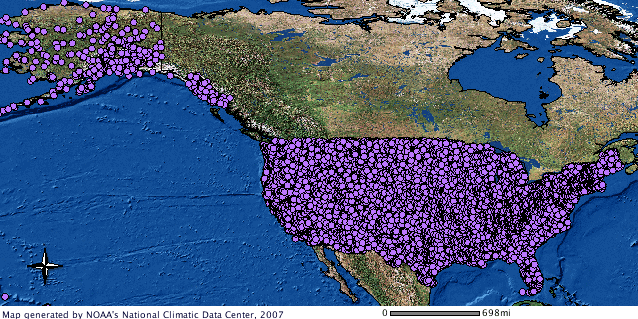
Summary of the month GIS image
U.S. COOP Summary of the Month is digital data set DSI-3220, archived at the National Climatic Data Center (NCDC).
Cite this dataset when used as a source.
  • NCEI DSI 3220
  • gov.noaa.ncdc:C00504
Order Data
  • NCEI Customer Support Page (order)
    To access the original format of the data, contact Customer Engagement Branch for more information.
Distribution Formats
  • ASCII
  • XML
Ordering InstructionsContact NCEI for other distribution options and instructions.
DistributorNOAA National Centers for Environmental Information
ncei.info@noaa.gov
Dataset Point of Contact Customer Engagement Branch
NOAA National Centers for Environmental Information
1-828-271-4800
ncei.orders@noaa.gov
Time Period1867-01-01 to Present
Spatial Bounding Box Coordinates
N: 72.0
S: -15.0
E: -60.0
W: 130.0
Spatial Coverage Map
General Documentation
Publication Dates
  • publication: unknown
Data Presentation Form Digital table - digital representation of facts or figures systematically displayed, especially in columns
Dataset Progress StatusComplete - production of the data has been completed
Data Update Frequency As needed
PurposeTo make a wide range of climatic data available to researchers and the public.
Cited Authors
  • User Engagement and Services Branch
    DOC/NOAA/NESDIS/NCDC > National Climatic Data Center, NESDIS, NOAA, U.S. Department of Commerce
Originators
  • User Engagement and Services Branch
    DOC/NOAA/NESDIS/NCDC > National Climatic Data Center, NESDIS, NOAA, U.S. Department of Commerce
Publishers
  • DOC/NOAA/NESDIS/NCEI > National Centers for Environmental Information, NESDIS, NOAA, U.S. Department of Commerce
Theme keywordsGlobal Change Master Directory (GCMD) Science Keywords
  • Earth Science > Agriculture > Soils > Soil Temperature
  • Earth Science > Atmosphere > Atmospheric Temperature > Surface Temperature > Maximum/Minimum Temperature
  • Earth Science > Atmosphere > Atmospheric Temperature > Surface Temperature
  • Earth Science > Atmosphere > Atmospheric Temperature > Temperature Anomalies
  • Earth Science > Atmosphere > Atmospheric Water Vapor > Water Vapor Processes > Evaporation
  • Earth Science > Atmosphere > Atmospheric Winds > Surface Winds
  • Earth Science > Atmosphere > Precipitation > Precipitation Amount
  • Earth Science > Atmosphere > Precipitation > Precipitation Anomalies
  • Earth Science > Atmosphere > Precipitation > Precipitation Rate
  • Earth Science > Atmosphere > Precipitation > Solid Precipitation > Snow
  • Earth Science > Land Surface > Soils > Soil Temperature
  • Earth Science > Cryosphere > Snow/Ice > Snow Depth
  • Earth Science > Terrestrial Hydrosphere > Snow/Ice > Snow Depth
Data Center keywordsGlobal Change Master Directory (GCMD) Data Center Keywords
  • DOC/NOAA/NESDIS/NCDC > National Climatic Data Center, NESDIS, NOAA, U.S. Department of Commerce
  • DOC/NOAA/NESDIS/NCEI > National Centers for Environmental Information, NESDIS, NOAA, U.S. Department of Commerce
Place keywordsGlobal Change Master Directory (GCMD) Location Keywords
  • Continent > North America > United States Of America
  • Ocean > Atlantic Ocean > North Atlantic Ocean > Caribbean Sea > Virgin Islands
  • Ocean > Pacific Ocean > Central Pacific Ocean > Guam
  • Ocean > Pacific Ocean > Central Pacific Ocean > American Samoa
  • Ocean > Pacific Ocean > Western Pacific Ocean > Micronesia > Marshall Islands
  • Ocean > Pacific Ocean > Western Pacific Ocean > Micronesia
  • Ocean > Pacific Ocean > Western Pacific Ocean > Micronesia > Palau
  • Ocean > Pacific Ocean > Central Pacific Ocean > Wake Island
Stratum keywordsGlobal Change Master Directory (GCMD) Location Keywords
  • Vertical Location > Land Surface
Use Constraints
  • Use liability: NOAA and NCEI cannot provide any warranty as to the accuracy, reliability, or completeness of furnished data. Users assume responsibility to determine the usability of these data. The user is responsible for the results of any application of this data for other than its intended purpose.
Access Constraints
  • Distribution liability: NOAA and NCEI make no warranty, expressed or implied, regarding these data, nor does the fact of distribution constitute such a warranty. NOAA and NCEI cannot assume liability for any damages caused by any errors or omissions in these data. If appropriate, NCEI can only certify that the data it distributes are an authentic copy of the records that were accepted for inclusion in the NCEI archives.
Fees
  • In most cases, electronic downloads of the data are free. However, fees may apply for custom orders, data certifications, copies of analog materials, and data distribution on physical media.
Lineage information for: dataset
Processing Steps
  • Not derived from another source.
Lineage information for: repository
Processing Steps
  • 2015-04-22T00:00:00 - NOAA created the National Centers for Environmental Information (NCEI) by merging NOAA's National Climatic Data Center (NCDC), National Geophysical Data Center (NGDC), and National Oceanographic Data Center (NODC), including the National Coastal Data Development Center (NCDDC), per the Consolidated and Further Continuing Appropriations Act, 2015, Public Law 113-235. NCEI launched publicly on April 22, 2015.
Acquisition Information (collection)
Instrument
  • AWS > AUTOMATED WEATHER SYSTEM
  • > ANEMOMETERS
  • > BAROMETERS
  • > RAIN GAUGES
  • > SOIL TEMPERATURE PROBE
  • > THERMOMETERS
  • > TEMPERATURE LOGGERS
  • > SNOW MEASURING ROD
  • > TEMPERATURE SENSORS
  • > WIND VANES
Platform
  • METEOROLOGICAL STATIONS
Last Modified: 2023-06-23
For questions about the information on this page, please email: ncei.info@noaa.gov