Climate Forecast System Version 2 (CFSv2) Operational Forecasts
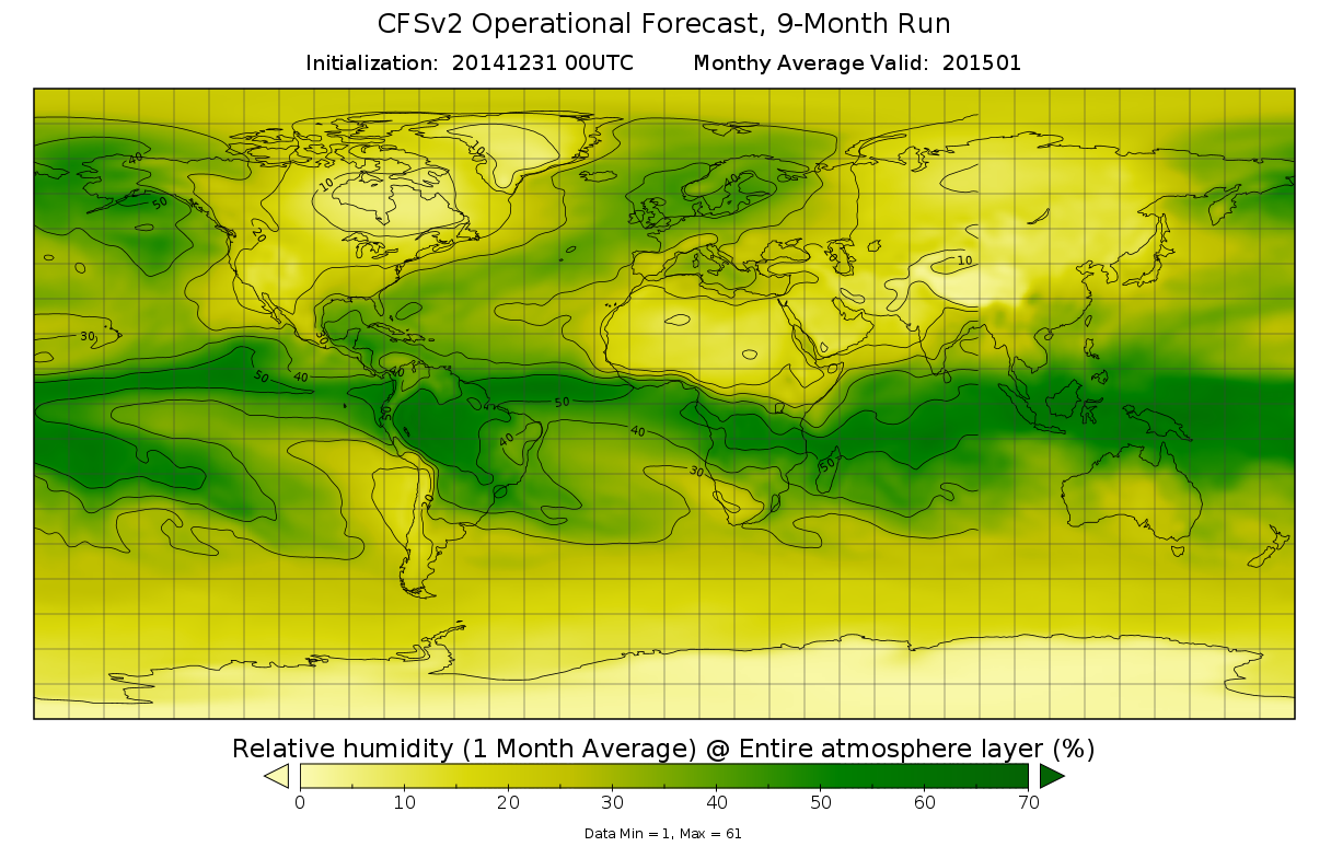 CFSv2 9-month run forecast of relative humidity (%) as 1-month average for entire atmosphere layer.
The Climate Forecast System Version 2 (CFSv2) produced by the NOAA National Centers for Environmental Prediction (NCEP) is a fully coupled model representing the interaction between the Earth's oceans, land and atmosphere. The four-times-daily, 9-month control runs, consist of all 6-hourly forecasts, and the monthly means and variable time-series (all variables). The CFSv2 outputs include: 2-D Energetics (EGY); 2-D Surface and Radiative Fluxes (FLX); 3-D Pressure Level Data (PGB); 3-D Isentropic Level Data (IPV); 3-D Ocean Data (OCN); Low-resolution output (GRBLOW); Dumps (DMP); and High- and Low-resolution Initial Conditions (HIC and LIC). The monthly CDAS variable timeseries includes all variables. The CFSv2 period of record begins on April 1, 2011 and continues onward. CFS output is in GRIB-2 file format.
- Cite this dataset when used as a source.
- NCEI DSI 2001_01
- gov.noaa.class:NCDC-CFSV2_FORECAST
- gov.noaa.ncdc:C00877
C00877
| Download Data |
|
| Distribution Formats |
|
| Ordering Instructions | Contact NCEI for other distribution options and instructions. |
| Distributor | NOAA National Centers for Environmental Information
ncei.info@noaa.gov |
| Dataset Point of Contact | Customer Engagement Branch
NOAA National Centers for Environmental Information 1-828-271-4800 ncei.orders@noaa.gov |
| Coverage Description | Global coverage for CFSv2 Forecasts. |
| Time Period | 2011-04-01 to Present |
| Spatial Bounding Box Coordinates |
N: 90.0
S: -90.0
E: 180.0
W: -180.0
|
| Spatial Coverage Map | |
| General Documentation |
|
| Associated Resources |
|
| Publication Dates |
|
| Data Presentation Form | Digital model - multi-dimensional digital representation of a feature, process, etc.
|
| Dataset Progress Status | Ongoing - data is continually being updated |
| Data Update Frequency | Continual |
| Purpose | The operational implementation of the CFSv2 Forecasts ensures a continuity of the climate record and provides a valuable up-to-date dataset to study many aspects of predictability on the seasonal and sub-seasonal scales. These real-time operational forecasts will be used by a wide community of users in their decision making processes in areas such as water management for rivers and agriculture, transportation, energy use by utilities, wind and other sustainable energy, and seasonal prediction of the hurricane season. |
| Dataset Citation |
|
| Cited Authors |
|
| Originators |
|
| Publishers |
|
| Theme keywords | Global Change Master Directory (GCMD) Science Keywords
|
| Data Center keywords | Global Change Master Directory (GCMD) Data Center Keywords
|
| Place keywords | Global Change Master Directory (GCMD) Location Keywords
|
| Project keywords | Global Change Master Directory (GCMD) Project Keywords
|
| Stratum keywords | Global Change Master Directory (GCMD) Location Keywords
|
| Use Constraints |
|
| Access Constraints |
|
| Fees |
|
| Lineage Statement | CFSv2 outputs were produced by the NOAA National Centers for Environmental Prediction (NCEP) and are archived at the NOAA National Centers for Environmental Information (NCEI). |
| Processing Steps |
|
| Instrument |
|
| Platform |
|
Last Modified: 2023-07-12
For questions about the information on this page, please email: ncei.info@noaa.gov