Surface Weather Observations Hourly
EV2 - Surface Weather Observations
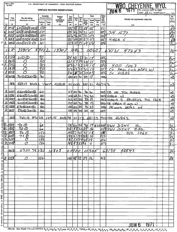 Record example
Standard hourly observations taken at Weather Bureau/National Weather Service offices and airports throughout the United States. Hourly observations began during the aviation boom in the late 1920s-early 1930s, and continue through Automated Surface Observing Stations (ASOS) today. Files scanned from original manuscript records of raw meteorological data collected by first and second order stations located in the U.S., U.S. Pacific Islands, U.S. Virgin Islands, Puerto Rico, and by military weather stations located worldwide. The vast majority of records are available online, but some records are still only available in the physical format only.
Cite this dataset when used as a source.
- NCEI DSI 3900_01
- NCEI WebARTIS: SWO (subset)
- gov.noaa.ncdc:C01106
C01106
| Download Data |
|
| Distribution Formats |
|
| Ordering Instructions | Contact NCEI for other distribution options and instructions. |
| Distributor | NOAA National Centers for Environmental Information
ncei.info@noaa.gov |
| Dataset Point of Contact | Customer Engagement Branch
NOAA National Centers for Environmental Information 1-828-271-4800 ncei.orders@noaa.gov |
| Coverage Description | |
| Time Period | 1920 to Present |
| Spatial Bounding Box Coordinates |
N: 72
S: 18
E: -65
W: 172
|
| Spatial Coverage Map | |
| General Documentation |
|
| Associated Resources |
|
| Publication Dates |
|
| Data Presentation Form | Digital image
Hardcopy image - image archived in analog format |
| Dataset Progress Status | Ongoing - data is continually being updated |
| Data Update Frequency | Irregular |
| Purpose | In the late 1990s NCDC realized the need to host digital images of weather and climate records on the internet. As a result, EV2 was developed as a key system for providing access to the millions of original source data images in the NCDC archives. With its upload and index capability, EV2 also enables the continuation of NCDC's commitment to make more of its weather and climate data available online so that users across the world can view climate and weather records held in the NCDC archives. |
| Use Limitations |
|
| Publishers |
|
| Theme keywords | Global Change Master Directory (GCMD) Science Keywords
|
| Data Center keywords | Global Change Master Directory (GCMD) Data Center Keywords
|
| Platform keywords | Global Change Master Directory (GCMD) Platform Keywords
|
| Instrument keywords | Global Change Master Directory (GCMD) Instrument Keywords
|
| Place keywords | Global Change Master Directory (GCMD) Location Keywords
|
| Stratum keywords | Global Change Master Directory (GCMD) Location Keywords
|
| Use Constraints |
|
| Access Constraints |
|
| Fees |
|
| Processing Steps |
|
| Instrument |
|
| Platform |
|
Last Modified: 2023-06-23
For questions about the information on this page, please email: ncei.info@noaa.gov