Regional Hydrodynamic Model Outputs of the NOAA Columbia River Estuary Operational Forecast System (CREOFS)
CO-OPS CREOFS
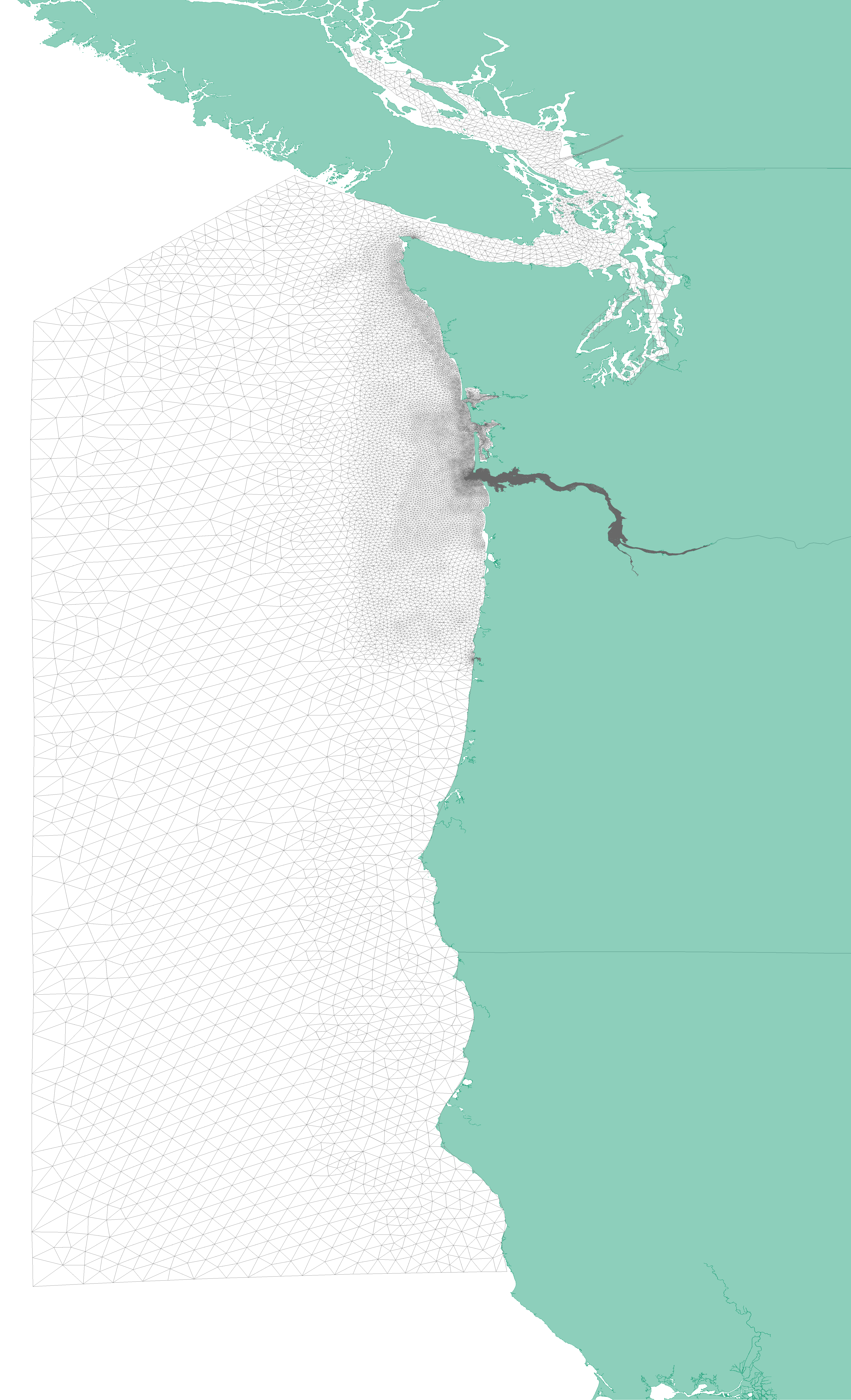 CREOFS model domain and grid map (source: NOAA/NOS)
NOAA's National Ocean Service (NOS) has developed a Columbia River Estuary Operational Forecast System (CREOFS). CREOFS is based on a three-dimensional SELFE model that runs on NOAA's High Performance Computers (HPC). CREOFS provides water level, currents, water temperature and salinity nowcast and forecast guidance as well as interpolated winds from National Weather Service products for five separate subdomains: Upper Columbia River subdomain, Middle Columbia River subdomain, Lower Columbia River subdomain, Columbia River Bar Entrance subdomain, and the mouth and offshore subdomain of the Columbia River. CREOFS runs four times per day and generates 6-hour nowcasts and 48-hour forecast guidance. CREOFS products include time series graphics at station locations and aerial animations of the Columbia River Estuary for all five parameters (wind, water level, currents, temperature and salinity).
- Cite As: NOAA National Ocean Service; NOAA National Weather Service; NOAA Office of Oceanic and Atmospheric Research (2017): Regional Hydrodynamic Model Outputs of the NOAA Columbia River Estuary Operational Forecast System (CREOFS). [indicate subset used]. NOAA National Centers for Environmental Information. https://doi.org/10.25921/fztr-mf31. Accessed [date].
- NCEI DSI 2014_01
- gov.noaa.ncdc:C01341
C01341
| Download Data |
|
| Distribution Formats |
|
| Ordering Instructions | Contact NCEI for other distribution options and instructions. |
| Distributor | NOAA National Centers for Environmental Information
ncei.info@noaa.gov |
| Dataset Point of Contact | Customer Engagement Branch
NOAA National Centers for Environmental Information 1-828-271-4800 ncei.orders@noaa.gov |
| Time Period | 2014-01-01 to Present (time interval: 6-minute) |
| Spatial Bounding Box Coordinates |
N: 50.50
S: 38.50
E: -121.0
W: -128.5
|
| Spatial Coverage Map | |
| General Documentation |
|
| Associated Resources |
|
| Publication Dates |
|
| Dataset Progress Status | Ongoing - data is continually being updated |
| Data Update Frequency | Daily |
| Purpose | This dataset is available to the public for a wide variety of uses including scientific research and analysis. |
| Dataset Citation |
|
| Cited Authors |
|
| Publishers | |
| Theme keywords | Global Change Master Directory (GCMD) Science Keywords
|
| Data Center keywords | Global Change Master Directory (GCMD) Data Center Keywords
|
| Platform keywords | Global Change Master Directory (GCMD) Platform Keywords
|
| Place keywords | Global Change Master Directory (GCMD) Location Keywords
|
| Use Constraints |
|
| Access Constraints |
|
| Fees |
|
| Lineage Statement | The model output was produced by the NOAA National Weather Service, the NOAA National Ocean Service, and the NOAA Office of Oceanic and Atmospheric Research, and it is archived by the NOAA National Centers for Environmental Information. |
| Processing Steps |
|
Last Modified: 2023-08-03
For questions about the information on this page, please email: ncei.info@noaa.gov