Regional Hydrodynamic Model Outputs of the NOAA Lake Erie Operational Forecast System (LEOFS)
CO-OPS LEOFS
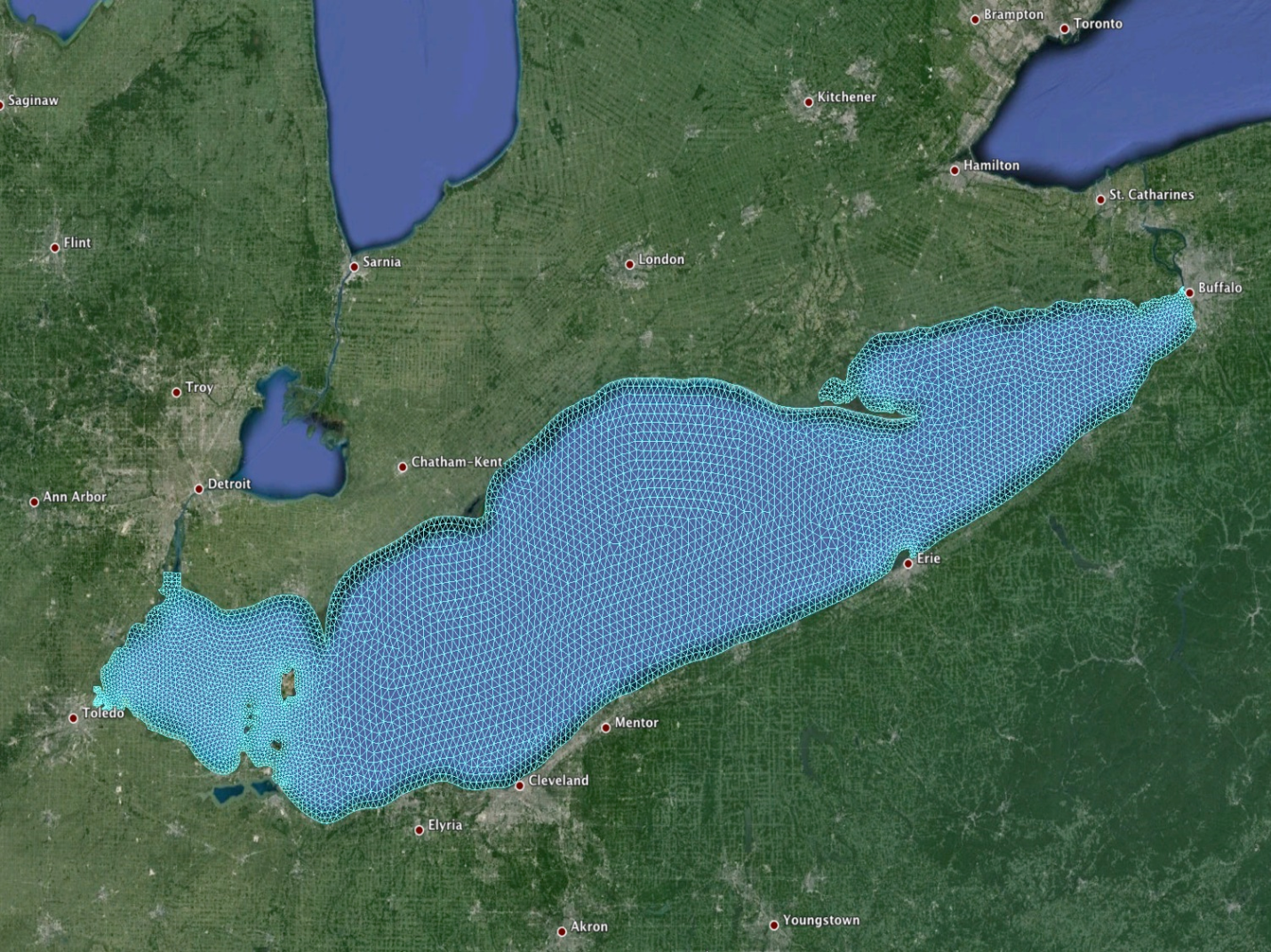 LEOFS model domain and grid map (source: NOAA/NOS)
NOAA's National Ocean Service (NOS) collaborated with the Great Lakes Environmental Research Laboratory (GLERL) in developing and transitioning the new generation of Lake Erie Operational Forecast System (LEOFS) to operations, to provide higher-resolution forecast guidance of water level, currents and water temperature. The upgraded LEOFS uses the Finite Volume Community Ocean Model (FVCOM) as its core ocean circulation model and has extended the forecast horizon to 120 hours. LEOFS runs four times per day with 6-hour nowcast and 120-hour forecast for each cycle on the NCEP's Weather Climate Operational Supercomputer (WCOSS).
- Cite As: NOAA National Ocean Service; NOAA National Weather Service; NOAA Office of Oceanic and Atmospheric Research (2017): Regional Hydrodynamic Model Outputs of the NOAA Lake Erie Operational Forecast System (LEOFS). [indicate subset used]. NOAA National Centers for Environmental Information. https://doi.org/10.25921/fztr-mf31. Accessed [date].
- NCEI DSI 2014_01
- gov.noaa.ncdc:C01345
C01345
| Download Data |
|
| Distribution Formats |
|
| Ordering Instructions | Contact NCEI for other distribution options and instructions. |
| Distributor | NOAA National Centers for Environmental Information
ncei.info@noaa.gov |
| Dataset Point of Contact | Customer Engagement Branch
NOAA National Centers for Environmental Information 1-828-271-4800 ncei.orders@noaa.gov |
| Time Period | 2017-07-06 to Present (time interval: 6-minute) |
| Spatial Bounding Box Coordinates |
N: 43
S: 41.2
E: -78.5
W: -84.0
|
| Spatial Coverage Map | |
| General Documentation |
|
| Associated Resources |
|
| Publication Dates |
|
| Dataset Progress Status | Ongoing - data is continually being updated |
| Data Update Frequency | Daily |
| Purpose | This dataset is available to the public for a wide variety of uses including scientific research and analysis. |
| Dataset Citation |
|
| Cited Authors |
|
| Publishers | |
| Theme keywords | Global Change Master Directory (GCMD) Science Keywords
|
| Data Center keywords | Global Change Master Directory (GCMD) Data Center Keywords
|
| Platform keywords | Global Change Master Directory (GCMD) Platform Keywords
|
| Place keywords | Global Change Master Directory (GCMD) Location Keywords
|
| Use Constraints |
|
| Access Constraints |
|
| Fees |
|
| Lineage Statement | The model output was produced by the NOAA National Weather Service, the NOAA National Ocean Service, and the NOAA Office of Oceanic and Atmospheric Research, and it is archived by the NOAA National Centers for Environmental Information. |
| Processing Steps |
|
Last Modified: 2023-08-07
For questions about the information on this page, please email: ncei.info@noaa.gov