Hyperspectral imagery to study harmful algal blooms (HABs) of Lake Erie, Lake St. Clair, and Saginaw Bay, Lake Huron of the Great Lakes region
HYPERSPECTRAL-IMAGERY-HAB-GL
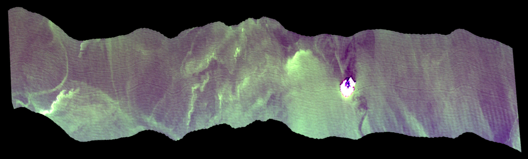 Lake Erie hyperspectral example image.
The hyperspectral images in this collection contain flights over the western basin of Lake Erie, and Saginaw Bay, Lake Huron of the Great Lakes region during the HAB season from typically June until the end of October. Images were acquired from a manned aircraft with a Resonon hyperspectral imaging camera. Each flight has approximately 200-400 images along the flight trajectory that are in band interleave per pixel (.bip) or band interleave per line (.bil) format. The files are in raw binary, radiance values, and reflectance values. The resolution is typically 1 meter or less depending on the altitude that is flown. The flight path covered the Michigan and Ohio drinking water intake locations and also the Cooperative Institute for Great Lakes Research (CIGLR) water quality monitoring stations in western Lake Erie. Each flight took into account the solar zenith angle to minimize sun glint correction. The data are currently in raw and radiance formats that were converted to radiance using the calibration files provided by the manufacture and no other corrections have been made. The camera is sent annually to be calibrated by the manufacturer. Imagery was collected to monitor harmful algal blooms (HABs) over the western basin of Lake Erie and Saginaw Bay, Lake Huron. Funding for this project was received via the Great Lakes Restoration Initiative (GLRI) from the U.S. Environmental Protection Agency (USEPA).
- Cite as: VanderWoude, Andrea; Marshall, Lauren (2021): Hyperspectral imagery to study harmful algal blooms (HABs) of Lake Erie, Lake St. Clair, and Saginaw Bay, Lake Huron of the Great Lakes region. [indicate subset used]. NOAA National Centers for Environmental Information. NCEI DSI 2056_01. Accessed [date]
- NCEI DSI 2056_01
- gov.noaa.ncdc:C01631
C01631
| Download Data |
|
| Other Access |
|
| Distribution Formats |
|
| Ordering Instructions | Contact NCEI for other distribution options and instructions. |
| Distributor | NOAA National Centers for Environmental Information
ncei.info@noaa.gov |
| Dataset Point of Contact | NOAA National Centers for Environmental Information
ncei.info@noaa.gov |
| Time Period | 2015-09-04 to Present (time interval: 7-day) |
| Spatial Reference System | urn:ogc:def:crs:EPSG::4326 |
| Spatial Bounding Box Coordinates |
N: 44.4
S: 41.2
E: -82.5
W: -84.0
|
| Spatial Coverage Map | |
| General Documentation |
|
| Processing Documents |
|
| Associated Resources |
|
| Publication Dates |
|
| Edition | 1 |
| Data Presentation Form | Digital image
|
| Dataset Progress Status | Ongoing - data is continually being updated |
| Data Update Frequency | Annually |
| Purpose | The intended use of this mission was to collect, pre-process, and analyze airborne hyperspectral imagery around the Great Lakes for harmful algal blooms (HAB) and submerged aquatic vegetation (SAV). The benefits of the dataset are the wealth of applications beyond HABs and SAV, a wealth of study areas could use hyperspectral data (i.e. sediment types, wetland delineation, invasive species detection, etc.). |
| Dataset Citation |
|
| Cited Authors |
|
| Collaborators |
|
| Resource Providers |
|
| Publishers |
|
| Theme keywords | Global Change Master Directory (GCMD) Science Keywords
|
| Data Center keywords | Global Change Master Directory (GCMD) Data Center Keywords
|
| Platform keywords | Global Change Master Directory (GCMD) Platform Keywords
|
| Instrument keywords | Global Change Master Directory (GCMD) Instrument Keywords
|
| Place keywords | Global Change Master Directory (GCMD) Location Keywords
|
| Project keywords | Global Change Master Directory (GCMD) Project Keywords
|
| Data Resolution keywords | Global Change Master Directory (GCMD) Horizontal Data Resolution Keywords
|
| Stratum keywords | Global Change Master Directory (GCMD) Location Keywords
|
| Use Constraints |
|
| Access Constraints |
|
| Fees |
|
| Lineage Statement | Images were acquired from a manned aircraft contracted to Aerial Associates Photography, Inc. out of the Ann Arbor airport with a Resonon hyperspectral imaging camera, the Resonon Pika II from 2015-2020 and the Pika L from 2021 to present. |
| Processor | |
| Processing Steps |
|
| Processing Environment | Processing environment is Windows based. Processing images from raw radiance into radiance values using the manufacturer software and calibration files. These files are not georeferenced but include header information for georeferencing. |
| Processing Documents |
|
| Processing Steps |
|
Last Modified: 2023-06-23
For questions about the information on this page, please email: ncei.info@noaa.gov