Aerial Imagery over U.S. Coastal Areas collected by the NOAA Office for Coastal Management dating from 1944 to Present

browse graphic
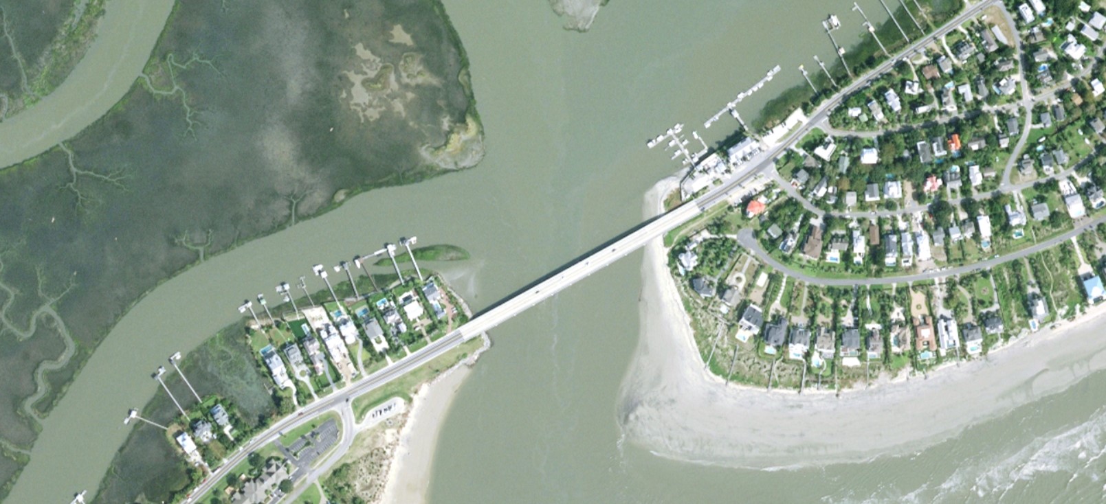
OCM Orthoimagery example
This aerial imagery dataset consists of high resolution (1 inch up to 1 meter) true color, infrared, 4-band, black and white, and hyperspectral ortho-rectified mosaic tiles collected in coastal areas to support shoreline and coastal mapping efforts. This data is created as a product from the NOAA Office for Coastal Management (OCM) from data collected by the NOAA National Geodetic Survey (NGS), the NOAA Office for Coastal Management (OCM) and the US Army Corps of Engineers (USACE). The source imagery was acquired from airplane flights from across the United States since 1944 and is an ongoing project. Ortho-rectified mosaic tiles are an ancillary product supporting the Interagency Working Group - Ocean and Coastal Mapping with a goal of increasing support for multiple uses of the data. Most of the data was collected through NOAA NGS's Coastal Mapping Program (CMP) and typically has a ground sample distance (GSD) for each pixel of 0.50 m, though more recent data may have a 0.35 m or 0.25 m GSD. Data collected by the US Army Corps of Engineers (USACE) is typically higher resolution with 0.05 m GSD. The rest of the data was acquired by OCM. OCM has an agreement with NGS and the USACE to archive the imagery that is delivered to OCM. The data set includes Geotiff (.tif) or ERDAS Imagine .img format images with associated GIS tile index shapefiles and a manifest file.
  • Cite as: NOAA Office for Coastal Management; NOAA National Geodetic Survey (2022): Aerial Imagery over U.S. Coastal Areas collected by the NOAA Office for Coastal Management dating from 1944 to Present. [indicate subset used]. NOAA National Centers for Environmental Information. NCEI DSI 2059_01. Accessed [date].
  • NCEI DSI 2059_01
  • gov.noaa.ncdc:C01633
Other Access
  • Contact NCEI (offlineAccess)
    Users can access the data online from the NOAA Office for Coastal Management website. Users can contact NCEI for more information and to request access to the archived data. User requests for the archived data are subject to NCEI order fulfillment constraints.
Distribution Formats
  • GeoTIFF
  • IMG
Ordering InstructionsContact NCEI for other distribution options and instructions.
DistributorNOAA National Centers for Environmental Information
ncei.info@noaa.gov
Dataset Point of Contact Customer Engagement Branch
NOAA National Centers for Environmental Information
1-828-271-4800
ncei.orders@noaa.gov
Time Period1944-01-01 to Present
Spatial Reference Systemurn:ogc:def:crs:EPSG::4269
Spatial Bounding Box Coordinates
N: 74
S: 15
E: -61
W: -167
Spatial Coverage Map
General Documentation
Associated Resources
  • Digital Coast Data access viewer
Publication Dates
  • publication: 2022-02-28
Data Presentation Form Digital image
Dataset Progress StatusOngoing - data is continually being updated
Data Update Frequency Monthly
PurposeThe imagery in this dataset is used by universities, private industry, and state and local governments.
Use Limitations
  • Data should not be used for navigation.
Dataset Citation
  • Cite as: NOAA Office for Coastal Management; NOAA National Geodetic Survey (2022): Aerial Imagery over U.S. Coastal Areas collected by the NOAA Office for Coastal Management dating from 1944 to Present. [indicate subset used]. NOAA National Centers for Environmental Information. NCEI DSI 2059_01. Accessed [date].
Cited Authors
  • NOAA Office for Coastal Management
  • NOAA National Geodetic Survey
Originators
  • NOAA Office for Coastal Management
  • NOAA National Geodetic Survey
Publishers
  • NOAA National Centers for Environmental Information
Theme keywordsGlobal Change Master Directory (GCMD) Science Keywords
  • Earth Science > Spectral/Engineering > Visible Wavelengths > Visible Imagery
  • Earth Science > Spectral/Engineering > Infrared Wavelengths > Infrared Imagery
  • Earth Science > Spectral/Engineering > Infrared Wavelengths > Hyperspectral Imagery
  • Earth Science > Spectral/Engineering > Infrared Wavelengths > Black And White Imagery
Provider Keywords
  • Orthoimagery
  • Digital orthophotography
  • 8-bit radiometric Resolution
  • 16-bit radiometric Resolution
  • 32-bit radiometric Resolution
  • Infrared Imagery
  • True color (Red Green Blue) Imagery
  • 4-Channel Imagery
  • Hyperspectral Imagery
  • Color infrared Imagery
  • Panchromatic Imagery
  • Aerial Imagery
Data Center keywordsGlobal Change Master Directory (GCMD) Data Center Keywords
  • DOC/NOAA/NESDIS/NCEI > National Centers for Environmental Information, NESDIS, NOAA, U.S. Department of Commerce
  • DOC/NOAA/NOS/OCM > Office of Coastal Management, National Ocean Service, NOAA, U.S. Department of Commerce
  • DOC/NOAA/NOS/NGS > National Geodetic Survey, National Ocean Service, NOAA, U.S. Department of Commerce
  • DOD/USARMY/USACE/CHL > Coastal and Hydraulics Laboratory, U. S. Army Corps of Engineers, U.S. Army, U. S. Department of Defense
Platform keywordsGlobal Change Master Directory (GCMD) Platform Keywords
  • Aircraft > AIRCRAFT
Instrument keywordsGlobal Change Master Directory (GCMD) Instrument Keywords
  • Earth Remote Sensing Instruments > Passive Remote Sensing > Photon/Optical Detectors > Cameras > CAMERAS
Place keywordsGlobal Change Master Directory (GCMD) Location Keywords
  • Continent > North America > United States Of America
Use Constraints
  • Cite as: NOAA Office for Coastal Management; NOAA National Geodetic Survey (2022): Aerial Imagery over U.S. Coastal Areas collected by the NOAA Office for Coastal Management dating from 1944 to Present. [indicate subset used]. NOAA National Centers for Environmental Information. NCEI DSI 2059_01. Accessed [date].
  • Use liability: NOAA and NCEI cannot provide any warranty as to the accuracy, reliability, or completeness of furnished data. Users assume responsibility to determine the usability of these data. The user is responsible for the results of any application of this data for other than its intended purpose.
Access Constraints
  • Distribution liability: NOAA and NCEI make no warranty, expressed or implied, regarding these data, nor does the fact of distribution constitute such a warranty. NOAA and NCEI cannot assume liability for any damages caused by any errors or omissions in these data. If appropriate, NCEI can only certify that the data it distributes are an authentic copy of the records that were accepted for inclusion in the NCEI archives.
Fees
  • In most cases, electronic downloads of the data are free. However, fees may apply for custom orders, data certifications, copies of analog materials, and data distribution on physical media.
Lineage information for: dataset
Lineage StatementThe imagery consists of high resolution (1 inch up to 1 meter) infrared, natural color and 4-band datasets. Most of the imagery was collected by the National Geodetic Survey (NGS), while the rest was acquired by NOAA Office for Coastal Management (OCM).
Lineage information for: repository
Processing Steps
  • 2015-04-22T00:00:00 - NOAA created the National Centers for Environmental Information (NCEI) by merging NOAA's National Climatic Data Center (NCDC), National Geophysical Data Center (NGDC), and National Oceanographic Data Center (NODC), including the National Coastal Data Development Center (NCDDC), per the Consolidated and Further Continuing Appropriations Act, 2015, Public Law 113-235. NCEI launched publicly on April 22, 2015.
Last Modified: 2023-06-23
For questions about the information on this page, please email: ncei.info@noaa.gov