Infrared Atmospheric Sounding Interferometer (IASI) Level 2 Cloud cleared Radiances (CCR)

IASI L2 Cloud-Cleared Radiances

browse graphic
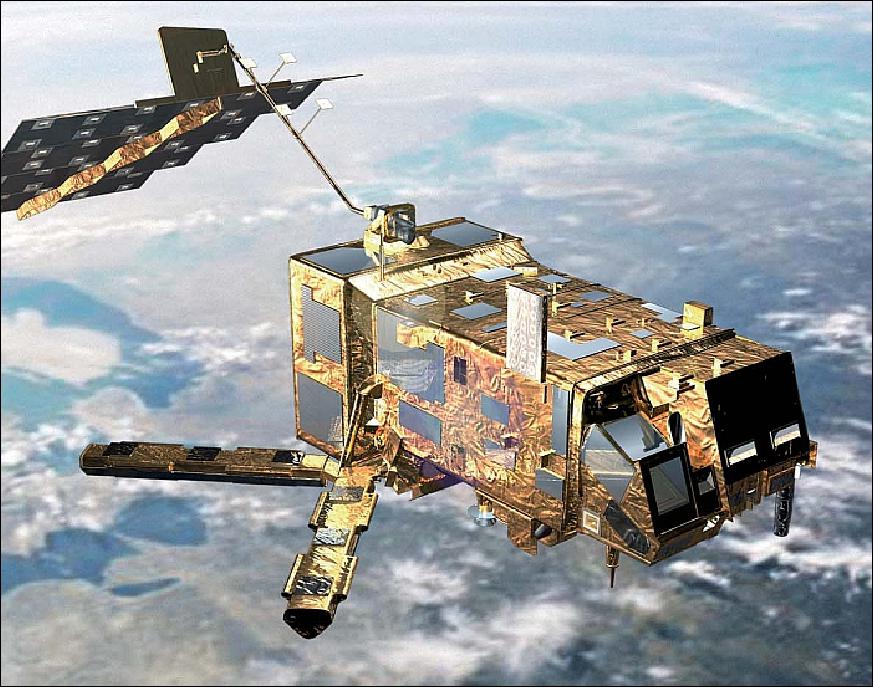
Artist's view of the MetOp-A spacecraft in orbit (image credit: ESA, EUMETSAT)
The Infrared Atmospheric Sounding Interferometer is a Cross-nadir infrared sounder flown on the European MetOp satellite series. IASI measures atmospheric emission spectra to derive temperature and humidity profiles with high vertical resolution and accuracy. IASI is a Michelson interferometer with spectral coverage between 3.6 and 15.5 micrometers. At nadir, the instrument samples data at intervals of 25 km along track and cross track with each sample having a maximum diameter of about 12 km. The IASI Level-2 Cloud-Cleared Radiances (CCR) product from MetOp-B/C is a NOAA-unique product generated from the European Organization for Meteorological Satellites (EUMETSAT) IASI level 1C data. The data are produced by the NOAA Environmental Satellite, Data, and Information Service (NESDIS) and are distributed by the Comprehensive Large Array-Data Stewardship System (CLASS) as 3 minute files in the netCDF-4 file format with attributes included.
  • Cite as: King, Tom (2021): Infrared Atmospheric Sounding Interferometer (IASI) Level 2 Cloud Cleared Radiance [indicate subset used]. NOAA National Centers for Environmental Information. [access date].
  • gov.noaa.ncdc:C01663
  • gov.noaa.class:IASI
Download Data
  • NOAA CLASS FTP Server (download)
    Access and download data tar files by date and product for the previous 85 days. The directory structure is as follows, date(yyyymmdd)->instrument family->product.
Order Data
Distribution Formats
  • NetCDF (Version: 4)
Ordering InstructionsContact NCEI for other distribution options and instructions.
DistributorNOAA National Centers for Environmental Information
ncei.info@noaa.gov
Dataset Point of Contact Customer Engagement Branch
DOC/NOAA/NESDIS/NCEI > National Centers for Environmental Information, NESDIS, NOAA, U.S. Department of Commerce
ncei.sat.info@noaa.gov
Time Period2007-05-21 to Present (time interval: 12-hour)
Spatial Reference Systemurn:ogc:def:crs:EPSG::4326
Spatial Bounding Box Coordinates
N: 90.0
S: -90.0
E: 180.0
W: -180.0
Spatial Coverage Map
General Documentation
Processing Documents
Publication Dates
  • publication: 2007-05-21
Data Presentation Form Digital image
Dataset Progress StatusOngoing - data is continually being updated
Data Update Frequency Continual
PurposeCloud-clearing is the process of computing the clear column radiance for a given channeL The Cloud Cleared Radiance product represents what the channel would have observed if the entire scene were cloud free.
Use Limitations
  • For a complete description of use limitations for this EDR, see the Algorithm Theoretical Basis Document (ATBD).
Dataset Citation
  • Cite as: King, Tom (2021): Infrared Atmospheric Sounding Interferometer (IASI) Level 2 Cloud Cleared Radiance [indicate subset used]. NOAA National Centers for Environmental Information. [access date].
Cited Authors
  • King, Tom
    DOC/NOAA/NESDIS/STAR > Center for Satellite Applications and Research, NESDIS, NOAA, U.S. Department of Commerce
Originators
  • NOAA Office of Satellite and Product Operations
Principal Investigators
  • King, Tom
    DOC/NOAA/NESDIS/STAR > Center for Satellite Applications and Research, NESDIS, NOAA, U.S. Department of Commerce
Publishers
  • NOAA National Centers for Environmental Information
Theme keywordsGlobal Change Master Directory (GCMD) Science Keywords
  • Earth Science > Atmosphere > Clouds > Cloud Cleared Radiance
Data Center keywords
  • DOC/NOAA/NESDIS/NCEI > National Centers for Environmental Information, NESDIS, NOAA, U.S. Department of Commerce
  • DOC/NOAA/NESDIS/NCDC > National Climatic Data Center, NESDIS, NOAA, U.S. Department of Commerce
  • DOC/NOAA/NESDIS/STAR > Center for Satellite Applications and Research, NESDIS, NOAA, U.S. Department of Commerce
  • DOC/NOAA/NESDIS/OSPO > Office of Satellite and Product Operations, NESDIS, NOAA, U.S. Department of Commerce
Platform keywords
  • METOP-A > Meteorological Operational Satellite - A
  • METOP-B Meteorological Operational Satellite - B
  • METOP-C Meteorological Operational Satellite - C
Instrument keywords
  • IASI > Infrared Atmospheric Sounding Interferometer
Place keywords
  • Geographic Region > Global
Project keywords
  • NOAA OneStop Project
Data Resolution keywords
  • 10 km < 100 km
Use Constraints
  • Cite as: King, Tom (2021): Infrared Atmospheric Sounding Interferometer (IASI) Level 2 Cloud Cleared Radiance [indicate subset used]. NOAA National Centers for Environmental Information. [access date].
  • Use liability: NOAA and NCEI cannot provide any warranty as to the accuracy, reliability, or completeness of furnished data. Users assume responsibility to determine the usability of these data. The user is responsible for the results of any application of this data for other than its intended purpose.
Access Constraints
  • Distribution liability: NOAA and NCEI make no warranty, expressed or implied, regarding these data, nor does the fact of distribution constitute such a warranty. NOAA and NCEI cannot assume liability for any damages caused by any errors or omissions in these data. If appropriate, NCEI can only certify that the data it distributes are an authentic copy of the records that were accepted for inclusion in the NCEI archives.
Fees
  • In most cases, electronic downloads of the data are free. However, fees may apply for custom orders, data certifications, copies of analog materials, and data distribution on physical media.
Lineage information for: dataset
Lineage StatementThe data were produced by the NOAA Office of Satellite and Product Operations (OSPO) NDE/IDPS and are archived at the NOAA National Centers for Environmental Information (NCEI).
Processing Steps
  • For a complete description of the processing steps, see the Algorithm Theoretical Basis Document and Data Flow Diagram.
Processing Documents
Source Datasets
  • IASI Level 1C
    • NOAA CLASS Data Search and Order (order)
      Search the data archive and submit an order for the dataset via the interface.
    • Description of Source: IASI Level 1C data from EUMETSAT
    • Temporal extent used: 2007-05-21 to Present
    • Spatial extent used: N:90 S:-90 E:180 W:-180
Lineage information for: repository
Processing Steps
  • 2015-04-22T00:00:00 - NOAA created the National Centers for Environmental Information (NCEI) by merging NOAA's National Climatic Data Center (NCDC), National Geophysical Data Center (NGDC), and National Oceanographic Data Center (NODC), including the National Coastal Data Development Center (NCDDC), per the Consolidated and Further Continuing Appropriations Act, 2015, Public Law 113-235. NCEI launched publicly on April 22, 2015.
Last Modified: 2023-06-23
For questions about the information on this page, please email: ncei.info@noaa.gov