Hydrometeorological Automated Data System (HADS) SHEF-encoded Data
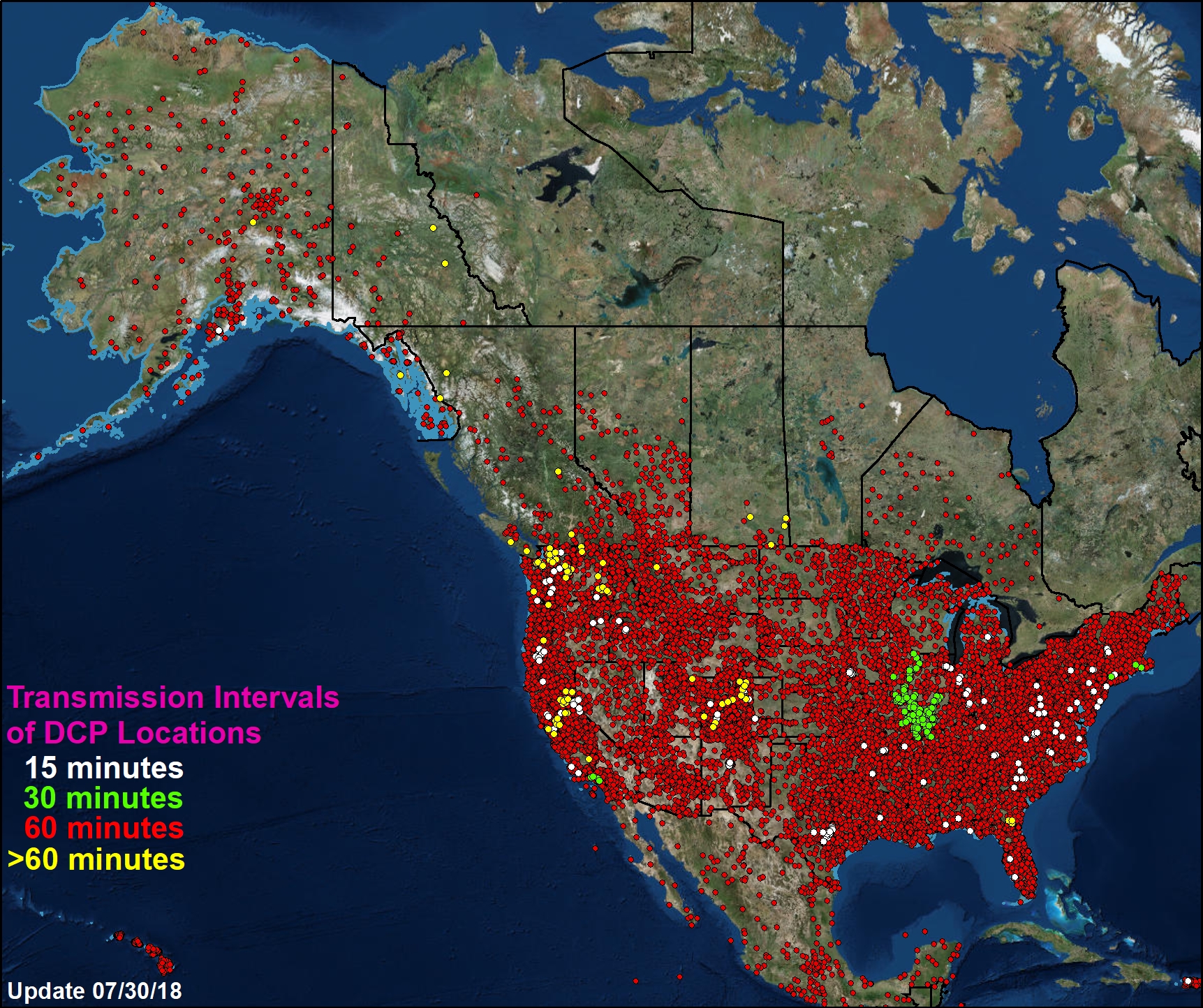 All digital collection platforms from HADS
HADS is a real-time and near real-time data acquisition, processing, and distribution system operated by the National Weather Service Office of Dissemination. The HADS system acquires raw hydrological and meteorological observation messages from Geostationary Operational Environmental Satellites (GOES) Data Collection Platforms (DCPs). The data originates from DCPs owned and/or operated by more than 100 cooperators. The NWS operates a relatively small network of DCPs. The majority of the data acquired and processed by HADS comes from DCPs owned and/or operated by the Water Resources Division of the U.S. Geologic Survey, the U.S. Army Corps of Engineers, the Tennessee Valley Authority, the Bureau of Land Management, the U.S. Forest Service, the Bureau of Reclamation, and departments of natural resources from numerous state and local agencies throughout the country.
- Cite as: NOAA National Centers for Environmental Prediction. 2006. Hydrometeorological Automated Data System (HADS) SHEF-encoded Data.[indicate subset used]. NOAA National Centers for Environmental Information. Accessed [date].
- NCEI DSI 6328_03
- gov.noaa.ncdc:C01673
C01673
| Download Data |
|
| Distribution Formats |
|
| Ordering Instructions | Contact NCEI for other distribution options and instructions. |
| Distributor | NOAA National Centers for Environmental Information
ncei.info@noaa.gov |
| Dataset Point of Contact | Jay Lawrimore
NOAA National Centers for Environmental Information jay.lawrimore@noaa.gov |
| Time Period | 1997-02-01 to Present (time interval: 15-minute) |
| Spatial Reference System | urn:ogc:def:crs:EPSG::4269 |
| Spatial Bounding Box Coordinates |
N: 72.0
S: -15.0
E: -64.0
W: 134.0
|
| Spatial Coverage Map | |
| General Documentation |
|
| Associated Resources |
|
| Publication Dates |
|
| Dataset Progress Status | Complete - production of the data has been completed |
| Data Update Frequency | Daily |
| Purpose | The system exists in support of National Weather Service (NWS) activities of national scope, specifically the Flood and Flash Flood Warning programs administered by the Weather Service Forecast Offices and the operations performed at River Forecast Centers throughout the United States. Additionally HADS created data products bolster several other NWS program areas including fire weather support services, local and national analysis of precipitation events, hydrologic modeling, and the verification of NEXRAD precipitation estimates. |
| Dataset Citation |
|
| Cited Authors |
|
| Originators |
|
| Publishers |
|
| Theme keywords | Global Change Master Directory (GCMD) Science Keywords
|
| Use Constraints |
|
| Access Constraints |
|
| Fees |
|
| Lineage Statement | The HADS system acquires raw hydrological and meteorological observation messages from Geostationary Operational Environmental Satellites (GOES) Data Collection Platforms (DCPs). The data originates from DCPs owned and/or operated by more than 100 cooperators. The NWS operates a relatively small network of DCPs. The majority of the data acquired and processed by HADS comes from DCPs owned and/or operated by the Water Resources Division of the U.S. Geologic Survey, the U.S. Army Corps of Engineers, the Tennessee Valley Authority, the Bureau of Land Management, the U.S. Forest Service, the Bureau of Reclamation, and departments of natural resources from numerous state and local agencies throughout the country. |
| Processor |
|
| Processing Steps |
|
| Source Datasets |
|
| Processing Steps |
|
Last Modified: 2023-06-23
For questions about the information on this page, please email: ncei.info@noaa.gov