NOAA/WDS Paleoclimatology - Sniderhan - Inuvik - PCMA - ITRDB CANA612
 Paleoclimatology - Tree Ring
This archived Paleoclimatology Study is available from the NOAA National Centers for Environmental Information (NCEI), under the World Data Service (WDS) for Paleoclimatology. The associated NCEI study type is Tree Ring. The data include parameters of tree ring with a geographic location of Northwest Territories, Canada. The time period coverage is from 90 to -64 in calendar years before present (BP). See metadata information for parameter and study location details. Please cite this study when using the data.
- Cite as: Sniderhan, A.E.; Baltzer, J.L. (2020-09-04): NOAA/WDS Paleoclimatology - Sniderhan - Inuvik - PCMA - ITRDB CANA612. [indicate subset used]. NOAA National Centers for Environmental Information. https://doi.org/10.25921/vnd9-mm56. Accessed [date].
- Please refer to Credit tab for full citation information.
- doi:10.25921/vnd9-mm56
- noaa-tree-31112
- NCEI DSI 1200_02
- NCEI DSI 1200_01
noaa-tree-31112
| Search Data |
|
| Download Data |
|
| Distribution Formats |
|
| Ordering Instructions | Contact NCEI for other distribution options and instructions. |
| Distributor | NOAA National Centers for Environmental Information
ncei.info@noaa.gov |
| Dataset Point of Contact | NOAA National Centers for Environmental Information
ncei.info@noaa.gov |
| Dataset Point of Contact | Data Center Contact
NOAA World Data Service for Paleoclimatology 828-271-4800 paleo@noaa.gov |
| Coverage Description | Date Range: 1860 CE to 2014 CE; Date Range: 90 cal yr BP to -64 cal yr BP; |
| Time Period | 1860 to 2014 |
| Spatial Bounding Box Coordinates |
N: 68.31472
S: 68.31472
E: -133.4583
W: -133.4583
|
| Spatial Coverage Map | |
| General Documentation |
|
| Associated Resources |
|
| Publication Dates |
|
| Data Presentation Form | Digital table - digital representation of facts or figures systematically displayed, especially in columns
|
| Dataset Progress Status | Complete - production of the data has been completed |
| Data Update Frequency | Data update frequency not available |
| Supplemental Information |
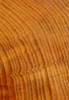
STUDY NOTES: Tree ring sampled; In four stands, cores were taken from the nearest black spruce (with DBH greater than ~5 cm to ensure a non-destructive core sample) every 10 m along three parallel 90 meter transects, spaced 25 m apart ? a total of 10 trees per transect. Where there were not trees present within a 5 m radius of a sampling point, the transect was extended by an additional 10 m until 10 trees were sampled. Subset of trees used in delta 13C analysis. NOAA Template Raw Measurements file added 2020-11-18.
ABSTRACT SUPPLIED BY ORIGINATOR: Northwestern Canada's boreal forest has experienced rapid warming, drying, and changes to permafrost, yet the growth responses and mechanisms driving productivity have been understudied at broad scales. Forest responses are largely driven by black spruce - the region's most widespread and dominant tree. We collected tree-ring samples from four black spruce-dominated sites across 15 degrees of latitude, spanning gradients in climate and permafrost. We investigated (1) differences in growth patterns, (2) variations in climatic drivers of growth, and (3) trends in water use efficiency (WUE) through 13C isotope analysis from 1945 - 2006. We found positive growth trends at all sites except mid-latitude, where rapid permafrost thaw drove declines. Annual growth was lowest at the tree limit site and highest at the treeline. Climatic drivers of these growth patterns varied; positive growth responses at the northerly sites were associated with warmer winters, whereas d13C trends and climate-growth responses at mid-latitude sites indicated growth was limited by moisture availability. d13C signatures indicated increased WUE at the southernmost site, with no significant trends at northern sites. These results suggest that warming will increase growth of trees at black spruce's northern extent, but southerly areas may face drought stress if precipitation does not balance evapotranspiration. |
| Purpose | Tree ring data from the International Tree Ring Data Bank and World Data Center for Paleoclimatology archives. Most data sets include raw treering measurements (most are annual ring width, with some collections of earlywood or latewood width or wood density), plus chronologies (standardized growth indices for a site compiled from multiple treering samples). Reconstructions of climate variables are included with some of these data sets. Each data type is stored in a separate data file; the data type is coded into the file name. For details please see: http://www.ncei.noaa.gov/products/paleoclimatology/tree-ring |
| Dataset Citation |
|
| Cited Authors |
|
| Originators |
|
| Publishers |
|
| Theme keywords | Global Change Master Directory (GCMD) Science Keywords
|
| Data Center keywords | Global Change Master Directory (GCMD) Data Center Keywords
|
| Place keywords |
|
| Use Constraints |
|
| Access Constraints |
|
| Fees |
|
Last Modified: 2024-04-30
For questions about the information on this page, please email: ncei.info@noaa.gov