NOAA GOES-R Series Magnetometer (MAG) Instrument Calibration Data
MAG-INST-CAL-ENG
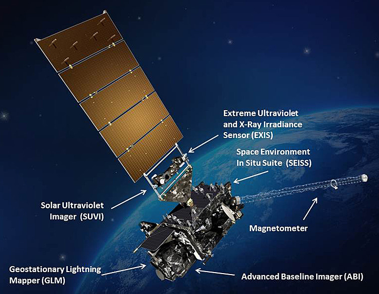 GOES-R satellite illustration
The Magnetometer Instrument Engineering Telemetry Data file contains data used to support the generation of the Magnetometer Level 1b product, and monitor and evaluate the health and performance of the two magnetometers. This data is transmitted to the ground in raw digital counts, and subsequently converted into physical units by the ground system. Some of the data pertains to the temperature of components of the magnetometers. This includes temperatures for the electronics and sensors. Other telemetry includes reference voltages and temperature dependent scale factors and offsets relating raw observed counts to magnetic field units (nanoteslas) for the two magnetometers.
The Magnetometer Calibration Data file contains raw observation counts and data acquisition status from the inboard and outbound magnetometers for a one second interval during a calibration maneuver. Nominally, this file contains ten observation samples acquired at one-tenth of a second intervals.
The Magnetometer Calibration Data file contains raw observation counts and data acquisition status from the inboard and outbound magnetometers for a one second interval during a calibration maneuver. Nominally, this file contains ten observation samples acquired at one-tenth of a second intervals.
- Cite as: GOES-R Calibration Working Group and GOES-R Series Program, (2015): NOAA GOES-R Series Magnetometer (MAG) Instrument Calibration Data. [indicate subset used]. NOAA National Centers for Environmental Information. MAG-INST-CAL-ENG. Accessed [date].
- MAG-INST-CAL-ENG
- gov.noaa.ncdc:C01530
C01530
| Order Data |
|
| Distribution Formats |
|
| Ordering Instructions | Contact NCEI for other distribution options and instructions. |
| Distributor | NOAA National Centers for Environmental Information
ncei.info@noaa.gov |
| Dataset Point of Contact | Customer Engagement Branch
NOAA National Centers for Environmental Information 1-828-271-4800 ncei.orders@noaa.gov |
| Time Period | 2015-01-01 to Present (time interval: 0.1-second) |
| Spatial Bounding Box Coordinates |
N: 90.0
S: -90.0
E: 180.0
W: -180.0
|
| Spatial Coverage Map | |
| General Documentation |
|
| Processing Documents |
|
| Associated Resources |
|
| Publication Dates |
|
| Data Presentation Form | Digital table - digital representation of facts or figures systematically displayed, especially in columns
|
| Dataset Progress Status | Ongoing - data is continually being updated |
| Data Update Frequency | Continual |
| Purpose | These instrument calibration data can be used to evaluate, monitor, and trend sensor performance. |
| Dataset Citation |
|
| Cited Authors |
|
| Principal Investigators |
|
| Resource Providers |
|
| Publishers |
|
| Theme keywords | Global Change Master Directory (GCMD) Science Keywords
|
| Data Center keywords | Global Change Master Directory (GCMD) Data Center Keywords
|
| Platform keywords | Global Change Master Directory (GCMD) Platform Keywords
|
| Instrument keywords | Global Change Master Directory (GCMD) Instrument Keywords
|
| Place keywords | Global Change Master Directory (GCMD) Location Keywords
|
| Project keywords | Global Change Master Directory (GCMD) Project Keywords
|
| Use Constraints |
|
| Access Constraints |
|
| Fees |
|
| Lineage Statement | These data were produced by the NOAA Office of Satellite and Product Operations (OSPO) and are archived at the NOAA National Centers for Environmental Information (NCEI). |
| Processor |
|
| Processing Steps |
|
| Processing Documents |
|
| Processing Steps |
|
Last Modified: 2023-12-13
For questions about the information on this page, please email: ncei.info@noaa.gov