Dataset Overview | National Centers for Environmental Information (NCEI)

Monthly Climatic Data for the World

NERMS - Monthly Climatic Data for the World

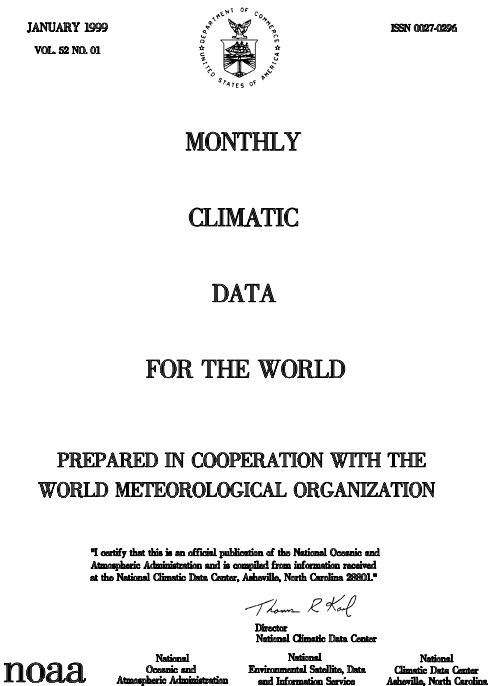
browse graphicImage example
Monthly Climatic Data for the World (MCDW) is available as a publication and also as a digital dataset (DSI-3500), both of which contain the same data. The geographic coverage is selected stations in most nations that are members of the World Meteorological Organization (WMO) -- in effect, global. MCDW is prepared in cooperation with the WMO. NCEI processes international electronic transmissions in CLIMAT format (surface land station), CLIMAT SHIP format (ocean ship) and CLIMAT TEMP format (upper air), for the purpose of building a surface/upper air data base and producing MCDW. Approximately 1200 surface and 500 upper air stations are processed. These data are used in agricultural and energy assessment activities, in crop yield model development, and in the analysis of global atmospheric and regional climatic variations. The major parameters in MCDW are monthly mean station pressure, sea level pressure, and vapor pressure with departure from normal, mean temperature with departure from normal, total precipitation with departure from normal, percentage of long-term average sunshine, and upper air data such as height, temperature, dew point temperature depression, vector wind direction and speed with the steadiness factor for the surface and constant pressure levels of 850, 700, 500, 300, 200, 150, 100, 50, and 30 mb. The publication began in 1948. The digital dataset DSI-3500 contains data from 1986 to the present. The National Center for Atmospheric Research (NCAR) produces important derived datasets DSI-9645 and DSI- 9648, which combine MCDW data and data from other sources, from as long ago as 1731. These are also available from NCEI.
Cite this dataset when used as a source.
  • NCEI DSI 3900_03
  • NCEI Physical Archive Collection: MCDW \ MCDW_D
  • gov.noaa.ncdc:C01037
  • NERMS UUID: B5FF6C68CC4B4D71A1FEEEEA96CA9AA9
gov.noaa.ncdc:C01037
Search Data
Other Access
  • Contact NCEI (offlineAccess)
    Contact NCEI for more information and to request access to the archived data. Requests are subject to NCEI order fulfillment constraints.
Distribution Formats
  • PDF
  • ASCII format
Ordering Instructions Contact NCEI for other distribution options and instructions.
Distributor NOAA National Centers for Environmental Information
ncei.info@noaa.gov
Dataset Point of Contact William Angel
CDMP Program Manager
DOC/NOAA/NESDIS/NCEI > National Centers for Environmental Information, NESDIS, NOAA, U.S. Department of Commerce
+1 828-271-4800
ncei.orders@noaa.gov
Time Period 1948 to Present
Spatial Bounding Box Coordinates
West: -180
East: 180
South: -90
North: 90
Spatial Coverage Map
General Documentation
Processing Documents
Publication Dates
  • publication: 2011-03-15
  • revision: 2013-05-02
Data Presentation Form Digital table - digital representation of facts or figures systematically displayed, especially in columns
Digital image
Hardcopy document - document archived in analog format
Dataset Progress Status Complete - production of the data has been completed
Data Update Frequency Irregular
Purpose In the late 1990s NCEI realized the need to host digital images of environmental records on the internet, and developed an internal-to-NOAA system for uploading and indexing millions of original source data images from the NCEI archives. The system also enables collection and management, and supports public access. For decades, NCEI has remained committed to making more of its original environmental records available digitally to users across the United States and around the world.
Cited Authors
  • NOAA National Centers for Environmental Information
Publishers
  • NOAA National Centers for Environmental Information
Theme keywords Global Change Master Directory (GCMD) Science Keywords
  • Earth Science > Atmosphere > Precipitation
  • Earth Science > Atmosphere > Atmospheric Temperature
  • Earth Science > Atmosphere > Atmospheric Pressure
  • Earth Science > Atmosphere > Atmospheric Winds > Surface Winds
  • Earth Science > Atmosphere > Atmospheric Radiation > Sunshine
  • EARTH SCIENCE > ATMOSPHERE > ALTITUDE > BAROMETRIC ALTITUDE
  • EARTH SCIENCE > ATMOSPHERE > ALTITUDE > GEOPOTENTIAL HEIGHT
  • EARTH SCIENCE > ATMOSPHERE > ALTITUDE > STATION HEIGHT
  • EARTH SCIENCE > ATMOSPHERE > ALTITUDE > TROPOPAUSE
  • EARTH SCIENCE > ATMOSPHERE > ATMOSPHERIC PRESSURE > ATMOSPHERIC PRESSURE MEASUREMENTS
  • EARTH SCIENCE > ATMOSPHERE > ATMOSPHERIC PRESSURE > PRESSURE ANOMALIES
  • EARTH SCIENCE > ATMOSPHERE > ATMOSPHERIC PRESSURE > SEA LEVEL PRESSURE
  • EARTH SCIENCE > ATMOSPHERE > ATMOSPHERIC PRESSURE > SURFACE PRESSURE
  • EARTH SCIENCE > ATMOSPHERE > ATMOSPHERIC TEMPERATURE > SURFACE TEMPERATURE
  • EARTH SCIENCE > ATMOSPHERE > ATMOSPHERIC TEMPERATURE > SURFACE TEMPERATURE > AIR TEMPERATURE
  • EARTH SCIENCE > ATMOSPHERE > ATMOSPHERIC TEMPERATURE > SURFACE TEMPERATURE > DEW POINT TEMPERATURE
  • EARTH SCIENCE > ATMOSPHERE > ATMOSPHERIC TEMPERATURE > SURFACE TEMPERATURE > TEMPERATURE ANOMALIES
  • EARTH SCIENCE > ATMOSPHERE > ATMOSPHERIC WATER VAPOR > WATER VAPOR INDICATORS > WATER VAPOR
  • EARTH SCIENCE > ATMOSPHERE > ATMOSPHERIC WATER VAPOR > WATER VAPOR INDICATORS > HUMIDITY
  • EARTH SCIENCE > ATMOSPHERE > ATMOSPHERIC WINDS > UPPER LEVEL WINDS
  • EARTH SCIENCE > ATMOSPHERE > PRECIPITATION > PRECIPITATION AMOUNT
  • EARTH SCIENCE > ATMOSPHERE > PRECIPITATION > PRECIPITATION ANOMALIES
  • Earth Science Services > Data Analysis And Visualization > Geographic Information Systems > Desktop Geographic Information Systems
  • Earth Science Services > Data Analysis And Visualization > Geographic Information Systems > Web-Based Geographic Information Systems
  • Earth Science Services > Reference And Information Services > Subscription Services
Global Climate Observing System (GCOS) Essential Climate Variables (ECVs)
  • Atmospheric - Surface - Air Temperature
  • Atmospheric - Surface - Precipitation
  • Atmospheric - Surface - Wind Speed And Direction
Data Center keywords Global Change Master Directory (GCMD) Data Center Keywords
  • DOC/NOAA/NESDIS/NCDC > National Climatic Data Center, NESDIS, NOAA, U.S. Department of Commerce
  • DOC/NOAA/NESDIS/NCEI > National Centers for Environmental Information, NESDIS, NOAA, U.S. Department of Commerce
Platform keywords Global Change Master Directory (GCMD) Platform Keywords
  • Meteorological Stations
Instrument keywords Global Change Master Directory (GCMD) Instrument Keywords
  • Thermometers
  • Anemometers
  • Rain Gauges
  • Barometers
  • Visual Observations
Place keywords Global Change Master Directory (GCMD) Location Keywords
  • Geographic Region > Global Land
  • GEOGRAPHIC REGION > GLOBAL OCEAN
Stratum keywords Global Change Master Directory (GCMD) Location Keywords
  • Vertical Location > Land Surface
  • Vertical Location > Sea Surface
  • Vertical Location > Boundary Layer
  • Vertical Location > Troposphere
  • Vertical Location > Stratosphere
Use Constraints
  • Use liability: NOAA and NCEI cannot provide any warranty as to the accuracy, reliability, or completeness of furnished data. Users assume responsibility to determine the usability of these data. The user is responsible for the results of any application of this data for other than its intended purpose.
Access Constraints
  • Distribution liability: NOAA and NCEI make no warranty, expressed or implied, regarding these data, nor does the fact of distribution constitute such a warranty. NOAA and NCEI cannot assume liability for any damages caused by any errors or omissions in these data. If appropriate, NCEI can only certify that the data it distributes are an authentic copy of the records that were accepted for inclusion in the NCEI archives.
Fees
  • In most cases, electronic downloads of the data are free. However, fees may apply for custom orders, data certifications, copies of analog materials, and data distribution on physical media.
Lineage information for: dataset
Lineage Statement The vast majority of these digital image records were created by scanning original records from the NCEI physical archives through the Climate Database Modernization Program (CDMP). These efforts produced over 50 million images from 2000-2011. Additional scanning activities at NCEI also contribute to the image repository. Partnerships with other NOAA line offices and international weather services have contributed to the broad and global nature of digitally imaged records available from the NCEI.
Processor
  • NCDC Climate Data Modernization Program
Processing Steps
  • Scan
    Rationale: To digitize collection in order to make available online.
Processing Environment paper forms
Processing Documents
Lineage information for: repository
Processing Steps
  • 2015-04-22T00:00:00 - NOAA created the National Centers for Environmental Information (NCEI) by merging NOAA's National Climatic Data Center (NCDC), National Geophysical Data Center (NGDC), and National Oceanographic Data Center (NODC), including the National Coastal Data Development Center (NCDDC), per the Consolidated and Further Continuing Appropriations Act, 2015, Public Law 113-235. NCEI launched publicly on April 22, 2015.
Last Modified: 2026-08-07T16:06:10
For questions about the information on this page, please email: ncei.info@noaa.gov