NOAA GOES-R Series Geostationary Lightning Mapper (GLM) Level 0 Data
GLM-L0
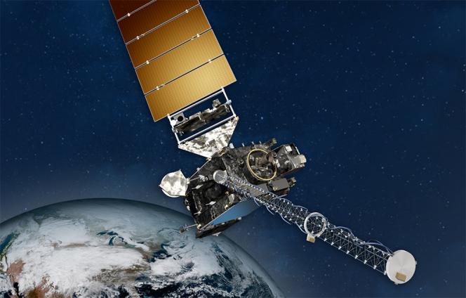 NOAA GOES-R Series Satellite illustration.
This data collection consists of archived Geostationary Operational Environmental Satellite-R (GOES-R) Series Geostationary Lightning Mapper (GLM) Level 0 data from the GOES-East and GOES-West satellites in the operational (OPS) and the post-launch test (PLT) phases. The GOES-R Series provides continuity of the GOES mission through 2035 and improvements in geostationary satellite observational data. GOES-16, the first GOES-R satellite, began operating as GOES-East on December 18, 2017. GOES-17 began operating as GOES-West on February 12, 2019. GOES-T launched on March 1, 2022, and was renamed to GOES-18 on March 14, 2022. GOES-U, the final satellite in the series, is scheduled to launch in 2024. GLM is a near-infrared optical transient detector observing the Western Hemisphere. The GLM Level 0 data are composed of Consultative Committee for Space Data Systems (CCSDS) packets containing the science, housekeeping, engineering, and diagnostic telemetry data downlinked from the instrument. The Level 0 data files also contain orbit and attitude/angular rate packets generated by the GOES spacecraft. Each CCSDS packet contains a unique Application Process Identifier (APID) in the primary header that identifies the specific type of packet, and is used to support interpretation of its contents. Users may refer to the GOES-R Series Product Definition and Users’ Guide (PUG) Volume 1 (Main) and Volume 2 (Level 0 Products) for Level 0 data documentation. Related instrument calibration data and Level 1b processing information are archived and available for order at the NOAA CLASS website. The GLM Level 0 data files are delivered in a netCDF-4 file format, however, the constituent CCSDS packets are stored in a byte array making the data opaque for standard netCDF reader applications. The GLM Level 0 data files are packaged in hourly tar files (data bundles) by satellite for the archive. Recently ingested archive tar files are available for 14 days on an anonymous FTP server for users to download. Data archived on offline tape may be requested from NCEI.
Dataset Citation
- Cite as: GOES-R Series Program, (2019): NOAA GOES-R Series Geostationary Lightning Mapper (GLM) Level 0 Data. [indicate subset used]. NOAA National Centers for Environmental Information. doi:10.25921/qc2r-ps67. [access date].
Dataset Identifiers
- doi:10.25921/qc2r-ps67
- NCEI DSI 2023_01
- NCEI DSI 2023_02
- gov.noaa.ncdc:C01571
ISO 19115-2 Metadata
gov.noaa.ncdc:C01571
| Download Data |
|
| Other Access |
|
| Distribution Formats |
|
| Ordering Instructions | Contact NCEI for other distribution options and instructions. |
| Distributor |
NOAA National Centers for Environmental Information ncei.info@noaa.gov |
| Dataset Point of Contact | Customer Engagement Branch DOC/NOAA/NESDIS/NCEI > National Centers for Environmental Information, NESDIS, NOAA, U.S. Department of Commerce ncei.sat.info@noaa.gov |
| Time Period | 2017-07-05 to Present |
| Spatial Bounding Box Coordinates |
West: 141.7005
East: 6.2995
South: -81.3282
North: 81.3282
West: -156.2995
East: 6.2995
South: -81.3282
North: 81.3282
West: 141.7005
East: -55.7005
South: -81.3282
North: 81.3282
|
| Spatial Coverage Map |
| General Documentation |
|
| Associated Resources |
|
| Publication Dates |
|
| Dataset Progress Status | Ongoing - data is continually being updated |
| Data Update Frequency | Continual |
| Purpose | The GLM Level 0 data are used for specialized data processing activities. The Level 0 CCSDS packets must be uncompressed, extracted and byte-aligned to create an intermediate Level 1 data product. The subsequent Level 1 data processing extracts the data, and performs the radiometric and geometric corrections. |
| Use Limitations |
|
| Dataset Citation |
|
| Cited Authors |
|
| Resource Providers |
|
| Publishers |
|
| Theme keywords |
Global Change Master Directory (GCMD) Science Keywords
|
| Data Center keywords |
Global Change Master Directory (GCMD) Data Center Keywords
|
| Platform keywords |
Global Change Master Directory (GCMD) Platform Keywords
|
| Instrument keywords |
Global Change Master Directory (GCMD) Instrument Keywords
|
| Place keywords |
Global Change Master Directory (GCMD) Location Keywords
|
| Project keywords |
Global Change Master Directory (GCMD) Project Keywords
|
| Use Constraints |
|
| Access Constraints |
|
| Fees |
|
| Lineage information for: dataset | |
|---|---|
| Lineage Statement | These data were produced by the NOAA Office of Satellite and Product Operations (OSPO) and are archived at the NOAA National Centers for Environmental Information (NCEI). |
| Processor |
|
| Processing Steps |
|
| Lineage information for: repository | |
|---|---|
| Processing Steps |
|
Last Modified: 2023-06-23
For questions about the information on this page, please email: ncei.info@noaa.gov
For questions about the information on this page, please email: ncei.info@noaa.gov