Archive of Core and Site/Hole Data and Photographs from the Deep Sea Drilling Project (DSDP)
- spatialRepresentationInfo
- referenceSystemInfo
- identificationInfo
- contentInfo
- contentInfo
- distributionInfo
- dataQualityInfo
- dataQualityInfo
- metadataMaintenance
- acquisitionInformation
(MI_Metadata)
fileIdentifier: gov.noaa.ngdc.mgg.geology:G00993
hierarchyLevel: (MD_ScopeCode) dataset
contact: (CI_ResponsibleParty)
organisationName: NOAA National Centers for Environmental Information
contactInfo: (CI_Contact)
address: (CI_Address)
electronicMailAddress: ncei.info@noaa.gov
onlineResource: (CI_OnlineResource)
linkage: https://www.ncei.noaa.gov/contact
name: NCEI Contact Information
description: Information for contacts at NCEI.
function: (CI_OnLineFunctionCode) information
role: (CI_RoleCode) pointOfContact
dateStamp: 2020-04-21
metadataStandardName: ISO 19115-2 Geographic Information - Metadata - Part 2: Extensions for Imagery and Gridded Data
metadataStandardVersion: ISO 19115-2:2009(E)
return to top
spatialRepresentationInfo: (MD_VectorSpatialRepresentation)
geometricObjects: (MD_GeometricObjects)
geometricObjectType: (MD_GeometricObjectTypeCode) point
return to top
referenceSystemInfo: (MD_ReferenceSystem)
referenceSystemIdentifier: (RS_Identifier)
authority: (CI_Citation)
title: European Petroleum Survey Group (EPSG) Geodetic Parameter Registry
date: (CI_Date)
date: 2008-11-12
dateType: (CI_DateTypeCode) publication
citedResponsibleParty: (CI_ResponsibleParty)
organisationName: European Petroleum Survey Group
contactInfo: (CI_Contact)
onlineResource: (CI_OnlineResource)
linkage: http://www.epsg-registry.org/
name: European Petroleum Survey Group Geodetic Parameter Dataset
description: Registry that accesses the EPSG Geodetic Parameter Dataset, which is a structured dataset of Coordinate Reference Systems and Coordinate Transformations.
function: (CI_OnLineFunctionCode) search
role: (inapplicable)
code: urn:ogc:def:crs:EPSG:4326
version: 6.18.3
return to top
identificationInfo: (MD_DataIdentification)
citation: (CI_Citation)
title: Archive of Core and Site/Hole Data and Photographs from the Deep Sea Drilling Project (DSDP)
date: (CI_Date)
date: 1989-12-31
dateType: (CI_DateTypeCode) publication
date: (CI_Date)
date: 2013-08-21
dateType: (CI_DateTypeCode) revision
edition: Third
identifier: (MD_Identifier)
authority: (CI_Citation)
title: International DOI Foundation (IDF)
date: (inapplicable)
code:
Anchor: DOI doi:10.7289/V54M92G2
identifier: (MD_Identifier)
authority: (CI_Citation)
title: NOAA National Centers for Environmental Information
date: (inapplicable)
code: NCEI Metadata ID: gov.noaa.ngdc.mgg.geology:G00993
citedResponsibleParty: (CI_ResponsibleParty)
individualName:
organisationName: Deep Sea Drilling Project
role: (CI_RoleCode) author
citedResponsibleParty: (CI_ResponsibleParty)
individualName: Peter Woodbury
organisationName: Scripps Institution of Oceanography, Science Operator for the Deep Sea Drilling Project (DSDP)
role: (CI_RoleCode) originator
citedResponsibleParty: (CI_ResponsibleParty)
individualName:
organisationName: Joint Oceanographic Institutions for Deep Earth Sampling (JOIDES)
role: (CI_RoleCode) originator
citedResponsibleParty: (CI_ResponsibleParty)
individualName:
organisationName: U.S. National Science Foundation (NSF)
role: (CI_RoleCode) originator
citedResponsibleParty: (CI_ResponsibleParty)
organisationName: NOAA National Centers for Environmental Information
role: (CI_RoleCode) publisher
presentationForm: (CI_PresentationFormCode) tableDigital
presentationForm: (CI_PresentationFormCode) imageDigital
presentationForm: (CI_PresentationFormCode) documentDigital
series: (CI_Series)
name: Marine Geology and Geophysics (MGG)
issueIdentification: MGG15055099, World Data Center for Marine Geology and Geophysics, WDC Seafloor Series Volume 1/Core Data from the Deep Sea Drilling Project Legs 1-96, Data Announcement 00-MGG-03
abstract: The Deep Sea Drilling Project (DSDP) operated the D/V GLOMAR CHALLENGER from 1968-1983, drilling 1,112 holes at 624 sites worldwide. The DSDP was funded by the US National Science Foundation and several foreign countries through the Joint Oceanographic Institutions for Deep Earth Sampling (JOIDES), and was operated by the Scripps Institution of Oceanography. The DSDP data management group at SIO compiled a full suite of computerized marine geological and geophysical data files before they were disbanded in 1987, at which time the data files were transferred to NGDC and to the Ocean Drilling Program at Texas A&M University for distribution.In 1989, with support from, and in cooperation with, the Joint Oceanographic Institutions, Inc., U.S. Science Support Program, NGDC produced two compact discs (CDROM) containing all computerized DSDP data. In 2000, all but the logging and geophysical data were re-released as 1 CD-ROM with an HTML interface. Data are available for free online download. In 2007, the Integrated Ocean Drilling Program (IODP) transferred digital images of all core photographs and closeup core photographs in their collection to NGDC for archive. Due to their volume, these data are not available online, but are archived and available on request. The photo collections consists of 17,635 high-resolution TIFF files, volume 553.34 gigabytes.
purpose: Scientific Research
credit: The DSDP data were prepared by the Scripps Institution of Oceanography with funding from the Joint Oceanographic Institutions for Deep Earth Sampling (JOIDES). The CD-ROM data set was prepared by the NOAA National Geophysical Data Center with support from the US National Science Foundation through the Joint Oceanographic Institutions, Inc. (JOI). Core Data from the Deep Sea Drilling Project Legs 1-96, World Data Center for Marine Geology and Geophysics, Boulder, Seafloor Series Volume 1, 2000. Digital core photographs were produced by the DSDP, ODP, and IODP.
status: (MD_ProgressCode) completed
status: (MD_ProgressCode) historicalArchive
pointOfContact: (CI_ResponsibleParty)
organisationName: NOAA National Centers for Environmental Information
contactInfo: (CI_Contact)
address: (CI_Address)
electronicMailAddress: ncei.info@noaa.gov
onlineResource: (CI_OnlineResource)
linkage: https://www.ncei.noaa.gov/contact
name: NCEI Contact Information
description: Information for contacts at NCEI.
function: (CI_OnLineFunctionCode) information
role: (CI_RoleCode) pointOfContact
pointOfContact: (CI_ResponsibleParty)
organisationName: NOAA National Centers for Environmental Information
positionName: Marine Geology Data Manager
contactInfo: (CI_Contact)
address: (CI_Address)
deliveryPoint: 325 Broadway, Mail Code E/NE42
city: Boulder
administrativeArea: CO
postalCode: 80305-3328
country: USA
electronicMailAddress: geology.info@noaa.gov
role: (CI_RoleCode) pointOfContact
resourceMaintenance: (MD_MaintenanceInformation)
maintenanceAndUpdateFrequency: (MD_MaintenanceFrequencyCode) notPlanned
maintenanceNote: Completed data set, no additions planned.
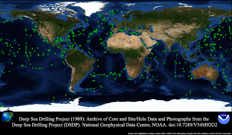
graphicOverview: (MD_BrowseGraphic)
fileName: https://www.ngdc.noaa.gov/mgg/image/g00993.png
fileDescription: DSDP drill sites
fileType: PNG
descriptiveKeywords: (MD_Keywords)
keyword: ODP/DSDP > Ocean Drilling Program/Deep Sea Drilling Program
keyword: ICSU-WDS > International Council for Science - World Data System
type: (MD_KeywordTypeCode) project
thesaurusName: (CI_Citation)
title: Global Change Master Directory (GCMD) Project Keywords
date: (CI_Date)
date: 2020-01-09
dateType: (CI_DateTypeCode) publication
edition: 9.1
citedResponsibleParty: (CI_ResponsibleParty)
organisationName: NASA Goddard Space Flight Center, Earth Science Data and Information System
contactInfo: (CI_Contact)
onlineResource: (CI_OnlineResource)
linkage: https://www.earthdata.nasa.gov/learn/find-data/idn/gcmd-keywords
name: Global Change Master Directory (GCMD) Keywords
description: The information provided on this page seeks to define how the GCMD Keywords are structured, used and accessed. It also provides information on how users can participate in the further development of the keywords.
function: (CI_OnLineFunctionCode) information
role: (CI_RoleCode) custodian
descriptiveKeywords: (MD_Keywords)
keyword: Deep Sea Drilling Project
keyword: DSDP
type: (MD_KeywordTypeCode) project
thesaurusName: (CI_Citation)
title: Uncontrolled vocabulary
date: (unknown)
descriptiveKeywords: (MD_Keywords)
keyword: Scientific archives
keyword: Electronic records
keyword: Oceanography
keyword: Ocean bottom
keyword: Geology
keyword: Submarine geology
keyword: Marine sediments
type: (MD_KeywordTypeCode) theme
thesaurusName: (CI_Citation)
title: Library of Congress Subject Headings
date: (unknown)
citedResponsibleParty: (CI_ResponsibleParty)
organisationName: US Library of Congress
contactInfo: (CI_Contact)
onlineResource: (CI_OnlineResource)
linkage: http://id.loc.gov/authorities/subjects
protocol: http
applicationProfile: web browser
name: Library of Congress Subject Headings (LCSH)
description: The Library of Congress Subject Headings (LCSH) are part of a Linked Data Service, actively maintained since 1898 to catalog materials held at the Library of Congress.
function: (CI_OnLineFunctionCode) information
role: (CI_RoleCode) resourceProvider
descriptiveKeywords: (MD_Keywords)
keyword: Marine geology
type: (MD_KeywordTypeCode) theme
thesaurusName: (CI_Citation)
title: SeaDataNet Common Vocabularies
date: (unknown)
citedResponsibleParty: (CI_ResponsibleParty)
organisationName: SeaDataNet
contactInfo: (CI_Contact)
onlineResource: (CI_OnlineResource)
linkage: http://www.seadatanet.org/Standards-Software/Common-Vocabularies
protocol: http
applicationProfile: web browser
name: SeaDataNet Common Vocabularies
description: The SeaDataNet Vocabulary Server is populated with lists describing a wide range of entities relevant to marine metadata and data such as parameters, sea area names, platform classes, instrument types, and so on.
function: (CI_OnLineFunctionCode) information
role: (CI_RoleCode) resourceProvider
descriptiveKeywords: (MD_Keywords)
keyword: Sea-floor characteristics
type: (MD_KeywordTypeCode) theme
thesaurusName: (CI_Citation)
title: USGS Science Topics
date: (unknown)
citedResponsibleParty: (CI_ResponsibleParty)
organisationName: US Geological Survey
contactInfo: (CI_Contact)
onlineResource: (CI_OnlineResource)
linkage: https://www2.usgs.gov/science/about/
protocol: http
applicationProfile: web browser
name: USGS Thesaurus
description: The USGS Thesaurus contains thematic terms for categorizing information resources intended to support finding and understanding scientific information.
function: (CI_OnLineFunctionCode) information
role: (CI_RoleCode) resourceProvider
descriptiveKeywords: (MD_Keywords)
keyword: Earth Science > OCEANS > Marine Geophysics > Marine Magnetics
keyword: Earth Science > OCEANS > Marine Sediments > Sedimentation
keyword: Earth Science > OCEANS > Marine Sediments > Sediment Composition
keyword: Earth Science > OCEANS > Marine Sediments > Stratigraphic Sequence
keyword: Earth Science > Paleoclimate > Ocean/Lake Records > Sediments
keyword: Earth Science > PALEOCLIMATE > Ocean/Lake Records > Stratigraphic Sequence
keyword: Earth Science > SOLID EARTH > Rocks/Minerals/Crystals > Age Determinations
keyword: Earth Science > SOLID EARTH > Rocks/Minerals/Crystals > Bedrock Lithology
keyword: Earth Science > SOLID EARTH > Rocks/Minerals/Crystals > Igneous Rocks
keyword: Earth Science > SOLID EARTH > Rocks/Minerals/Crystals > Metamorphic Rocks
keyword: Earth Science > SOLID EARTH > Rocks/Minerals/Crystals > Sedimentary Rocks
keyword: Earth Science > SOLID EARTH > Geomagnetism > Paleomagnetism
type: (MD_KeywordTypeCode) theme
thesaurusName: (CI_Citation)
title: Global Change Master Directory (GCMD) Science Keywords
date: (CI_Date)
date: 2020-01-09
dateType: (CI_DateTypeCode) publication
edition: 9.1
citedResponsibleParty: (CI_ResponsibleParty)
organisationName: NASA Goddard Space Flight Center, Earth Science Data and Information System
contactInfo: (CI_Contact)
onlineResource: (CI_OnlineResource)
linkage: https://www.earthdata.nasa.gov/learn/find-data/idn/gcmd-keywords
name: Global Change Master Directory (GCMD) Keywords
description: The information provided on this page seeks to define how the GCMD Keywords are structured, used and accessed. It also provides information on how users can participate in the further development of the keywords.
function: (CI_OnLineFunctionCode) information
role: (CI_RoleCode) custodian
descriptiveKeywords: (MD_Keywords)
keyword: In Situ Ocean-based Platforms > Ships
type: (MD_KeywordTypeCode) platform
thesaurusName: (CI_Citation)
title: Global Change Master Directory (GCMD) Platform Keywords
date: (CI_Date)
date: 2020-01-09
dateType: (CI_DateTypeCode) publication
edition: 9.1
citedResponsibleParty: (CI_ResponsibleParty)
organisationName: NASA Goddard Space Flight Center, Earth Science Data and Information System
contactInfo: (CI_Contact)
onlineResource: (CI_OnlineResource)
linkage: https://www.earthdata.nasa.gov/learn/find-data/idn/gcmd-keywords
name: Global Change Master Directory (GCMD) Keywords
description: The information provided on this page seeks to define how the GCMD Keywords are structured, used and accessed. It also provides information on how users can participate in the further development of the keywords.
function: (CI_OnLineFunctionCode) information
role: (CI_RoleCode) custodian
descriptiveKeywords: (MD_Keywords)
keyword: In Situ/Laboratory Instruments > Photon/Optical Detectors > Cameras
keyword: In Situ/Laboratory Instruments > Corers > Coring Devices
keyword: In Situ/Laboratory Instruments > Corers > ROCK CORERS
keyword: In Situ/Laboratory Instruments > Corers > Sediment Corers
type: (MD_KeywordTypeCode) instrument
thesaurusName: (CI_Citation)
title: Global Change Master Directory (GCMD) Instrument Keywords
date: (CI_Date)
date: 2020-01-09
dateType: (CI_DateTypeCode) publication
edition: 9.1
citedResponsibleParty: (CI_ResponsibleParty)
organisationName: NASA Goddard Space Flight Center, Earth Science Data and Information System
contactInfo: (CI_Contact)
onlineResource: (CI_OnlineResource)
linkage: https://www.earthdata.nasa.gov/learn/find-data/idn/gcmd-keywords
name: Global Change Master Directory (GCMD) Keywords
description: The information provided on this page seeks to define how the GCMD Keywords are structured, used and accessed. It also provides information on how users can participate in the further development of the keywords.
function: (CI_OnLineFunctionCode) information
role: (CI_RoleCode) custodian
descriptiveKeywords: (MD_Keywords)
keyword: DOC/NOAA/NESDIS/NCEI > National Centers for Environmental Information, NESDIS, NOAA, U.S. Department of Commerce
keyword: DOC/NOAA/NESDIS/NGDC > National Geophysical Data Center, NESDIS, NOAA, U.S. Department of Commerce
type: (MD_KeywordTypeCode) dataCenter
thesaurusName: (CI_Citation)
title: Global Change Master Directory (GCMD) Data Center Keywords
date: (CI_Date)
date: 2020-01-09
dateType: (CI_DateTypeCode) publication
edition: 9.1
citedResponsibleParty: (CI_ResponsibleParty)
organisationName: NASA Goddard Space Flight Center, Earth Science Data and Information System
contactInfo: (CI_Contact)
onlineResource: (CI_OnlineResource)
linkage: https://www.earthdata.nasa.gov/learn/find-data/idn/gcmd-keywords
name: Global Change Master Directory (GCMD) Keywords
description: The information provided on this page seeks to define how the GCMD Keywords are structured, used and accessed. It also provides information on how users can participate in the further development of the keywords.
function: (CI_OnLineFunctionCode) information
role: (CI_RoleCode) custodian
descriptiveKeywords: (MD_Keywords)
keyword: SOLID EARTH > CRUST
keyword: Geographic Region > Global Ocean
keyword: Vertical Location >Sea Floor
type: (MD_KeywordTypeCode) place
thesaurusName: (CI_Citation)
title: Global Change Master Directory (GCMD) Location Keywords
date: (CI_Date)
date: 2020-01-09
dateType: (CI_DateTypeCode) publication
edition: 9.1
citedResponsibleParty: (CI_ResponsibleParty)
organisationName: NASA Goddard Space Flight Center, Earth Science Data and Information System
contactInfo: (CI_Contact)
onlineResource: (CI_OnlineResource)
linkage: https://www.earthdata.nasa.gov/learn/find-data/idn/gcmd-keywords
name: Global Change Master Directory (GCMD) Keywords
description: The information provided on this page seeks to define how the GCMD Keywords are structured, used and accessed. It also provides information on how users can participate in the further development of the keywords.
function: (CI_OnLineFunctionCode) information
role: (CI_RoleCode) custodian
resourceConstraints: (MD_LegalConstraints)
accessConstraints: (MD_RestrictionCode) otherRestrictions
otherConstraints: Distribution liability: NOAA and NCEI make no warranty, expressed or implied, regarding these data, nor does the fact of distribution constitute such a warranty. NOAA and NCEI cannot assume liability for any damages caused by any errors or omissions in these data. If appropriate, NCEI can only certify that the data it distributes are an authentic copy of the records that were accepted for inclusion in the NCEI archives.
resourceConstraints: (MD_LegalConstraints)
useConstraints: (MD_RestrictionCode) otherRestrictions
otherConstraints: Use liability: NOAA and NCEI cannot provide any warranty as to the accuracy, reliability, or completeness of furnished data. Users assume responsibility to determine the usability of these data. The user is responsible for the results of any application of this data for other than its intended purpose.
resourceConstraints: (MD_LegalConstraints)
useLimitation: (MD_RestrictionCode) otherRestrictions
otherConstraints: Cite as: Deep Sea Drilling Project.1989: Archive of Core and Site/Hole Data and Photographs from the Deep Sea Drilling Project (DSDP). Third. NOAA National Centers for Environmental Information. https://doi.org/10.7289/V54M92G2. Accessed [date].
resourceConstraints: (MD_Constraints)
useLimitation: Produced by the NOAA National Centers for Environmental Information. Not subject to copyright protection within the United States.
resourceConstraints: (MD_LegalConstraints)
useConstraints: (MD_RestrictionCode) otherRestrictions
otherConstraints: While every effort has been made to ensure that these data are accurate and reliable within the limits of the current state of the art, NOAA cannot assume liability for any damages caused by any errors or omissions in the data, nor as a result of the failure of the data to function on a particular system. NOAA makes no warranty, expressed or implied, nor does the fact of distribution constitute such a warranty.
resourceConstraints: (MD_SecurityConstraints)
classification: (MD_ClassificationCode) unclassified
resourceConstraints: (MD_LegalConstraints)
accessConstraints: (MD_RestrictionCode) otherRestrictions
otherConstraints: Access to this dataset is unrestricted.
aggregationInfo: (MD_AggregateInformation)
aggregateDataSetName: (CI_Citation)
title: NCEI Marine Geology Data Archive
date: (CI_Date)
date: 1977-12-31
dateType: (CI_DateTypeCode)
citedResponsibleParty: (CI_ResponsibleParty)
organisationName: NOAA National Centers for Environmental Information
role: (CI_RoleCode) resourceProvider
citedResponsibleParty: (CI_ResponsibleParty)
organisationName: (inapplicable)
contactInfo: (CI_Contact)
onlineResource: (CI_OnlineResource)
linkage: https://data.noaa.gov/metaview/page?xml=NOAA/NESDIS/NGDC/Collection/iso/xml/Marine_Geology.xml&view=getDataView&header=none
protocol: WWW:LINK-1.0-http--link
applicationProfile: Web Browser
name: Parent Archive
description: Information about the Marine Geology Data Archive at NCEI.
function: (CI_OnLineFunctionCode) information
role: (inapplicable)
associationType: (DS_AssociationTypeCode) largerWorkCitation
initiativeType: (DS_InitiativeTypeCode) collection
aggregationInfo: (MD_AggregateInformation)
aggregateDataSetName: (CI_Citation)
title: Index to Marine and Lacustrine Geological Samples (IMLGS)
date: (CI_Date)
date: 1977-12-31
dateType: (CI_DateTypeCode) publication
identifier: (MD_Identifier)
code:
Anchor: DOI doi:10.7289/V5H41PB
citedResponsibleParty: (CI_ResponsibleParty)
organisationName: Curators of Marine and Lacustrine Geological Samples
role: (CI_RoleCode) author
citedResponsibleParty: (CI_ResponsibleParty)
organisationName: (inapplicable)
contactInfo: (CI_Contact)
onlineResource: (CI_OnlineResource)
linkage: https://dx.doi.org/10.7289/V5H41PB8
protocol: WWW:LINK-1.0-http--link
applicationProfile: Web Browser
name: Parent Database
description: The parent IMLGS database contains more/related data and information.
function: (CI_OnLineFunctionCode) information
role: (inapplicable)
associationType: (DS_AssociationTypeCode) largerWorkCitation
initiativeType: (DS_InitiativeTypeCode) project
aggregationInfo: (MD_AggregateInformation)
aggregateDataSetName: (CI_Citation)
title: A Hypercube of Deep Sea Drilling Project (DSDP) Marine Geological and Geophysical Data
date: (CI_Date)
date: 2000-12-31
dateType: (CI_DateTypeCode) publication
identifier: (MD_Identifier)
code:
Anchor: DOI doi:10.7289/V5057CV7
citedResponsibleParty: (CI_ResponsibleParty)
individualName: Jenkins, C.
role: (CI_RoleCode) author
citedResponsibleParty: (CI_ResponsibleParty)
organisationName: (inapplicable)
contactInfo: (CI_Contact)
onlineResource: (CI_OnlineResource)
linkage: https://doi.org/10.7289/V5057CV7
protocol: WWW:LINK-1.0-http--link
applicationProfile: Web Browser
name: doi:10.7289/V5057CV7
description: This data set contains related data and information.
function: (CI_OnLineFunctionCode) information
role: (inapplicable)
otherCitationDetails: Jenkins, C., Haxby, W., and W. Ryan (2000): A Hypercube of Deep Sea Drilling Project (DSDP) Marine Geological and Geophysical Data. NOAA National Centers for Environmental Information. doi:10.7289/V5057CV7
associationType: (DS_AssociationTypeCode) crossReference
initiativeType: (DS_InitiativeTypeCode) study
aggregationInfo: (MD_AggregateInformation)
aggregateDataSetName: (CI_Citation)
title: Archive of Core and Site/Hole Data and Photographs from the Ocean Drilling Program (ODP)
date: (CI_Date)
date: 2005-12-31
dateType: (CI_DateTypeCode) publication
identifier: (MD_Identifier)
code:
Anchor: DOI doi:10.7289/V5W37T8C
citedResponsibleParty: (CI_ResponsibleParty)
organisationName: Ocean Drilling Program
role: (CI_RoleCode) author
citedResponsibleParty: (CI_ResponsibleParty)
organisationName: (inapplicable)
contactInfo: (CI_Contact)
onlineResource: (CI_OnlineResource)
linkage: https://doi.org/10.7289/V5W37T8C
protocol: WWW:LINK-1.0-http--link
applicationProfile: Web Browser
name: doi:10.7289/V5W37T8C
description: This data set contains related data and information.
function: (CI_OnLineFunctionCode) information
role: (inapplicable)
otherCitationDetails: Ocean Drilling Program (2005): Archive of Core and Site/Hole Data and Photographs from the Ocean Drilling Program (ODP). NOAA National Centers for Environmental Information. doi:10.7289/V5W37T8C
associationType: (DS_AssociationTypeCode) crossReference
initiativeType: (DS_InitiativeTypeCode) project
aggregationInfo: (MD_AggregateInformation)
aggregateDataSetName: (CI_Citation)
title: Archive of Core and Site/Hole Data and Photographs from the Integrated Ocean Drilling Program (IODP)
date: (CI_Date)
date: 2010-12-31
dateType: (CI_DateTypeCode) publication
identifier: (MD_Identifier)
code:
Anchor: DOI doi:10.7289/V58913SM
citedResponsibleParty: (CI_ResponsibleParty)
organisationName: Integrated Ocean Drilling Program
role: (CI_RoleCode) author
citedResponsibleParty: (CI_ResponsibleParty)
organisationName: NOAA National Centers for Environmental Information
role: (CI_RoleCode) resourceProvider
citedResponsibleParty: (CI_ResponsibleParty)
organisationName: (inapplicable)
contactInfo: (CI_Contact)
onlineResource: (CI_OnlineResource)
linkage: https://doi.org/10.7289/V58913SM
protocol: WWW:LINK-1.0-http--link
applicationProfile: Web Browser
name: doi:10.7289/V58913SM
description: This data set contains related data and information.
function: (CI_OnLineFunctionCode) information
role: (inapplicable)
otherCitationDetails: Integrated Ocean Drilling Program (2010): Archive of Core and Site/Hole Data and Photographs from the Integrated Ocean Drilling Program (IODP). NOAA National Centers for Environmental Information. doi:10.7289/V58913SM
associationType: (DS_AssociationTypeCode) crossReference
initiativeType: (DS_InitiativeTypeCode) project
aggregationInfo: (MD_AggregateInformation)
aggregateDataSetName: (CI_Citation)
title: Archive of Geosample Information from Scientific Ocean Drilling
date: (CI_Date)
date: 1977-12-31
dateType: (CI_DateTypeCode) publication
identifier: (MD_Identifier)
code:
Anchor: contact doi:10.7289/V57M05XN
citedResponsibleParty: (CI_ResponsibleParty)
organisationName: International Ocean Discovery Program (IODP)
role: (CI_RoleCode) author
citedResponsibleParty: (CI_ResponsibleParty)
organisationName: (inapplicable)
contactInfo: (CI_Contact)
onlineResource: (CI_OnlineResource)
linkage: https://doi.org/10.7289/V57M05XN
protocol: WWW:LINK-1.0-http--link
applicationProfile: Web Browser
name: International Ocean Discovery Program (IODP)
description: Sample information from all phases of scientific ocean drilling, DSDP, ODP, and IODP.
function: (CI_OnLineFunctionCode) information
role: (inapplicable)
otherCitationDetails: International Ocean Discovery Program (IODP)(2015): Archive of geosample information from scientific ocean drilling. NOAA National Centers for Environmental Information. doi:10.7289/V57M05XN
associationType: (DS_AssociationTypeCode) crossReference
initiativeType: (DS_InitiativeTypeCode) collection
aggregationInfo: (MD_AggregateInformation)
aggregateDataSetName: (CI_Citation)
title: NOAA/NCEI Marine Geology WAF
date: (CI_Date)
date: 2015-10-05
dateType: (CI_DateTypeCode)
citedResponsibleParty: (CI_ResponsibleParty)
organisationName: NOAA National Centers for Environmental Information
role: (CI_RoleCode) author
citedResponsibleParty: (CI_ResponsibleParty)
organisationName: (inapplicable)
contactInfo: (CI_Contact)
onlineResource: (CI_OnlineResource)
linkage: https://data.noaa.gov/waf/NOAA/NESDIS/NGDC/MGG/Geology/iso/
protocol: WWW:LINK-1.0-http--link
applicationProfile: Web Browser
name: Marine geology metadata records.
function: (CI_OnLineFunctionCode) search
role: (inapplicable)
associationType: (DS_AssociationTypeCode) crossReference
initiativeType: (DS_InitiativeTypeCode) collection
spatialRepresentationType: (MD_SpatialRepresentationTypeCode) vector
spatialResolution: (missing) (MD_Resolution)
levelOfDetail: Vertical resolution is 1 meter and horizontal resolution is .001 degree.
language:
LanguageCode: eng; USA
characterSet: (MD_CharacterSetCode) UTF8
topicCategory: (MD_TopicCategoryCode) geoscientificInformation
topicCategory: (MD_TopicCategoryCode) oceans
environmentDescription: Native Dataset Environment: ASCII text
extent: (EX_Extent)
description: Global sea floor - sparse locations
geographicElement: (EX_GeographicBoundingBox)
westBoundLongitude: -178.5
eastBoundLongitude: 179.7380
southBoundLatitude: -77.4420
northBoundLatitude: 76.15000
temporalElement: (EX_TemporalExtent)
extent:
TimePeriod:
description: Publication Date
beginPosition: 1968-01-01
endPosition: 2000-12-31
verticalElement: (EX_VerticalExtent)
minimumValue:
Real: -10000
maximumValue:
Real: 0
verticalCRS: (missing)
supplementalInformation: The original, 1989 DSDP CDROM set included two discs and access software developed by NGDC for DOS and Macintosh platforms. Disc I contained sediment and hard rock descriptive and analytical data, documentation files, and several summary and reference files. Disc II contained downhole logging in the Schlumberger LIS format, and underway geophysical data (bathymetry, magnetics, and navigation) in the MGD77 format - the borehole and geophysical data are not included in the current metadata record/data set. Not all data types are included for all legs. Data files on the discs include the following: Age profile, carbon-carbonate, core depth recovery, density-porosity, gamma ray attenuation porosity evaluator (GRAPE), hard rock major and minor element geochemistry, thin section and visual descriptions of hard rock samples, interstitial water chemistry paleomagnetism of sediment and hard rock samples, paleonotology (including 22 fossil groups), smear slide descriptions, sonic velocity, vane shear, visual core descriptions, and x-ray mineralogy. Core images were scanned from paper photographs/negatives by staff of the Ocean Drilling Program. Additional images of laboratory forms, were scanned from microfilm under an NGDC CDMP project. All images are available offline only due to volume. Note: on Feb 22, 2006 latitude/longitude information was updated for LEG 001 Hole 2 to correct an error that was present since the files were first transferred to NGDC. ODP personnel certified the correction.
return to top
contentInfo: (MD_CoverageDescription)
attributeDescription:
RecordType: The Latitude and Longitude (point) from which a sample of sediment or rock was collected from the sea floor or a lakebed.
contentType: (MD_CoverageContentTypeCode) point
dimension: (MD_Band)
sequenceIdentifier:
MemberName:
aName: Latitude
attributeType: (unknown)
descriptor: Distance measured north or south from the equator. Distance north is positive, distance south is negative.
maxValue:
Real: 90.00000
minValue:
Real: -90.00000
units:
UnitDefinition:
identifier: decimal degrees
name: decimal degrees
dimension: (MD_Band)
sequenceIdentifier:
MemberName:
aName: Longitude
attributeType: (unknown)
descriptor: Longitude is measured from the Prime Meridian (which is the north/south line that runs through Greenwich, England), values measured east are positive and values measured west are negative.
maxValue:
Real: 180.00000
minValue:
Real: -180.00000
units:
UnitDefinition:
identifier: decimal degrees
name: decimal degrees
return to top
contentInfo: (MD_FeatureCatalogueDescription)
complianceCode: false
includedWithDataset: true
featureTypes:
LocalName:
featureCatalogueCitation: (CI_Citation)
title: Documentation for the Core Data from the Deep Sea Drilling Project Legs 1-96 dataset.
date: (CI_Date)
date: 1984-01-01
dateType: (CI_DateTypeCode) creation
otherCitationDetails: Entities and attributes are completely described in a text file accompanying the dataset on download.
return to top
distributionInfo: (MD_Distribution)
distributor: (MD_Distributor)
distributorContact: (CI_ResponsibleParty)
organisationName: NOAA National Centers for Environmental Information
contactInfo: (CI_Contact)
address: (CI_Address)
electronicMailAddress: ncei.info@noaa.gov
onlineResource: (CI_OnlineResource)
linkage: https://www.ncei.noaa.gov/contact
name: NCEI Contact Information
description: Information for contacts at NCEI.
function: (CI_OnLineFunctionCode) information
role: (CI_RoleCode) distributor
distributionOrderProcess: (MD_StandardOrderProcess)
fees: In most cases, electronic downloads of the data are free. However, fees may apply for custom orders, data certifications, copies of analog materials, and data distribution on physical media.
orderingInstructions: Contact NCEI for other distribution options and instructions.
distributorFormat: (MD_Format)
name: ASCII
version: (unknown)
distributorFormat: (MD_Format)
name: TIFF
version: (unknown)
distributorFormat: (MD_Format)
name: JPEG
version: (unknown)
distributorTransferOptions: (MD_DigitalTransferOptions)
onLine: (CI_OnlineResource)
linkage: https://doi.org/10.7289/V54M92G2
protocol: WWW:LINK-1.0-http--link
applicationProfile: Web Browser
name: Metadata Landing Page
description: How to cite this data set (doi:10.7289/V54M92G2), all access options, and complete documentation.
function: (CI_OnLineFunctionCode) information
distributorTransferOptions: (MD_DigitalTransferOptions)
onLine: (CI_OnlineResource)
linkage: https://www.ngdc.noaa.gov/mgg/geology/dsdp/
protocol: WWW:LINK-1.0-http--link
applicationProfile: Web Browser
name: Data files and documentation
description: Web version of data and documentation from the original 1989 CD-ROM (modified in 2000 for web access) containing ASCII text versions of all prime data files from the DSDP. Data file access by leg, site/hole, data type, and geographic area.
function: (CI_OnLineFunctionCode) download
distributorTransferOptions: (MD_DigitalTransferOptions)
onLine: (CI_OnlineResource)
linkage: https://www.ngdc.noaa.gov/geosamples/index.jsp?inst=DSDP
protocol: WWW:LINK-1.0-http--link
applicationProfile: Web Browser
name: Web forms interface
description: Text interface to search and download data and access related links through the Index to Marine and Lacustrine Geological Samples (IMLGS). Descriptive data in this system were produced by the staff of the DSDP from the SCREEN and smearslide data files.
function: (CI_OnLineFunctionCode) search
distributorTransferOptions: (MD_DigitalTransferOptions)
onLine: (CI_OnlineResource)
linkage: https://maps.ngdc.noaa.gov/viewers/sample_index/index.html?institution=DSDP
protocol: WWW:LINK-1.0-http--link
applicationProfile: Web Browser
name: Map viewer
description: ArcGIS interactive map interface to search and download data and access related links through the Index to Marine and Lacustrine Geological Samples (IMLGS).
function: (CI_OnLineFunctionCode) search
distributorTransferOptions: (MD_DigitalTransferOptions)
onLine: (CI_OnlineResource)
linkage: https://www.ngdc.noaa.gov/mgg/geology/drill.html
protocol: WWW:LINK-1.0-http--link
applicationProfile: Web Browser
name: Archive Web page
description: Web page of information about the database
function: (CI_OnLineFunctionCode) information
distributorTransferOptions: (MD_DigitalTransferOptions)
onLine: (CI_OnlineResource)
linkage: http://www.iodp.org
protocol: WWW:LINK-1.0-http--link
applicationProfile: Web Browser
name: Originator's Web page
description: Access data and information from the IODP website
function: (CI_OnLineFunctionCode) information
distributorTransferOptions: (MD_DigitalTransferOptions)
onLine: (CI_OnlineResource)
linkage: https://doi.org/10.2973/odp.tn.9.1988
protocol: WWW:LINK-1.0-http--link
applicationProfile: Web Browser
name: Originator's documentation
description: Ocean Drilling Program (1988): Deep Sea Drilling Project documentation files. Ocean Drilling Program Technical Note 9. doi:10.2973/odp.tn.9.1988. PDF document containing an image of the original documentation files for the DSDP prime data types.
function: (CI_OnLineFunctionCode) information
return to top
dataQualityInfo: (DQ_DataQuality)
scope: (DQ_Scope)
level: (MD_ScopeCode) dataset
extent: #boundingExtent
levelDescription: (MD_ScopeDescription)
dataset: gov.noaa.ngdc.mgg.geology:G00993
report: (DQ_AbsoluteExternalPositionalAccuracy)
nameOfMeasure: Horizontal Positional Accuracy
measureDescription: (unknown)
evaluationMethodDescription: The horizontal accuracy of data values is approximately .001 degree of latitude/longitude.
result: (unknown)
report: (DQ_QuantitativeAttributeAccuracy)
nameOfMeasure: Reliability
measureDescription: NGDC performed extensive quality control on the prime data in coordination with the DSDP office at the Scripps Institution of Oceanography and multiple principal investigators. Details are included in documentation that accompanyies the CD-ROM and online interface.
evaluationMethodDescription: Quality control was performed by the originator. NGDC performed basic out-of-range location testing.
result: (unknown)
lineage: (LI_Lineage)
statement: Prior to transmission to NGDC, the core data were maintained in a pre-relational database management system written in Algol on a Burroughs computer. Data were written off to 9-track magnetic tape for transfer to both NGDC and the successor Ocean Drilling Program (ODP) at Texas A and M University. The Burroughs computer was then decommissioned and no further work was possible to change or correct the data that came from it. Peter Woodbury did do some post-database correction on the SCREEN database. Digital images were scanned by staff of the Ocean Drilling Program (ODP) at Texas A and M University, from core photographs taken by DSDP staff, and some later photographs taken by ODP staff.
processStep: (LI_ProcessStep)
description: Received data from originator
dateTime:
DateTime: 1987-12-31T00:00:00
source: (LI_Source)
description: Peter Woodbury Deep Sea Drilling Project
return to top
dataQualityInfo: (DQ_DataQuality)
scope: (DQ_Scope)
level: (MD_ScopeCode) repository
levelDescription: (MD_ScopeDescription)
other: NOAA National Centers for Environmental Information
lineage: (LI_Lineage)
processStep: (LE_ProcessStep)
description: NOAA created the National Centers for Environmental Information (NCEI) by merging NOAA's National Climatic Data Center (NCDC), National Geophysical Data Center (NGDC), and National Oceanographic Data Center (NODC), including the National Coastal Data Development Center (NCDDC), per the Consolidated and Further Continuing Appropriations Act, 2015, Public Law 113-235. NCEI launched publicly on April 22, 2015.
dateTime:
DateTime: 2015-04-22T00:00:00
return to top
metadataMaintenance: (MD_MaintenanceInformation)
maintenanceAndUpdateFrequency: (MD_MaintenanceFrequencyCode) asNeeded
maintenanceNote: Modified for compliance to NCEI Template v1.2.
return to top
acquisitionInformation: (MI_AcquisitionInformation)
instrument: (MI_Instrument)
identifier: (MD_Identifier)
code: In Situ/Laboratory Instruments
type: instrument
description: Instrument Type: Sea floor and lakebed geologic sampling (coring, drilling, dredging, trawling, and/or grab sampling devices) and/or in situ measurements (cameras, visual observations, and/or recorders/loggers)
platform: (MI_Platform)
identifier: (RS_Identifier)
code: Glomar Challenger
description: (unknown)
instrument: (MI_Instrument)
identifier: (MD_Identifier)
code: In Situ/Laboratory Instruments
type: instrument
description: Instrument Type: Sea floor and lakebed geologic sampling (coring, drilling, dredging, trawling, and/or grab sampling devices) and/or in situ measurements (cameras, visual observations, and/or recorders/loggers)