Bottom Sediment Granulometric Data for the Continental Margins of the Bering, Chukchi, East Siberia, Laptev, and Beaufort Seas
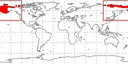 sample locations in study area
These data are part of Roberts, Richard W., University of Washington, Department of Oceanography Special Report No. 70, Bottom Sediment Granulometric Data for the Continental Margins of the Bering, Chukchi, East Siberian, Laptev, and Beaufort Seas. Data in the report represent granulometric analyses conducted by UW of over 4,300 sediment samples from approximately 1,500 stations collected during cruises of the Brown Bear, Thomas G. Thompson, Northwind, Staten Island, Burton Island, Surveyor, John N. Cobb, and Drifting Ice Station Alpha II. The full report accompanying the tabular data is available in .pdf form online (27.4 Mbytes).Data include collecting institution, ship, cruise, sample id, latitude/longitude, date of collection, water depth, sampling device, method of analysis, sample weight, sampled interval, raw weight percentages of sediment, within a given phi range. Some samples also have percentages of total gravel, sand, silt, clay, and statistical measurements such as mean, median, skewness, kurtosis, and standard deviation of grain size. These data are also included in the NGDC Seafloor Sediment Grain Size Database (doi:10.7289/V5G44N6W).
Dataset Citation
- Cite as: Richard W. Roberts. 1976: Bottom Sediment Granulometric Data for the Continental Margins of the Bering, Chukchi, East Siberia, Laptev, and Beaufort Seas. First. NOAA National Centers for Environmental Information. Accessed [date].
Dataset Identifiers
- ID not available.
ISO 19115-2 Metadata
gov.noaa.ngdc.mgg.geology:G02893
| Download Data |
|
| Distribution Formats |
|
| Ordering Instructions | Contact NCEI for other distribution options and instructions. |
| Distributor |
NOAA National Centers for Environmental Information ncei.info@noaa.gov |
| Dataset Point of Contact |
NOAA National Centers for Environmental Information ncei.info@noaa.gov |
| Dataset Point of Contact | Marine Geology Data Manager NOAA National Centers for Environmental Information geology.info@noaa.gov |
| Coverage Description | Bering Sea, Chukchi Sea, East Siberian Sea, Laptev Sea, Beaufort Sea |
| Time Period | 1959-06-29 to 1970-09-14 |
| Spatial Reference System | urn:ogc:def:crs:EPSG:4326 |
| Spatial Bounding Box Coordinates |
West: -180
East: 180
South: 54.75
North: 78.16
|
| Spatial Coverage Map |
| General Documentation |
|
| Associated Resources |
|
| Publication Dates |
|
| Edition | First |
| Data Presentation Form | Digital table - digital representation of facts or figures systematically displayed, especially in columns |
| Dataset Progress Status | Complete - production of the data has been completed Historical archive - data has been stored in an offline storage facility |
| Data Update Frequency | Not planned - Completed data set, no additions planned. |
| Supplemental Information | Data consist of 4,320 analyses of 1,499 cores/grabs most of which correspond to samples previously in the University of Washington sample repository which were transferred to Oregon State University. An accompanying data report is available in PDF and microfiche form. A formatted data listing is also available on microfilm reel 1396. |
| Purpose | environmental research |
| Use Limitations |
|
| Dataset Citation |
|
| Cited Authors |
|
| Publishers |
|
| Acknowledgments |
|
| Theme keywords |
Library of Congress Subject Headings
|
| Data Center keywords |
Global Change Master Directory (GCMD) Data Center Keywords
|
| Platform keywords |
Global Change Master Directory (GCMD) Platform Keywords
|
| Instrument keywords |
Global Change Master Directory (GCMD) Instrument Keywords
|
| Place keywords |
Global Change Master Directory (GCMD) Location Keywords
|
| Project keywords |
Global Change Master Directory (GCMD) Project Keywords
|
| Use Constraints |
|
| Access Constraints |
|
| Other Constraints | Cite as: Richard W. Roberts. 1976: Bottom Sediment Granulometric Data for the Continental Margins of the Bering, Chukchi, East Siberia, Laptev, and Beaufort Seas. First. NOAA National Centers for Environmental Information. Accessed [date]. |
| Fees |
|
| Lineage information for: dataset | |
|---|---|
| Lineage Statement | Data were received as ASCII, nine track magnetic tape, 19,400 total original 80 character records in 24 files, 4000 character blocksize. in originator's format and translated to the 073 fixed-field format for upload to the NGDC Seafloor Sediment Grain Size Database (doi:10.7289/V5G44N6W). |
| Processing Environment | Native Dataset Environment: ASCII text |
| Source Datasets | |
| Lineage information for: repository | |
|---|---|
| Processing Steps |
|
| Acquisition Information (collection) | |
|---|---|
| Instrument |
|
| Platform | |
Last Modified: 2020-04-21
For questions about the information on this page, please email: ncei.info@noaa.gov
For questions about the information on this page, please email: ncei.info@noaa.gov