Oceanographic data including conductivity, temperature, depth, dissolved oxygen, fluorescence, and turbidity, collected during towed-diver surveys from 2015-11-03 to 2015-11-18 in the Main Hawaiian Islands to assess damage from the 2015 mass coral bleaching event (NCEI Accession 0189254)
 Preview graphic
The oceanographic data included in this dataset were collected by the NOAA Pacific Islands Fisheries Science Center (PIFSC), Ecosystem Sciences Division (ESD; formerly the Coral Reef Ecosystem Division) from November 3-18, 2015 with funding from the NOAA Coral Reef Conservation Program. The purpose of the two-week research cruise was to evaluate the impacts of the 2015 mass coral bleaching event in the Main Hawaiian Islands. A modified version of ESD's towed-diver method was used to conduct surveys around south Oahu, west Maui, Lanai, and west Hawaii island. The modified towed-diver method involved towing a pair of SCUBA divers behind a small boat for 50 minutes and covering a linear distance of ~2 kilometers per survey. Each diver was equipped with a towboard and attempted to maintain position ~1 meter above the surface of the reef for the duration of the survey. The oceanographic data was collected with a Seabird Electronics 19P CTD mounted to one of the towboards with two auxiliary sensors connected to it, including a Seabird Electronics SBE43 oxygen sensor and a Wet labs FLNTURTD fluorometer and scattering meter. The data were collected continuously throughout each survey and included conductivity, temperature, depth, dissolved oxygen, fluorescence, and turbidity. A complete towed-diver survey includes ten 5-minute segments, with oceanographic data averaged by 5-minute segment to correspond with the visual observations recorded by the benthic diver. At the conclusion of the mission, approximately 90 kilometers of 15-m wide transects at depths ranging from ~1 m to ~13 m were surveyed.
- Cite as: Ecosystem Sciences Division, Pacific Islands Fisheries Science Center (2019). Oceanographic data including conductivity, temperature, depth, dissolved oxygen, fluorescence, and turbidity, collected during towed-diver surveys from 2015-11-03 to 2015-11-18 in the Main Hawaiian Islands to assess damage from the 2015 mass coral bleaching event (NCEI Accession 0189254). [indicate subset used]. NOAA National Centers for Environmental Information. Dataset. https://www.ncei.noaa.gov/archive/accession/0189254. Accessed [date].
| Time Period |
2015-11-03 to 2015-11-18 |
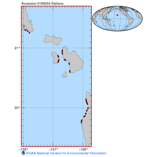
| Spatial Bounding Box Coordinates |
West: -157.947
East: -155.829
South: 19.7485
North: 21.3028
|
| Spatial Coverage Map |
|
| General Documentation |
|
| Associated Resources |
- Pacific Islands Fisheries Science Center, 2019: Oceanographic data, including conductivity, temperature, depth, dissolved oxygen, fluorescence, and turbidity, collected during towed-diver surveys conducted from November 3-18, 2015 in the Main Hawaiian Islands to assess damage from the 2015 mass coral bleaching event, https://www.fisheries.noaa.gov/inport/item/32586.
|
| Publication Dates |
|
| Data Presentation Form |
Digital table - digital representation of facts or figures systematically displayed, especially in columns
|
| Dataset Progress Status |
Complete - production of the data has been completed
Historical archive - data has been stored in an offline storage facility |
| Data Update Frequency |
As needed |
| Purpose |
The 2014–2015 global coral bleaching event brought widespread and severe impacts to the entire Hawaiian archipelago. In 2015, the corals of the Main Hawaiian Islands were subjected to unprecedented levels of thermal stress that resulted in the most severe coral bleaching ever recorded in the islands. To document the event, local researchers and reef managers conducted free-swimming diver surveys in areas generally accessible via same-day field excursions. In an effort to survey larger high coral cover areas that are not as accessible, the Ecosystem Sciences Division at the Pacific Islands Fisheries Science Center led a two-week research cruise in November 2015 aboard the NOAA Ship Hi‘ialaka‘i to evaluate the impacts of the 2015 coral bleaching event in the Main Hawaiian Islands. |
| Use Limitations |
- Distribution liability: NOAA and NCEI make no warranty, expressed or implied, regarding these data, nor does the fact of distribution constitute such a warranty. NOAA and NCEI cannot assume liability for any damages caused by any errors or omissions in these data. If appropriate, NCEI can only certify that the data it distributes are an authentic copy of the records that were accepted for inclusion in the NCEI archives.
|
| Dataset Citation |
- Cite as: Ecosystem Sciences Division, Pacific Islands Fisheries Science Center (2019). Oceanographic data including conductivity, temperature, depth, dissolved oxygen, fluorescence, and turbidity, collected during towed-diver surveys from 2015-11-03 to 2015-11-18 in the Main Hawaiian Islands to assess damage from the 2015 mass coral bleaching event (NCEI Accession 0189254). [indicate subset used]. NOAA National Centers for Environmental Information. Dataset. https://www.ncei.noaa.gov/archive/accession/0189254. Accessed [date].
|
| Cited Authors |
|
| Principal Investigators |
|
| Collaborators |
|
| Contributors |
|
| Resource Providers |
|
| Publishers |
|
| Acknowledgments |
- Funding Agency: NOAA Coral Reef Conservation Program
|
| Theme keywords |
NODC DATA TYPES THESAURUS
NODC OBSERVATION TYPES THESAURUS
WMO_CategoryCode
CoRIS Discovery Thesaurus- Numeric Data Sets > Oceanography
CoRIS Theme Thesaurus
- EARTH SCIENCE > Oceans > Coastal Processes > Coral Reefs
- EARTH SCIENCE > Oceans > Coastal Processes > Coral Reefs > Coral Reef Ecology > Habitats
- EARTH SCIENCE > Oceans > Ocean Chemistry > Oxygen
- EARTH SCIENCE > Oceans > Ocean Optics > Fluorescence
- EARTH SCIENCE > Oceans > Ocean Pressure > Sea Level Pressure
- EARTH SCIENCE > Oceans > Ocean Temperature > Water Temperature
- EARTH SCIENCE > Oceans > Salinity/Density > Conductivity
- EARTH SCIENCE > Oceans > Salinity/Density > Salinity
Global Change Master Directory (GCMD) Science Keywords
|
| Data Center keywords |
NODC COLLECTING INSTITUTION NAMES THESAURUS
NODC SUBMITTING INSTITUTION NAMES THESAURUS
Contributing Organizations
- CRED
- CREP
- Coral Reef Ecosystem Division
- Coral Reef Ecosystem Program
- PIFSC
- Pacific Islands Fisheries Science Center
Global Change Master Directory (GCMD) Data Center Keywords
|
| Platform keywords |
NODC PLATFORM NAMES THESAURUS
Global Change Master Directory (GCMD) Platform Keywords
ICES/SeaDataNet Ship Codes
|
| Instrument keywords |
NODC INSTRUMENT TYPES THESAURUS
Global Change Master Directory (GCMD) Instrument Keywords
|
| Place keywords |
NODC SEA AREA NAMES THESAURUS
CoRIS Place Thesaurus
- COUNTRY/TERRITORY > United States of America > Hawaii > Hawaii > Hawaii Island (19N155W0003)
- COUNTRY/TERRITORY > United States of America > Hawaii > Honolulu > Oahu (21N157W0003)
- COUNTRY/TERRITORY > United States of America > Hawaii > Maui > Lanai Island (20N156W0002)
- COUNTRY/TERRITORY > United States of America > Hawaii > Maui > Maui Island (20N156W0004)
- COUNTRY/TERRITORY > United States of America > Hawaiian Islands (21N157W0027)
- OCEAN BASIN > Pacific Ocean > Central Pacific Ocean > Hawaiian Islands (21N157W0027)
- OCEAN BASIN > Pacific Ocean > Central Pacific Ocean > Hawaiian Islands > Hawaii Island > Hawaii Island (19N155W0003)
- OCEAN BASIN > Pacific Ocean > Central Pacific Ocean > Hawaiian Islands > Lanai Island > Lanai Island (20N156W0002)
- OCEAN BASIN > Pacific Ocean > Central Pacific Ocean > Hawaiian Islands > Maui Island > Maui Island (20N156W0004)
- OCEAN BASIN > Pacific Ocean > Central Pacific Ocean > Hawaiian Islands > Oahu Island > Oahu (21N157W0003)
Global Change Master Directory (GCMD) Location Keywords
|
| Project keywords |
NODC PROJECT NAMES THESAURUS
CRCP Project
- 31075
- Observing and Documenting Predicted 2015/2016 Mass Coral Bleaching Events in Hawaii
|
| Keywords |
NCEI ACCESSION NUMBER
|
| Keywords |
Send2NCEI Submission Package ID
|
| Use Constraints |
- Cite as: Ecosystem Sciences Division, Pacific Islands Fisheries Science Center (2019). Oceanographic data including conductivity, temperature, depth, dissolved oxygen, fluorescence, and turbidity, collected during towed-diver surveys from 2015-11-03 to 2015-11-18 in the Main Hawaiian Islands to assess damage from the 2015 mass coral bleaching event (NCEI Accession 0189254). [indicate subset used]. NOAA National Centers for Environmental Information. Dataset. https://www.ncei.noaa.gov/archive/accession/0189254. Accessed [date].
|
| Access Constraints |
- Use liability: NOAA and NCEI cannot provide any warranty as to the accuracy, reliability, or completeness of furnished data. Users assume responsibility to determine the usability of these data. The user is responsible for the results of any application of this data for other than its intended purpose.
|
| Fees |
- In most cases, electronic downloads of the data are free. However, fees may apply for custom orders, data certifications, copies of analog materials, and data distribution on physical media.
|
| Lineage information for: dataset |
|---|
| Processing Steps |
- 2019-06-06T21:11:19Z - NCEI Accession 0189254 v1.1 was published.
|
| Output Datasets |
- NCEI Accession 0189254 v1.1
|
| Lineage information for: dataset |
|---|
| Processing Steps |
- Parameter or Variable: CONDUCTIVITY (measured); Units: siemens; Observation Category: in situ; Sampling Instrument: CTD; Sampling and Analyzing Method: A Seabird Electronics 19P CTD was mounted to one of the towboards and collected data continuously for the duration of the survey. Measurements were averaged by each 5-min segment of the tow survey..
- Parameter or Variable: WATER TEMPERATURE (measured); Units: degrees Celsius; Observation Category: in situ; Sampling Instrument: CTD; Sampling and Analyzing Method: A Seabird Electronics 19P CTD was mounted to one of the towboards and collected data continuously for the duration of the survey. Measurements were averaged by each 5-min segment of the tow survey..
- Parameter or Variable: PRESSURE - WATER [HYDROSTATIC PRESSURE] (measured); Units: decibar; Observation Category: in situ; Sampling Instrument: CTD; Sampling and Analyzing Method: A Seabird Electronics 19P CTD was mounted to one of the towboards and collected data continuously for the duration of the survey. Measurements were averaged by each 5-min segment of the tow survey..
- Parameter or Variable: DEPTH - SENSOR (calculated); Units: meter; Observation Category: in situ; Sampling Instrument: CTD; Sampling and Analyzing Method: A Seabird Electronics 19P CTD was mounted to one of the towboards and collected data continuously for the duration of the survey. Measurements were averaged by each 5-min segment of the tow survey. Depth is calculated from pressure..
- Parameter or Variable: SALINITY (calculated); Units: practical salinity unit; Observation Category: in situ; Sampling Instrument: CTD; Sampling and Analyzing Method: A Seabird Electronics 19P CTD was mounted to one of the towboards and collected data continuously for the duration of the survey. Measurements were averaged by each 5-min segment of the tow survey. Salinity is calculated from temperature and conductivity..
- Parameter or Variable: OXYGEN - PERCENT SATURATION (measured); Units: percent; Observation Category: in situ; Sampling Instrument: oxygen meter; Sampling and Analyzing Method: A Seabird Electronics SBE43 oxygen sensor was connected to a Seabird Electronics 19P CTD that was mounted to one of the towboards and collected data continuously for the duration of the survey. Measurements were averaged by each 5-min segment of the tow survey..
- Parameter or Variable: DISSOLVED OXYGEN (measured); Units: mg/L; Observation Category: in situ; Sampling Instrument: oxygen meter; Sampling and Analyzing Method: A Seabird Electronics SBE43 oxygen sensor was connected to a Seabird Electronics 19P CTD that was mounted to one of the towboards and collected data continuously for the duration of the survey. Measurements were averaged by each 5-min segment of the tow survey..
- Parameter or Variable: FLUORESCENCE (measured); Units: unitless; Observation Category: in situ; Sampling Instrument: fluorometer; Sampling and Analyzing Method: A Wet labs FLNTURTD fluorometer and scattering meter was connected to a Seabird Electronics 19P CTD that was mounted to one of the towboards and collected data continuously for the duration of the survey. Measurements were averaged by each 5-min segment of the tow survey..
- Parameter or Variable: turbidity (measured); Units: NTU; Observation Category: in situ; Sampling Instrument: nephelometer; Sampling and Analyzing Method: A Wet labs FLNTURTD fluorometer and scattering meter was connected to a Seabird Electronics 19P CTD that was mounted to one of the towboards and collected data continuously for the duration of the survey. The FLNTURTD combines the ECO standard fluorometer with an optional scattering measurement for simultaneous determination of turbidity. Measurements were averaged by each 5-min segment of the tow survey..
|
| Acquisition Information (collection) |
|---|
| Instrument |
- CTD
- fluorometer
- nephelometer
- oxygen sensor
|
| Platform |
|
Last Modified: 2024-09-17T19:15:11Z
For questions about the information on this page, please email:
ncei.info@noaa.gov