Oceanographic and surface water meteorological parameter data collected from moored Realtime Coastal Observation Network (ReCON) Saginaw Bay Buoy (NDBC station 45163), Lake Huron, in the Great Lakes region by NOAA Great Lakes Environmental Research Laboratory from 2010-06-17 to 2019-10-24 (NCEI Accession 0213627)
 Preview graphic
NOAA Great Lakes Environmental Research Laboratory collected the data from moored Realtime Coastal Observation Network (ReCON) Saginaw Bay Buoy (NDBC station 45163), Lake Huron, an in-situ moored station, in the Great Lakes. Observations were collected during the open water seasons of 2010-2019. This station is also known as NOAA National Data Buoy Center (NDBC) station Saginaw Bay Buoy, MI (45163). A temporal subset of these data are available from NDBC and the Great Lakes Observing System (GLOS) since 2012, this data accession contains the complete record of observations.
The ReCON buoy provides continuous, real-time observations, facilitates modification of sampling parameters in anticipation of episodic events, facilitates collection of field samples in response to episodic events, supports long term research, and contributes to sensor and system development. Parameters collected include currents, water temperature, other oceanographic parameters, and meteorological parameters. The block of text at the beginning of each file contains information about the location and sensor used to collect data and the data headers followed by the observed data. Column 1 of the data is the timestamp, column 2 is the observed data, and column 3, where applicable, the QARTOD flag. Five QARTOD tests were run including gross range, climatological, spike, rate of change, and flat line tests. The highest value from the five tests were included under the “Qartod” column. If data were known to be invalid, that line of data was removed from the dataset.
- Cite as: NOAA Great Lakes Environmental Research Laboratory (2020). Oceanographic and surface water meteorological parameter data collected from moored Realtime Coastal Observation Network (ReCON) Saginaw Bay Buoy (NDBC station 45163), Lake Huron, in the Great Lakes region by NOAA Great Lakes Environmental Research Laboratory from 2010-06-17 to 2019-10-24 (NCEI Accession 0213627). [indicate subset used]. NOAA National Centers for Environmental Information. Dataset. https://www.ncei.noaa.gov/archive/accession/0213627. Accessed [date].
| Time Period |
2010-06-17 to 2019-10-24 |
| Spatial Bounding Box Coordinates |
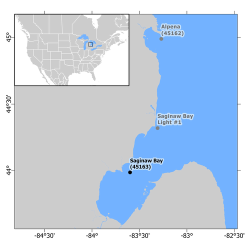
West: -83.6
East: -83.5
South: 43.95
North: 44.05
|
| Spatial Coverage Map |
|
| General Documentation |
|
| Associated Resources |
- Oceanographic, surface meteorological, and chemical water quality parameter data collected from moored Real-time Coastal Observation Network (ReCON) buoys in the Great Lakes region by NOAA Great Lakes Environmental Research Laboratory since 2004
- A wireless real‐time coastal observation network
- Societal benefits of the Real-Time Coastal Observation Network (ReCON): Implications for municipal drinking water quality
- Great Lakes Meteorological Real-Time Coastal Observation Network (ReCON)
- Observing Systems and Advanced Technology
- ReCON Data File Archive
Parent ID (indicates this dataset is related to other data):- gov.noaa.nodc:GLERL-ReCON
|
| Publication Dates |
- publication: 2020-07-31
- revision: 2020-10-28
|
| Data Presentation Form |
Digital table - digital representation of facts or figures systematically displayed, especially in columns
|
| Dataset Progress Status |
Complete - production of the data has been completed
Historical archive - data has been stored in an offline storage facility |
| Data Update Frequency |
As needed |
| Supplemental Information |
In this accession, NCEI has archived multiple versions of these data. The latest (and best) version of these data has the largest version number. |
| Purpose |
The goal of the ReCON project is to develop a national network of coastal buoys capable of seabed to sea-surface observations. This wireless Internet observation system, with shore stations at coastal locations covering approximately 800 square miles of sea surface, uses commercially available networking equipment allowing straightforward integration into a nationwide network. Each system collects meteorological data and provides sub-surface measurements of chemical, biological, and physical parameters. The system is designed to allow controlled access to multi-institutional users through surface buoys and sub-surface sensor guest ports located on an underwater hub. The observation network currently provides environmental data to state, federal, and university researchers, educators and resource managers. |
| Use Limitations |
- Distribution liability: NOAA and NCEI make no warranty, expressed or implied, regarding these data, nor does the fact of distribution constitute such a warranty. NOAA and NCEI cannot assume liability for any damages caused by any errors or omissions in these data. If appropriate, NCEI can only certify that the data it distributes are an authentic copy of the records that were accepted for inclusion in the NCEI archives.
|
| Dataset Citation |
- Cite as: NOAA Great Lakes Environmental Research Laboratory (2020). Oceanographic and surface water meteorological parameter data collected from moored Realtime Coastal Observation Network (ReCON) Saginaw Bay Buoy (NDBC station 45163), Lake Huron, in the Great Lakes region by NOAA Great Lakes Environmental Research Laboratory from 2010-06-17 to 2019-10-24 (NCEI Accession 0213627). [indicate subset used]. NOAA National Centers for Environmental Information. Dataset. https://www.ncei.noaa.gov/archive/accession/0213627. Accessed [date].
|
| Cited Authors |
|
| Principal Investigators |
|
| Contributors |
|
| Resource Providers |
|
| Points of Contact |
|
| Publishers |
|
| Acknowledgments |
- Funding Agency: Great Lakes Observing System
- Funding Agency: NOAA Great Lakes Environmental Research Laboratory
|
| Theme keywords |
NODC DATA TYPES THESAURUS
NODC OBSERVATION TYPES THESAURUS
WMO_CategoryCode
Global Change Master Directory (GCMD) Science Keywords
Provider Keywords
- Dissolved oxygen - saturation
- Total Dissolved Solids (TDS)
- altitude
- fluorescent Dissolved Organic Matter (fDOM)
- phycocyanin (blue-green algae)
- specific conductivity
- wind speed - maximum
|
| Data Center keywords |
NODC COLLECTING INSTITUTION NAMES THESAURUS
NODC SUBMITTING INSTITUTION NAMES THESAURUS
Global Change Master Directory (GCMD) Data Center Keywords
|
| Platform keywords |
Provider Platform Names
|
| Instrument keywords |
NODC INSTRUMENT TYPES THESAURUS
Global Change Master Directory (GCMD) Instrument Keywords
Provider Instruments
- AirMar Weather Station Model 200WX
- AirMar Weather Station Model 200WX & R.M. Young 05106 Marine Wind Monitor
- Campbell Scientific 109 Temperature Probe & AirMar Weather Station Model 200WX
- Yellow Springs YSI EXO2 Sonde
- Yellow Springs YSI EXO2 Sonde & Nortek AWAC 600 KHz Meter
- Yellow Springs YSI EXO2 Sonde & SeaBird SBE16plus CTD Sensor
- Yellow Springs YSI EXO2 Sonde&Nortek AWAC 600 KHz Meter & Campbell Scientific 109 Temp. Probe
|
| Place keywords |
NODC SEA AREA NAMES THESAURUS
Global Change Master Directory (GCMD) Location Keywords
Provider Location Keywords
|
| Project keywords |
NODC PROJECT NAMES THESAURUS
|
| Keywords |
NCEI ACCESSION NUMBER
|
| Keywords |
Send2NCEI Submission Package ID
|
| Use Constraints |
- Cite as: NOAA Great Lakes Environmental Research Laboratory (2020). Oceanographic and surface water meteorological parameter data collected from moored Realtime Coastal Observation Network (ReCON) Saginaw Bay Buoy (NDBC station 45163), Lake Huron, in the Great Lakes region by NOAA Great Lakes Environmental Research Laboratory from 2010-06-17 to 2019-10-24 (NCEI Accession 0213627). [indicate subset used]. NOAA National Centers for Environmental Information. Dataset. https://www.ncei.noaa.gov/archive/accession/0213627. Accessed [date].
|
| Access Constraints |
- Use liability: NOAA and NCEI cannot provide any warranty as to the accuracy, reliability, or completeness of furnished data. Users assume responsibility to determine the usability of these data. The user is responsible for the results of any application of this data for other than its intended purpose.
|
| Fees |
- In most cases, electronic downloads of the data are free. However, fees may apply for custom orders, data certifications, copies of analog materials, and data distribution on physical media.
|
| Lineage information for: dataset |
|---|
| Processing Steps |
- 2020-07-31T20:20:23Z - NCEI Accession 0213627 v1.1 was published.
- 2020-10-28T19:29:55Z - NCEI Accession 0213627 was revised and v2.2 was published.
Rationale: Updates were received for this dataset. These updates were copied into the data/0-data/ directory of this accession. These updates may provide additional files or replace obsolete files. This version contains the most complete and up-to-date representation of this archival information package. All of the files received prior to this update are available in the preceding version of this accession.
|
| Output Datasets |
- NCEI Accession 0213627 v1.1
- NCEI Accession 0213627 v2.2
|
| Lineage information for: dataset |
|---|
| Processing Steps |
- Parameter or Variable: WATER TEMPERATURE (measured); Units: degrees Celsius; Observation Category: in situ; Sampling Instrument: Yellow Springs YSI EXO2 Sonde & Nortek AWAC 600 KHz Meter & Campbell Scientific 109 Temp. Probe; Sampling and Analyzing Method: Single sample at each time stamp.; Data Quality Method: Quality Assurance / Quality Control of Real Time Oceanographic Data cf. https://ioos.noaa.gov/project/qartod/.
- Parameter or Variable: CURRENT SPEED - NORTH/SOUTH COMPONENT (V) (measured); Units: cm per second; Observation Category: in situ; Sampling Instrument: Nortek AWAC 600 KHz Meter; Sampling and Analyzing Method: 10 minute vector average of data samples taken at 60 second interval; Data Quality Method: Quality Assurance / Quality Control of Real Time Oceanographic Data cf. https://ioos.noaa.gov/project/qartod/.
- Parameter or Variable: CURRENT SPEED - EAST/WEST COMPONENT (U) (measured); Units: cm per second; Observation Category: in situ; Sampling Instrument: Nortek AWAC 600 KHz Meter; Sampling and Analyzing Method: 10 minute vector average of data samples taken at 60 second interval; Data Quality Method: Quality Assurance / Quality Control of Real Time Oceanographic Data cf. https://ioos.noaa.gov/project/qartod/.
- Parameter or Variable: AIR TEMPERATURE (measured); Units: degrees C; Observation Category: in situ; Sampling Instrument: Campbell Scientific 109 Temperature Probe & AirMar Weather Station Model 200WX; Sampling and Analyzing Method: 2 minute average of data samples taken at 5 second interval; Data Quality Method: Quality Assurance / Quality Control of Real Time Oceanographic Data cf. https://ioos.noaa.gov/project/qartod/.
- Parameter or Variable: CONDUCTIVITY (measured); Units: microsiemens per centimeter; Observation Category: in situ; Sampling Instrument: Yellow Springs YSI EXO2 Sonde & SeaBird SBE16plus CTD Sensor; Sampling and Analyzing Method: single sample; Data Quality Method: Quality Assurance / Quality Control of Real Time Oceanographic Data cf. https://ioos.noaa.gov/project/qartod/.
- Parameter or Variable: DEPTH - SENSOR (measured); Units: meter; Observation Category: in situ; Sampling Instrument: Yellow Springs YSI EXO2 Sonde & Nortek AWAC 600 KHz Meter; Sampling and Analyzing Method: single sample; Data Quality Method: Quality Assurance / Quality Control of Real Time Oceanographic Data cf. https://ioos.noaa.gov/project/qartod/.
- Parameter or Variable: DISSOLVED OXYGEN (measured); Units: micrograms per liter; Observation Category: in situ; Sampling Instrument: Yellow Springs YSI EXO2 Sonde; Sampling and Analyzing Method: single sample; Data Quality Method: Quality Assurance / Quality Control of Real Time Oceanographic Data cf. https://ioos.noaa.gov/project/qartod/.
- Parameter or Variable: Dissolved oxygen - saturation (measured); Units: percent; Observation Category: in situ; Sampling Instrument: Yellow Springs YSI EXO2 Sonde; Sampling and Analyzing Method: single sample; Data Quality Method: Quality Assurance / Quality Control of Real Time Oceanographic Data cf. https://ioos.noaa.gov/project/qartod/.
- Parameter or Variable: specific conductivity (measured); Units: microsiemens per centimeter; Observation Category: in situ; Sampling Instrument: Yellow Springs YSI EXO2 Sonde; Sampling and Analyzing Method: single sample; Data Quality Method: Quality Assurance / Quality Control of Real Time Oceanographic Data cf. https://ioos.noaa.gov/project/qartod/.
- Parameter or Variable: WAVE DIRECTION (measured); Units: degrees C; Observation Category: in situ; Sampling Instrument: Nortek AWAC 600 KHz Meter; Sampling and Analyzing Method: Mean wave direction over 20 minute sampling period; Data Quality Method: Quality Assurance / Quality Control of Real Time Oceanographic Data cf. https://ioos.noaa.gov/project/qartod/.
- Parameter or Variable: WAVE HEIGHT - MAXIMUM (measured); Units: meter; Observation Category: in situ; Sampling Instrument: Nortek AWAC 600 KHz Meter; Sampling and Analyzing Method: Max wave height in wave ensemble over 20 minute sampling period; Data Quality Method: Quality Assurance / Quality Control of Real Time Oceanographic Data cf. https://ioos.noaa.gov/project/qartod/.
- Parameter or Variable: WAVE PERIOD (measured); Units: seconds; Observation Category: in situ; Sampling Instrument: Nortek AWAC 600 KHz Meter; Sampling and Analyzing Method: Mean zero-crossing period over 20 minute sampling period; Data Quality Method: Quality Assurance / Quality Control of Real Time Oceanographic Data cf. https://ioos.noaa.gov/project/qartod/.
- Parameter or Variable: WAVE HEIGHT - SIGNIFICANT (measured); Units: meter; Observation Category: in situ; Sampling Instrument: Nortek AWAC 600 KHz Meter; Sampling and Analyzing Method: Significant wave height (mean of largest 1/3) over 20 minute sampling period; Data Quality Method: Quality Assurance / Quality Control of Real Time Oceanographic Data cf. https://ioos.noaa.gov/project/qartod/.
- Parameter or Variable: WIND DIRECTION (measured); Units: degrees N; Observation Category: in situ; Sampling Instrument: AirMar Weather Station Model 200WX & R.M. Young 05106 Marine Wind Monitor; Sampling and Analyzing Method: 2 minute unit vector average of data samples taken at 5 second interval. Using AirMar Weather Station Model 200WX for north reference.; Data Quality Method: Quality Assurance / Quality Control of Real Time Oceanographic Data cf. https://ioos.noaa.gov/project/qartod/.
- Parameter or Variable: WIND SPEED (measured); Units: meters per second; Observation Category: in situ; Sampling Instrument: AirMar Weather Station Model 200WX & R.M. Young 05106 Marine Wind Monitor; Sampling and Analyzing Method: 2 minute scalar average of data samples taken at 5 second interval; Data Quality Method: Quality Assurance / Quality Control of Real Time Oceanographic Data cf. https://ioos.noaa.gov/project/qartod/.
- Parameter or Variable: wind speed - maximum (measured); Units: meters per second; Observation Category: in situ; Sampling Instrument: AirMar Weather Station Model 200WX & R.M. Young 05106 Marine Wind Monitor; Sampling and Analyzing Method: 2 minute scalar average of data samples taken at 5 second interval; Data Quality Method: Quality Assurance / Quality Control of Real Time Oceanographic Data cf. https://ioos.noaa.gov/project/qartod/.
- Parameter or Variable: CHLOROPHYLL (measured); Units: Relative Fluoresence Units (RFU); Observation Category: in situ; Sampling Instrument: Yellow Springs YSI EXO2 Sonde; Sampling and Analyzing Method: single sample; Data Quality Method: Quality Assurance / Quality Control of Real Time Oceanographic Data cf. https://ioos.noaa.gov/project/qartod/.
- Parameter or Variable: turbidity (measured); Units: NTU; Observation Category: in situ; Sampling Instrument: Yellow Springs YSI EXO2 Sonde; Sampling and Analyzing Method: single sample; Data Quality Method: Quality Assurance / Quality Control of Real Time Oceanographic Data cf. https://ioos.noaa.gov/project/qartod/.
- Parameter or Variable: altitude (measured); Units: meter; Observation Category: in situ; Sampling Instrument: AirMar Weather Station Model 200WX; Sampling and Analyzing Method: Best value in 2 minute sampling period; Data Quality Method: n/a.
- Parameter or Variable: phycocyanin (blue-green algae) (measured); Units: Relative Fluoresence Units (RFU); Observation Category: in situ; Sampling Instrument: Yellow Springs YSI EXO2 Sonde; Sampling and Analyzing Method: single sample; Data Quality Method: Quality Assurance / Quality Control of Real Time Oceanographic Data cf. https://ioos.noaa.gov/project/qartod/.
- Parameter or Variable: fluorescent Dissolved Organic Matter (fDOM) (measured); Units: Relative Fluoresence Units (RFU); Observation Category: in situ; Sampling Instrument: Yellow Springs YSI EXO2 Sonde; Sampling and Analyzing Method: single sample; Data Quality Method: Quality Assurance / Quality Control of Real Time Oceanographic Data cf. https://ioos.noaa.gov/project/qartod/.
- Parameter or Variable: pH (measured); Units: pH; Observation Category: in situ; Sampling Instrument: Yellow Springs YSI EXO2 Sonde; Sampling and Analyzing Method: single sample; Data Quality Method: Quality Assurance / Quality Control of Real Time Oceanographic Data cf. https://ioos.noaa.gov/project/qartod/.
- Parameter or Variable: Total Dissolved Solids (TDS) (measured); Units: micrograms per liter; Observation Category: in situ; Sampling Instrument: Yellow Springs YSI EXO2 Sonde; Sampling and Analyzing Method: single sample; Data Quality Method: Quality Assurance / Quality Control of Real Time Oceanographic Data cf. https://ioos.noaa.gov/project/qartod/.
|
| Acquisition Information (collection) |
|---|
| Instrument |
- ADCP
- CTD
- temperature probe
|
Last Modified: 2024-09-17T19:15:21Z
For questions about the information on this page, please email:
ncei.info@noaa.gov