Current measurements, navigational, physical, and underway data collected aboard the NEW HORIZON during cruise NH1207 in the North Pacific Ocean from 2012-07-26 to 2012-08-08 (NCEI Accession 0132079)
 Preview graphic
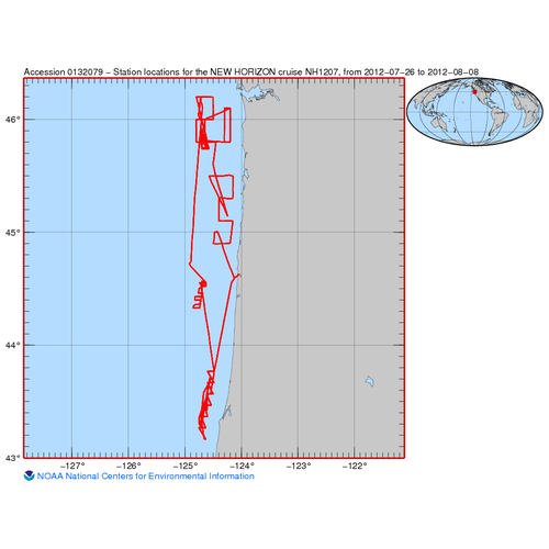
This dataset includes current measurements, navigational, physical, and underway data collected aboard the NEW HORIZON during cruise NH1207 in the North Pacific Ocean from 2012-07-26 to 2012-08-08. These data include CURRENT SPEED - EAST/WEST COMPONENT (U), CURRENT SPEED - NORTH/SOUTH COMPONENT (V), LATITUDE, LONGITUDE, course over ground, and speed over ground. The instruments used to collect these data include ADCP and GPS. These data were collected by Roger Gauss of US Navy; Naval Research Laboratory - Washington DC, and by University of California San Diego; Scripps Institution of Oceanography as part of Fish Acoustics Basic Research Challenge. The Rolling Deck to Repository (R2R) program submitted these data to NCEI.
The ADCP data represent the raw dataset. Post processed quality assessed data are not available in this dataset. A suite of navigation products produced by R2R is included in this dataset, comprised of one high resolution, one 1 minute resolution, and one low resolution coordinate file.
- Cite as: Rolling Deck to Repository (R2R) Program (2015). Current measurements, navigational, physical, and underway data collected aboard the NEW HORIZON during cruise NH1207 in the North Pacific Ocean from 2012-07-26 to 2012-08-08 (NCEI Accession 0132079). https://www.ncei.noaa.gov/archive/accession/0132079. In Rolling Deck to Repository (R2R) Program. Oceanographic and meteorological data collected on expeditions of vessels in the academic fleet since 1994, submitted by the Rolling Deck to Repository (R2R) program. [indicate subset used]. NOAA National Centers for Environmental Information. Dataset. https://www.ncei.noaa.gov/archive/accession/NSF-R2R. Accessed [date].
| Download Data |
-
HTTPS (download)
Navigate directly to the URL for data access and direct download.
-
FTP (download)
These data are available through the File Transfer Protocol (FTP). FTP is no longer supported by most internet browsers. You may copy and paste the FTP link to the data into an FTP client (e.g., FileZilla or WinSCP).
|
| Distribution Formats |
- ADCP (uhdas)
- File Specification: https://www.ncei.noaa.gov/archive/accession/0086548/data/0-data/format/100036/
- GNSS (nmea_gpxxx)
- File Specification: https://www.ncei.noaa.gov/archive/accession/0086548/data/0-data/format/100010/
- R2RNAV (r2rnav_geocsv)
- File Specification: https://www.ncei.noaa.gov/archive/accession/0086548/data/0-data/format/100157/
|
| Ordering Instructions |
Contact NCEI for other distribution options and instructions. |
| Distributor |
NOAA National Centers for Environmental Information
+1-301-713-3277
ncei.info@noaa.gov
|
| Dataset Point of Contact |
NOAA National Centers for Environmental Information
ncei.info@noaa.gov
|
| Time Period |
2012-07-26 to 2012-08-08 |
| Spatial Bounding Box Coordinates |
West: -124.92
East: -124.045
South: 43.166
North: 46.2
|
| Spatial Coverage Map |
|
| General Documentation |
|
| Associated Resources |
- Oceanographic and meteorological data collected on expeditions of vessels in the academic fleet since 1994, submitted by the Rolling Deck to Repository (R2R) program
- Rolling Deck To Repository (R2R). (2012). Cruise NH1207 on New Horizon. Rolling Deck to Repository (R2R). https://doi.org/10.7284/903854
Parent ID (indicates this dataset is related to other data):
|
| Publication Dates |
- publication: 2015-10-02
- revision: 2025-05-13
- creation: 2015-10-02
|
| Data Presentation Form |
Digital table - digital representation of facts or figures systematically displayed, especially in columns
|
| Dataset Progress Status |
Complete - production of the data has been completed
Historical archive - data has been stored in an offline storage facility |
| Data Update Frequency |
As needed - NCEI Accession 0132079 was revised and a new version of the archival package was published. Updates to existing archival packages may provide additional files or replace obsolete files. The latest version contains the most complete and up-to-date representation of this archival information package. All of the files received prior to this update are available in the preceding version of this accession. Please see journal.txt in the /about directory for additional details on changes made. |
| Supplemental Information |
NCEI Accession 0086548 contains documentation about datasets submitted to NCEI as part of the R2R program.
One or more of the data packages in this dataset contains an incorrect data license. The R2R program has requested that all such packages must be documented with a Creative Commons CC0 1.0 Universal (CC0 1.0) Public Domain Dedication. The documentation has been updated accordingly. However, none of the original data files have been changed.
In this accession, NCEI has archived multiple versions of these data. The latest (and best) version of these data has the largest version number. |
| Purpose |
This dataset is available to the public for a wide variety of uses including scientific research and analysis. |
| Use Limitations |
- Distribution liability: NOAA and NCEI make no warranty, expressed or implied, regarding these data, nor does the fact of distribution constitute such a warranty. NOAA and NCEI cannot assume liability for any damages caused by any errors or omissions in these data. If appropriate, NCEI can only certify that the data it distributes are an authentic copy of the records that were accepted for inclusion in the NCEI archives.
|
| Dataset Citation |
- Cite as: Rolling Deck to Repository (R2R) Program (2015). Current measurements, navigational, physical, and underway data collected aboard the NEW HORIZON during cruise NH1207 in the North Pacific Ocean from 2012-07-26 to 2012-08-08 (NCEI Accession 0132079). https://www.ncei.noaa.gov/archive/accession/0132079. In Rolling Deck to Repository (R2R) Program. Oceanographic and meteorological data collected on expeditions of vessels in the academic fleet since 1994, submitted by the Rolling Deck to Repository (R2R) program. [indicate subset used]. NOAA National Centers for Environmental Information. Dataset. https://www.ncei.noaa.gov/archive/accession/NSF-R2R. Accessed [date].
|
| Cited Authors |
- Rolling Deck to Repository (R2R) Program
|
| Principal Investigators |
|
| Collaborators |
|
| Contributors |
|
| Processors |
|
| Resource Providers |
|
| Points of Contact |
- Data Manager
Rolling Deck to Repository (R2R) Program
|
| Publishers |
|
| Theme keywords |
NODC DATA TYPES THESAURUS
NODC OBSERVATION TYPES THESAURUS
WMO_CategoryCode
Global Change Master Directory (GCMD) Science Keywords
|
| Data Center keywords |
NODC COLLECTING INSTITUTION NAMES THESAURUS
NODC SUBMITTING INSTITUTION NAMES THESAURUS
|
| Platform keywords |
NODC PLATFORM NAMES THESAURUS
Global Change Master Directory (GCMD) Platform Keywords
ICES/SeaDataNet Ship Codes
|
| Instrument keywords |
NODC INSTRUMENT TYPES THESAURUS
Global Change Master Directory (GCMD) Instrument Keywords
Originator Instrument Keywords
|
| Place keywords |
NODC SEA AREA NAMES THESAURUS
Global Change Master Directory (GCMD) Location Keywords
|
| Project keywords |
NODC PROJECT NAMES THESAURUS
Cruise ID
|
| Keywords |
NCEI ACCESSION NUMBER
|
| Use Constraints |
- Cite as: Rolling Deck to Repository (R2R) Program (2015). Current measurements, navigational, physical, and underway data collected aboard the NEW HORIZON during cruise NH1207 in the North Pacific Ocean from 2012-07-26 to 2012-08-08 (NCEI Accession 0132079). https://www.ncei.noaa.gov/archive/accession/0132079. In Rolling Deck to Repository (R2R) Program. Oceanographic and meteorological data collected on expeditions of vessels in the academic fleet since 1994, submitted by the Rolling Deck to Repository (R2R) program. [indicate subset used]. NOAA National Centers for Environmental Information. Dataset. https://www.ncei.noaa.gov/archive/accession/NSF-R2R. Accessed [date].
|
| Data License |
|
| Access Constraints |
- Use liability: NOAA and NCEI cannot provide any warranty as to the accuracy, reliability, or completeness of furnished data. Users assume responsibility to determine the usability of these data. The user is responsible for the results of any application of this data for other than its intended purpose.
|
| Fees |
- In most cases, electronic downloads of the data are free. However, fees may apply for custom orders, data certifications, copies of analog materials, and data distribution on physical media.
|
| Lineage information for: dataset |
|---|
| Processing Steps |
- 2015-10-02T04:33:39Z - NCEI Accession 0132079 v1.1 was published.
- 2019-12-04T09:18:18Z - NCEI Accession 0132079 was revised and v2.2 was published.
Rationale: Updates were received for this dataset. These updates were copied into the data/0-data/ directory of this accession. These updates may provide additional files or replace obsolete files. This version contains the most complete and up-to-date representation of this archival information package. All of the files received prior to this update are available in the preceding version of this accession.
- 2024-05-15T00:24:53Z - NCEI Accession 0132079 was revised and v2.3 was published.
Rationale: Additional metadata files were received or created for this dataset. These updates were copied into the about/ directory of this accession. These updates may provide additional files or replace obsolete files. This version contains the most complete and up-to-date representation of this archival information package. All of the files received prior to this update are available in the preceding version of this accession.
- 2024-12-25T12:51:28Z - NCEI Accession 0132079 was revised and v2.4 was published.
Rationale: Additional metadata files were received or created for this dataset. These updates were copied into the about/ directory of this accession. These updates may provide additional files or replace obsolete files. This version contains the most complete and up-to-date representation of this archival information package. All of the files received prior to this update are available in the preceding version of this accession.
- 2025-02-16T00:30:35Z - NCEI Accession 0132079 was revised and v3.5 was published.
Rationale: Updates were received for this dataset. These updates were copied into the data/0-data/ directory of this accession. These updates may provide additional files or replace obsolete files. This version contains the most complete and up-to-date representation of this archival information package. All of the files received prior to this update are available in the preceding version of this accession.
- 2025-05-13T10:55:46Z - NCEI Accession 0132079 was revised and v4.6 was published.
Rationale: Updates were received for this dataset. These updates were copied into the data/0-data/ directory of this accession. These updates may provide additional files or replace obsolete files. This version contains the most complete and up-to-date representation of this archival information package. All of the files received prior to this update are available in the preceding version of this accession.
|
| Output Datasets |
- NCEI Accession 0132079 v1.1
- NCEI Accession 0132079 v2.2
- NCEI Accession 0132079 v2.3
- NCEI Accession 0132079 v2.4
- NCEI Accession 0132079 v3.5
- NCEI Accession 0132079 v4.6
|
| Acquisition Information (collection) |
|---|
| Instrument |
|
| Platform |
|
Last Modified: 2026-02-02T22:31:17Z
For questions about the information on this page, please email:
ncei.info@noaa.gov