Oceanographic profile data collected from CTD and sound velocimeter - moving vessel profiler casts aboard FA2805, FA2806, FA2807, FA2808, and NOAA Ship Fairweather as part of project OPR-O190-FA-15 in the Coastal Waters of Southeast Alaska and British Columbia and North Pacific Ocean from 2015-09-23 to 2015-11-11 (NCEI Accession 0138176)
 Preview graphic
This dataset includes physical and profile data collected aboard the FA2805, FA2806, FA2807, FA2808, and NOAA Ship Fairweather during project OPR-O190-FA-15 in the Coastal Waters of Southeast Alaska and British Columbia and North Pacific Ocean from 2015-09-23 to 2015-11-11. These data include CONDUCTIVITY, HYDROSTATIC PRESSURE, SALINITY, SOUND VELOCITY, WATER DENSITY, and WATER TEMPERATURE. The instruments used to collect these data include CTD and sound velocimeter - moving vessel profiler. These data were collected and submitted by the NOAA Office of Coast Survey in support of hydrographic multibeam surveys to meet NOAA charting requirements.
- Cite as: Bravo, Douglas; NOAA Office of Marine and Aviation Operations (2015). Oceanographic profile data collected from CTD and sound velocimeter - moving vessel profiler casts aboard FA2805, FA2806, FA2807, FA2808, and NOAA Ship Fairweather as part of project OPR-O190-FA-15 in the Coastal Waters of Southeast Alaska and British Columbia and North Pacific Ocean from 2015-09-23 to 2015-11-11 (NCEI Accession 0138176). https://www.ncei.noaa.gov/archive/accession/0138176. In NOAA Office of Coast Survey. CTD and sound speed profile data acquired in support of hydrographic multibeam surveys to meet NOAA/NOS, Office of Coast Survey charting requirements. [indicate subset used]. NOAA National Centers for Environmental Information. Dataset. https://www.ncei.noaa.gov/archive/accession/OCS-Profile. Accessed [date].
| Download Data |
-
HTTPS (download)
Navigate directly to the URL for data access and direct download.
-
FTP (download)
These data are available through the File Transfer Protocol (FTP). FTP is no longer supported by most internet browsers. You may copy and paste the FTP link to the data into an FTP client (e.g., FileZilla or WinSCP).
-
THREDDS (download)
These data are available through a variety of services via a THREDDS (Thematic Real-time Environmental Distributed Data Services) Data Server (TDS). Depending on the dataset, the TDS can provide WMS, WCS, DAP, HTTP, and other data access and metadata services as well. For more information on the TDS, see http://www.unidata.ucar.edu/software/thredds/current/tds/.
-
HTTPS (download)
Navigate directly to the URL for data access and direct download.
-
FTP (download)
These data are available through the File Transfer Protocol (FTP). FTP is no longer supported by most internet browsers. You may copy and paste the FTP link to the data into an FTP client (e.g., FileZilla or WinSCP).
|
| Distribution Formats |
- netCDF (Version: netCDF-4)
- File Specification: CF-1.6
|
| Ordering Instructions |
Contact NCEI for other distribution options and instructions. |
| Distributor |
NOAA National Centers for Environmental Information
+1-301-713-3277
ncei.info@noaa.gov
|
| Dataset Point of Contact |
NOAA National Centers for Environmental Information
ncei.info@noaa.gov
|
| Time Period |
2015-09-23 to 2015-11-11 |
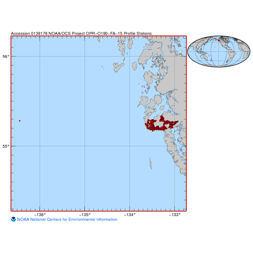
| Spatial Bounding Box Coordinates |
West: -136.4438
East: -132.931
South: 55.17
North: 55.3348
|
| Spatial Coverage Map |
|
| General Documentation |
|
| Associated Resources |
- CTD and sound speed profile data acquired in support of hydrographic multibeam surveys to meet NOAA/NOS, Office of Coast Survey charting requirements
Parent ID (indicates this dataset is related to other data):- gov.noaa.nodc:OCS-Profile
|
| Publication Dates |
- publication: 2015-12-02
- creation: 2015-11-21
|
| Data Presentation Form |
Digital table - digital representation of facts or figures systematically displayed, especially in columns
|
| Dataset Progress Status |
Complete - production of the data has been completed
Historical archive - data has been stored in an offline storage facility |
| Data Update Frequency |
As needed |
| Purpose |
This dataset is available to the public for a wide variety of uses including scientific research and analysis. |
| Use Limitations |
- Distribution liability: NOAA and NCEI make no warranty, expressed or implied, regarding these data, nor does the fact of distribution constitute such a warranty. NOAA and NCEI cannot assume liability for any damages caused by any errors or omissions in these data. If appropriate, NCEI can only certify that the data it distributes are an authentic copy of the records that were accepted for inclusion in the NCEI archives.
|
| Dataset Citation |
- Cite as: Bravo, Douglas; NOAA Office of Marine and Aviation Operations (2015). Oceanographic profile data collected from CTD and sound velocimeter - moving vessel profiler casts aboard FA2805, FA2806, FA2807, FA2808, and NOAA Ship Fairweather as part of project OPR-O190-FA-15 in the Coastal Waters of Southeast Alaska and British Columbia and North Pacific Ocean from 2015-09-23 to 2015-11-11 (NCEI Accession 0138176). https://www.ncei.noaa.gov/archive/accession/0138176. In NOAA Office of Coast Survey. CTD and sound speed profile data acquired in support of hydrographic multibeam surveys to meet NOAA/NOS, Office of Coast Survey charting requirements. [indicate subset used]. NOAA National Centers for Environmental Information. Dataset. https://www.ncei.noaa.gov/archive/accession/OCS-Profile. Accessed [date].
|
| Cited Authors |
|
| Contributors |
|
| Resource Providers |
|
| Publishers |
|
| Acknowledgments |
- The collection of these data were funded by NOAA's Office of Coast Survey.
|
| Theme keywords |
NODC DATA TYPES THESAURUS
NODC OBSERVATION TYPES THESAURUS
WMO_CategoryCode
Global Change Master Directory (GCMD) Science Keywords
NetCDF Climate and Forecast (CF) Metadata Convention Standard Names
- altitude
- latitude
- longitude
- sea_water_salinity
- sea_water_sigma_theta
- sea_water_temperature
- time
|
| Data Center keywords |
NODC COLLECTING INSTITUTION NAMES THESAURUS
NODC SUBMITTING INSTITUTION NAMES THESAURUS
Global Change Master Directory (GCMD) Data Center Keywords
|
| Platform keywords |
NODC PLATFORM NAMES THESAURUS
Global Change Master Directory (GCMD) Platform Keywords
ICES/SeaDataNet Ship Codes
NOAA Office of Coast Survey: Ship Keywords
- F5 FAIRWEATHER - LAUNCH 2805
- F6 FAIRWEATHER - LAUNCH 2806
- F7 FAIRWEATHER - LAUNCH 2807
- F8 FAIRWEATHER - LAUNCH 2808
- FA FAIRWEATHER NOAA SHIP
|
| Instrument keywords |
NODC INSTRUMENT TYPES THESAURUS
Global Change Master Directory (GCMD) Instrument Keywords
NOAA Office of Coast Survey: Instrument Keywords
- MVP
- MVP-X
- SBE19PLUS (SN:6121)
- SBE19PLUS (SN:6122)
- SBE19PLUS (SN:7370)
- SBE19PLUS (SN:7634)
|
| Place keywords |
NODC SEA AREA NAMES THESAURUS
Global Change Master Directory (GCMD) Location Keywords
|
| Project keywords |
NOAA Office of Coast Survey: Project Keywords
- OPR-0190-FA-15
- OPR-019O-FA-15
- OPR-O190-FA-15
NOAA Office of Coast Survey: Survey Keywords
- H12741
- H12742
- H12743
- H12744
- Prince of Wales
|
| Keywords |
NCEI ACCESSION NUMBER
|
| Use Constraints |
- Cite as: Bravo, Douglas; NOAA Office of Marine and Aviation Operations (2015). Oceanographic profile data collected from CTD and sound velocimeter - moving vessel profiler casts aboard FA2805, FA2806, FA2807, FA2808, and NOAA Ship Fairweather as part of project OPR-O190-FA-15 in the Coastal Waters of Southeast Alaska and British Columbia and North Pacific Ocean from 2015-09-23 to 2015-11-11 (NCEI Accession 0138176). https://www.ncei.noaa.gov/archive/accession/0138176. In NOAA Office of Coast Survey. CTD and sound speed profile data acquired in support of hydrographic multibeam surveys to meet NOAA/NOS, Office of Coast Survey charting requirements. [indicate subset used]. NOAA National Centers for Environmental Information. Dataset. https://www.ncei.noaa.gov/archive/accession/OCS-Profile. Accessed [date].
|
| Access Constraints |
- Use liability: NOAA and NCEI cannot provide any warranty as to the accuracy, reliability, or completeness of furnished data. Users assume responsibility to determine the usability of these data. The user is responsible for the results of any application of this data for other than its intended purpose.
|
| Fees |
- In most cases, electronic downloads of the data are free. However, fees may apply for custom orders, data certifications, copies of analog materials, and data distribution on physical media.
|
| Lineage information for: dataset |
|---|
| Processing Steps |
- 2015-12-02T11:51:24Z - NCEI Accession 0138176 v1.1 was published.
|
| Output Datasets |
- NCEI Accession 0138176 v1.1
|
| Acquisition Information (collection) |
|---|
| Instrument |
- CTD
- sound velocimeter - moving vessel profiler
|
| Platform |
- FA2805
- FA2806
- FA2807
- FA2808
- NOAA Ship Fairweather
|
Last Modified: 2025-12-20T23:53:22Z
For questions about the information on this page, please email:
ncei.info@noaa.gov