Coral reef ecosystem marine protected area monitoring in Fagamalo, American Samoa: benthic cover derived from analysis of benthic images collected during belt transect surveys of coral demography from 2015-10-26 to 2015-11-13 (NCEI Accession 0169724)
 Preview graphic
In 2010 the village of Fagamalo, Tutuila, American Samoa, designated a no-take Marine Protected Area that sees the protection of 2.25 square kilometers of ocean. Because little is known regarding the status of living marine communities in the area, and at the request of the American Samoa Department of Marine and Wildlife Resources, NOAA scientists conducted surveys to assess the status of the benthic communities and establish a baseline against which to compare temporal change.
The benthic cover data described here were generated from the quantitative analysis of photoquadrat benthic images using image analysis software, whereby random points are projected on each image and the benthic elements falling directly underneath each point are identified. The images were collected at 18 randomly selected stratified sites in Fagamalo in 2015 during belt transect surveys of coral demography by the NOAA Coral Reef Ecosystem Program (CREP).
The benthic cover data can be accessed online via the NOAA National Centers for Environmental Information (NCEI) Ocean Archive. The benthic images and coral demography data are described and archived separately.
- Cite as: Coral Reef Ecosystem Program; Pacific Islands Fisheries Science Center (2018). Coral reef ecosystem marine protected area monitoring in Fagamalo, American Samoa: benthic cover derived from analysis of benthic images collected during belt transect surveys of coral demography from 2015-10-26 to 2015-11-13 (NCEI Accession 0169724). [indicate subset used]. NOAA National Centers for Environmental Information. Dataset. https://www.ncei.noaa.gov/archive/accession/0169724. Accessed [date].
| Time Period |
2015-10-26 to 2015-11-13 |
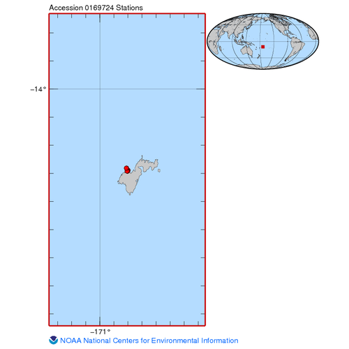
| Spatial Bounding Box Coordinates |
West: -170.812
East: -170.799
South: -14.2925
North: -14.2806
|
| Spatial Coverage Map |
|
| General Documentation |
|
| Associated Resources |
- Pacific Islands Fisheries Science Center, 2017: Coral reef ecosystem marine protected area monitoring in Fagamalo, American Samoa: benthic percent cover derived from analysis of benthic images collected during belt transect surveys of coral demography in 2015, https://www.fisheries.noaa.gov/inport/item/31621.
- Lozada-Misa, P., Schumacher, B., & Vargas-Ángel, Bernardo, 1965-. (20 C.E.). Analysis of benthic survey images via CoralNet : a summary of standard operating procedures and guidelines. U.S. Department of Commerce, National Oceanic and Atmospheric Administration, National Marine Fisheries Service, Pacific Islands Fisheries Science Center. https://doi.org/10.7289/v5/ar-pifsc-h-17-02
- Summary Report of Baseline Surveys for Benthic and Fish Communities in the Fagamalo No-Take Marine Protected Area, American Samoa
|
| Publication Dates |
- publication: 2018-03-10
- creation: 2018-01-10
|
| Data Presentation Form |
Digital table - digital representation of facts or figures systematically displayed, especially in columns
|
| Dataset Progress Status |
Complete - production of the data has been completed
Historical archive - data has been stored in an offline storage facility |
| Data Update Frequency |
As needed |
| Supplemental Information |
This dataset is related to Accession 0146681 (benthic images at Fagamalo) and Accession 0166380 (coral demographic/belt transect surveys at Fagamalo) |
| Purpose |
These data were generated from benthic surveys to establish a comprehensive baseline for benthic composition and coral demographics, and are part of a NOAA Coral Reef Conservation Program (CRCP) funded project, entitled: "Coral reef ecosystem monitoring training and capacity building to support improved resource management in American Samoa." |
| Use Limitations |
- Distribution liability: NOAA and NCEI make no warranty, expressed or implied, regarding these data, nor does the fact of distribution constitute such a warranty. NOAA and NCEI cannot assume liability for any damages caused by any errors or omissions in these data. If appropriate, NCEI can only certify that the data it distributes are an authentic copy of the records that were accepted for inclusion in the NCEI archives.
|
| Dataset Citation |
- Cite as: Coral Reef Ecosystem Program; Pacific Islands Fisheries Science Center (2018). Coral reef ecosystem marine protected area monitoring in Fagamalo, American Samoa: benthic cover derived from analysis of benthic images collected during belt transect surveys of coral demography from 2015-10-26 to 2015-11-13 (NCEI Accession 0169724). [indicate subset used]. NOAA National Centers for Environmental Information. Dataset. https://www.ncei.noaa.gov/archive/accession/0169724. Accessed [date].
|
| Cited Authors |
|
| Principal Investigators |
|
| Collaborators |
|
| Contributors |
|
| Resource Providers |
|
| Publishers |
|
| Acknowledgments |
- Funding Agency: NOAA Coral Reef Conservation Program
|
| Theme keywords |
NODC DATA TYPES THESAURUS
NODC OBSERVATION TYPES THESAURUS
WMO_CategoryCode
CoRIS Discovery Thesaurus- Numeric Data Sets > Benthic
CoRIS Theme Thesaurus
- EARTH SCIENCE > Biosphere > Aquatic Habitat > Benthic Habitat
- EARTH SCIENCE > Biosphere > Aquatic Habitat > Reef Habitat
- EARTH SCIENCE > Biosphere > Microbiota > Blue-green Algae
- EARTH SCIENCE > Biosphere > Vegetation > Algae > Algal Cover
- EARTH SCIENCE > Biosphere > Vegetation > Algae > Crustose Coralline Algae
- EARTH SCIENCE > Biosphere > Vegetation > Algae > Encrusting Macroalgae
- EARTH SCIENCE > Biosphere > Vegetation > Algae > Turf Algae
- EARTH SCIENCE > Biosphere > Zoology > Corals
- EARTH SCIENCE > Biosphere > Zoology > Corals > Reef Monitoring and Assessment
- EARTH SCIENCE > Biosphere > Zoology > Corals > Reef Monitoring and Assessment > Baseline studies
- EARTH SCIENCE > Biosphere > Zoology > Corals > Reef Monitoring and Assessment > Benthos Analysis
- EARTH SCIENCE > Biosphere > Zoology > Corals > Reef Monitoring and Assessment > Benthos Analysis > Quadrat Monitoring > Photograph Analysis
- EARTH SCIENCE > Biosphere > Zoology > Corals > Reef Monitoring and Assessment > Benthos Analysis > Transect Monitoring
- EARTH SCIENCE > Biosphere > Zoology > Corals > Reef Monitoring and Assessment > Benthos Analysis > Transect Monitoring > Belt Transect
- EARTH SCIENCE > Biosphere > Zoology > Corals > Reef Monitoring and Assessment > In Situ Biological
- EARTH SCIENCE > Biosphere > Zoology > Corals > Reef Monitoring and Assessment > Photographic Analysis
- EARTH SCIENCE > Biosphere > Zoology > Corals > Reef Monitoring and Assessment > Rapid Assessment Studies
- EARTH SCIENCE > Biosphere > Zoology > Mollusks > Tridacna
- EARTH SCIENCE > Biosphere > Zoology > Sponges
- EARTH SCIENCE > Oceans > Coastal Processes > Coral Reefs
- EARTH SCIENCE > Oceans > Coastal Processes > Coral Reefs > Coral Reef Ecology
- EARTH SCIENCE > Oceans > Coastal Processes > Coral Reefs > Coral Reef Ecology > Benthic biology
- EARTH SCIENCE > Oceans > Coastal Processes > Coral Reefs > Coral Reef Ecology > Coral Cover
- EARTH SCIENCE > Oceans > Coastal Processes > Coral Reefs > Coral Reef Ecology > Hard Coral Cover
- EARTH SCIENCE > Oceans > Coastal Processes > Coral Reefs > Coral Reef Ecology > Hard Coral Cover Live percentage
- EARTH SCIENCE > Oceans > Coastal Processes > Coral Reefs > Coral Reef Ecology > Octocoral Cover
- EARTH SCIENCE > Oceans > Marine Biology > Coral
- EARTH SCIENCE > Oceans > Marine Biology > Coral Communities
- EARTH SCIENCE > Oceans > Marine Biology > Marine Invertebrates
- EARTH SCIENCE > Oceans > Marine Biology > Marine Invertebrates > Macroinvertebrates
- EARTH SCIENCE > Oceans > Marine Biology > Marine Plants > Seagrass
Global Change Master Directory (GCMD) Science Keywords
|
| Data Center keywords |
NODC COLLECTING INSTITUTION NAMES THESAURUS
NODC SUBMITTING INSTITUTION NAMES THESAURUS
Global Change Master Directory (GCMD) Data Center Keywords
Provider Keywords
- CRED
- CREP
- Coral Reef Ecosystem Division
- Coral Reef Ecosystem Program
- PIFSC
- Pacific Islands Fisheries Science Center
|
| Instrument keywords |
NODC INSTRUMENT TYPES THESAURUS
|
| Place keywords |
NODC SEA AREA NAMES THESAURUS
CoRIS Place Thesaurus
- COUNTRY/TERRITORY > United States of America > American Samoa > American Samoa > Tutuila Island (14S170W0016)
- COUNTRY/TERRITORY > United States of America > American Samoa > Tutuila Island > Fagamalo (14S170W0047)
- OCEAN BASIN > Pacific Ocean > American Samoa > Tutuila Island (14S170W0016)
- OCEAN BASIN > Pacific Ocean > Tutuila Island > Fagamalo (14S170W0047)
Global Change Master Directory (GCMD) Location Keywords
|
| Project keywords |
NODC PROJECT NAMES THESAURUS
CRCP Project
- 1083
- Coral reef ecosystem monitoring training and capacity building to support improved resource management in American Samoa
|
| Keywords |
NCEI ACCESSION NUMBER
|
| Keywords |
Send2NCEI Submission Package ID
|
| Use Constraints |
- Cite as: Coral Reef Ecosystem Program; Pacific Islands Fisheries Science Center (2018). Coral reef ecosystem marine protected area monitoring in Fagamalo, American Samoa: benthic cover derived from analysis of benthic images collected during belt transect surveys of coral demography from 2015-10-26 to 2015-11-13 (NCEI Accession 0169724). [indicate subset used]. NOAA National Centers for Environmental Information. Dataset. https://www.ncei.noaa.gov/archive/accession/0169724. Accessed [date].
|
| Access Constraints |
- Use liability: NOAA and NCEI cannot provide any warranty as to the accuracy, reliability, or completeness of furnished data. Users assume responsibility to determine the usability of these data. The user is responsible for the results of any application of this data for other than its intended purpose.
|
| Fees |
- In most cases, electronic downloads of the data are free. However, fees may apply for custom orders, data certifications, copies of analog materials, and data distribution on physical media.
|
| Lineage information for: dataset |
|---|
| Processing Steps |
- 2018-03-10T21:33:18Z - NCEI Accession 0169724 v1.1 was published.
|
| Output Datasets |
- NCEI Accession 0169724 v1.1
|
| Lineage information for: dataset |
|---|
| Processing Steps |
- Parameter or Variable: REEF AND/OR BOTTOM REGIME - PERCENT COVER (calculated); Units: percent; Observation Category: laboratory analysis; Sampling Instrument: software; Sampling and Analyzing Method: See the published standard operating procedures: Lozada-Misa P, Schumacher BD, Vargas-Angel B. 2017. Analysis of benthic survey images via CoralNet : a summary of standard operating procedures and guidelines. Pacific Islands Fisheries Science Center, PIFSC Administrative Report, H-17-02, 169 p. https://doi.org/10.7289/V5/AR-PIFSC-H-17-02.
|
| Acquisition Information (collection) |
|---|
| Instrument |
|
Last Modified: 2025-12-15T19:28:56Z
For questions about the information on this page, please email:
ncei.info@noaa.gov