Total alkalinity, pH on total scale, temperature, salinity, oxygen, nutrients and other measurements collected from discrete samples and profile observations during the R/V Hesperides cruise FICARAM_XIX (EXPOCODE 29HE20190406) in the Atlantic Ocean from 2019-04-06 to 2019-05-18 (NCEI Accession 0209070)
 Preview graphic
This dataset includes discrete profile measurements of total alkalinity, pH on total scale, temperature, salinity, oxygen and nutrients collected during the R/V Hesperides cruise FICARAM_XIX (EXPOCODE 29HE20190406) along the Repeat Hydrography Section A17 in the Atlantic Ocean from 2019-04-06 to 2019-05-18.
- Cite as: Pérez, Fiz F.; Velo, Antón; Gilcoto, Miguel; Fontela, Marcos; Álvarez, María Jesús; Chamorro Valverde, Álex; Alonso-Pérez, Fernando; Rey Muras, Jesús (2020). Total alkalinity, pH on total scale, temperature, salinity, oxygen, nutrients and other measurements collected from discrete samples and profile observations during the R/V Hesperides cruise FICARAM_XIX (EXPOCODE 29HE20190406) in the Atlantic Ocean from 2019-04-06 to 2019-05-18 (NCEI Accession 0209070). [indicate subset used]. NOAA National Centers for Environmental Information. Dataset. https://doi.org/10.25921/261t-b220. Accessed [date].
| Time Period |
2019-04-06 to 2019-05-18 |
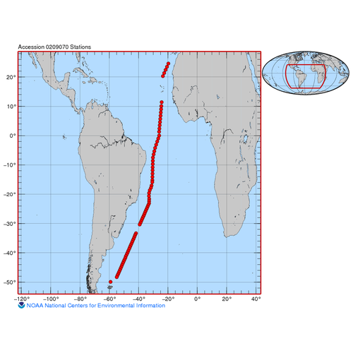
| Spatial Bounding Box Coordinates |
West: -59.4
East: -19.5
South: -50.4
North: 24.8
|
| Spatial Coverage Map |
|
| General Documentation |
|
| Associated Resources |
- CLIVAR Repeat Section FICARAM
- NOAA National Centers for Environmental Information (2022). Ocean Carbon and Acidification Data System (OCADS). NOAA National Centers for Environmental Information. https://www.ncei.noaa.gov/products/ocean-carbon-acidification-data-system
|
| Publication Dates |
- publication: 2020-02-21
- revision: 2024-03-11
- creation: 2020-02-13
|
| Data Presentation Form |
Digital table - digital representation of facts or figures systematically displayed, especially in columns
|
| Dataset Progress Status |
Complete - production of the data has been completed
Historical archive - data has been stored in an offline storage facility |
| Data Update Frequency |
As needed - NCEI Accession 0209070 was revised and a new version of the archival package was published. Updates to existing archival packages may provide additional files or replace obsolete files. The latest version contains the most complete and up-to-date representation of this archival information package. All of the files received prior to this update are available in the preceding version of this accession. Please see journal.txt in the /about directory for additional details on changes made. |
| Supplemental Information |
In this accession, NCEI has archived multiple versions of these data. The latest (and best) version of these data has the largest version number. |
| Purpose |
This dataset is available to the public for a wide variety of uses including scientific research and analysis. |
| Use Limitations |
- Distribution liability: NOAA and NCEI make no warranty, expressed or implied, regarding these data, nor does the fact of distribution constitute such a warranty. NOAA and NCEI cannot assume liability for any damages caused by any errors or omissions in these data. If appropriate, NCEI can only certify that the data it distributes are an authentic copy of the records that were accepted for inclusion in the NCEI archives.
|
| Dataset Citation |
- Cite as: Pérez, Fiz F.; Velo, Antón; Gilcoto, Miguel; Fontela, Marcos; Álvarez, María Jesús; Chamorro Valverde, Álex; Alonso-Pérez, Fernando; Rey Muras, Jesús (2020). Total alkalinity, pH on total scale, temperature, salinity, oxygen, nutrients and other measurements collected from discrete samples and profile observations during the R/V Hesperides cruise FICARAM_XIX (EXPOCODE 29HE20190406) in the Atlantic Ocean from 2019-04-06 to 2019-05-18 (NCEI Accession 0209070). [indicate subset used]. NOAA National Centers for Environmental Information. Dataset. https://doi.org/10.25921/261t-b220. Accessed [date].
|
| Cited Authors |
|
| Principal Investigators |
|
| Collaborators |
|
| Contributors |
|
| Resource Providers |
|
| Publishers |
|
| Theme keywords |
NODC DATA TYPES THESAURUS
NODC OBSERVATION TYPES THESAURUS
WMO_CategoryCode
Global Change Master Directory (GCMD) Science Keywords
OCADS Study Type
Provider Variable Abbreviations
- ALKALI
- CTDSAL
- CTDTMP
- Nutrients
- OXYGEN
- PH_TOT
- SALNTY
|
| Data Center keywords |
NODC COLLECTING INSTITUTION NAMES THESAURUS
NODC SUBMITTING INSTITUTION NAMES THESAURUS
|
| Platform keywords |
NODC PLATFORM NAMES THESAURUS
ICES/SeaDataNet Ship Codes
|
| Instrument keywords |
NODC INSTRUMENT TYPES THESAURUS
Global Change Master Directory (GCMD) Instrument Keywords
|
| Place keywords |
NODC SEA AREA NAMES THESAURUS
Global Change Master Directory (GCMD) Location Keywords
Provider Geographic Names
- North Atlantic Ocean
- South Atlantic Ocean
|
| Project keywords |
NODC PROJECT NAMES THESAURUS
Cruise ID
EXPOCODE
Global Change Master Directory (GCMD) Project Keywords
Ocean Acidification Search Keywords- Ocean Carbon and Acidification Data System (OCADS) Project
Reference Section ID
|
| Keywords |
NCEI ACCESSION NUMBER
|
| Use Constraints |
- Cite as: Pérez, Fiz F.; Velo, Antón; Gilcoto, Miguel; Fontela, Marcos; Álvarez, María Jesús; Chamorro Valverde, Álex; Alonso-Pérez, Fernando; Rey Muras, Jesús (2020). Total alkalinity, pH on total scale, temperature, salinity, oxygen, nutrients and other measurements collected from discrete samples and profile observations during the R/V Hesperides cruise FICARAM_XIX (EXPOCODE 29HE20190406) in the Atlantic Ocean from 2019-04-06 to 2019-05-18 (NCEI Accession 0209070). [indicate subset used]. NOAA National Centers for Environmental Information. Dataset. https://doi.org/10.25921/261t-b220. Accessed [date].
|
| Access Constraints |
- Use liability: NOAA and NCEI cannot provide any warranty as to the accuracy, reliability, or completeness of furnished data. Users assume responsibility to determine the usability of these data. The user is responsible for the results of any application of this data for other than its intended purpose.
|
| Fees |
- In most cases, electronic downloads of the data are free. However, fees may apply for custom orders, data certifications, copies of analog materials, and data distribution on physical media.
|
| Lineage information for: dataset |
|---|
| Processing Steps |
- 2020-02-21T18:57:19Z - NCEI Accession 0209070 v1.1 was published.
- 2020-03-18T21:17:15Z - NCEI Accession 0209070 was revised and v2.2 was published.
Rationale: Updates were received for this dataset. These updates were copied into the data/0-data/ directory of this accession. These updates may provide additional files or replace obsolete files. This version contains the most complete and up-to-date representation of this archival information package. All of the files received prior to this update are available in the preceding version of this accession.
- 2020-04-10T21:36:22Z - NCEI Accession 0209070 was revised and v3.3 was published.
Rationale: Updates were received for this dataset. These updates were copied into the data/0-data/ directory of this accession. These updates may provide additional files or replace obsolete files. This version contains the most complete and up-to-date representation of this archival information package. All of the files received prior to this update are available in the preceding version of this accession.
- 2020-05-13T20:19:15Z - NCEI Accession 0209070 was revised and v4.4 was published.
Rationale: Updates were received for this dataset. These updates were copied into the data/0-data/ directory of this accession. These updates may provide additional files or replace obsolete files. This version contains the most complete and up-to-date representation of this archival information package. All of the files received prior to this update are available in the preceding version of this accession.
- 2024-03-11T23:56:48Z - NCEI Accession 0209070 was revised and v5.5 was published.
Rationale: Updates were received for this dataset. These updates were copied into the data/0-data/ directory of this accession. These updates may provide additional files or replace obsolete files. This version contains the most complete and up-to-date representation of this archival information package. All of the files received prior to this update are available in the preceding version of this accession.
|
| Output Datasets |
- NCEI Accession 0209070 v1.1
- NCEI Accession 0209070 v2.2
- NCEI Accession 0209070 v3.3
- NCEI Accession 0209070 v4.4
- NCEI Accession 0209070 v5.5
|
| Lineage information for: dataset |
|---|
| Processing Steps |
- Parameter or Variable: Total Alkalinity; Abbreviation: ALKALI; Unit: UMOL/KG; Observation type: discrete; Sampling instrument: Niskin Bottles; Quality flag convention: WOCE quality control flags are used: 2 = good value, 3 = questionable value, 4 = bad value; Researcher name: Marcos Fontela/Fiz F. Perez/Ma Jesus Alvarez
- Parameter or Variable: pH on total scale; Abbreviation: PH_TOT; Observation type: discrete; Sampling instrument: Niskin Bottles; Quality flag convention: WOCE quality control flags are used: 2 = good value, 3 = questionable value, 4 = bad value; Researcher name: Marcos Fontela/Fiz F. Perez/Ma Jesus Alvarez
- Parameter or Variable: CTD Temperature; Abbreviation: CTDTMP; Unit: degrees celcius; Observation type: CTD sensor; Sampling instrument: CTD; Analyzing instrument: CTD Sensor; Quality flag convention: WOCE quality control flags are used: 2 = good value, 3 = questionable value, 4 = bad value; Researcher name: Miguel Gilcoto/Fiz F. Perez/Alexandre Chamorro
- Parameter or Variable: CTD Salinity; Abbreviation: CTDSAL; Observation type: CTD sensor; Sampling instrument: CTD; Analyzing instrument: CTD sensor; Quality flag convention: WOCE quality control flags are used: 2 = good value, 3 = questionable value, 4 = bad value; Researcher name: Miguel Gilcoto/Fiz F. Perez/Alexandre Chamorro
- Parameter or Variable: Salinity; Abbreviation: SALNTY; Observation type: Discrete, bottle; Sampling instrument: Niskin Bottles; Quality flag convention: WOCE quality control flags are used: 2 = good value, 3 = questionable value, 4 = bad value; Researcher name: Miguel Gilcoto/Fiz F. Perez/Alexandre Chamorro
- Parameter or Variable: Dissolved Oxygen; Abbreviation: OXYGEN; Unit: UMOL/KG; Observation type: Discrete, bottle; Sampling instrument: Niskin Bottles; Quality flag convention: WOCE quality control flags are used: 2 = good value, 3 = questionable value, 4 = bad value; Researcher name: Marcos Fontela/Fiz F Perez/Ma Jesus Alvarez
- Parameter or Variable: silicate, nitrat, nitrit, phosphate; Abbreviation: Nutrients; Unit: UMOL/KG; Observation type: Discrete, bottle; Sampling instrument: Niskin Bottles; Quality flag convention: WOCE quality control flags are used: 2 = good value, 3 = questionable value, 4 = bad value; Researcher name: Fernando Alonso/Jesus Rey
|
| Acquisition Information (collection) |
|---|
| Instrument |
- CTD
- Niskin bottle
- oxygen sensor
- salinometer
- titrator
|
| Platform |
|
Last Modified: 2026-03-31T13:03:55Z
For questions about the information on this page, please email:
ncei.info@noaa.gov