Mesophotic and Deep Benthic Communities: Mapping, Ground-truthing, and Predictive Habitat Modeling: Geospatial products of water depth, and acoustic backscatter data collected on NOAA Ship Nancy Foster (NF2206) in the Gulf of Mexico from 2022-08-16 to 2022-09-03 (NCEI Accession 0279545)
 Preview graphic
This dataset contains bathymetry and backscatter surfaces created from data collected aboard NOAA ship Nancy Foster (NF-22-06), using Multibeam echosounder Kongsberg EM710. The dataset contains four geotagged tiff images – two each representing seafloor bathymetry and backscatter at 16 m by 16 m resolution. There are two images each for bathymetry and backscatter because the data collection area spanned across two UTM zones. The data were collected in 2022 as a part of the Mesophotic and Deep Benthic Communities (MDBC): Mapping Ground-truthing, and Predictive Habitat Modeling Project. This project is one of many selected by the Open Ocean Trustee Implementation Group to restore natural resources injured by the 2010 Deepwater Horizon oil spill in the Gulf of Mexico.
- Cite as: Battista, Timothy A.; US Department of Commerce; National Oceanic and Atmospheric Administration; NOAA National Ocean Service; National Centers for Coastal Ocean Science (2023). Mesophotic and Deep Benthic Communities: Mapping, Ground-truthing, and Predictive Habitat Modeling: Geospatial products of water depth, and acoustic backscatter data collected on NOAA Ship Nancy Foster (NF2206) in the Gulf of Mexico from 2022-08-16 to 2022-09-03 (NCEI Accession 0279545). [indicate subset used]. NOAA National Centers for Environmental Information. Dataset. https://www.ncei.noaa.gov/archive/accession/0279545. Accessed [date].
| Time Period |
2022-08-16 to 2022-09-03 |
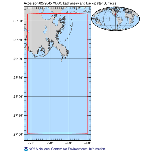
| Spatial Bounding Box Coordinates |
West: -91.192145
East: -88.011152
South: 27.024598
North: 30.183019
|
| Spatial Coverage Map |
|
| General Documentation |
|
| Associated Resources |
- Mesophotic and Deep Benthic Communities: Habitat Assessment and Evaluation (HAE) and Mapping, Ground-truthing, and Predictive Habitat Modeling (MGM) Projects Expedition on the NOAA Ship Nancy Foster (NF-22-06) in the Gulf of Mexico
-
NCEI Collection
Navigate directly to the URL for data access and direct download.
- Open Ocean Restoration Area
- NOAA Gulf Spill Restoration
- Scientific Support for Mesophotic and Deep Benthic Community Restoration in the Gulf of Mexico
Parent ID (indicates this dataset is related to other data):- gov.noaa.nodc:MDBC-NF2206
|
| Publication Dates |
|
| Data Presentation Form |
Digital table - digital representation of facts or figures systematically displayed, especially in columns
|
| Dataset Progress Status |
Complete - production of the data has been completed
Historical archive - data has been stored in an offline storage facility |
| Data Update Frequency |
As needed |
| Supplemental Information |
Submission Package ID: 3J52DF |
| Purpose |
The dataset will be used for 1) developing maps for habitat characterization, 2) refine predictive models to improve the effectiveness and cost efficiency of restoration and mapping efforts, and 3) provide fundamental information to prioritize and support protection and management activities and to target locations for direct restoration. |
| Use Limitations |
- Distribution liability: NOAA and NCEI make no warranty, expressed or implied, regarding these data, nor does the fact of distribution constitute such a warranty. NOAA and NCEI cannot assume liability for any damages caused by any errors or omissions in these data. If appropriate, NCEI can only certify that the data it distributes are an authentic copy of the records that were accepted for inclusion in the NCEI archives.
|
| Dataset Citation |
- Cite as: Battista, Timothy A.; US Department of Commerce; National Oceanic and Atmospheric Administration; NOAA National Ocean Service; National Centers for Coastal Ocean Science (2023). Mesophotic and Deep Benthic Communities: Mapping, Ground-truthing, and Predictive Habitat Modeling: Geospatial products of water depth, and acoustic backscatter data collected on NOAA Ship Nancy Foster (NF2206) in the Gulf of Mexico from 2022-08-16 to 2022-09-03 (NCEI Accession 0279545). [indicate subset used]. NOAA National Centers for Environmental Information. Dataset. https://www.ncei.noaa.gov/archive/accession/0279545. Accessed [date].
|
| Cited Authors |
|
| Principal Investigators |
|
| Contributors |
|
| Resource Providers |
|
| Points of Contact |
|
| Publishers |
|
| Acknowledgments |
- Related Funding Agency: US DOC; NOAA; NESDIS; National Centers for Environmental Information
- Related Funding Agency: US DOC; NOAA; NOS; National Centers for Coastal Ocean Science
- Related Funding Agency: US DOC; NOAA; NOS; Office of National Marine Sanctuaries
- Related Funding Agency: US DOC; NOAA; National Marine Fisheries Service
- Related Funding Agency: US DOI; Bureau of Ocean Energy Management
- Related Funding Agency: US DOI; US Geological Survey
|
| Theme keywords |
NODC DATA TYPES THESAURUS
NODC OBSERVATION TYPES THESAURUS
WMO_CategoryCode
Global Change Master Directory (GCMD) Science Keywords
NCCOS Research Data Type
- NCCOS Research Data Type > Derived Data Product
- NCCOS Research Data Type > Geospatial
- NCCOS Research Data Type > Model
NCCOS Research Keywords
- NCCOS Research Priority > Coastal Change
- NCCOS Research Priority > Marine Spatial Ecology
- NCCOS Research Priority > Social Science
- NCCOS Research Priority > Stressor Impacts and Mitigation
- NCCOS Research Topic > Ecological and Biogeographic Assessments
- NCCOS Research Topic > Habitat Mapping
- NCCOS Research Topic > Regional Ecosystem Science
Provider Keywords
- Acoustic Backscatter
- OOTIG
|
| Data Center keywords |
NODC COLLECTING INSTITUTION NAMES THESAURUS
NODC SUBMITTING INSTITUTION NAMES THESAURUS
Global Change Master Directory (GCMD) Data Center Keywords
|
| Platform keywords |
NODC PLATFORM NAMES THESAURUS
Global Change Master Directory (GCMD) Platform Keywords
ICES/SeaDataNet Ship Codes
|
| Instrument keywords |
NODC INSTRUMENT TYPES THESAURUS
Global Change Master Directory (GCMD) Instrument Keywords
Provider Instruments
|
| Place keywords |
NODC SEA AREA NAMES THESAURUS
Global Change Master Directory (GCMD) Location Keywords
NCCOS Research Locations
- NCCOS Research Location > Region > Alabama
- NCCOS Research Location > Region > Atlantic Ocean
- NCCOS Research Location > Region > Florida
- NCCOS Research Location > Region > Gulf of Mexico
- NCCOS Research Location > Region > Louisiana
- NCCOS Research Location > Region > Mississippi
- NCCOS Research Location > Region > Texas
|
| Project keywords |
NODC PROJECT NAMES THESAURUS
Global Change Master Directory (GCMD) Project Keywords
Provider Project Names- Mesophotic and Deep Benthic Communities (MDBC) Mapping, Ground-truthing, and Predictive Habitat Modeling Project
|
| Keywords |
NCEI ACCESSION NUMBER
|
| Use Constraints |
- Cite as: Battista, Timothy A.; US Department of Commerce; National Oceanic and Atmospheric Administration; NOAA National Ocean Service; National Centers for Coastal Ocean Science (2023). Mesophotic and Deep Benthic Communities: Mapping, Ground-truthing, and Predictive Habitat Modeling: Geospatial products of water depth, and acoustic backscatter data collected on NOAA Ship Nancy Foster (NF2206) in the Gulf of Mexico from 2022-08-16 to 2022-09-03 (NCEI Accession 0279545). [indicate subset used]. NOAA National Centers for Environmental Information. Dataset. https://www.ncei.noaa.gov/archive/accession/0279545. Accessed [date].
|
| Access Constraints |
- Use liability: NOAA and NCEI cannot provide any warranty as to the accuracy, reliability, or completeness of furnished data. Users assume responsibility to determine the usability of these data. The user is responsible for the results of any application of this data for other than its intended purpose.
|
| Fees |
- In most cases, electronic downloads of the data are free. However, fees may apply for custom orders, data certifications, copies of analog materials, and data distribution on physical media.
|
| Lineage information for: dataset |
|---|
| Processing Steps |
- 2023-07-06T23:11:42Z - NCEI Accession 0279545 v1.1 was published.
|
| Output Datasets |
- NCEI Accession 0279545 v1.1
|
| Lineage information for: dataset |
|---|
| Processing Steps |
- Parameter or Variable: DEPTH - SENSOR (measured); Units: meters; Observation Category: in situ; Sampling Instrument: Kongsberg EM710; Sampling and Analyzing Method: Multibeam, sound speed, and GPS position data were incorporated and processed using Caris HIPS and SIPS 11.3.Soundings were reduced to North American Vertical Datum 1988. Raster grids were created as a final product which show water depth in meters.; Data Quality Method: Data were acquired and processed in accordance with NOAA’s Hydrographic Survey Specifications and Deliverables (HSSD). Data quality checks were performed with Pydro 2022 QC Tools..
- Parameter or Variable: Acoustic Backscatter (calculated); Units: Decibels; Observation Category: in situ; Sampling Instrument: Kongsberg EM710; Sampling and Analyzing Method: Multibeam, sound speed, and GPS position data were incorporated and processed using Fledermaus FMGT. Raster grids were created as a final product which show sound intensity in decibels.; Data Quality Method: Data were acquired and processed in accordance with NOAA’s Hydrographic Survey Specifications and Deliverables (HSSD)..
|
| Acquisition Information (collection) |
|---|
| Instrument |
|
| Platform |
|
Last Modified: 2024-04-10T23:31:49Z
For questions about the information on this page, please email:
ncei.info@noaa.gov