January brought the largest drought footprint in nearly 4 years to the United States

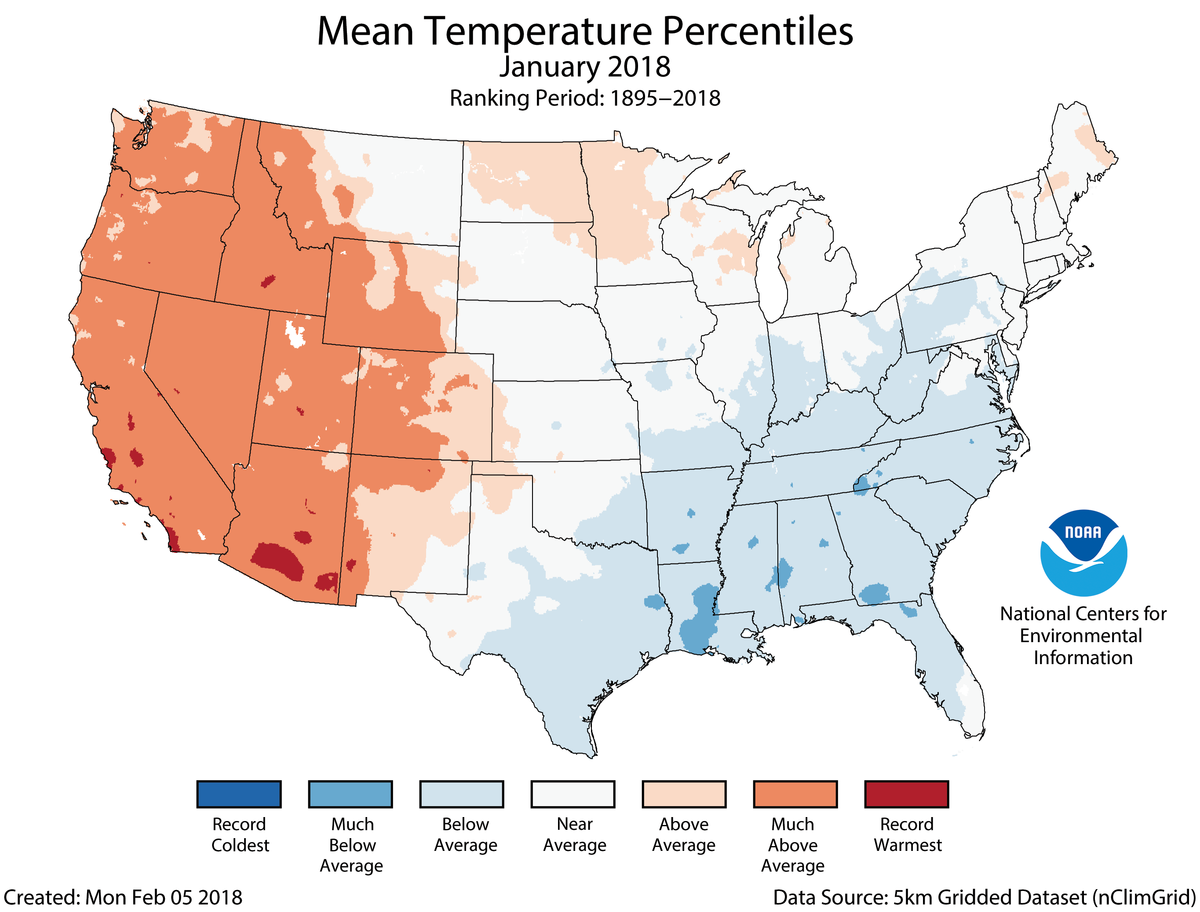
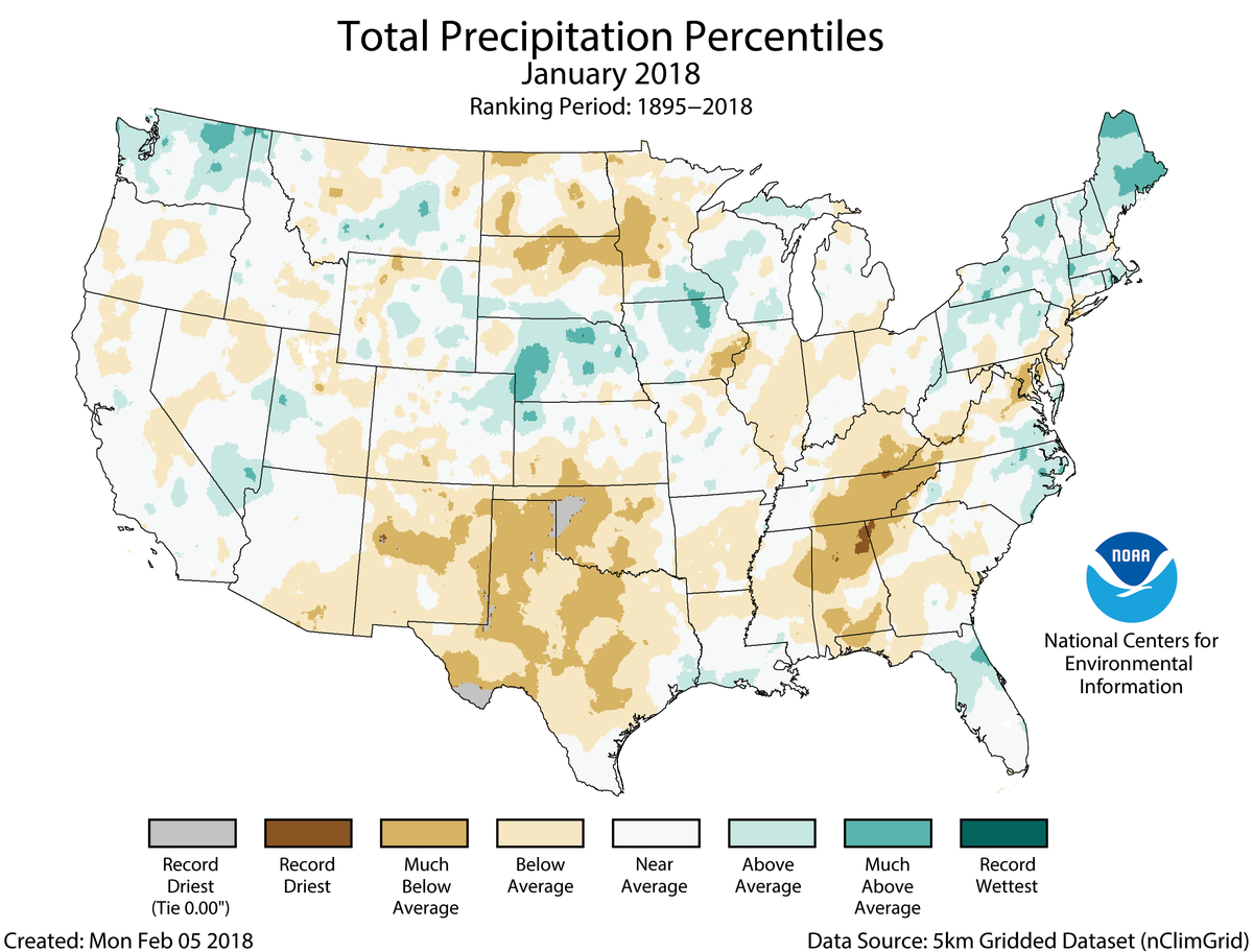
During January, the average contiguous U.S. temperature was 32.2°F, 2.1°F above the 20th century average. This ranked among the warmest third of the 124-year period of record. Much-above-average temperatures in the West offset below-average conditions in the East. The January precipitation total was 1.81 inches, 0.50 inch below the 20th century average. This tied the 21st driest January on record. Drought intensified and expanded across parts of the West, Southern Plains and Southeast.
This monthly summary from NOAA’s National Centers for Environmental Information is part of the suite of climate services NOAA provides to government, business, academia and the public to support informed decision-making.
January Temperature
-
Most locations from the Rockies to the West Coast were warmer than average, where nine states had monthly temperatures that ranked among the 10 warmest on record. While no state was record warm during January, more than 2,000 daily warm temperature records were broken or tied across the region.
-
Below-average temperatures stretched from the Southern Plains to the East Coast. Several significant cold waves impacted the eastern half of the nation during January with more than 4,000 daily cold temperature records broken or tied across the East. No state had a record cold monthly temperature.
-
The Alaska January temperature was 6.8°F, 4.6°F above the long-term average. This ranked in the warmest third of the 94-year period of record for the state. The first half of January was mild across Alaska with a cold end to the month. On January 14, the temperature at a NOAA tide gauge at Ketchikan reached 67°F, the highest January daily temperature ever measured in Alaska. The previous record was 62°F in January 2014.
January Precipitation
-
During January, below-average precipitation was observed across large areas of the country, including parts of the Southwest, Southern Plains, Northern Plains, Midwest, Southeast and Mid-Atlantic. Alabama had its ninth driest January and New Mexico tied its 10th driest. Above-average precipitation was observed across parts of the Northwest, Central Plains and Northeast.
-
In January, numerous snow storms impacted the eastern U.S., bringing snow and ice to locations across the South that hadn’t experienced snow in many years. On January 4, the Savannah, Georgia, airport received 1.2 inches of snow, the most since 1989. Conversely, snow generally missed large parts of the West. Mountain locations in the Southern Cascades, Southern Rockies and Sierra Nevada Mountains had snowpack totals that were less than 25 percent of average. The lack of snow in the West could result in below-average spring runoff causing water resource concerns. Tourism in the region was also impacted.
-
According to the January 30 U.S. Drought Monitor report, 38.4 percent of the contiguous U.S. was in drought, up from 27.7 percent at the beginning of the month. This was the largest drought footprint since May 2014. Drought conditions expanded and intensified in parts of the West, Southern Plains and Southeast. Some drought improvement was observed in the Northern High Plains, Central Plains, Lower Mississippi Valley and coastal Southeast.
-
The NOAA National Weather Service issued a drought statement for Guam, Northern Mariana Islands and the Marshall Islands as drought intensified and spread during January 2018. With 0.94 inch of rain, the weather station at Guam observed the driest January in the 1957–2018 record.
See all January U.S. temperature and precipitation maps.


