

According to the January 31, 2017, U.S. Drought Monitor, moderate to exceptional drought covers 14.6% of the contiguous United States, a decrease from last week’s 16.1%. This week marks the first time drought conditions have affected less than 15% of the Lower 48 since June 2016. The worst drought categories (extreme to exceptional drought) held steady at around 0.4% for a second week.
Upper-level weather systems and their associated surface lows and cold fronts moved across the contiguous United States this U.S. Drought Monitor week, bringing areas of precipitation to parts of the East and Central Plains to Great Lakes. An upper-level ridge of high pressure deflected storm systems away from the West for much of the week, resulting in below-normal precipitation. With the storm track generally across the northern states, the southern and eastern contiguous United States also was drier than normal this week. Improving moisture conditions from precipitation that fell earlier in the month resulted in contraction of drought and abnormal dryness in parts of the western, central, and northeastern contiguous United States.
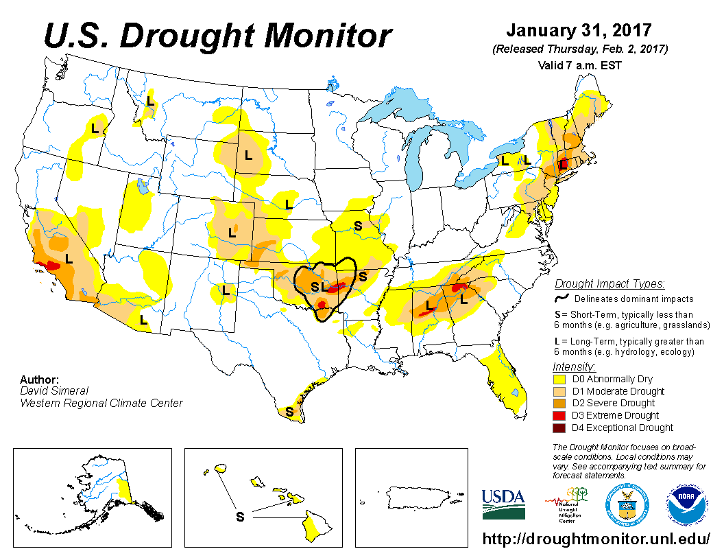
The full U.S. Drought Monitor weekly update is available from Drought.gov.
In addition to Drought.gov, you can find further information on the current drought as well as on this week’s Drought Monitor update at the National Drought Mitigation Center. See their recent news releases.
The most recent U.S. Drought Outlook is available from NOAA’s Climate Prediction Center and the U.S. Department of Agriculture’s World Agriculture Outlook Board provides information about the drought’s influence on crops and livestock.
For additional drought information, follow #DroughtMonitor on Facebook and Twitter.


