Magnetic poles are commonly understood as positions on Earth's surface where the geomagnetic field is vertical (i.e., perpendicular) to the ellipsoid. These north and south positions, called dip poles, do not need to be (and are not currently) antipodal. In principle, the dip poles can be found by conducting a magnetic survey to determine where the field is vertical. In practice, the geomagnetic field is vertical on oval-shaped loci traced on a daily basis, with considerable variation from one day to the next. Other definitions of geomagnetic poles depend on the way the poles are computed from a geomagnetic model.
Experimental Observations of Dip Poles
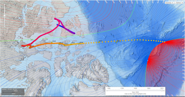
It has been long understood that dip poles migrate over time. In 1831, James Clark Ross located the north dip pole position in northern Canada. Natural Resources Canada (NRCan) tracked the North Magnetic Pole, which is slowly drifting across the Canadian Arctic, by periodically carrying out magnetic surveys to reestablish the Pole's location from 1948 to 1994. An international collaboration, led by a French fundraising association, Poly-Arctique, and involving NRCan, Institut de Physique du Globe de Paris and Bureau de Recherche Geologique et Miniere, added two locations of the North Magnetic Pole in 2001 and 2007. The most recent survey determined that the Pole is moving approximately north-northwest at 55km per year.
Historical Magnetic Declination Viewer
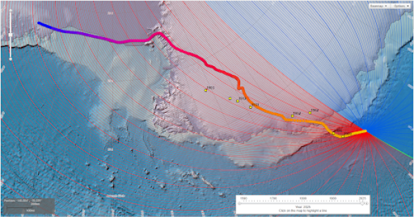
Use this interactive map to view experimental and modeled pole locations for 1590–2025.
About
Geomagnetic field models can also define geomagnetic poles. The geomagnetic poles, or geocentric dipole, can be computed from the first three Gauss coefficients from a main field model, such as the World Magnetic Model (WMM) or International Geomagnetic Reference Field (IGRF). The WMM representation of the field includes a magnetic dipole at the center of Earth. This dipole defines an axis that intersects Earth's surface at two antipodal points called geomagnetic poles. Based on the WMM2025 coefficients for 2025.0, the Geomagnetic North Pole is at 72.76°W longitude and 80.85°N geodetic latitude (80.79°N geocentric), and the Geomagnetic South Pole is at 107.24°E longitude and 80.85°S geodetic latitude (80.79°S geocentric). The axis of the dipole is currently inclined at 9.21° to Earth's rotation axis. The same dipole is the basis for the simple geomagnetic coordinate system of geomagnetic latitude and longitude.
Scientists, map makers, and polar explorers have an interest in the locations of the dip and geomagnetic poles. Although geomagnetic pole positions cannot be observed, they are arguably of greater significance than the dip poles because the auroral ovals (approximate 5° latitude bands where the spectacular aurora is likely visible) are closely centered on the geomagnetic poles. They are usually displaced slightly to the night-side of the geomagnetic poles and greatly vary in size: bands of greatest activity occur between 15° and 25° from the geomagnetic poles.
Software
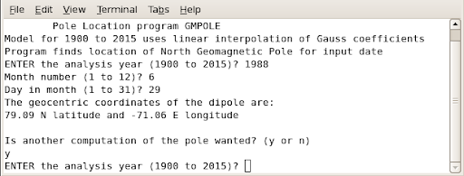
GM POLE is a program that can compute the locations of the geomagnetic poles from January 1900–December 2015 using a linear interpolation of the dipole Gauss coefficients from the geomagnetic reference field models (see file ALL-IGRF.TAB below). This program uses a computational method devised by Fraser-Smith (1987) and originally coded by W.H. Campbell. New version coded by Adam Woods.

The magnetic poles or dip poles are computed from all the Gauss coefficients using an iterative method. Magnetic poles derived in this fashion are geographically closer to the experimentally observed poles. Based on the current WMM, the 2025 location of the North Magnetic Pole is 85.762°N and 139.298°E and the South Magnetic Pole is 63.851°S and 135.078°E.


