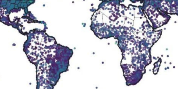
The North American Multi-Model Ensemble (NMME) is a seasonal forecasting system that consists of multiple coupled models from North American modeling centers. NCEI provides access to data for global, 12-month forecasts of 13 key variables. NMME data is daily or 6-hourly with a 1º by 1º spatial resolution. Most NMME datasets have 10 realizations for each variable.
Access Methods
As of March 2018, data for CFSv2 and CCSM4 are accessible through the access links below. The other model datasets will be accessible once they arrive in the NCEI archive.
| Model | Grid/Scale | Period of Record | Model Cycle | Output Timestep | Data Access Links |
|---|---|---|---|---|---|
| CCSM4 | Global, 1º | 01Jan2011–Present | 1/day | Daily | |
| CFSV2-2011 | Global, 1º | 01Jan2011–Present | 1/day | 6-hourly | |
| CanCM3 | Global, 1º | 01Jan2011–Present | 1/day | Daily | |
| CanCM4 | Global, 1º | 01Jan2011–Present | 1/day | Daily | |
| GEOS-5 | Global, 1º | 01Jan2011–Present | 1/day | Daily | |
| GEM/NEMO | Global, 1º | 01Nov2019–Present | 1/day | Daily |
Acknowledging NMME Data
To document NMME data impact and enable continuing support, data users must acknowledge NMME data and the participating modeling groups in papers, applications, and other use cases.
NMME model output should be referred to as "NMME System data [https://www.earthsystemgrid.org/search.html?Project=NMME]."
In publications, users should include a table (referred to below as Table XX) listing the models and institutions that provided model output used in the NMME system, as well as the digital object identifier of publications documenting the models. In addition, an acknowledgment similar to the following should be included in any publication:
"We acknowledge the agencies that support the NMME system, and we thank the climate modeling groups (Environment Canada and Climate Change, NASA/GMAO, NOAA/GFDL, NOAA/NCEP, and University of Miami, IRI) for producing and/or making available their model output. NOAA/NCEP, NOAA/CTB, and NOAA/WPO jointly provided coordinating support and led development of the NMME system."
where "Table XX" in the paper should list the models and modeling groups that provided the NMME data.
Besides the above acknowledgement, users should register any journal articles (or other scientific documents) that are based on NMME results.
Contributing Organizations
- NOAA's National Centers for Environmental Prediction (NCEP)
- NOAA's Geophysical Fluid Dynamics Laboratory (GFDL)
- National Center for Atmospheric Research (NCAR)
- NASA's Goddard Space Flight Center (GSFC)
- Canadian Centre for Climate Modelling and Analysis (CCCma)
Models
- The Community Climate System Model version 4 (CCSM4)
- The Climate Forecast Model version 2 (CFSv2-2011)
- The Canadian Coupled Climate Model versions 3 and 4 (CanCM3, CanCM4)
- The Global Environmental Multiscale/Nucleus for European Modeling of the Ocean (GEM/NEMO)
- The Goddard Earth Observing System Model version 5 (GEOS-5)
Variables
Variables are listed by model and variable name. "N/A" denotes variables that are not available.

| Variable | CCSM4 | CESM1 | CFSV2-2011 | CanCM3 | CanCM4 | FLORB-01 | GEOS-5 |
|---|---|---|---|---|---|---|---|
| Precipitation rate | pr | precip | pr | prlr | prlr | pr | pr |
| Daily Maximum Surface Air Temperature | TREFMXAV | Tasmax | tasmax | tasmax | tasmax | tasmax | tasmax |
| Daily Minimum Surface Air Temperature | TREFMNAV | Tasmin | tasmin | tasmin | tasmin | tasmin | tasmin |
| Zonal surface stress | STX | Stx | stx | stx | stx | N/A | stx |
| Meridional surface stress | STY | Sty | sty | sty | sty | N/A | sty |
| Sea level pressure | PSL | Psl | psl | psl | psl | N/A | psl |
| Zonal wind (@850 hPa) | ua | ua | ua | ua | ua | N/A | ua |
| Meridional wind (@850 hPa) | va | va | va | va | va | N/A | va |
| Zonal wind (@200 hPa) | ua | ua | ua | ua | ua | N/A | ua |
| Meridional wind (@200 hPa) | va | va | va | va | va | N/A | va |
| Net longwave flux at top of model | N/A | Rlt | N/A | rlt | rlt | N/A | rlt |
| Net solar flux at surface | N/A | Rss | N/A | rss | rss | N/A | N/A |
| Geopotential height (@500 hPa) | g | G | g | g | g | N/A | g |
| Specific Humidity | HUS | hus | hus | hus | hus | N/A | hus |


