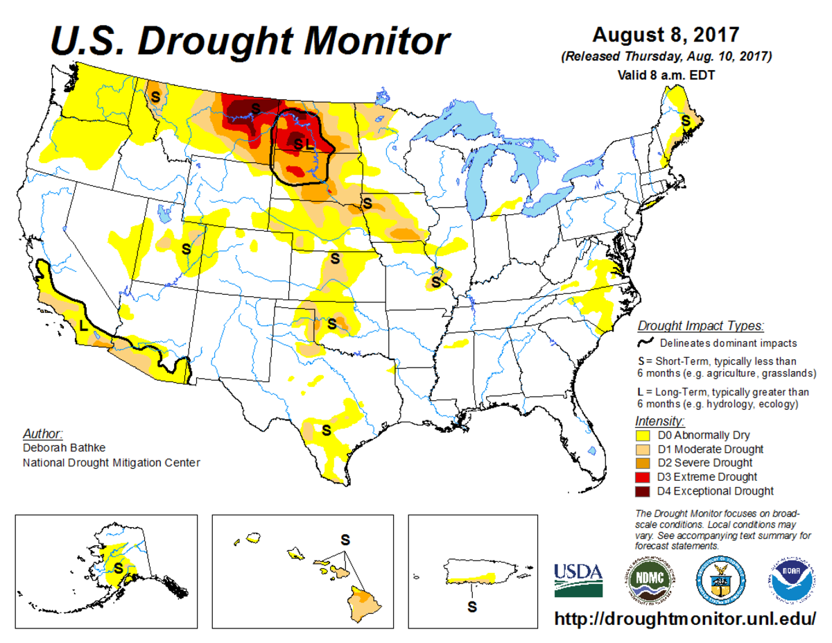
According to the August 8, 2017, U.S. Drought Monitor, moderate to exceptional drought covers 11.2% of the contiguous United States, a slight decrease from last week’s 11.8%. The worst drought categories (extreme to exceptional drought) also decreased slightly from 2.6% last week to 2.4%.
This U.S. Drought Monitor week was marked by torrential rains and flooding in cities such as New Orleans, Houston, Kansas City, and Las Vegas. Heavy rainfall over the Gulf Coast and into the Mid-South kept drought conditions at bay, while scattered showers and thunderstorms over the southern Rockies erased pockets of abnormally dry conditions.
In the drought-afflicted Plains, rains brought relief to a few areas, slowed deterioration in others, and had minimal impact on areas suffering from long-term impacts. Once again, rain bypassed the Pacific Northwest, where record-breaking warm temperatures and the prolonged dry spell deteriorated drought conditions.
Abnormal dryness and drought are currently affecting nearly 64 million people across the United States—over 20 percent of the country’s population.

The full U.S. Drought Monitor weekly update is available from Drought.gov.
In addition to Drought.gov, you can find further information on the current drought as well as on this week’s Drought Monitor update at the National Drought Mitigation Center.
The most recent U.S. Drought Outlook is available from NOAA’s Climate Prediction Center and the U.S. Department of Agriculture provides information about the drought’s influence on crops and livestock.
For additional drought information, follow #DroughtMonitor on Facebook and Twitter.


