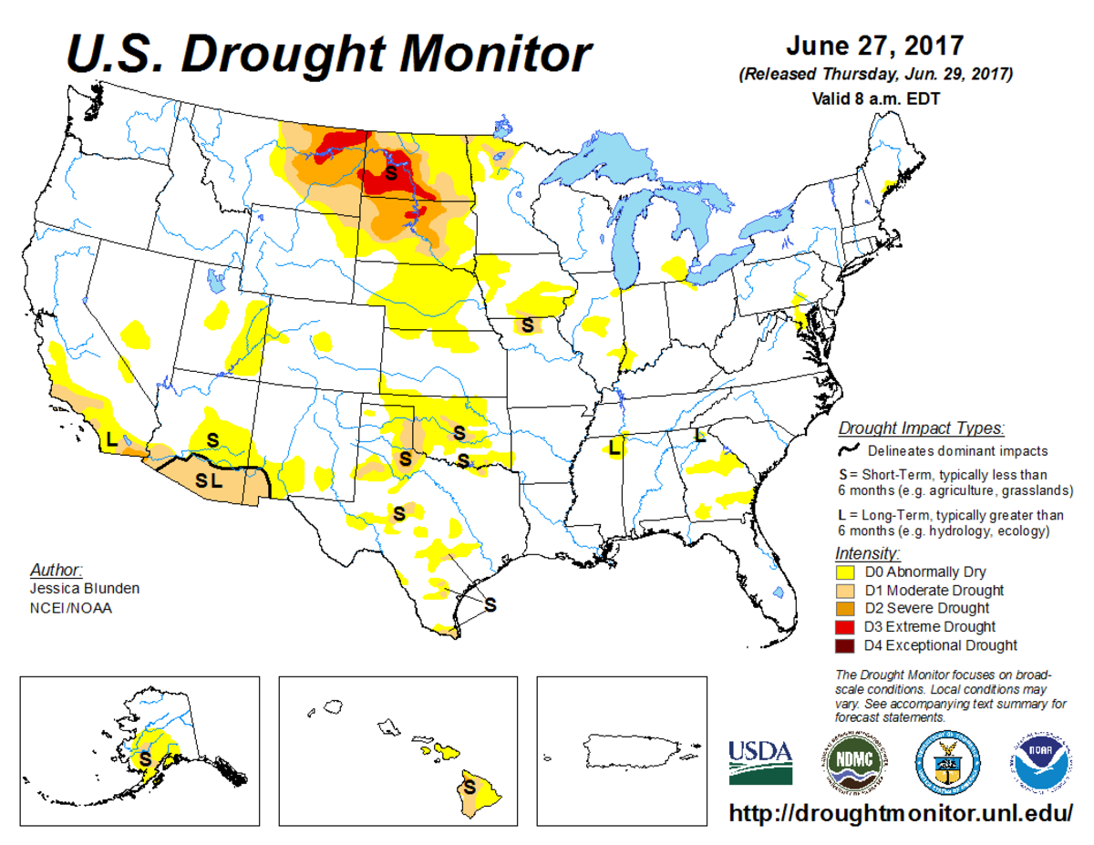
According to the June 27, 2017, U.S. Drought Monitor, moderate to extreme drought covers 8.0% of the contiguous United States, an increase from last week’s 7.0%. Extreme drought also expanded to cover nearly 1.0% of the Lower 48, up from 0.6% last week. But, exceptional drought—the worst category—continued to remain absent for the 23rd consecutive week.
An upper-level ridge of high pressure dominated the western contiguous United States during this U.S. Drought Monitor week, bringing warmer- and drier-than-normal weather to the West and northern to central Plains, while a trough of low pressure funneled cold fronts across the eastern half of the country.
The Canadian air masses behind the fronts brought cooler-than-normal weather to the Plains to East Coast. The circulation drew in Gulf of Mexico moisture, as well as the remnants of Tropical Storm Cindy, with frontal lifting contributing to above-normal precipitation across the southern Plains and Southeast to parts of the Great Lakes and Northeast.
The continued dry weather expanded drought and abnormal dryness from Montana and the Dakotas to Oklahoma, while the wet weather contracted drought and abnormal dryness across parts of Texas and the eastern contiguous United States.
The full U.S. Drought Monitor weekly update is available from Drought.gov.
In addition to Drought.gov, you can find further information on the current drought as well as on this week’s Drought Monitor update at the National Drought Mitigation Center.
The most recent U.S. Drought Outlook is available from NOAA’s Climate Prediction Center and the U.S. Department of Agriculture provides information about the drought’s influence on crops and livestock.
For additional drought information, follow #DroughtMonitor on Facebook and Twitter.


